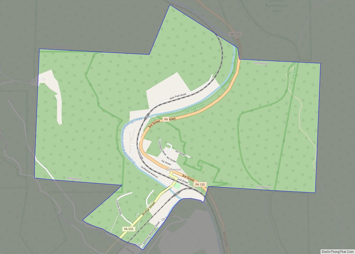
Driftwood is a borough in Cameron County, Pennsylvania, United States. The population was 36 at the 2020 census.
| Name: | Driftwood borough |
|---|---|
| LSAD Code: | 21 |
| LSAD Description: | borough (suffix) |
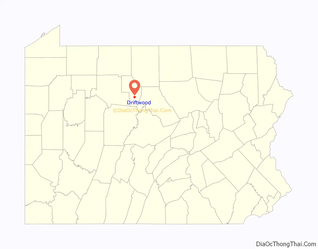
| State: | Pennsylvania |
| County: | Cameron County |
| Elevation: | 850 ft (260 m) |
| Total Area: | 2.56 sq mi (6.62 km²) |
| Land Area: | 2.49 sq mi (6.45 km²) |
| Water Area: | 0.07 sq mi (0.18 km²) |
| Total Population: | 38 |
| Population Density: | 15.27/sq mi (5.89/km²) |
| ZIP code: | 15832 |
| Area code: | 814 |
| FIPS code: | 4219976 |
Online Interactive Map
Click on ![]() to view map in "full screen" mode.
to view map in "full screen" mode.
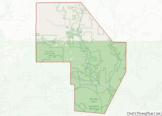
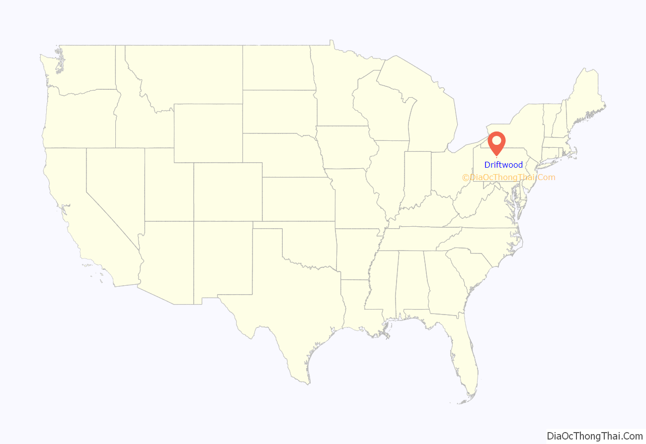
Driftwood location map. Where is Driftwood borough?
History
The community takes its name from Driftwood Branch Sinnemahoning Creek (in older sources called “Driftwood Creek”).
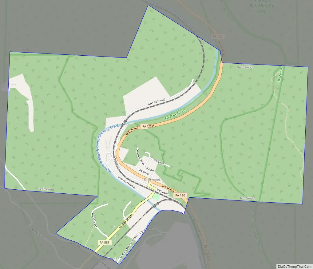
Driftwood Road Map
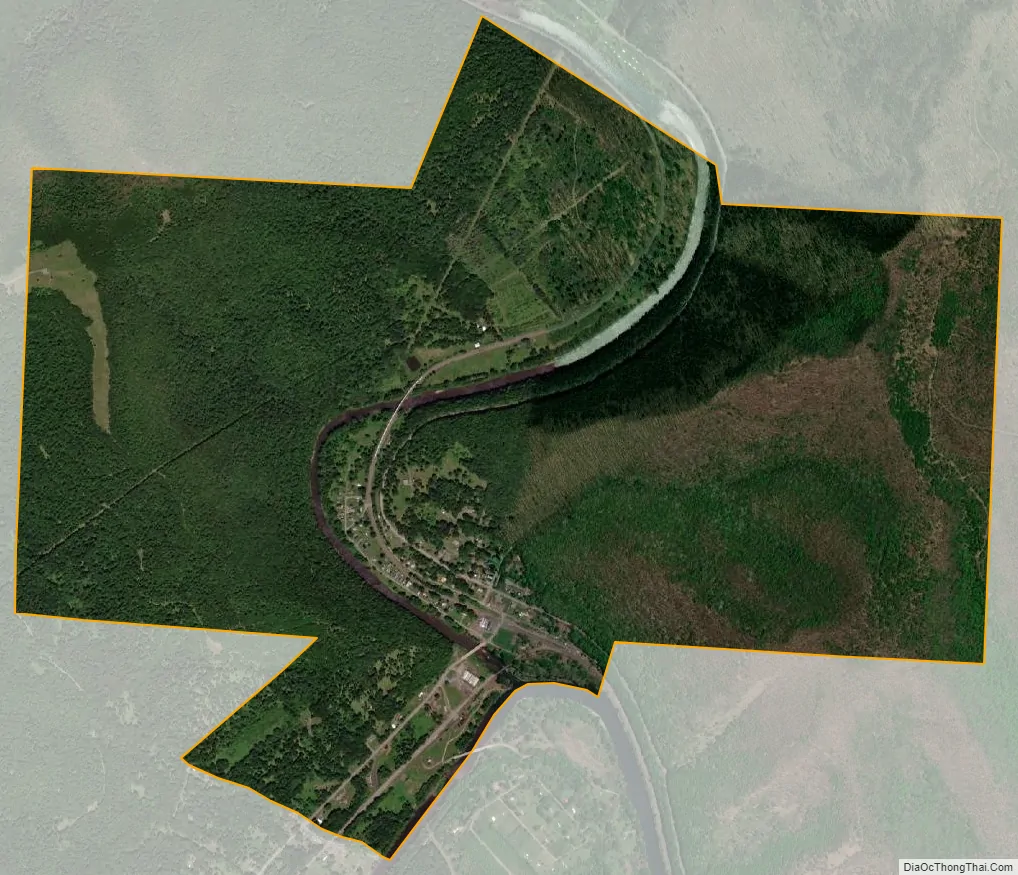
Driftwood city Satellite Map
Geography
Driftwood is located in southern Cameron County at 41°20′20″N 78°8′8″W / 41.33889°N 78.13556°W / 41.33889; -78.13556 (41.338836, -78.135535), at the confluence of the Bennett Branch and the Driftwood Branch of Sinnemahoning Creek, an east-flowing tributary of the West Branch Susquehanna River. The community is at the bottom of a gorge carved 1,200 feet (370 m) deep or more into the Allegheny Plateau by the creek and its branches.
Pennsylvania Route 120 passes through Driftwood, following the Driftwood Branch north (upstream) 18 miles (29 km) to Emporium, the Cameron County seat, and following Sinnemahoning Creek and the West Branch of the Susquehanna east (downstream) 27 miles (43 km) to Renovo. Pennsylvania Route 555 leads west from Driftwood up the Bennett Branch 25 miles (40 km) to Weedville.
According to the United States Census Bureau, the borough of Driftwood has a total area of 2.5 square miles (6.6 km), of which 2.5 square miles (6.4 km) is land and 0.08 square miles (0.2 km), or 2.66%, is water.
See also
Map of Pennsylvania State and its subdivision:- Adams
- Allegheny
- Armstrong
- Beaver
- Bedford
- Berks
- Blair
- Bradford
- Bucks
- Butler
- Cambria
- Cameron
- Carbon
- Centre
- Chester
- Clarion
- Clearfield
- Clinton
- Columbia
- Crawford
- Cumberland
- Dauphin
- Delaware
- Elk
- Erie
- Fayette
- Forest
- Franklin
- Fulton
- Greene
- Huntingdon
- Indiana
- Jefferson
- Juniata
- Lackawanna
- Lancaster
- Lawrence
- Lebanon
- Lehigh
- Luzerne
- Lycoming
- Mc Kean
- Mercer
- Mifflin
- Monroe
- Montgomery
- Montour
- Northampton
- Northumberland
- Perry
- Philadelphia
- Pike
- Potter
- Schuylkill
- Snyder
- Somerset
- Sullivan
- Susquehanna
- Tioga
- Union
- Venango
- Warren
- Washington
- Wayne
- Westmoreland
- Wyoming
- York
- Alabama
- Alaska
- Arizona
- Arkansas
- California
- Colorado
- Connecticut
- Delaware
- District of Columbia
- Florida
- Georgia
- Hawaii
- Idaho
- Illinois
- Indiana
- Iowa
- Kansas
- Kentucky
- Louisiana
- Maine
- Maryland
- Massachusetts
- Michigan
- Minnesota
- Mississippi
- Missouri
- Montana
- Nebraska
- Nevada
- New Hampshire
- New Jersey
- New Mexico
- New York
- North Carolina
- North Dakota
- Ohio
- Oklahoma
- Oregon
- Pennsylvania
- Rhode Island
- South Carolina
- South Dakota
- Tennessee
- Texas
- Utah
- Vermont
- Virginia
- Washington
- West Virginia
- Wisconsin
- Wyoming