Duncansville is a borough in Blair County, Pennsylvania, United States. It is part of the Altoona, PA Metropolitan Statistical Area. Duncansville is one of the communities that comprises the Altoona Urban Area. The population was 1,258 at the 2020 census.
| Name: | Duncansville borough |
|---|---|
| LSAD Code: | 21 |
| LSAD Description: | borough (suffix) |
| State: | Pennsylvania |
| County: | Blair County |
| Founded: | 1831 |
| Elevation: | 1,011 ft (308 m) |
| Total Area: | 0.53 sq mi (1.38 km²) |
| Land Area: | 0.53 sq mi (1.38 km²) |
| Water Area: | 0.00 sq mi (0.00 km²) |
| Total Population: | 1,255 |
| Population Density: | 2,359.02/sq mi (910.16/km²) |
| ZIP code: | 16635 |
| Area code: | 814 |
| FIPS code: | 4220248 |
| GNISfeature ID: | 1214941 |
| Website: | duncansvillepa.org |
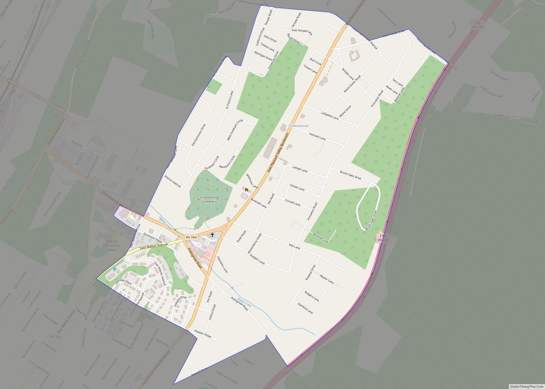
Online Interactive Map
Click on ![]() to view map in "full screen" mode.
to view map in "full screen" mode.
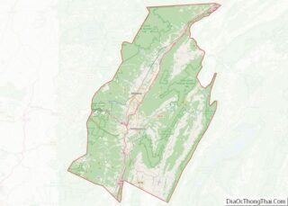
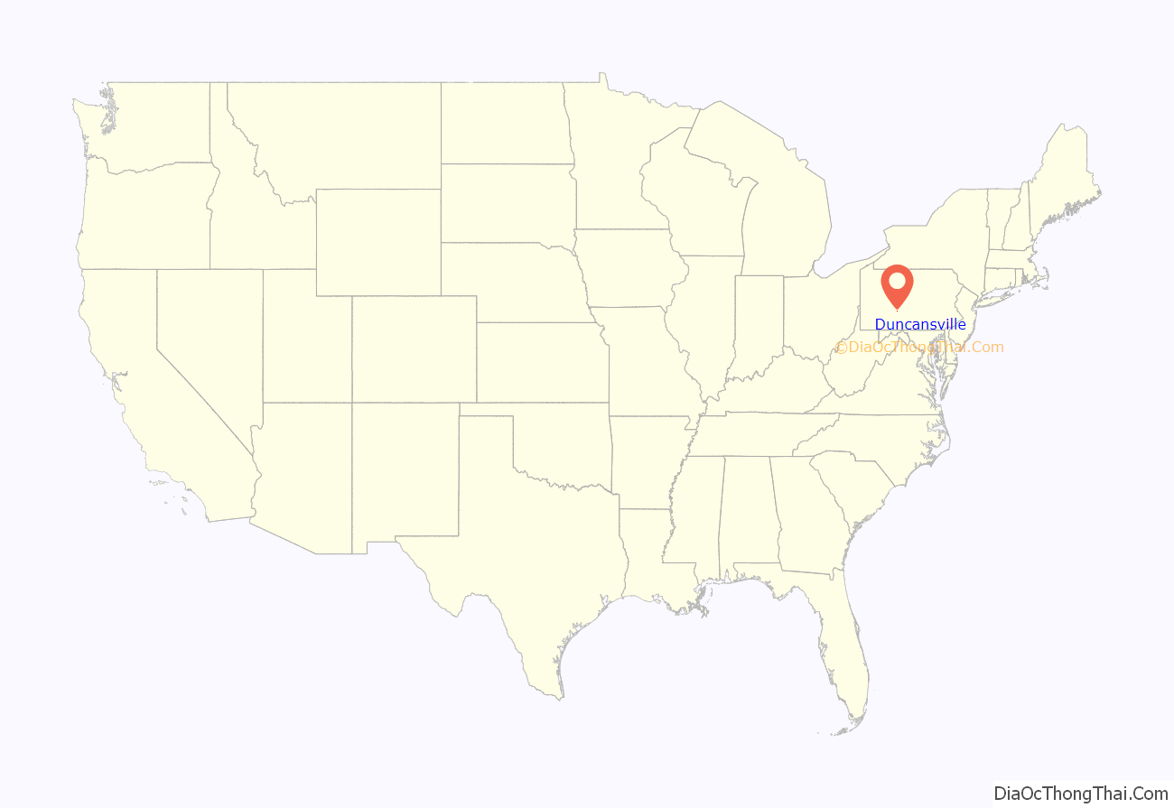
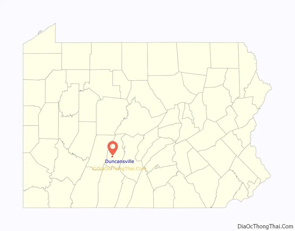
Duncansville location map. Where is Duncansville borough?
History
In 1830, Tim Duncan, recognizing the excellent possibilities for land development, purchased land on the western banks of the stream which traversed the area and plotted a town, which he named Duncansville. About the same time, Jacob Walters laid out plots of land on the eastern side of the stream and called his settlement Walterstown. Confusion and some rivalry existed between the two settlements. Both Duncan and Walters agreed that a common name should be used for the two places. They decided to cast lots to select the name to be used. The people of both settlements declared a holiday and arranged quite a celebration for the occasion. All assembled at the wooden bridge separating the two towns. A coin was tossed and fortune favored Duncan, thereby uniting the two communities under the name of Duncansville.
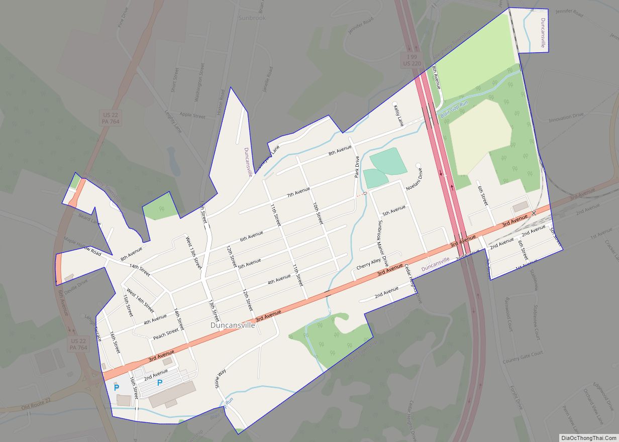
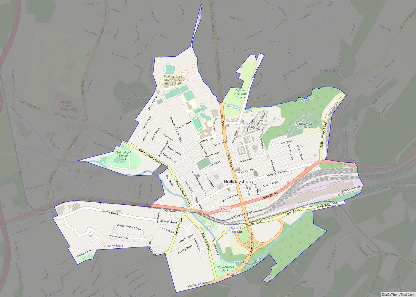
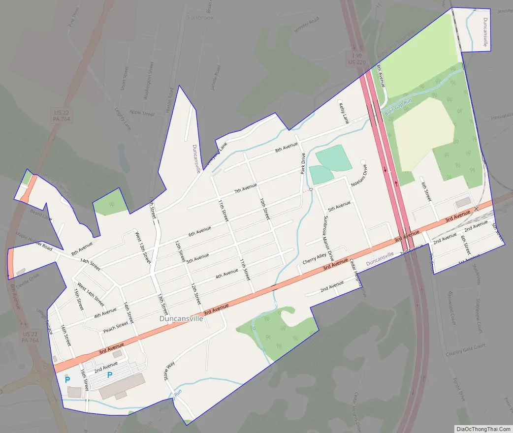
Duncansville Road Map
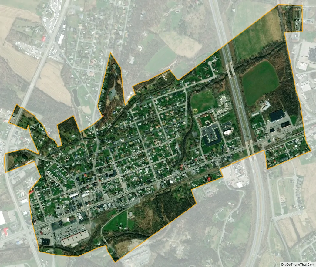
Duncansville city Satellite Map
Geography
Duncansville is located at 40°25′30″N 78°25′57″W / 40.42500°N 78.43250°W / 40.42500; -78.43250 (40.425072, -78.432435).
According to the United States Census Bureau, the borough has a total area of 0.5 square miles (1.3 km), all land.
See also
Map of Pennsylvania State and its subdivision:- Adams
- Allegheny
- Armstrong
- Beaver
- Bedford
- Berks
- Blair
- Bradford
- Bucks
- Butler
- Cambria
- Cameron
- Carbon
- Centre
- Chester
- Clarion
- Clearfield
- Clinton
- Columbia
- Crawford
- Cumberland
- Dauphin
- Delaware
- Elk
- Erie
- Fayette
- Forest
- Franklin
- Fulton
- Greene
- Huntingdon
- Indiana
- Jefferson
- Juniata
- Lackawanna
- Lancaster
- Lawrence
- Lebanon
- Lehigh
- Luzerne
- Lycoming
- Mc Kean
- Mercer
- Mifflin
- Monroe
- Montgomery
- Montour
- Northampton
- Northumberland
- Perry
- Philadelphia
- Pike
- Potter
- Schuylkill
- Snyder
- Somerset
- Sullivan
- Susquehanna
- Tioga
- Union
- Venango
- Warren
- Washington
- Wayne
- Westmoreland
- Wyoming
- York
- Alabama
- Alaska
- Arizona
- Arkansas
- California
- Colorado
- Connecticut
- Delaware
- District of Columbia
- Florida
- Georgia
- Hawaii
- Idaho
- Illinois
- Indiana
- Iowa
- Kansas
- Kentucky
- Louisiana
- Maine
- Maryland
- Massachusetts
- Michigan
- Minnesota
- Mississippi
- Missouri
- Montana
- Nebraska
- Nevada
- New Hampshire
- New Jersey
- New Mexico
- New York
- North Carolina
- North Dakota
- Ohio
- Oklahoma
- Oregon
- Pennsylvania
- Rhode Island
- South Carolina
- South Dakota
- Tennessee
- Texas
- Utah
- Vermont
- Virginia
- Washington
- West Virginia
- Wisconsin
- Wyoming