Eagleview is a census-designated place (CDP) in Uwchlan Township, Chester County, Pennsylvania, United States. The population was 1,644 at the 2010 census.
Eagleview was created as “… an old fashion town where you can work, live, shop, see your elders, and care for the young all in the same place.” According to a Landsat imagery, the Eagleview shopping center represents a medium density development that generated 400 square feet more living space per acre per the source than lower density developments also shown in the same imagery. Stevens, in his book on a study of how to make communities safer in new urban developments uses Eagleview, along with Weatherstone, as sample data for comparing amount of green space for every acreage of development. The community was listed in volume 6 of the New Urban News as an example of this new type of housing development.
The shopping district inside the census designated place of the same name contains a mixed use community of stores, restaurants, and residential units with “walkable streets” and green spaces according to the official website.
| Name: | Eagleview CDP |
|---|---|
| LSAD Code: | 57 |
| LSAD Description: | CDP (suffix) |
| State: | Pennsylvania |
| County: | Chester County |
| Elevation: | 450 ft (140 m) |
| Total Area: | 1.35 sq mi (3.51 km²) |
| Land Area: | 1.34 sq mi (3.47 km²) |
| Water Area: | 0.01 sq mi (0.04 km²) |
| Total Population: | 2,193 |
| Population Density: | 1,635.35/sq mi (631.23/km²) |
| ZIP code: | 19403 |
| Area code: | 610 |
| FIPS code: | 4220662 |
Online Interactive Map
Click on ![]() to view map in "full screen" mode.
to view map in "full screen" mode.
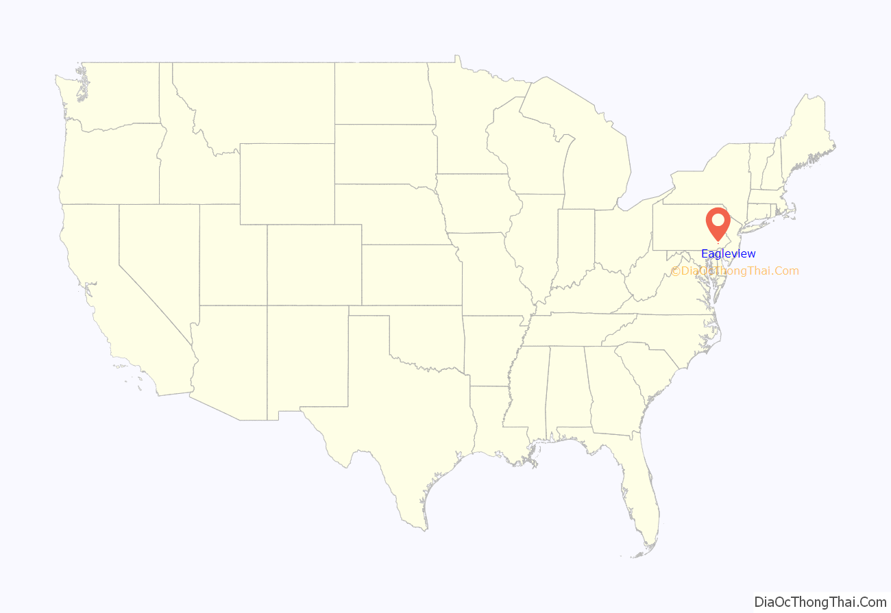
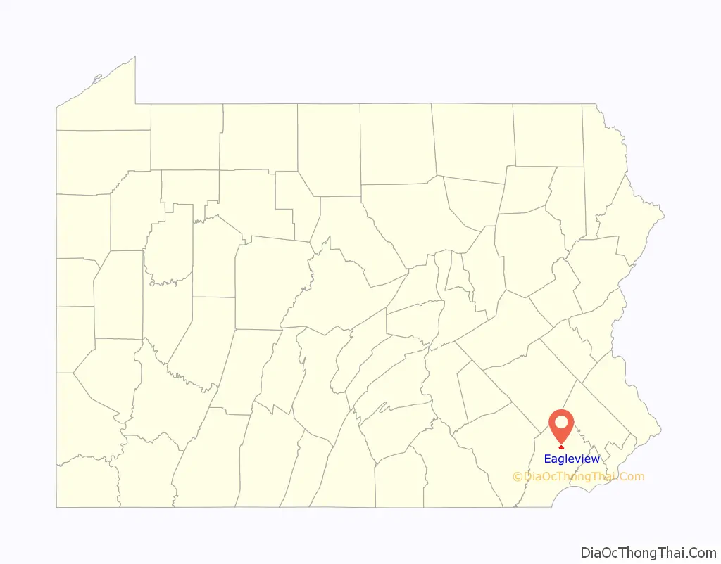
Eagleview location map. Where is Eagleview CDP?
Eagleview Road Map
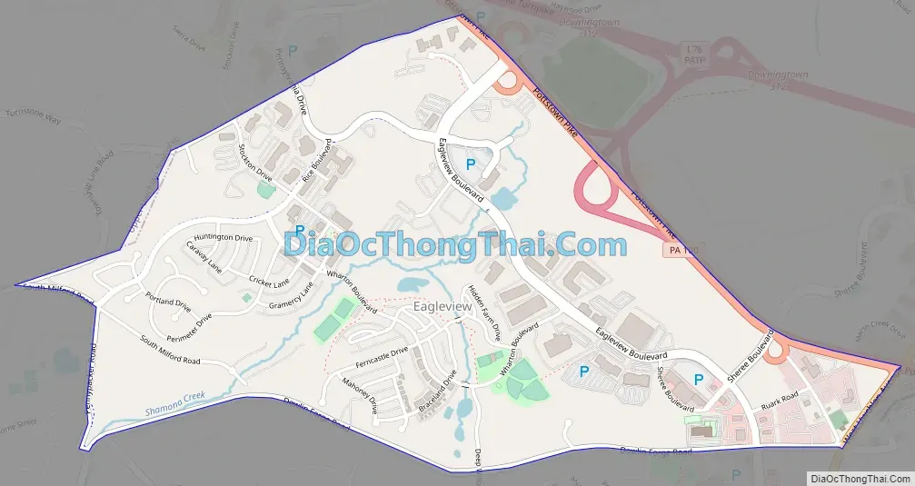
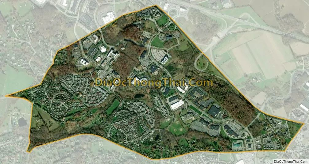
Eagleview city Satellite Map
Geography
Eagleview is located at 40°3′41″N 75°40′31″W / 40.06139°N 75.67528°W / 40.06139; -75.67528 along the northwest border of Uwchlan Township. Pennsylvania Route 100, also known as Pottstown Pike, forms the northeastern edge of Eagleview, including Route 100’s connection to Exit 312 of the Pennsylvania Turnpike. According to the U.S. Census Bureau, Eagleview has a total area of 1.4 square miles (3.5 km), all land.
See also
Map of Pennsylvania State and its subdivision:- Adams
- Allegheny
- Armstrong
- Beaver
- Bedford
- Berks
- Blair
- Bradford
- Bucks
- Butler
- Cambria
- Cameron
- Carbon
- Centre
- Chester
- Clarion
- Clearfield
- Clinton
- Columbia
- Crawford
- Cumberland
- Dauphin
- Delaware
- Elk
- Erie
- Fayette
- Forest
- Franklin
- Fulton
- Greene
- Huntingdon
- Indiana
- Jefferson
- Juniata
- Lackawanna
- Lancaster
- Lawrence
- Lebanon
- Lehigh
- Luzerne
- Lycoming
- Mc Kean
- Mercer
- Mifflin
- Monroe
- Montgomery
- Montour
- Northampton
- Northumberland
- Perry
- Philadelphia
- Pike
- Potter
- Schuylkill
- Snyder
- Somerset
- Sullivan
- Susquehanna
- Tioga
- Union
- Venango
- Warren
- Washington
- Wayne
- Westmoreland
- Wyoming
- York
- Alabama
- Alaska
- Arizona
- Arkansas
- California
- Colorado
- Connecticut
- Delaware
- District of Columbia
- Florida
- Georgia
- Hawaii
- Idaho
- Illinois
- Indiana
- Iowa
- Kansas
- Kentucky
- Louisiana
- Maine
- Maryland
- Massachusetts
- Michigan
- Minnesota
- Mississippi
- Missouri
- Montana
- Nebraska
- Nevada
- New Hampshire
- New Jersey
- New Mexico
- New York
- North Carolina
- North Dakota
- Ohio
- Oklahoma
- Oregon
- Pennsylvania
- Rhode Island
- South Carolina
- South Dakota
- Tennessee
- Texas
- Utah
- Vermont
- Virginia
- Washington
- West Virginia
- Wisconsin
- Wyoming