Eddystone is a borough in Delaware County, Pennsylvania, United States. The population was 2,410 at the 2010 census.
| Name: | Eddystone borough |
|---|---|
| LSAD Code: | 21 |
| LSAD Description: | borough (suffix) |
| State: | Pennsylvania |
| County: | Delaware County |
| Elevation: | 20 ft (6 m) |
| Total Area: | 1.52 sq mi (3.94 km²) |
| Land Area: | 0.99 sq mi (2.58 km²) |
| Water Area: | 0.53 sq mi (1.37 km²) |
| Total Population: | 2,459 |
| Population Density: | 2,471.36/sq mi (954.64/km²) |
| ZIP code: | 19022 |
| Area code: | 610 |
| FIPS code: | 4222296 |
| Website: | www.eddystoneboro.com |
Online Interactive Map
Click on ![]() to view map in "full screen" mode.
to view map in "full screen" mode.
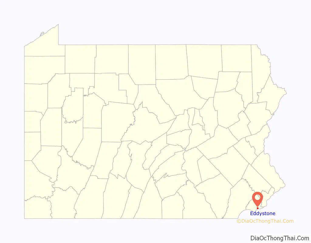
Eddystone location map. Where is Eddystone borough?

History
The area at the mouth of Ridley Creek was first called “Tequirassy” by Native Americans. The land was owned by Olof Persson Stille, one of the early settlers from New Sweden, who had immigrated in 1641. Olof Stille, a millwright by trade, came from Penningby Manor in Länna in the county of Uppland, north of Stockholm, Sweden. After the conquest of the colony by the Dutch in 1658, Stille was one of the four commissaries or magistrates appointed to administer justice among the inhabitants, and thus became a judge of the first court on the banks of the Delaware.
The borough of Eddystone was formed around the Eddystone Print Works. William Simpson & Sons established the Eddystone Print Works on the land that is now Eddystone in October 1873, after the land on which their previous factory had operated was condemned to make way for Fairmount Park.
Eddystone Borough was incorporated on December 7, 1888. Eddystone’s petition for incorporation was challenged in court on several grounds, including that “the finances of the township of Ridley and of the Ridley school district will be diminished by the creation of this borough.” On December 3, 1888, the Delaware County Court of Common Pleas issued an opinion rejecting these claims, noting that while Ridley’s “revenues…will be diminished, so will its burdens.”
On April 10, 1917, an explosion at the Eddystone Ammunition Corporation near Chester resulted in the deaths of 133 workers, mostly women.
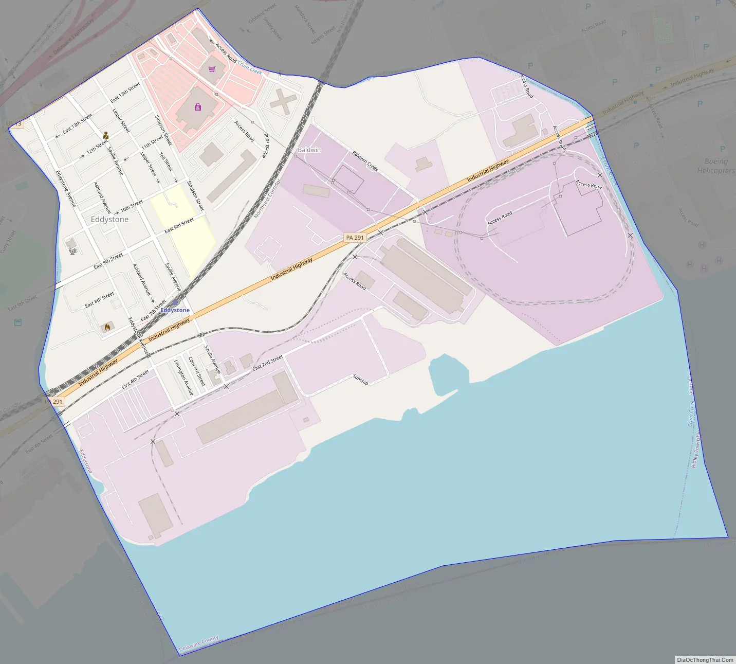
Eddystone Road Map
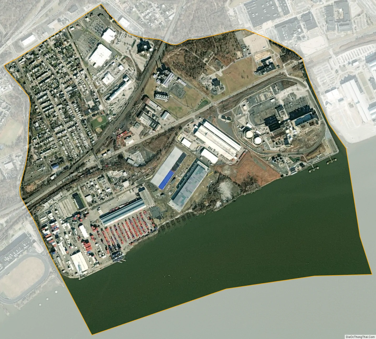
Eddystone city Satellite Map
Geography
Eddystone is located in southern Delaware County at 39°51′34″N 75°20′27″W / 39.85944°N 75.34083°W / 39.85944; -75.34083 (39.859345, -75.340920), on the north bank of the Delaware River. It is bordered to the east by Crum Creek, to the west by Ridley Creek. Ridley Township borders Eddystone to the north and east, the city of Chester is on the western border, and Gloucester County, New Jersey, is to the south across the Delaware.
According to the U.S. Census Bureau, Eddystone has a total area of 1.5 square miles (3.9 km), of which 1.0 square mile (2.6 km) is land and 0.54 square miles (1.4 km), or 34.70%, is water, primarily the Delaware River.
See also
Map of Pennsylvania State and its subdivision:- Adams
- Allegheny
- Armstrong
- Beaver
- Bedford
- Berks
- Blair
- Bradford
- Bucks
- Butler
- Cambria
- Cameron
- Carbon
- Centre
- Chester
- Clarion
- Clearfield
- Clinton
- Columbia
- Crawford
- Cumberland
- Dauphin
- Delaware
- Elk
- Erie
- Fayette
- Forest
- Franklin
- Fulton
- Greene
- Huntingdon
- Indiana
- Jefferson
- Juniata
- Lackawanna
- Lancaster
- Lawrence
- Lebanon
- Lehigh
- Luzerne
- Lycoming
- Mc Kean
- Mercer
- Mifflin
- Monroe
- Montgomery
- Montour
- Northampton
- Northumberland
- Perry
- Philadelphia
- Pike
- Potter
- Schuylkill
- Snyder
- Somerset
- Sullivan
- Susquehanna
- Tioga
- Union
- Venango
- Warren
- Washington
- Wayne
- Westmoreland
- Wyoming
- York
- Alabama
- Alaska
- Arizona
- Arkansas
- California
- Colorado
- Connecticut
- Delaware
- District of Columbia
- Florida
- Georgia
- Hawaii
- Idaho
- Illinois
- Indiana
- Iowa
- Kansas
- Kentucky
- Louisiana
- Maine
- Maryland
- Massachusetts
- Michigan
- Minnesota
- Mississippi
- Missouri
- Montana
- Nebraska
- Nevada
- New Hampshire
- New Jersey
- New Mexico
- New York
- North Carolina
- North Dakota
- Ohio
- Oklahoma
- Oregon
- Pennsylvania
- Rhode Island
- South Carolina
- South Dakota
- Tennessee
- Texas
- Utah
- Vermont
- Virginia
- Washington
- West Virginia
- Wisconsin
- Wyoming


