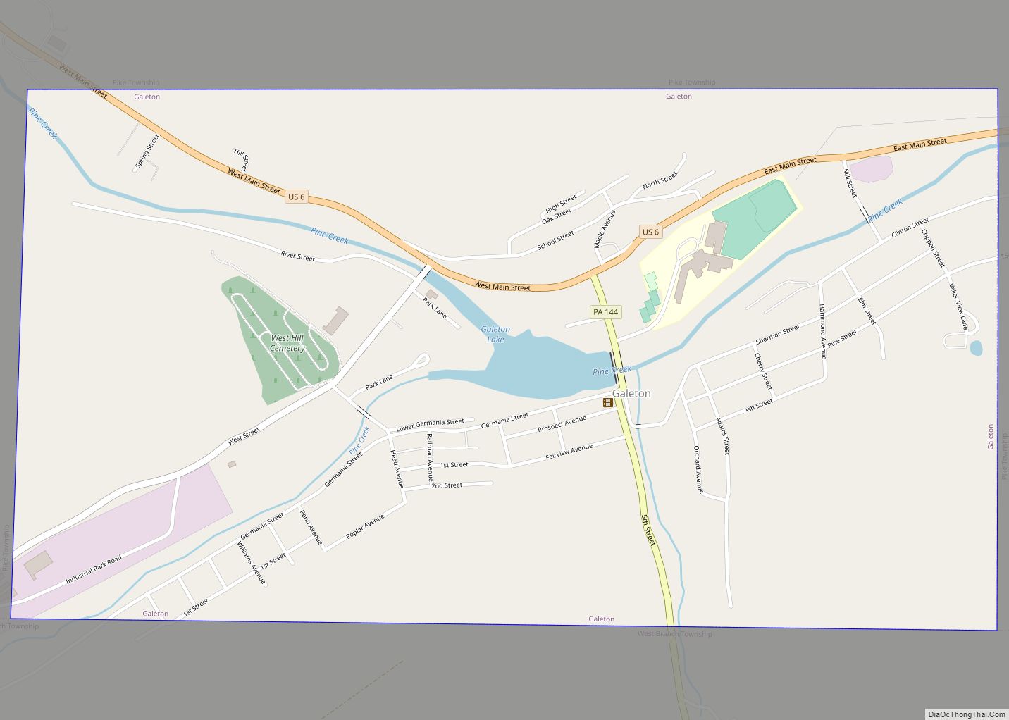
Galeton is a borough in Potter County, Pennsylvania. It is located 50 miles (80 km) southeast of Bradford, Pennsylvania. Light industries, including knitting mills and a tannery have existed in Galeton. The population declined to 993 people in 2020.
| Name: | Galeton borough |
|---|---|
| LSAD Code: | 21 |
| LSAD Description: | borough (suffix) |
| State: | Pennsylvania |
| County: | Potter County |
| Total Area: | 1.29 sq mi (3.35 km²) |
| Land Area: | 1.27 sq mi (3.29 km²) |
| Water Area: | 0.02 sq mi (0.06 km²) |
| Total Population: | 990 |
| Population Density: | 778.91/sq mi (300.78/km²) |
| ZIP code: | 16922 |
| Area code: | 814 |
| FIPS code: | 4228280 |
Online Interactive Map
Click on ![]() to view map in "full screen" mode.
to view map in "full screen" mode.
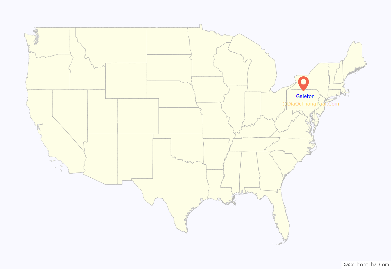
Galeton location map. Where is Galeton borough?
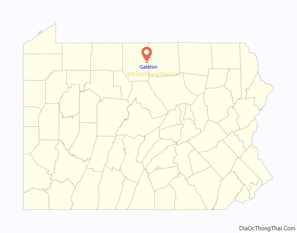
Galeton Road Map
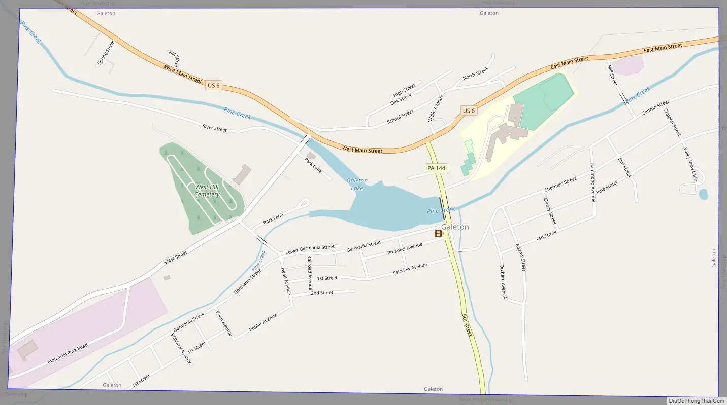
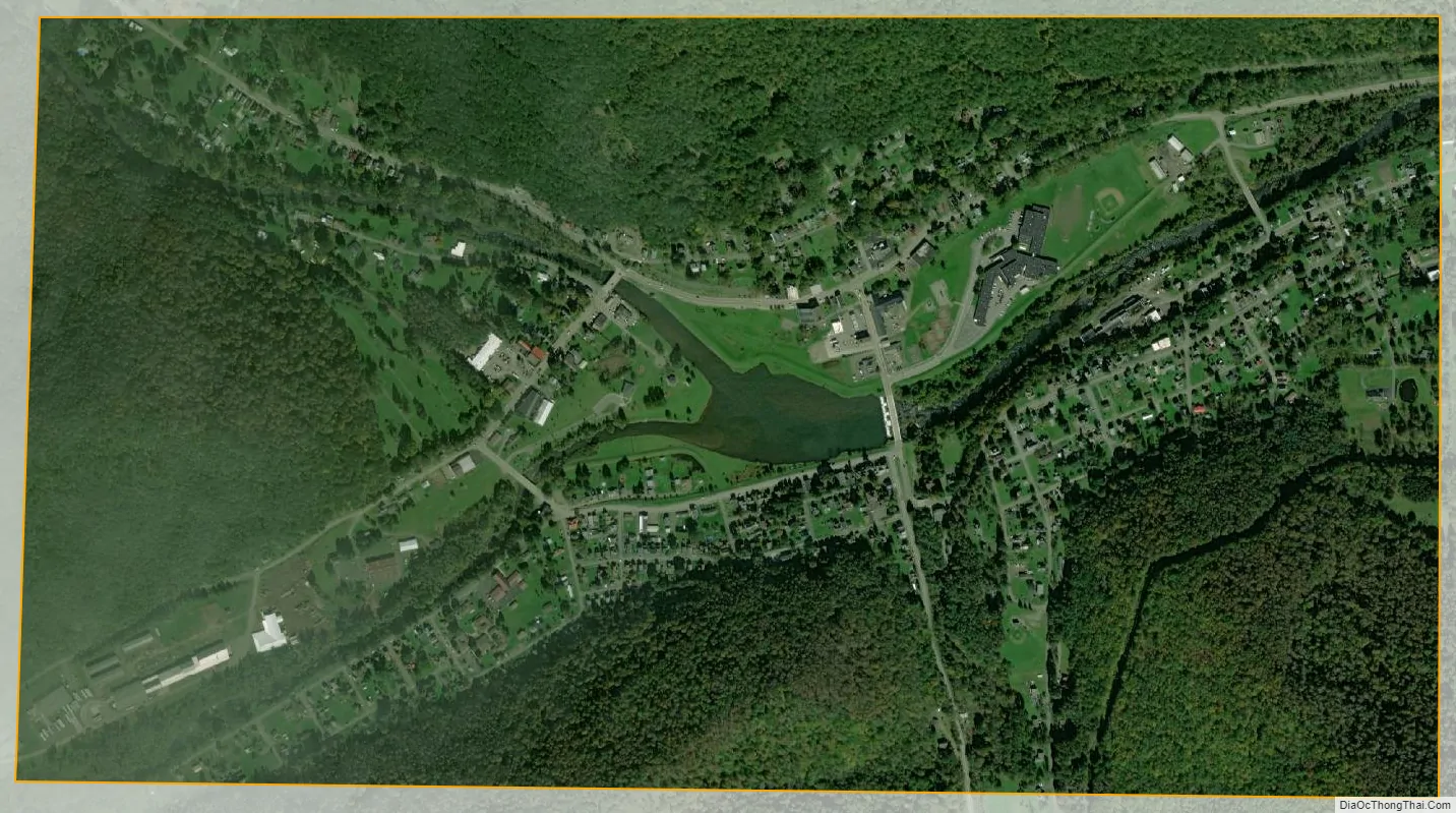
Galeton city Satellite Map
Geography
Galeton is located at 41°43′56″N 77°38′41″W / 41.73222°N 77.64472°W / 41.73222; -77.64472 (41.732267, −77.644646). It is almost completely surrounded by Pike Township, with a small portion of the southwestern corner abutting West Branch Township.
According to the U.S. Census Bureau, the borough has a total area of 0.7 square miles (1.8 km), of which 0.7 square miles (1.8 km) is land and 1.41% is water.
The town is located near Cherry Springs State Park, an area that is home to some of the darkest skies on the U.S. East Coast, making the town and the surrounding areas a tourist destination.
See also
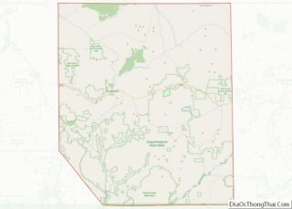
Map of Pennsylvania State and its subdivision:- Adams
- Allegheny
- Armstrong
- Beaver
- Bedford
- Berks
- Blair
- Bradford
- Bucks
- Butler
- Cambria
- Cameron
- Carbon
- Centre
- Chester
- Clarion
- Clearfield
- Clinton
- Columbia
- Crawford
- Cumberland
- Dauphin
- Delaware
- Elk
- Erie
- Fayette
- Forest
- Franklin
- Fulton
- Greene
- Huntingdon
- Indiana
- Jefferson
- Juniata
- Lackawanna
- Lancaster
- Lawrence
- Lebanon
- Lehigh
- Luzerne
- Lycoming
- Mc Kean
- Mercer
- Mifflin
- Monroe
- Montgomery
- Montour
- Northampton
- Northumberland
- Perry
- Philadelphia
- Pike
- Potter
- Schuylkill
- Snyder
- Somerset
- Sullivan
- Susquehanna
- Tioga
- Union
- Venango
- Warren
- Washington
- Wayne
- Westmoreland
- Wyoming
- York
- Alabama
- Alaska
- Arizona
- Arkansas
- California
- Colorado
- Connecticut
- Delaware
- District of Columbia
- Florida
- Georgia
- Hawaii
- Idaho
- Illinois
- Indiana
- Iowa
- Kansas
- Kentucky
- Louisiana
- Maine
- Maryland
- Massachusetts
- Michigan
- Minnesota
- Mississippi
- Missouri
- Montana
- Nebraska
- Nevada
- New Hampshire
- New Jersey
- New Mexico
- New York
- North Carolina
- North Dakota
- Ohio
- Oklahoma
- Oregon
- Pennsylvania
- Rhode Island
- South Carolina
- South Dakota
- Tennessee
- Texas
- Utah
- Vermont
- Virginia
- Washington
- West Virginia
- Wisconsin
- Wyoming