Homer City is a borough in Indiana County, Pennsylvania, United States. The population was 1,746 at the 2020 census. Homer City is located in the Indiana metro area. The community was named for the famous Greek poet Homer by founder William Wilson in 1854. It was incorporated as a borough on Thursday, September 26, 1872.
| Name: | Homer City borough |
|---|---|
| LSAD Code: | 21 |
| LSAD Description: | borough (suffix) |
| State: | Pennsylvania |
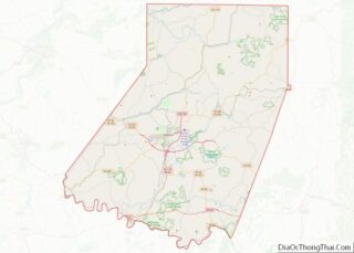
| County: | Indiana County |
| Elevation: | 1,375 ft (419 m) |
| Total Area: | 0.56 sq mi (1.45 km²) |
| Land Area: | 0.55 sq mi (1.43 km²) |
| Water Area: | 0.01 sq mi (0.02 km²) |
| Total Population: | 1,730 |
| Population Density: | 3,134.06/sq mi (1,209.57/km²) |
| ZIP code: | 15748 |
| FIPS code: | 4235408 |
| Website: | www.homercity.com |
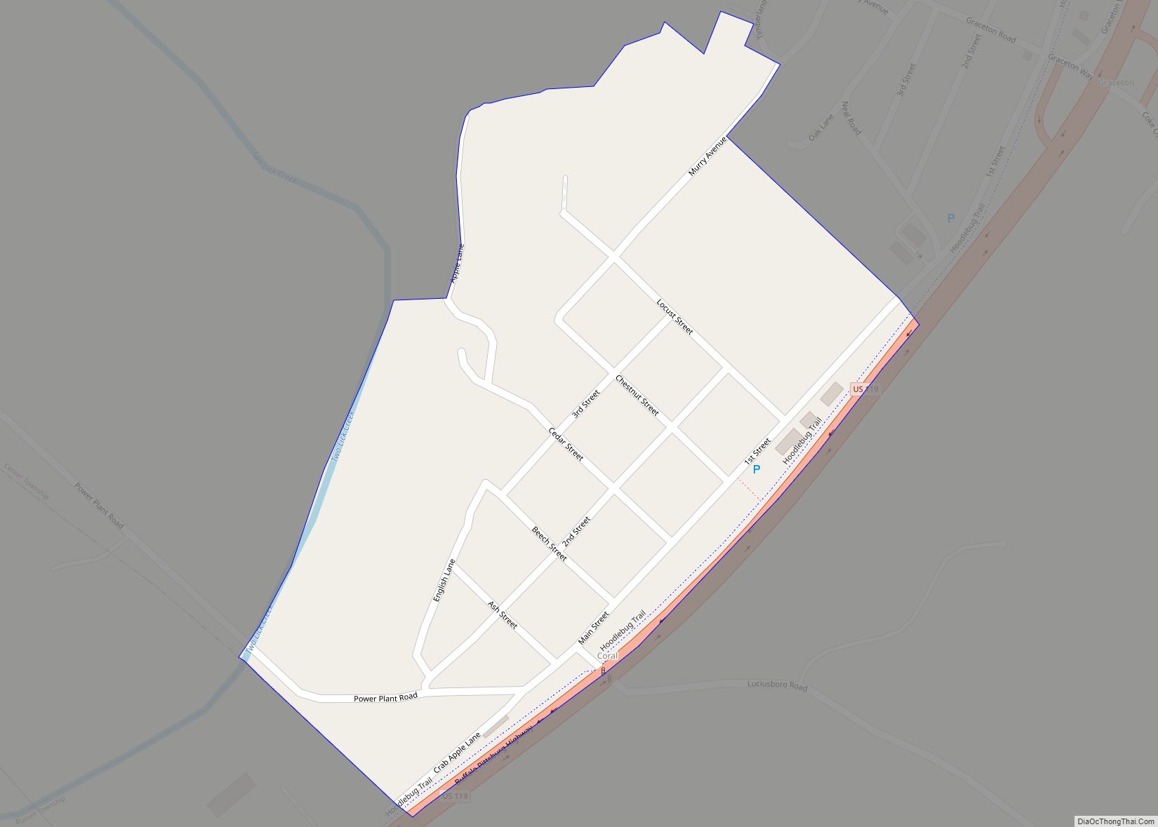
Online Interactive Map
Click on ![]() to view map in "full screen" mode.
to view map in "full screen" mode.
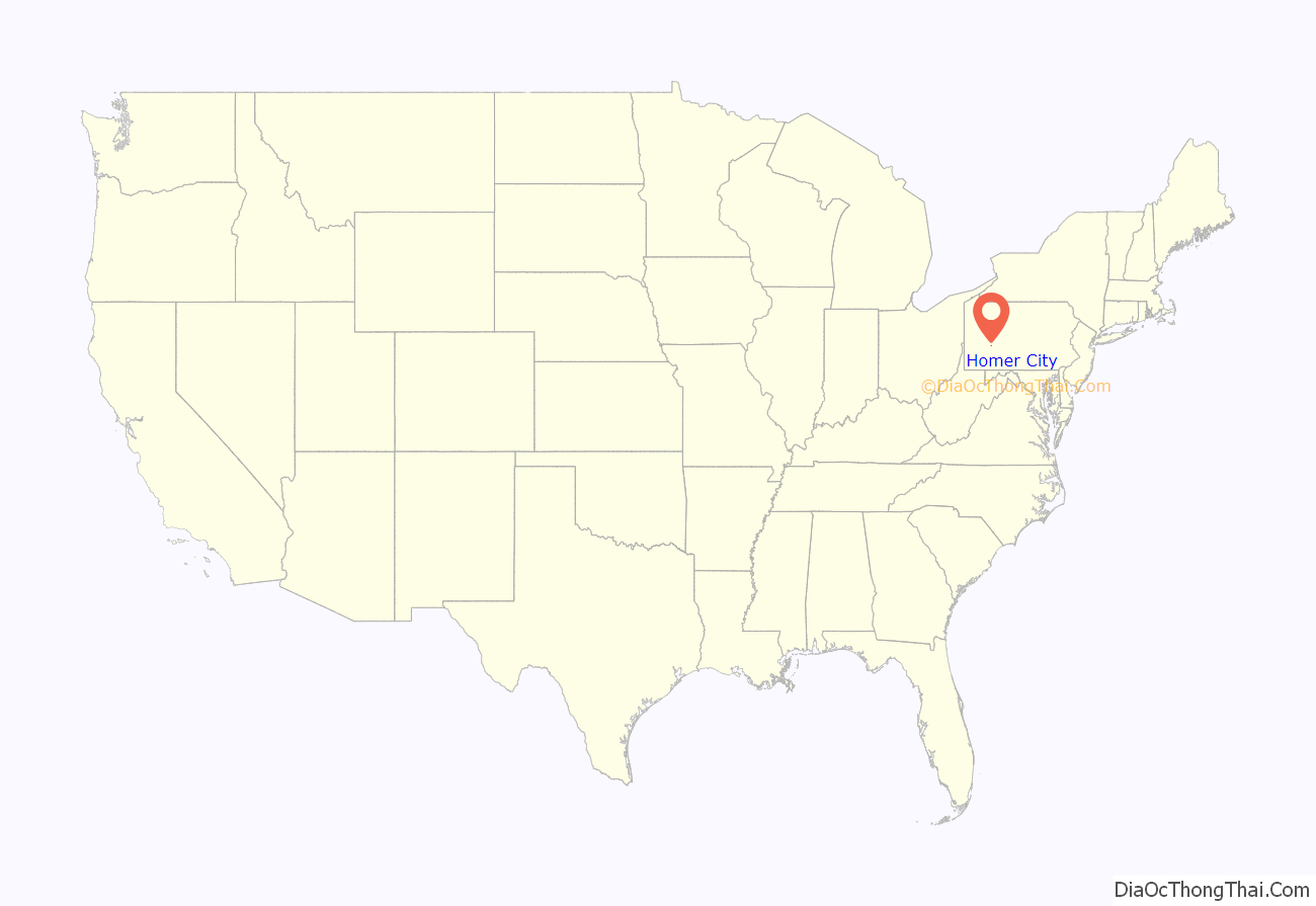
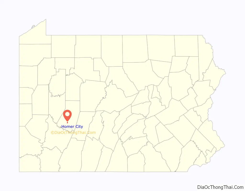
Homer City location map. Where is Homer City borough?
History
The two treaties of Fort Stanwix (of 1768 and, after American independence, of 1784) secured the westward expansion of Pennsylvania into the region where the Borough of Homer City is now located, on land inhabited by the six Indian nations. With white settlement these new territories were initially organized as part of existing counties in eastern and central Pennsylvania. White settlers were few in the eighteenth century and encountering Indians still very much a part of daily life. Any degree of stability and safety came only after the Battle of Fallen Timbers (1794). Indiana County was carved out of Westmoreland and Lycoming counties in 1803 and divided into three townships: Wheatfield, Armstrong, and Mahoning. The confluence of Two Lick and Yellow creeks (present-day Homer City) was a contender for the seat of government for the new county, but instead the “extraordinary overtures” of George Clymer, a local landowners and a signer of the Declaration of Independence, saw the county seat situated instead in what would become the Borough of Indiana. Center Township – the unincorporated area surrounding present-day Homer City – was created from a portion of Armstrong Township in 1807, its landscape dotted with larger and smaller family homesteads (farms) and an increasing number of mills and trading posts.
Parts of Center Township were settled early on by Scots-Irish Presbyterians as in other parts of Indiana County, but Methodist families of English and Welsh descent came to dominate the Homer City area, and they remained prominent in its civic and commercial life well into the twentieth century. William Wilson laid out the village of Homer in 1854 naming it after the Classical Greek poet. For several years, however, its post office was designated Phillips Mill (or Mills on some maps), a name derived from that of early settler Armour Phillips Sr. When the village became a borough in 1872 – with the consolidation and annexation of neighboring parcels – more and more it was referred to as Homer City.
With a post office and a stop (later station) on the Pennsylvania Railroad line, the Borough of Homer City developed along the lines of many small towns in the late nineteenth and early twentieth centuries. It traditionally offered goods and services including merchants, a bank, medical professionals, craftsmen, and schools not only to borough residents, but also to inhabitants of surrounding, rural Center Township. The township’s development took a different path. Enduring settlements beyond family homesteads awaited the establishment of villages (company towns) by coal companies in the early twentieth century. More often than not they bore the names of the companies, their owners, families and company executives (e.g., Waterman, Graceton, Luciusboro) as in other parts of Indiana County.
The general prosperity of the post-World War II era saw the greater affluence of Homer City and Center Township residents, better (wider, paved) roads and increased automobile ownership leading to the expansion of residential areas at the edges of Homer City and into the once rural farmland of Center Township – in the form of sub-developments and individually owned homesteads (non-agricultural lots). These trends have continued with newer developments such as Red Maple Drive and Mystic Rock on Route 56 in Center Township and the housing developments outside the village of Lucerne (Mines).
The Homer-Center School District has boundaries coterminous with the Borough of Homer City and surrounding Center Township. This fact, combined with the use of “Homer City” as a mailing address and telephone exchange, has often blurred the boundaries of the Borough and Center Township even though they remain distinct political entities. Residences and businesses beyond the confines of the Borough (and even beyond those of Center Township) can possess “Homer City” mailing addresses and telephone numbers. Examples include the Homer City Generating Station and Non-Lethal Technologies, both of which are referenced in this article.
A novella called The Roving Red Rangers or Laura Lamar of the Susquehanna by Charles Asbury Robinson, was set in the Homer City area. It was published by the author in 1902. It has often been erroneously understood as a work of non-fiction and given rise to mistaken notions about local history, especially when the name “Laura Lamar” derived from a character in this novella was suggested and adopted as the name of the local school district in the 1952.
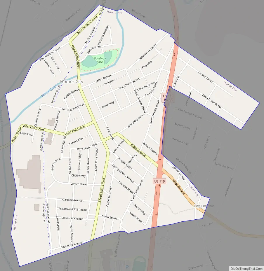
Homer City Road Map
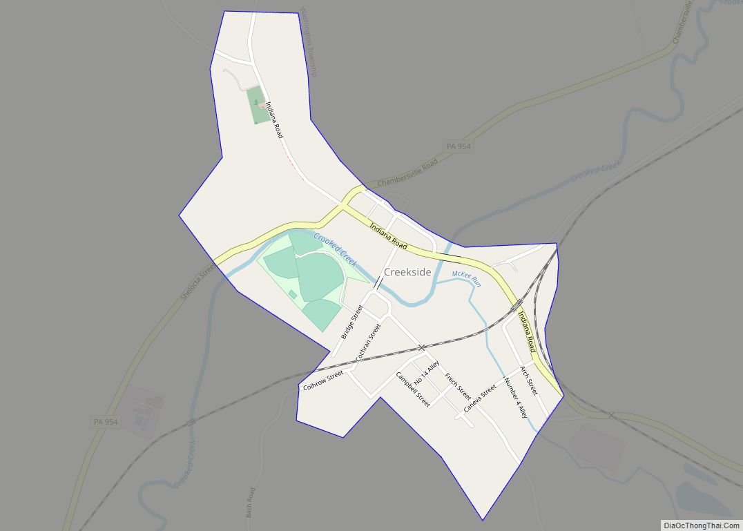
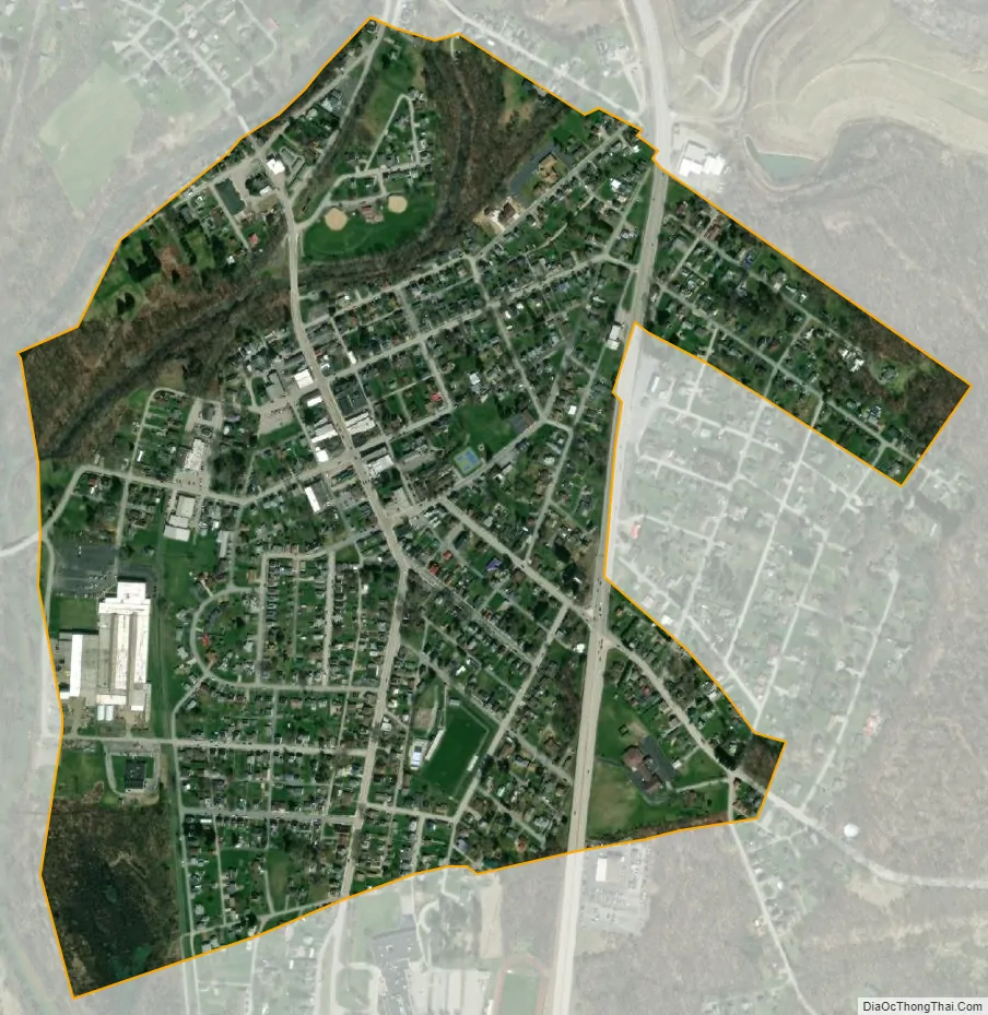
Homer City city Satellite Map
Geography
Homer City is located at 40°32′23″N 79°09′33″W / 40.539672°N 79.159244°W / 40.539672; -79.159244. It is situated 6 miles (10 km) from Indiana, 30 miles (48 km) from Greensburg, 25 miles (40 km) from Johnstown, and 50 miles (80 km) from Pittsburgh.
According to the United States Census Bureau, the borough has a total area of 0.6 square miles (1.6 km), all land.
See also
Map of Pennsylvania State and its subdivision:- Adams
- Allegheny
- Armstrong
- Beaver
- Bedford
- Berks
- Blair
- Bradford
- Bucks
- Butler
- Cambria
- Cameron
- Carbon
- Centre
- Chester
- Clarion
- Clearfield
- Clinton
- Columbia
- Crawford
- Cumberland
- Dauphin
- Delaware
- Elk
- Erie
- Fayette
- Forest
- Franklin
- Fulton
- Greene
- Huntingdon
- Indiana
- Jefferson
- Juniata
- Lackawanna
- Lancaster
- Lawrence
- Lebanon
- Lehigh
- Luzerne
- Lycoming
- Mc Kean
- Mercer
- Mifflin
- Monroe
- Montgomery
- Montour
- Northampton
- Northumberland
- Perry
- Philadelphia
- Pike
- Potter
- Schuylkill
- Snyder
- Somerset
- Sullivan
- Susquehanna
- Tioga
- Union
- Venango
- Warren
- Washington
- Wayne
- Westmoreland
- Wyoming
- York
- Alabama
- Alaska
- Arizona
- Arkansas
- California
- Colorado
- Connecticut
- Delaware
- District of Columbia
- Florida
- Georgia
- Hawaii
- Idaho
- Illinois
- Indiana
- Iowa
- Kansas
- Kentucky
- Louisiana
- Maine
- Maryland
- Massachusetts
- Michigan
- Minnesota
- Mississippi
- Missouri
- Montana
- Nebraska
- Nevada
- New Hampshire
- New Jersey
- New Mexico
- New York
- North Carolina
- North Dakota
- Ohio
- Oklahoma
- Oregon
- Pennsylvania
- Rhode Island
- South Carolina
- South Dakota
- Tennessee
- Texas
- Utah
- Vermont
- Virginia
- Washington
- West Virginia
- Wisconsin
- Wyoming