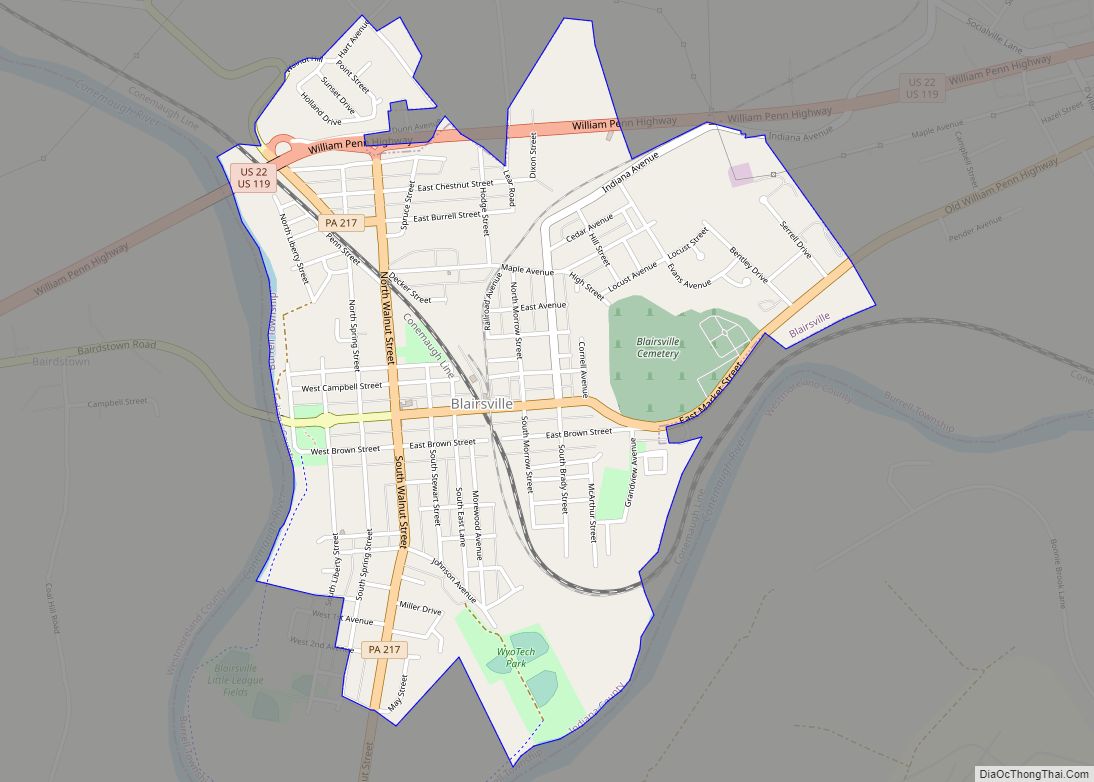
Indiana is a borough in and the county seat of Indiana County, Pennsylvania, United States. The population was 14,044 at the 2020 census. It is the principal city of the Indiana, Pennsylvania micropolitan area, about 46 miles (74 km) northeast of Pittsburgh. It is a part of the greater Pittsburgh–New Castle–Weirton combined statistical area, as well as the Johnstown and Pittsburgh media markets.
The borough and the region as a whole promote itself as the “Christmas Tree Capital of the World” because the national Christmas Tree Growers Association was founded there. There are still many Christmas tree farms in the area. The largest employer in the borough today is Indiana University of Pennsylvania, the second-largest of 14 PASSHE schools in the state.
| Name: | Indiana borough |
|---|---|
| LSAD Code: | 21 |
| LSAD Description: | borough (suffix) |
| State: | Pennsylvania |
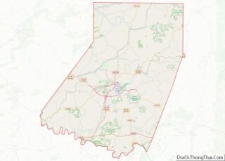
| County: | Indiana County |
| Incorporated: | 1816 |
| Elevation: | 1,301 ft (397 m) |
| Total Area: | 1.76 sq mi (4.57 km²) |
| Land Area: | 1.76 sq mi (4.56 km²) |
| Water Area: | 0.01 sq mi (0.01 km²) |
| Total Population: | 14,044 |
| Population Density: | 7,984.08/sq mi (3,082.17/km²) |
| FIPS code: | 4236816 |
| Website: | www.indianaboro.com |
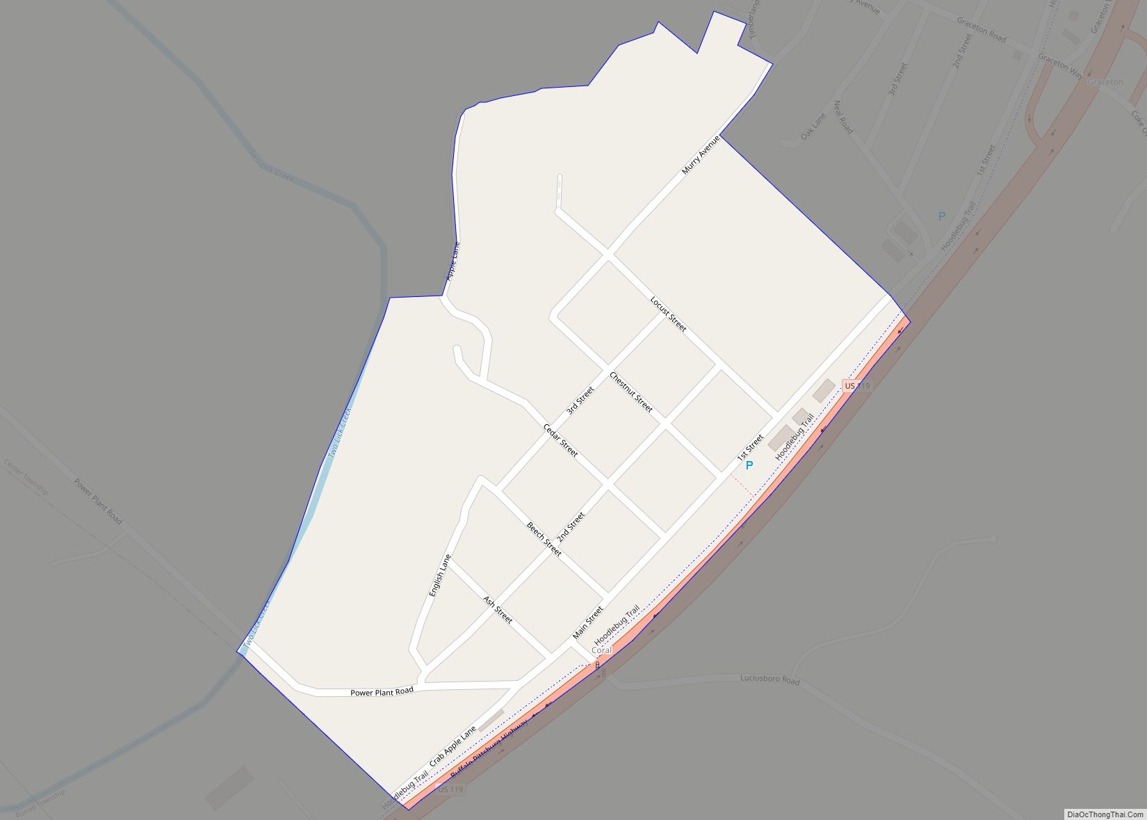
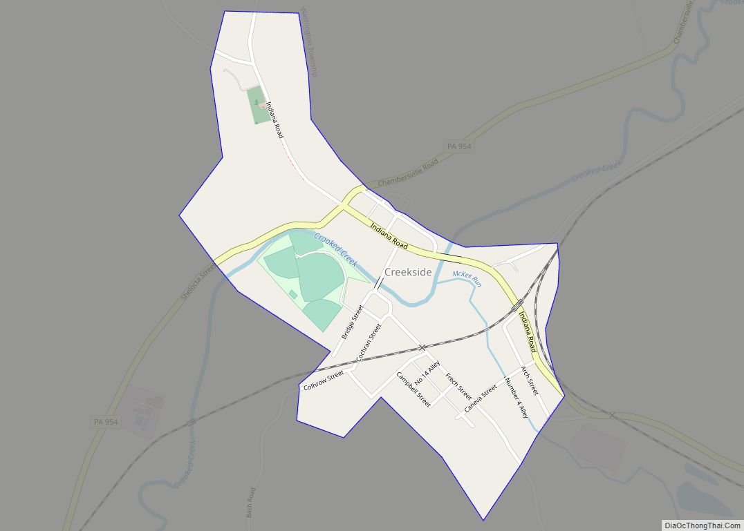
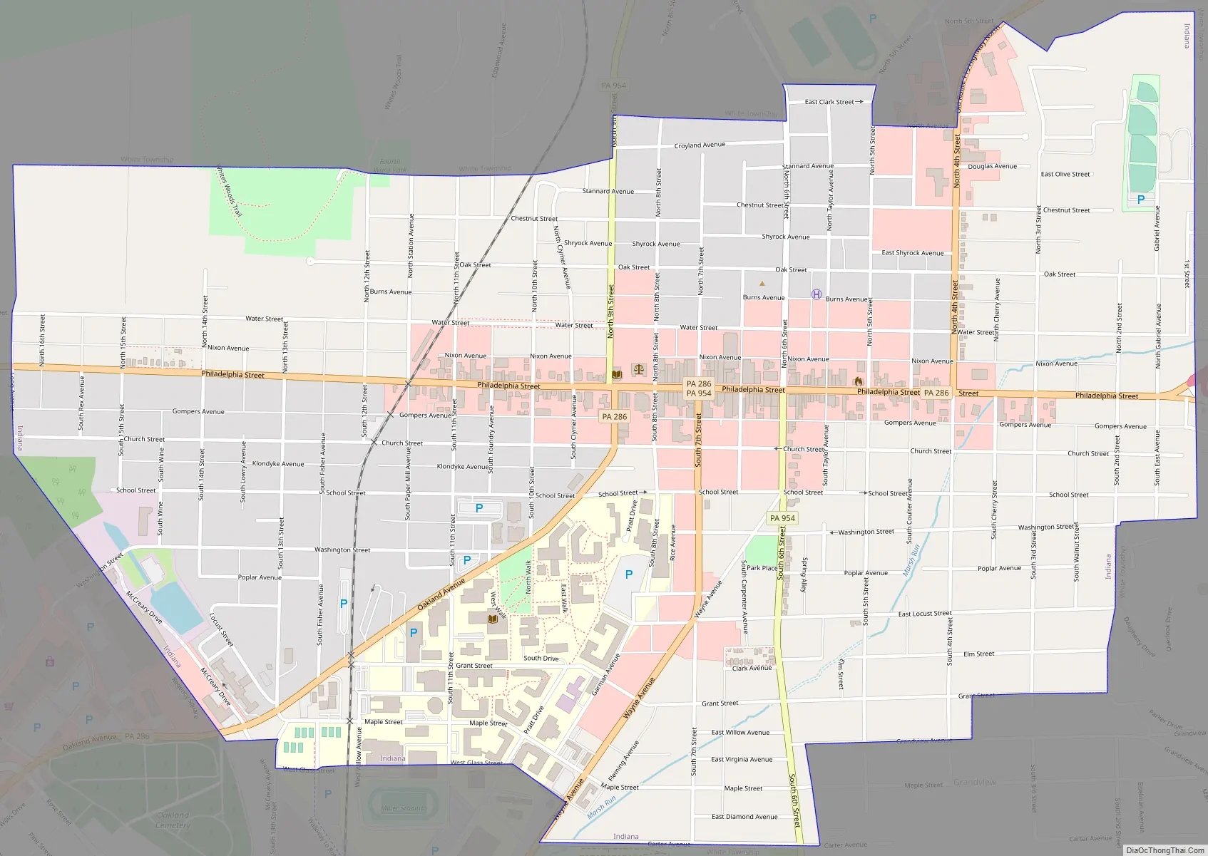
Online Interactive Map
Click on ![]() to view map in "full screen" mode.
to view map in "full screen" mode.
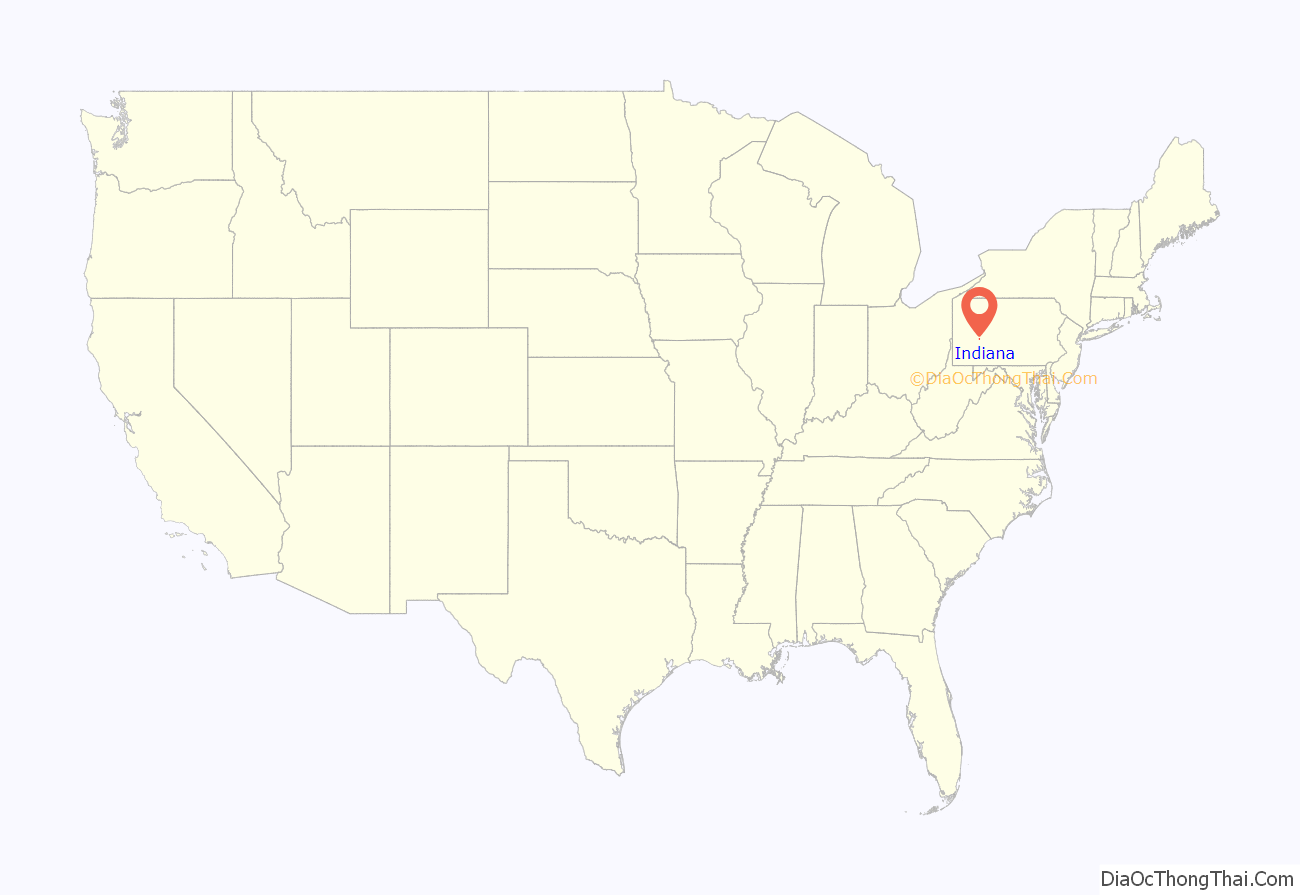
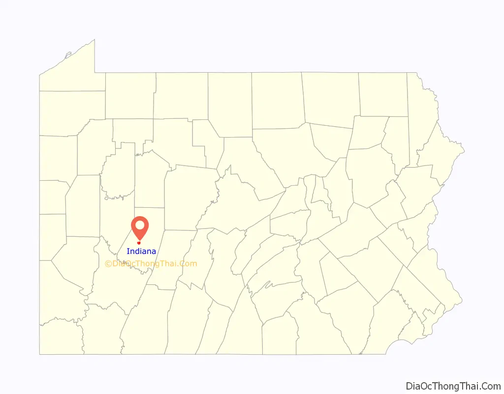
Indiana location map. Where is Indiana borough?
History
Indiana takes its name from Indiana County, which in turn gets its name from the “Indiana grant” of the First Treaty of Fort Stanwix. Indiana was founded in 1805 to be the new county’s seat from a grant of land by Founding Father George Clymer. By 1810, it had a population of 125.
On at least one occasion, an anti-slavery mob in Indiana rescued a fugitive slave from extradition back to slavery in the South. The town was also where James Moorhead, a local abolitionist leader, published several anti-slavery newspapers. The first of these was The Clarion of Freedom, founded in 1843. Moorhead eventually sold the Clarion and founded a new anti-slavery paper, the Indiana Independent, which he published until his death in 1857. The Independent was published by his son J. W. Moorhead after his death.
The Indiana Weekly Messenger was published in the town between 1874 and 1946.
The Downtown Indiana Historic District was listed on the National Register of Historic Places in 1993. Also listed on the National Register are Breezedale, Buffalo, Rochester & Pittsburgh Railway Indiana Passenger Station, Silas M. Clark House, Graff’s Market, James Mitchell House, Old Indiana County Courthouse, Indiana Borough 1912 Municipal Building, Indiana Armory, Old Indiana County Jail and Sheriff’s Office, and John Sutton Hall.
Indiana Road Map
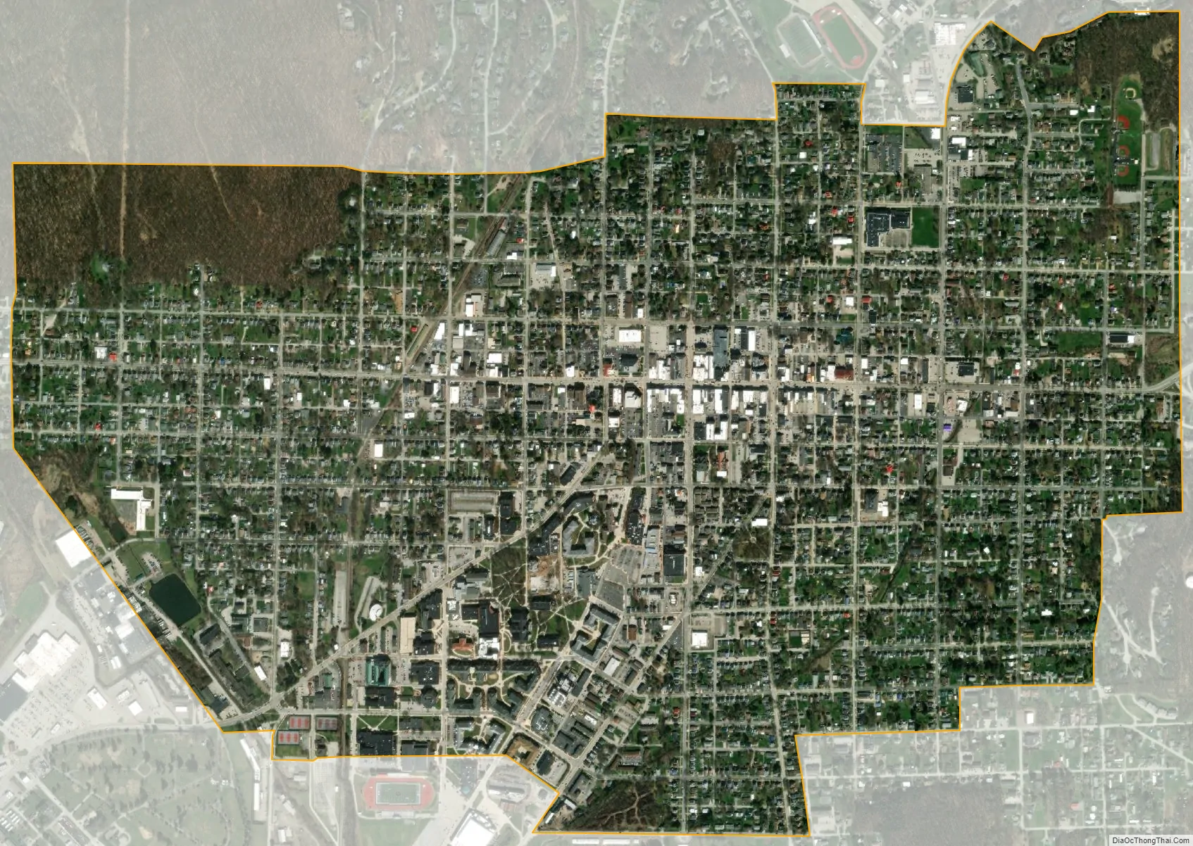
Indiana city Satellite Map
Geography
Indiana, Pennsylvania is located at 40°37′16″N 79°9′18″W / 40.62111°N 79.15500°W / 40.62111; -79.15500 (40.6211, -79.1549). The borough is an independent municipality surrounded by White Township. For some time in the 1990s there was discussion of merging the borough and township, but the matter was never acted upon.
According to the United States Census Bureau, the borough has a total area of 1.8 square miles (4.7 km), all of it land.
Climate
Indiana has a humid continental climate (Köppen Dfb), with warm summers and cold, snowy winters. Precipitation is highest in the summer months, falling as snow usually between November and April.
See also
Map of Pennsylvania State and its subdivision:- Adams
- Allegheny
- Armstrong
- Beaver
- Bedford
- Berks
- Blair
- Bradford
- Bucks
- Butler
- Cambria
- Cameron
- Carbon
- Centre
- Chester
- Clarion
- Clearfield
- Clinton
- Columbia
- Crawford
- Cumberland
- Dauphin
- Delaware
- Elk
- Erie
- Fayette
- Forest
- Franklin
- Fulton
- Greene
- Huntingdon
- Indiana
- Jefferson
- Juniata
- Lackawanna
- Lancaster
- Lawrence
- Lebanon
- Lehigh
- Luzerne
- Lycoming
- Mc Kean
- Mercer
- Mifflin
- Monroe
- Montgomery
- Montour
- Northampton
- Northumberland
- Perry
- Philadelphia
- Pike
- Potter
- Schuylkill
- Snyder
- Somerset
- Sullivan
- Susquehanna
- Tioga
- Union
- Venango
- Warren
- Washington
- Wayne
- Westmoreland
- Wyoming
- York
- Alabama
- Alaska
- Arizona
- Arkansas
- California
- Colorado
- Connecticut
- Delaware
- District of Columbia
- Florida
- Georgia
- Hawaii
- Idaho
- Illinois
- Indiana
- Iowa
- Kansas
- Kentucky
- Louisiana
- Maine
- Maryland
- Massachusetts
- Michigan
- Minnesota
- Mississippi
- Missouri
- Montana
- Nebraska
- Nevada
- New Hampshire
- New Jersey
- New Mexico
- New York
- North Carolina
- North Dakota
- Ohio
- Oklahoma
- Oregon
- Pennsylvania
- Rhode Island
- South Carolina
- South Dakota
- Tennessee
- Texas
- Utah
- Vermont
- Virginia
- Washington
- West Virginia
- Wisconsin
- Wyoming