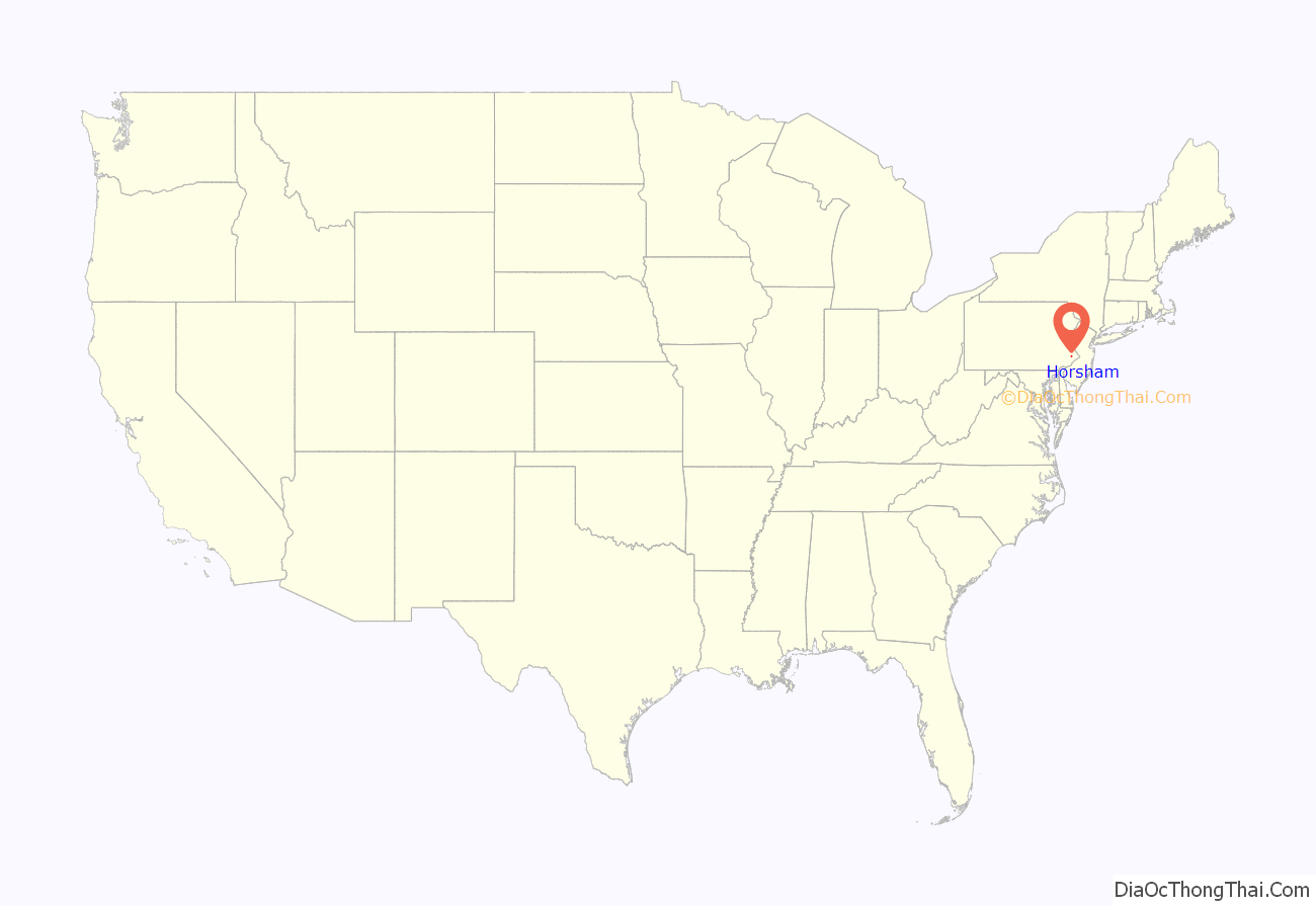
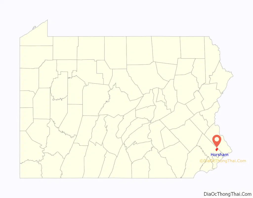
Horsham is a home rule municipality in Montgomery County, Pennsylvania, United States. The population was 15,193 at the 2020 census. Horsham is located entirely within Horsham Township, and it is home to the Horsham Air Guard Station at the former site of Naval Air Station Joint Reserve Base Willow Grove.
Horsham is located 34 miles (55 km) southeast of Allentown and 16 miles (26 km) north of Philadelphia.
| Name: | Horsham CDP |
|---|---|
| LSAD Code: | 57 |
| LSAD Description: | CDP (suffix) |
| State: | Pennsylvania |
| County: | Montgomery County |
| Elevation: | 249 ft (76 m) |
| Total Area: | 5.47 sq mi (14.17 km²) |
| Land Area: | 5.47 sq mi (14.17 km²) |
| Water Area: | 0.00 sq mi (0.00 km²) |
| Total Population: | 15,193 |
| Population Density: | 2,777.51/sq mi (1,072.40/km²) |
| ZIP code: | 19044 |
| Area code: | 215, 267, and 445 |
| FIPS code: | 4235800 |
| GNISfeature ID: | 1177472 |
Online Interactive Map
Click on ![]() to view map in "full screen" mode.
to view map in "full screen" mode.
Horsham location map. Where is Horsham CDP?
History
Horsham Township was established in 1717 by Samuel Carpenter, who was from the town of Horsham in Sussex, England. The Township, incorporated in 1717, is one of the oldest original municipalities in Montgomery County. Although it retains the word “Township” in its official name, it has been governed by a Home Rule Charter since 1975 and is therefore not subject to the Pennsylvania Township Code.
Horsham Township is named after the town of Horsham in West Sussex County, England. Horsham is one of several townships in Montgomery County whose name and size were determined by master survey lines drawn by William Penn’s engineers as they first plotted this part of the colony for sale and settlement. Parallel lines, projected at intervals of a mile and a half and extending in a northwesterly direction from settlements along the Delaware, served not only as base lines for measurement of individual land grants but also as courses for future highways. County Line Road, Horsham Road, and Welsh Road are examples of highways thus laid out. The effect of these survey lines upon the development pattern of Eastern Montgomery County is very much in evidence today.
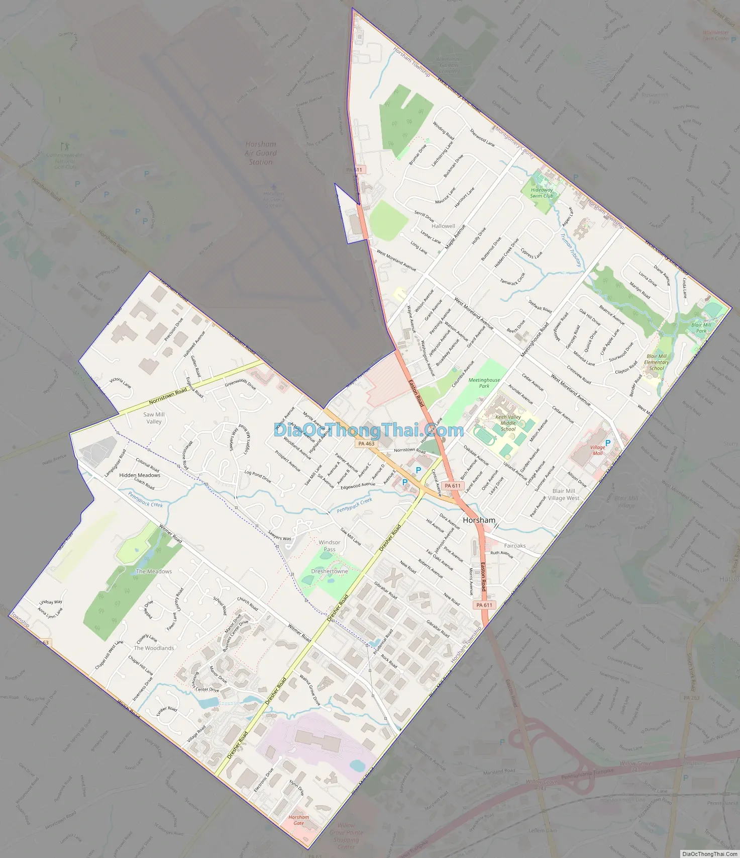
Horsham Road Map
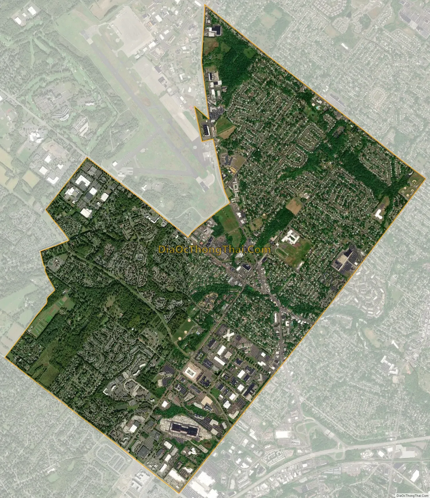
Horsham city Satellite Map
Geography
Horsham Township covers an area of 17 square miles, 89.70 miles of which are township roads. There are 23.72 miles of state roads and 1.5 miles of county roads. Horsham Township is made up of several community areas including Horsham (19044) and portions of the Hatboro (19040), Ambler (19002), Chalfont (18914), and North Wales (19454) zip codes.
Climate
The climate in this area is characterized by hot, humid summers and generally cool to cold winters. According to the Köppen Climate Classification system, Horsham has a humid continental climate, abbreviated “Dfa” on climate maps.
See also
Map of Pennsylvania State and its subdivision:- Adams
- Allegheny
- Armstrong
- Beaver
- Bedford
- Berks
- Blair
- Bradford
- Bucks
- Butler
- Cambria
- Cameron
- Carbon
- Centre
- Chester
- Clarion
- Clearfield
- Clinton
- Columbia
- Crawford
- Cumberland
- Dauphin
- Delaware
- Elk
- Erie
- Fayette
- Forest
- Franklin
- Fulton
- Greene
- Huntingdon
- Indiana
- Jefferson
- Juniata
- Lackawanna
- Lancaster
- Lawrence
- Lebanon
- Lehigh
- Luzerne
- Lycoming
- Mc Kean
- Mercer
- Mifflin
- Monroe
- Montgomery
- Montour
- Northampton
- Northumberland
- Perry
- Philadelphia
- Pike
- Potter
- Schuylkill
- Snyder
- Somerset
- Sullivan
- Susquehanna
- Tioga
- Union
- Venango
- Warren
- Washington
- Wayne
- Westmoreland
- Wyoming
- York
- Alabama
- Alaska
- Arizona
- Arkansas
- California
- Colorado
- Connecticut
- Delaware
- District of Columbia
- Florida
- Georgia
- Hawaii
- Idaho
- Illinois
- Indiana
- Iowa
- Kansas
- Kentucky
- Louisiana
- Maine
- Maryland
- Massachusetts
- Michigan
- Minnesota
- Mississippi
- Missouri
- Montana
- Nebraska
- Nevada
- New Hampshire
- New Jersey
- New Mexico
- New York
- North Carolina
- North Dakota
- Ohio
- Oklahoma
- Oregon
- Pennsylvania
- Rhode Island
- South Carolina
- South Dakota
- Tennessee
- Texas
- Utah
- Vermont
- Virginia
- Washington
- West Virginia
- Wisconsin
- Wyoming


