Allentown (Pennsylvania Dutch: Allenschteddel, Allenschtadt, or Ellsdaun) is a city in Lehigh County in the Commonwealth of Pennsylvania, United States. The city had a population of 125,845 at the 2020 census. Allentown is the fastest-growing major city in Pennsylvania and the state’s third-largest city after Philadelphia and Pittsburgh. It is the largest city in both Lehigh County and the Lehigh Valley, which had a population of 861,899 and was the 68th-most populous metropolitan area in the United States as of 2020. Allentown was founded in 1762 and is the county seat of Lehigh County.
Located on the Lehigh River, a 109-mile-long (175 km) tributary of the Delaware River, Allentown is the largest of three adjacent cities, including Bethlehem and Easton in Lehigh and Northampton counties, in the Lehigh Valley region of eastern Pennsylvania.
Allentown is located 48 miles (77 km) north of Philadelphia, the nation’s sixth-largest city, and 78 miles (126 km) west of New York City, the nation’s largest city.
| Name: | Allentown city |
|---|---|
| LSAD Code: | 25 |
| LSAD Description: | city (suffix) |
| State: | Pennsylvania |
| County: | Lehigh County |
| Founded: | 1762 (1762) |
| Incorporated: | March 12, 1867 (1867-03-12) |
| Elevation: | 338 ft (103 m) |
| Land Area: | 17.56 sq mi (45.49 km²) |
| Water Area: | 0.44 sq mi (1.15 km²) |
| Population Density: | 7,164.94/sq mi (2,766.35/km²) |
| FIPS code: | 4202000 |
| GNISfeature ID: | 1202899 |
| Website: | www.allentownpa.gov |
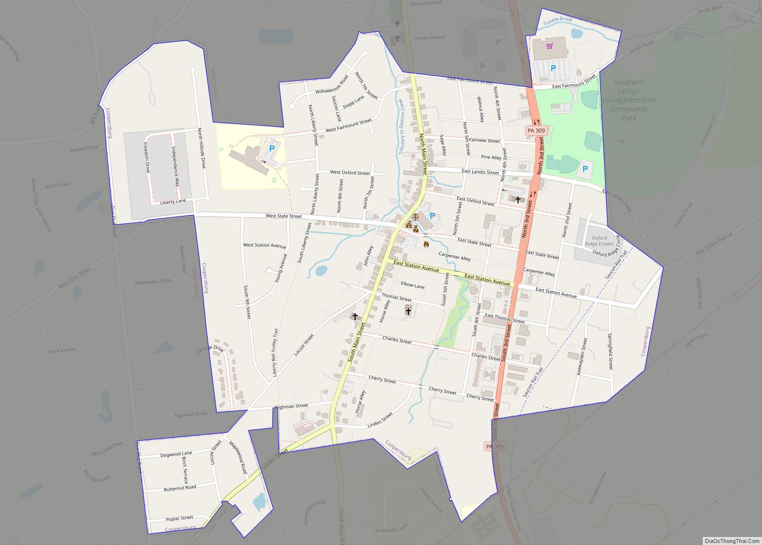
Online Interactive Map
Click on ![]() to view map in "full screen" mode.
to view map in "full screen" mode.
Allentown location map. Where is Allentown city?
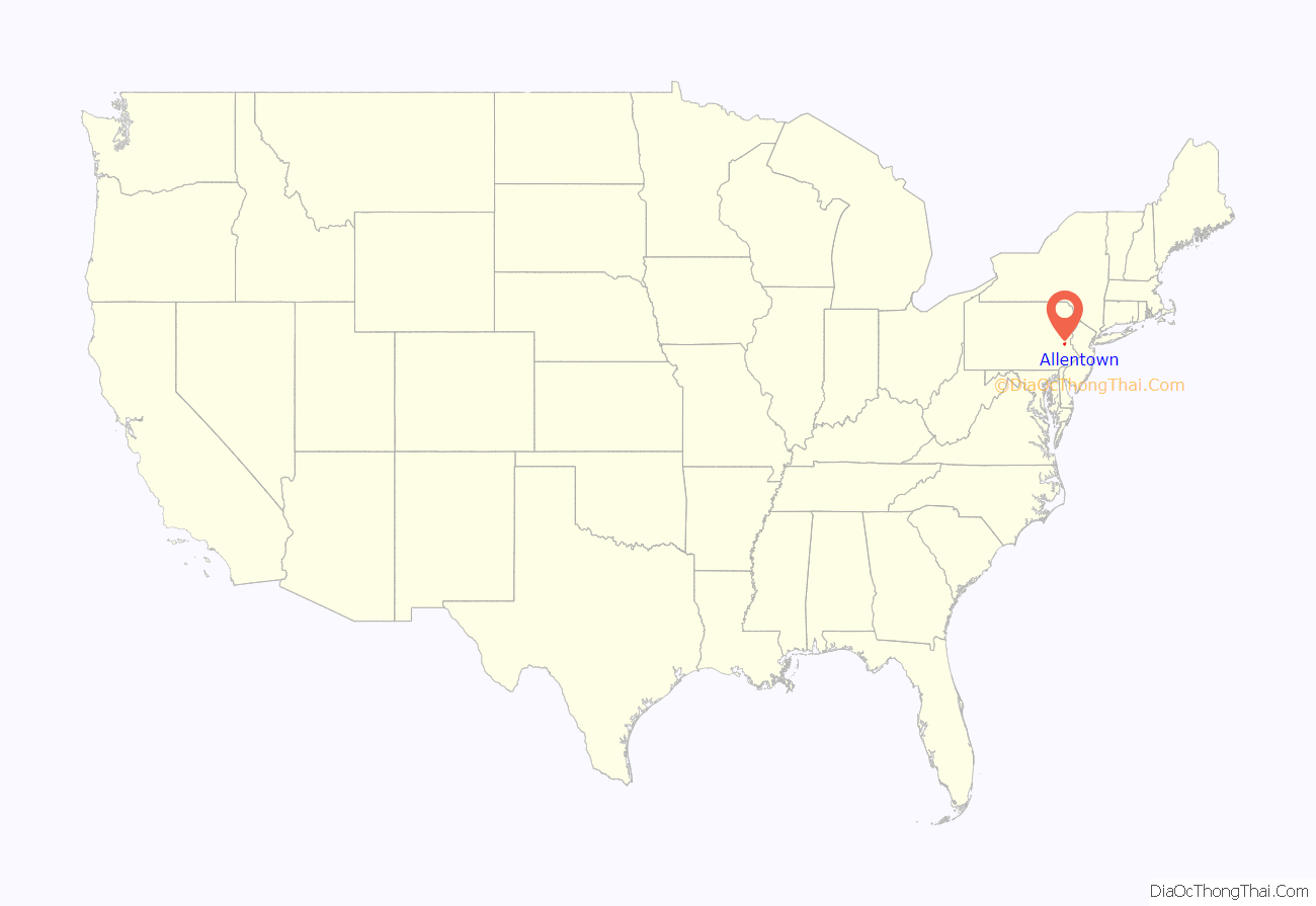
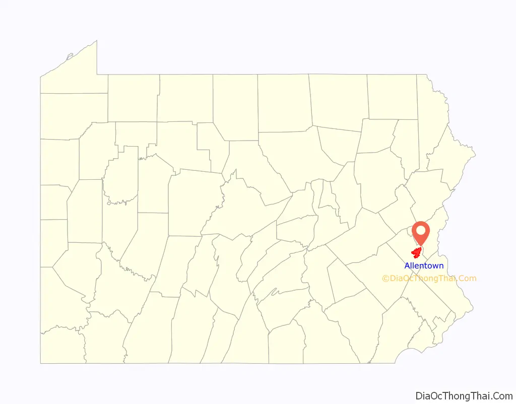
Allentown Road Map
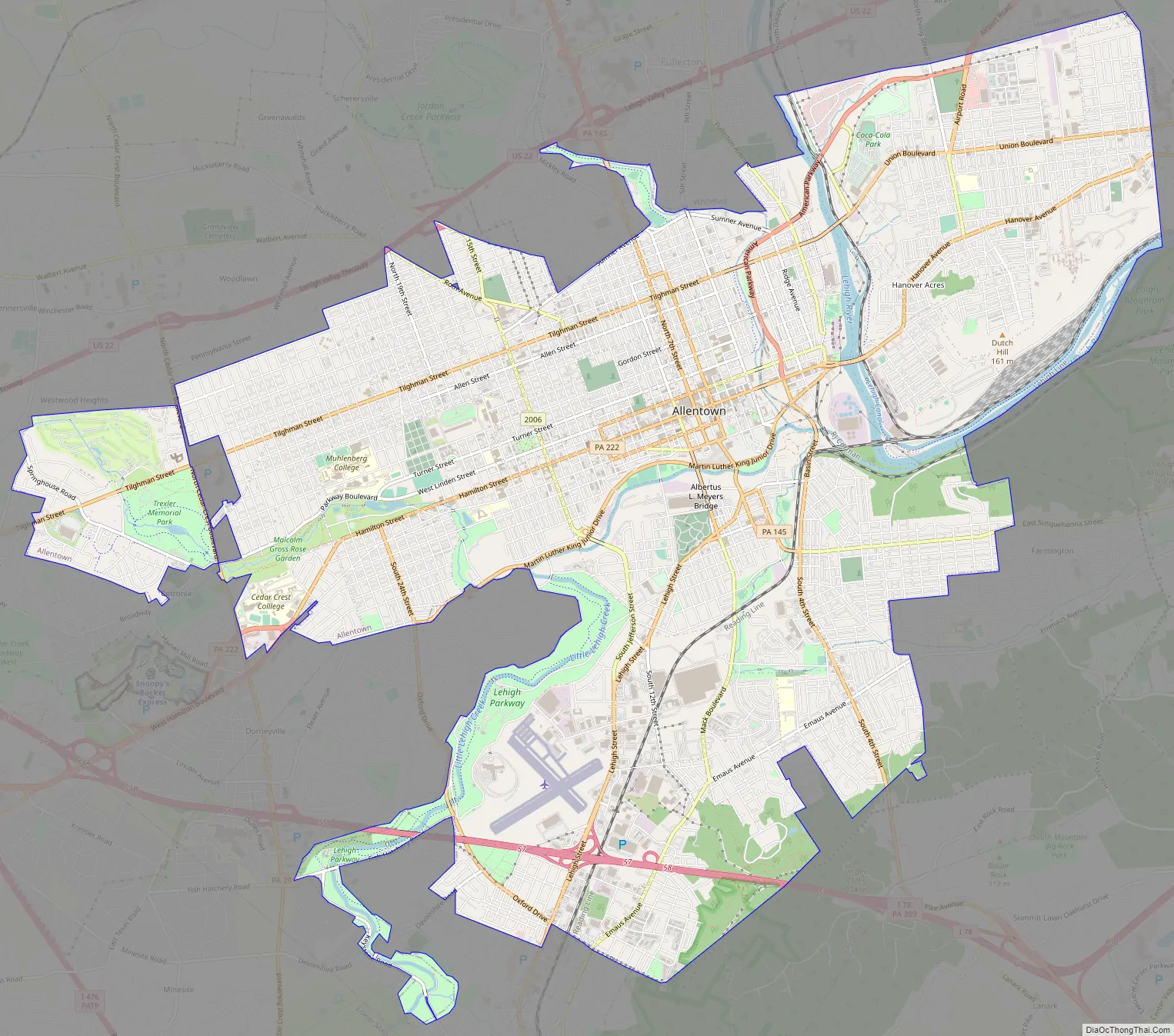
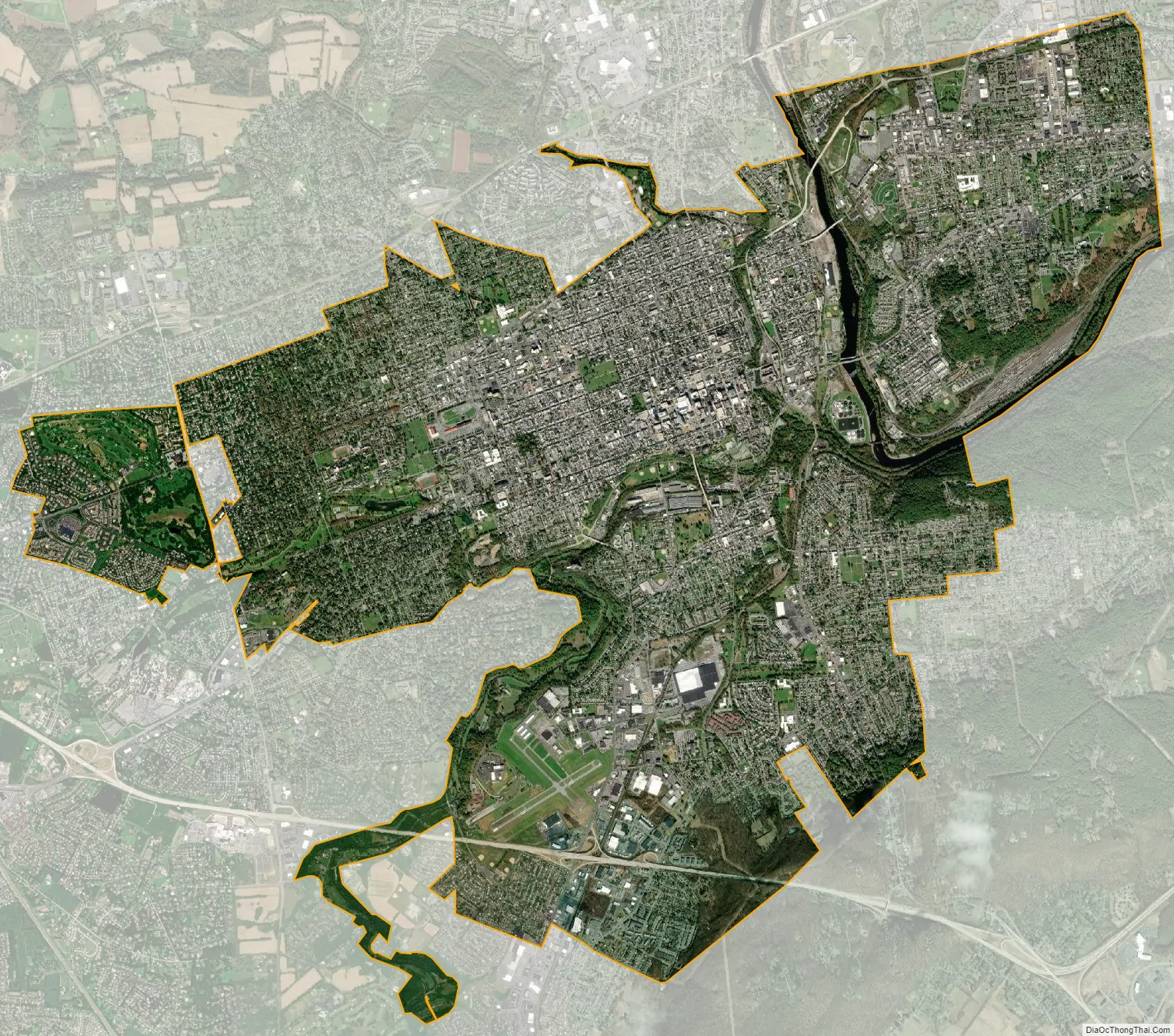
Allentown city Satellite Map
Geography
Topography
Allentown’s geographic boundaries include a total area of 18.0 square miles (46.6 km). Of this, 17.8 square miles (46.1 km) is land and 0.2 square miles (0.5 km) is water, according to the U.S. Census Bureau. Bodies of water include Jordan Creek and its tributary, Little Lehigh Creek, which join within the city limits and empty into the Lehigh River. Other bodies of water in Allentown include Lake Muhlenberg in Cedar Creek Parkway and a pond in Trexler Park.
Allentown is located in the Lehigh Valley, an eastern Pennsylvania geographic valley located between two Appalachian mountain ridges, Blue Mountain, which varies from 1,000 feet (300 m) to 1,600 feet (490 m) in height about 17 miles (27 km) north of the city, and South Mountain, a ridge of 500 feet (150 m) to 1,000 feet (300 m) in height that borders Allentown’s southern edge. It includes both Lehigh and Northampton counties.
The Lehigh Valley’s adjacent counties include Carbon and Monroe counties to its north, Bucks County to its southeast, Montgomery County to its south, Berks and Schuylkill counties to its west, and Warren County, New Jersey to its east.
Cityscape and neighborhoods
Center City Allentown, which includes the downtown area and its 7th Street retail and residential corridor, is the city’s central business district and the location of most of its city, county, and federal government buildings. To the east of Center City are The Wards, residential areas developed during Allentown’s late 19th century and early 20th century industrial boom. Just east of the Lehigh River are the city’s East Side residential neighborhoods, most of which border various routes to neighboring Bethlehem. South of Center City and across Little Lehigh Creek are the city’s South Side neighborhoods, which border Emmaus. Allentown’s West End, with a mix of commercial corridors, cultural centers, and larger single-family residences, begins approximately west of 15th Street.
Center City Allentown’s tallest building is the PPL Building at 322 feet (98 m). In addition to the PPL Building, Center City commercial office buildings include the Dime Savings and Trust Company building, which features the Art Deco architecture of the region during the 1920s and 1930s. One City Center, Two City Center, and other commercial buildings are also located in Center City. An 8,500-seat indoor arena, PPL Center, which hosts the Lehigh Valley Phantoms of the American Hockey League, opened in August 2014 at 701 Hamilton Street in Center City. Other Center City historic and recreational landmarks include Allentown Art Museum, Baum School of Art, Lehigh County Historical Society, Liberty Bell Museum, and Miller Symphony Hall.
In January 2015, two major hotels, Americus Hotel and a Marriott, opened in Center City Allentown.
See also
Map of Pennsylvania State and its subdivision:- Adams
- Allegheny
- Armstrong
- Beaver
- Bedford
- Berks
- Blair
- Bradford
- Bucks
- Butler
- Cambria
- Cameron
- Carbon
- Centre
- Chester
- Clarion
- Clearfield
- Clinton
- Columbia
- Crawford
- Cumberland
- Dauphin
- Delaware
- Elk
- Erie
- Fayette
- Forest
- Franklin
- Fulton
- Greene
- Huntingdon
- Indiana
- Jefferson
- Juniata
- Lackawanna
- Lancaster
- Lawrence
- Lebanon
- Lehigh
- Luzerne
- Lycoming
- Mc Kean
- Mercer
- Mifflin
- Monroe
- Montgomery
- Montour
- Northampton
- Northumberland
- Perry
- Philadelphia
- Pike
- Potter
- Schuylkill
- Snyder
- Somerset
- Sullivan
- Susquehanna
- Tioga
- Union
- Venango
- Warren
- Washington
- Wayne
- Westmoreland
- Wyoming
- York
- Alabama
- Alaska
- Arizona
- Arkansas
- California
- Colorado
- Connecticut
- Delaware
- District of Columbia
- Florida
- Georgia
- Hawaii
- Idaho
- Illinois
- Indiana
- Iowa
- Kansas
- Kentucky
- Louisiana
- Maine
- Maryland
- Massachusetts
- Michigan
- Minnesota
- Mississippi
- Missouri
- Montana
- Nebraska
- Nevada
- New Hampshire
- New Jersey
- New Mexico
- New York
- North Carolina
- North Dakota
- Ohio
- Oklahoma
- Oregon
- Pennsylvania
- Rhode Island
- South Carolina
- South Dakota
- Tennessee
- Texas
- Utah
- Vermont
- Virginia
- Washington
- West Virginia
- Wisconsin
- Wyoming