Hulmeville is a borough in Bucks County, Pennsylvania. The population was 1,003 at the 2010 census.
| Name: | Hulmeville borough |
|---|---|
| LSAD Code: | 21 |
| LSAD Description: | borough (suffix) |
| State: | Pennsylvania |
| County: | Bucks County |
| Elevation: | 46 ft (14 m) |
| Total Area: | 0.37 sq mi (0.97 km²) |
| Land Area: | 0.36 sq mi (0.92 km²) |
| Water Area: | 0.02 sq mi (0.04 km²) |
| Total Population: | 982 |
| Population Density: | 2,758.43/sq mi (1,065.09/km²) |
| ZIP code: | 19047 |
| FIPS code: | 4236192 |
| Website: | hulmeville-pa.gov |
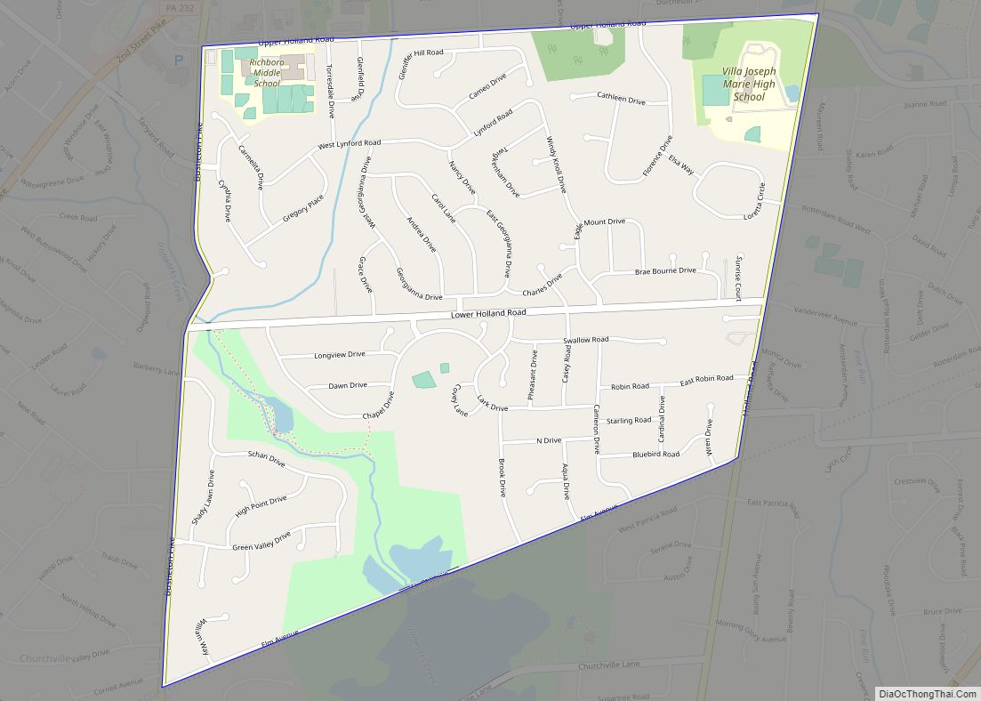
Online Interactive Map
Click on ![]() to view map in "full screen" mode.
to view map in "full screen" mode.
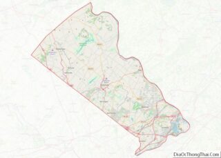
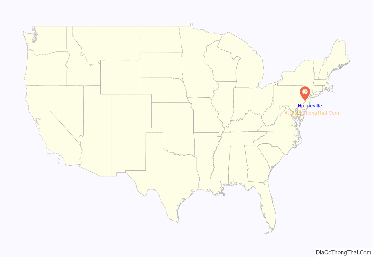
Hulmeville location map. Where is Hulmeville borough?
History
The Hulme family name, originally DeHoulme, is of Norman origin, dating from William the Conqueror. Members of the family originally settled in Lancashire, England, a branch later moved to Cheshire. The American family came from this branch. George Hulme Sr. and George Hulme Jr. immigrated to Bucks County from Tilston, Cheshire about 1700, purchasing land and settled in Middletown Township, some of the family later relocating to Buckingham. John Hulme Sr., grandson of George Sr. and his son, George Hulme Jr., moved from Buckingham to Fallsington and ran a weaving business until 1796 when John Jr. purchased land along the Neshaminy Creek and called it Milford. John Jr. married Rebecca Milnor daughter of William Milnor.
Within a few years, the village built up to a number of dwellings, mills and other shops. The five sons of John Jr. became a miller, two storekeepers, a tanner and a farmer. There was no public house, but John Jr. many times opened his house to travelers. One autumn day in 1809, Josiah Quincy III stayed overnight on the way from Boston to Washington, D.C. John Jr. served a term in the Pennsylvania General Assembly and helped start a post office at Milford established on 1 October 1809, his son Isaac, the first postmaster. The village name then changed to Hulmeville. It is claimed that the General Assembly changed the name in honor of John Jr.
The first bank in Bucks County was organized in 1814, John Jr. the first president. The bank moved to Bristol in 1830 and its name was changed to Farmers’ National Bank.
The Hulmeville Historic District was added to the National Register of Historic Places in 1986.
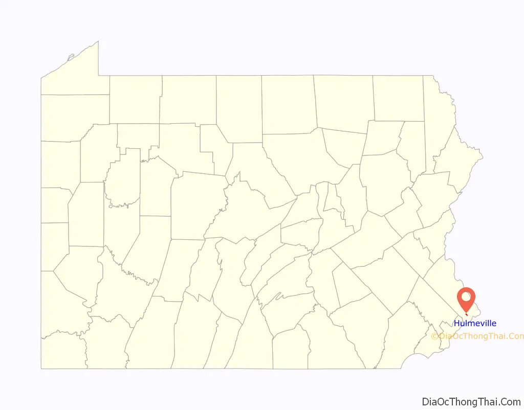
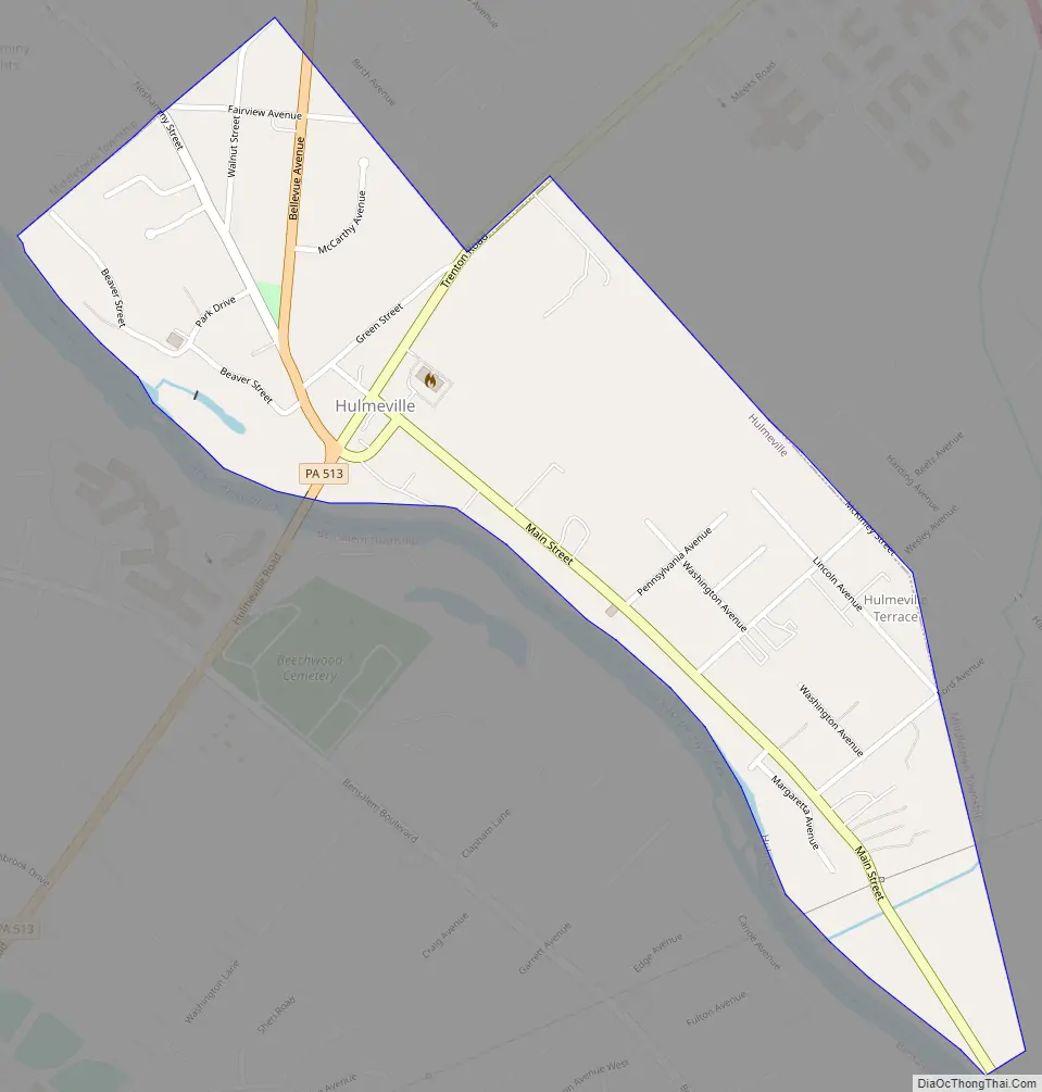
Hulmeville Road Map
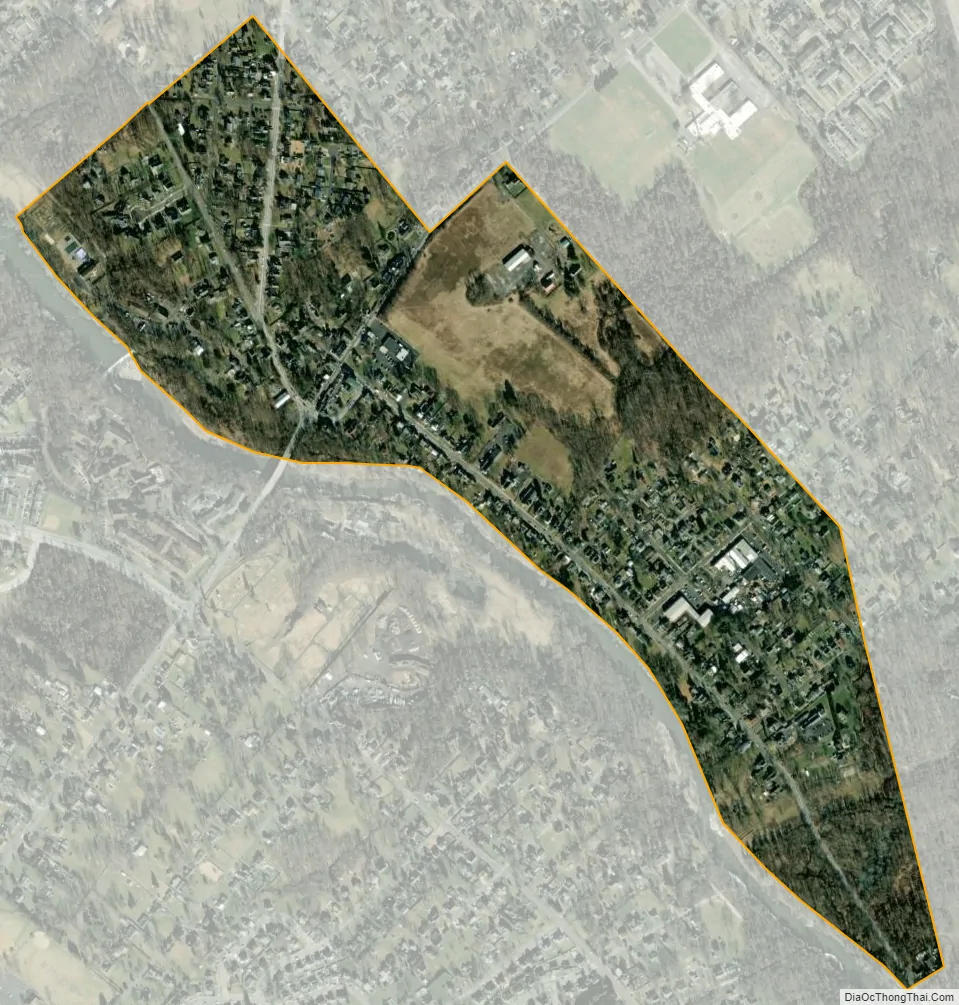
Hulmeville city Satellite Map
Geography
Hulmeville is located at 40°8′36″N 74°54′26″W / 40.14333°N 74.90722°W / 40.14333; -74.90722 (40.143259, -74.907118). According to the U.S. Census Bureau, the borough has a total area of 0.4 square miles (1.0 km), all land.
Neshaminy Creek passes through Hulmeville.
See also
Map of Pennsylvania State and its subdivision:- Adams
- Allegheny
- Armstrong
- Beaver
- Bedford
- Berks
- Blair
- Bradford
- Bucks
- Butler
- Cambria
- Cameron
- Carbon
- Centre
- Chester
- Clarion
- Clearfield
- Clinton
- Columbia
- Crawford
- Cumberland
- Dauphin
- Delaware
- Elk
- Erie
- Fayette
- Forest
- Franklin
- Fulton
- Greene
- Huntingdon
- Indiana
- Jefferson
- Juniata
- Lackawanna
- Lancaster
- Lawrence
- Lebanon
- Lehigh
- Luzerne
- Lycoming
- Mc Kean
- Mercer
- Mifflin
- Monroe
- Montgomery
- Montour
- Northampton
- Northumberland
- Perry
- Philadelphia
- Pike
- Potter
- Schuylkill
- Snyder
- Somerset
- Sullivan
- Susquehanna
- Tioga
- Union
- Venango
- Warren
- Washington
- Wayne
- Westmoreland
- Wyoming
- York
- Alabama
- Alaska
- Arizona
- Arkansas
- California
- Colorado
- Connecticut
- Delaware
- District of Columbia
- Florida
- Georgia
- Hawaii
- Idaho
- Illinois
- Indiana
- Iowa
- Kansas
- Kentucky
- Louisiana
- Maine
- Maryland
- Massachusetts
- Michigan
- Minnesota
- Mississippi
- Missouri
- Montana
- Nebraska
- Nevada
- New Hampshire
- New Jersey
- New Mexico
- New York
- North Carolina
- North Dakota
- Ohio
- Oklahoma
- Oregon
- Pennsylvania
- Rhode Island
- South Carolina
- South Dakota
- Tennessee
- Texas
- Utah
- Vermont
- Virginia
- Washington
- West Virginia
- Wisconsin
- Wyoming