Hummelstown is a borough in Dauphin County, Pennsylvania, United States. The population was 4,535 as of the 2020 census. It is part of the Harrisburg–Carlisle Metropolitan Statistical Area.
Originally named Fredrickstown, the town was established in 1762. The current mayor is David Roeting. Hummelstown is a Tree City and is located in District 15 of the Pennsylvania State Senate. It is centrally located between Harrisburg and Hershey, making it a common tourist drive-through. It has several businesses and shops designed to capitalize on the tourist travel that passes through town.
| Name: | Hummelstown borough |
|---|---|
| LSAD Code: | 21 |
| LSAD Description: | borough (suffix) |
| State: | Pennsylvania |
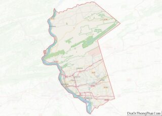
| County: | Dauphin County |
| Elevation: | 397 ft (121 m) |
| Total Area: | 1.31 sq mi (3.39 km²) |
| Land Area: | 1.24 sq mi (3.22 km²) |
| Water Area: | 0.07 sq mi (0.18 km²) |
| Total Population: | 4,544 |
| Population Density: | 3,658.62/sq mi (1,412.46/km²) |
| ZIP code: | 17036 |
| Area code: | 717 |
| FIPS code: | 4236232 |
| GNISfeature ID: | 1213972 |
| Website: | www.hummelstown.net |
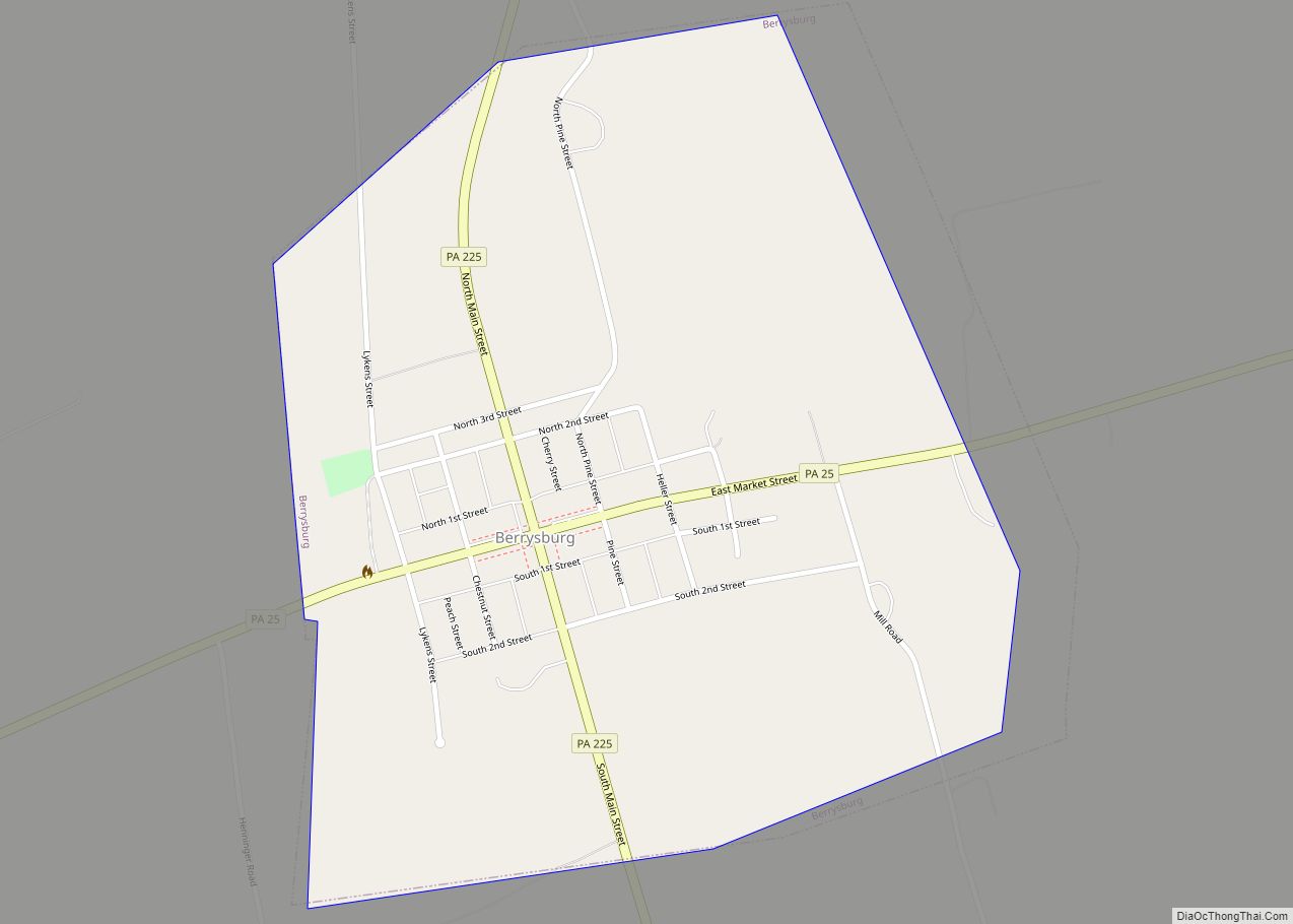
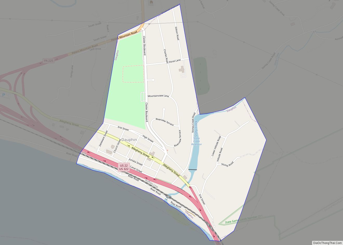
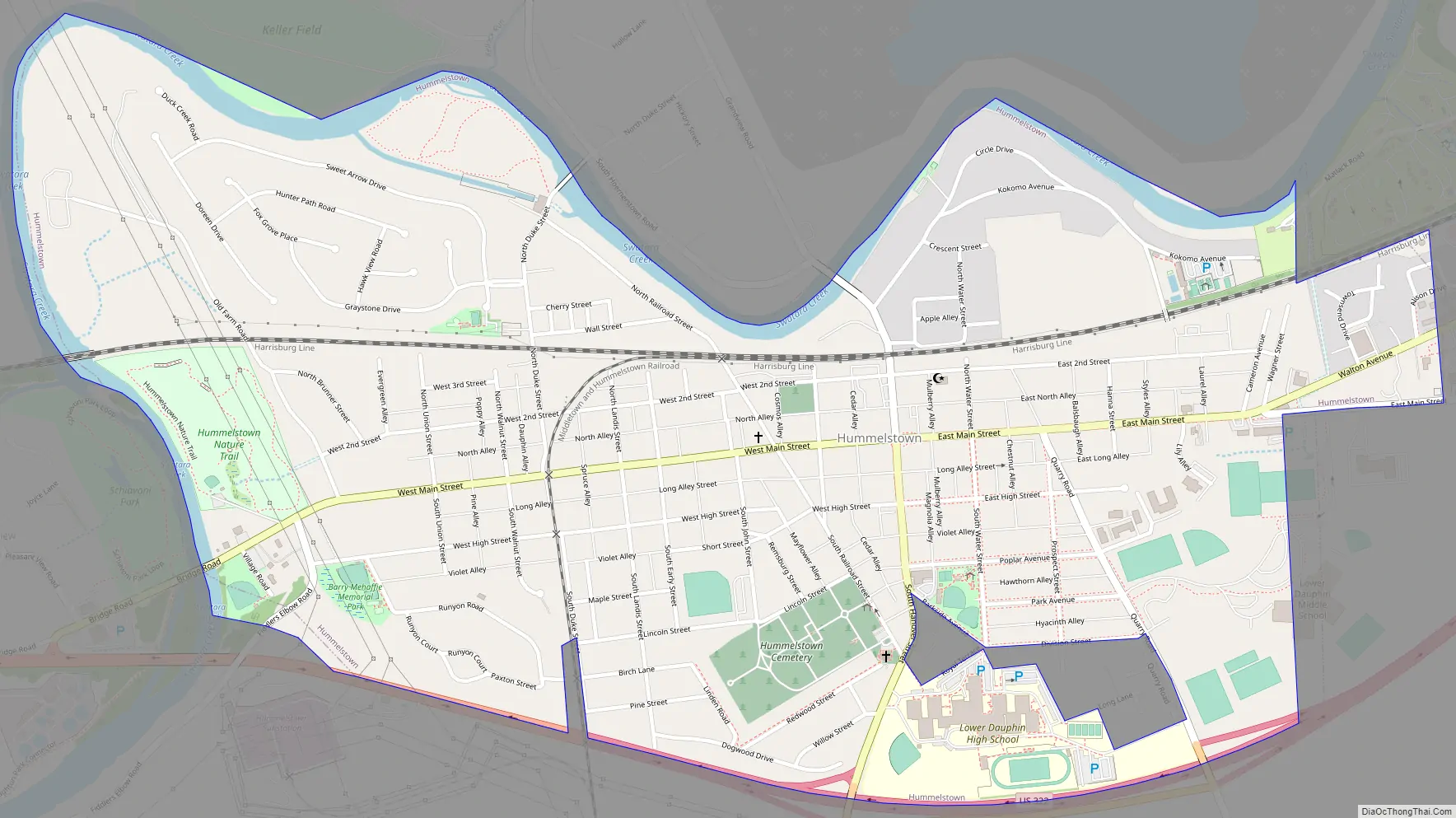
Online Interactive Map
Click on ![]() to view map in "full screen" mode.
to view map in "full screen" mode.
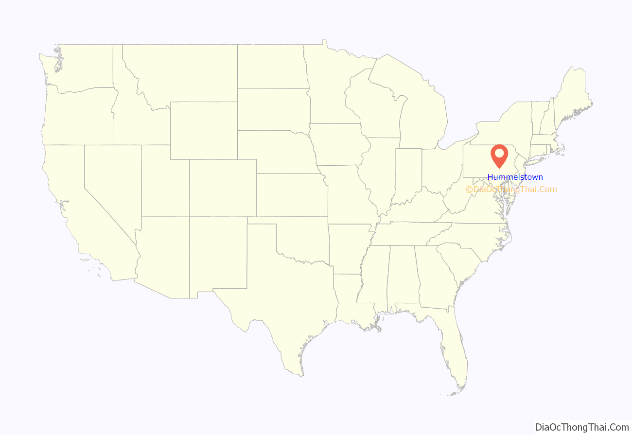
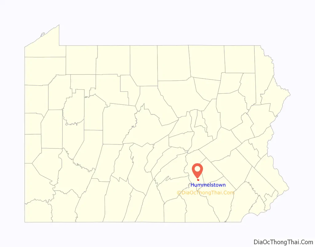
Hummelstown location map. Where is Hummelstown borough?
History
Hummelstown was founded as “Fredrickstown” in 1762 by two Germans, Frederick and Rosina Hummel. They purchased the land for 200 pounds sterling, then divided the area into building lots, which were sold to German settlers. During the mid-19th century, the Union Canal along Swatara Creek was an important factor in the development of the local economy, promoting trade and transportation.
The town was located on the Berks-Dauphin Turnpike, and later it was served by the Union Canal which paralleled Swatara Creek bordering the north and the west sides of the town, and was opened in 1827. The Lebanon Valley Railroad arrived in 1858. This brought about many jobs of stone cutting and shipyard work and helped facilitate the Hummelstown Brownstone Company which became the leading employer of Hummelstown residents. The company mined Hummelstown brownstone at its quarries from 1867 until 1929. The company was the largest producer of brownstone on the East Coast.
Throughout the history of the town it has been a stopping point for tourists traveling to Harrisburg, the capital of Pennsylvania, or to Hershey, the home of Hershey Foods, Hersheypark, and Chocolate World. At various times Hummelstown has been as close as 20 miles (32 km) from up to ten different professional sports teams, such as the Harrisburg Heat, Hershey Bears, Hershey Wildcats, and the Harrisburg City Islanders. The Calder Cup has had several ceremonies conducted in Hummelstown over the years.
The borough celebrated its semiquincentennial or 250-year anniversary in 2012.
The Dr. William Henderson House, Keystone Hotel, Enoch Matlack House, and Zion Lutheran Church and Graveyard are listed on the National Register of Historic Places. The Hummelstown Historical Society building is located at North Rosanna Street and North Alley Street in the original building for the Zion Lutheran Church, which is now the main brownstone church on Main Street of Hummelstown. The society has a library, museum, and genealogy section, and hosts numerous Native American relics, such as arrowheads, bones, and pottery.
Hummelstown is within a thirty-minute drive of several colleges and educational institutions, such as HACC, Lebanon Valley College, Penn State Harrisburg, YTI Career Institute, Kepler Career Institute, and VoTech. Many residents of Hummelstown have jobs in Derry Township, mainly through Hershey Foods and its subsidiaries.
Hummelstown currently has three historical markers in the town, one for the town’s oldest church, one for a former Revolutionary War gun factory, and the other for the Hummelstown Brownstone company.
Hummelstown Road Map
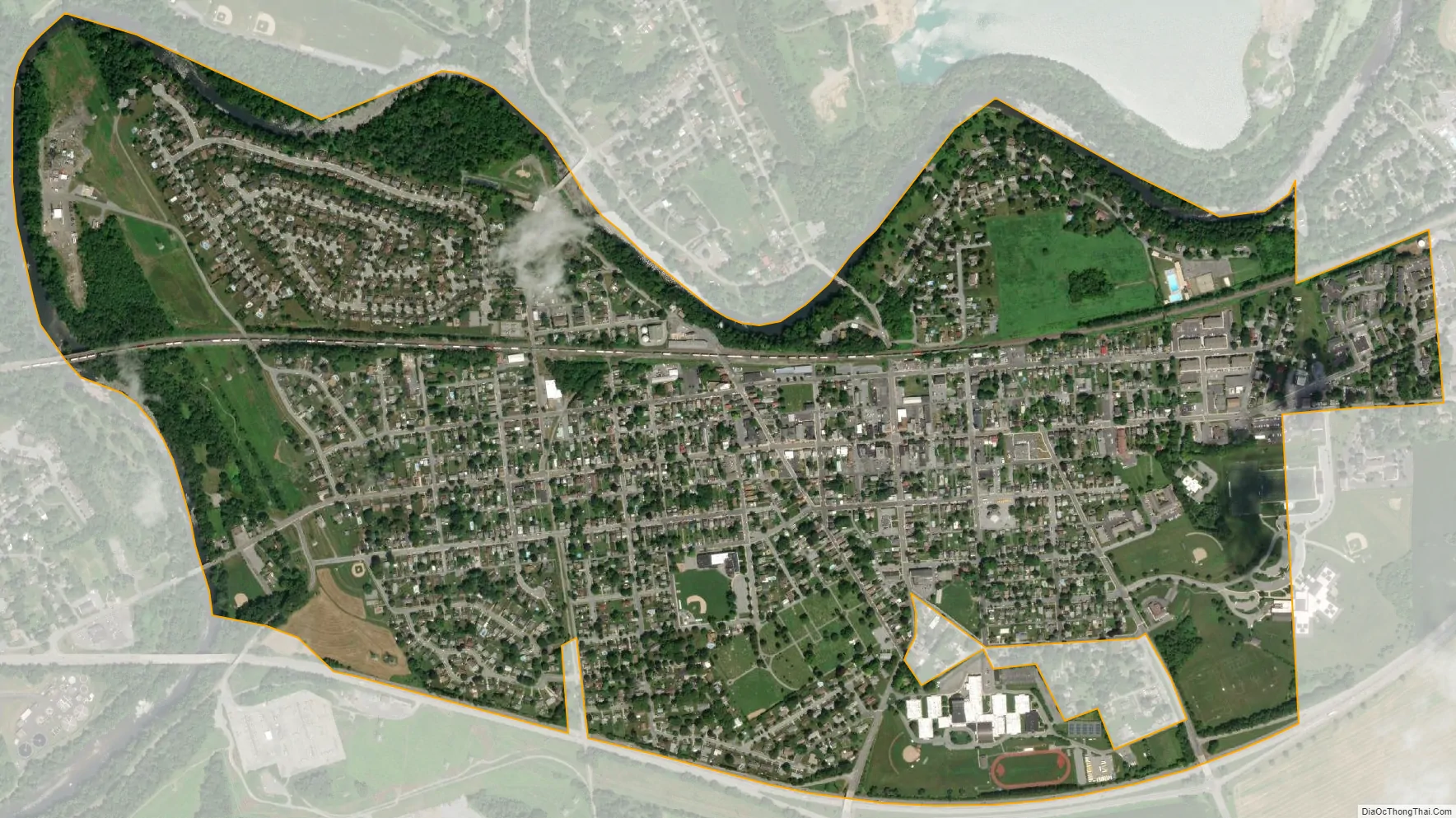
Hummelstown city Satellite Map
Geography
Hummelstown is located in southern Dauphin County at 40°15′55″N 076°42′30″W / 40.26528°N 76.70833°W / 40.26528; -76.70833 (40.265168, −76.710995) at an elevation of 397 feet (121 m) above sea level. According to the United States Census Bureau, the borough has a total area of 1.3 square miles (3.4 km), of which 1.2 square miles (3.2 km) is land and 0.1 square miles (0.2 km), or 6.31%, is water. Swatara Creek, a southward-flowing tributary of the Susquehanna River, forms the northern and western border of Hummelstown, and there is one unnamed pond by the Hummel Nature Trail east of the 7–11, at the end of town, next to the Tee Ball baseball field.
Climate
The climate of Hummelstown is similar to Harrisburg’s. The lows during winter reach about −5 °F (−21 °C), and the highs during summer reach about 95 °F (35 °C).
Few tornadoes or hurricanes striking Hummelstown over the years. In 1992 the borough was hit by a bow tornado. In past years the town has been hit by only several hurricanes, the most severe being Hurricane Agnes which knocked out two key bridges in the town.
Hummelstown has had numerous blizzards. In 1996, a blizzard hit with 13 inches (330 mm); in 1997, a blizzard hit Hummelstown with 9 inches (230 mm) of snow. In 2004, a blizzard with 7 inches (180 mm) hit Hummelstown, and a blizzard hit Hummelstown in 2010 with a record-setting 21 inches (530 mm).
Highways
U.S. Route 322 skirts the south side of the borough as the Hummelstown Bypass. U.S. Route 422 branches off US 322 just east of the borough limits. The center of Hershey is 3.5 miles (5.6 km) east of the center of Hummelstown, and Harrisburg is 11 miles (18 km) to the west.
East of the center of Hummelstown, Main Street ends at the Boro Bar and Walton Avenue (previously Main Street) turns into and becomes PA Route 39/Hersheypark Road. At the west end of Hummelstown, Fiddlers Elbow Road crosses the US 322 bypass without access to it, then leads south 3 miles (5 km) to the PA 283 expressway. Main Street, leaving Hummelstown to the west, joins U.S. Route 322. Going east Main Street turns into PA Route 39 at what part is known as Hersheypark Drive in Derry Township.
See also
Map of Pennsylvania State and its subdivision:- Adams
- Allegheny
- Armstrong
- Beaver
- Bedford
- Berks
- Blair
- Bradford
- Bucks
- Butler
- Cambria
- Cameron
- Carbon
- Centre
- Chester
- Clarion
- Clearfield
- Clinton
- Columbia
- Crawford
- Cumberland
- Dauphin
- Delaware
- Elk
- Erie
- Fayette
- Forest
- Franklin
- Fulton
- Greene
- Huntingdon
- Indiana
- Jefferson
- Juniata
- Lackawanna
- Lancaster
- Lawrence
- Lebanon
- Lehigh
- Luzerne
- Lycoming
- Mc Kean
- Mercer
- Mifflin
- Monroe
- Montgomery
- Montour
- Northampton
- Northumberland
- Perry
- Philadelphia
- Pike
- Potter
- Schuylkill
- Snyder
- Somerset
- Sullivan
- Susquehanna
- Tioga
- Union
- Venango
- Warren
- Washington
- Wayne
- Westmoreland
- Wyoming
- York
- Alabama
- Alaska
- Arizona
- Arkansas
- California
- Colorado
- Connecticut
- Delaware
- District of Columbia
- Florida
- Georgia
- Hawaii
- Idaho
- Illinois
- Indiana
- Iowa
- Kansas
- Kentucky
- Louisiana
- Maine
- Maryland
- Massachusetts
- Michigan
- Minnesota
- Mississippi
- Missouri
- Montana
- Nebraska
- Nevada
- New Hampshire
- New Jersey
- New Mexico
- New York
- North Carolina
- North Dakota
- Ohio
- Oklahoma
- Oregon
- Pennsylvania
- Rhode Island
- South Carolina
- South Dakota
- Tennessee
- Texas
- Utah
- Vermont
- Virginia
- Washington
- West Virginia
- Wisconsin
- Wyoming