Hershey is an unincorporated community and census-designated place (CDP) in Derry Township, Dauphin County, Pennsylvania, United States. It is home to The Hershey Company, which was founded by candy magnate Milton S. Hershey.
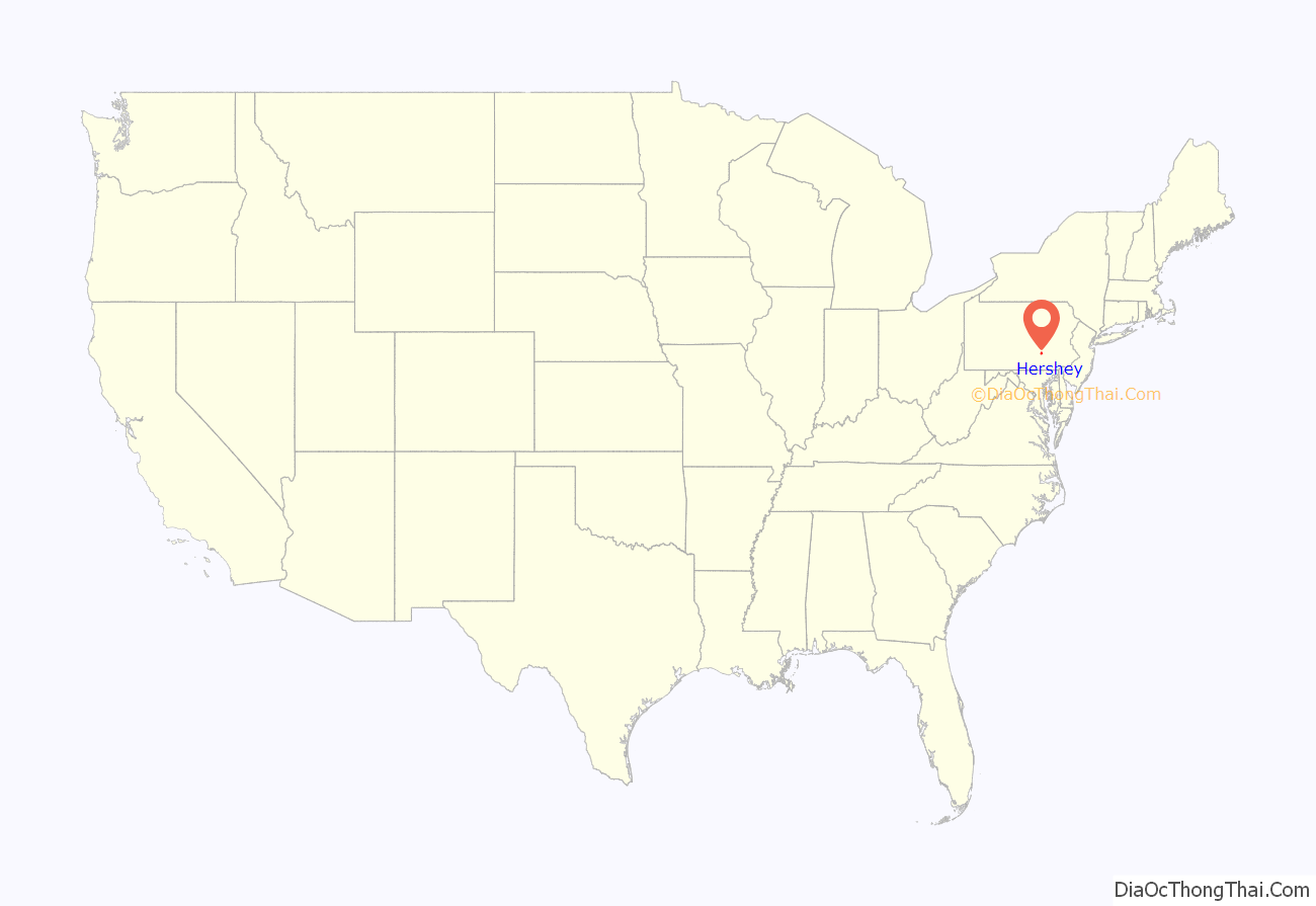
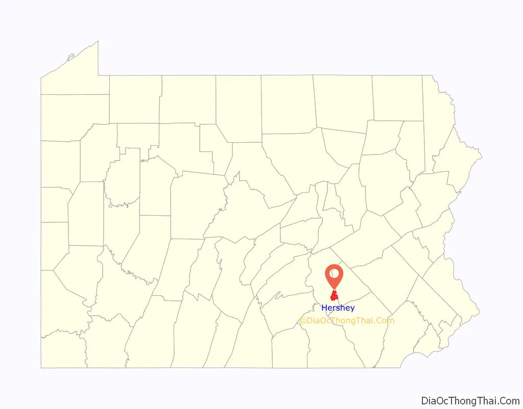
The community is located 14 miles (23 km) east of Harrisburg and is part of the Harrisburg metropolitan area. Hershey has no legal status as an incorporated municipality, and all its municipal services are provided by Derry Township. The population was 13,858 at the 2020 census.
Hershey is located 75.2 miles (121.0 km) southwest of Allentown, 14.7 miles (23.7 km) east of Harrisburg, and 94.5 miles (152.1 km) northwest of Philadelphia.
| Name: | Hershey CDP |
|---|---|
| LSAD Code: | 57 |
| LSAD Description: | CDP (suffix) |
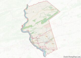
| State: | Pennsylvania |
| County: | Dauphin County |
| Elevation: | 411 ft (125 m) |
| Total Area: | 14.42 sq mi (37.34 km²) |
| Land Area: | 14.30 sq mi (37.03 km²) |
| Water Area: | 0.12 sq mi (0.30 km²) |
| Total Population: | 13,858 |
| Population Density: | 969.23/sq mi (374.23/km²) |
| ZIP code: | 17033 |
| Area code: | 717 |
| FIPS code: | 4234144 |
| GNISfeature ID: | 1176895 |
Online Interactive Map
Click on ![]() to view map in "full screen" mode.
to view map in "full screen" mode.
Hershey location map. Where is Hershey CDP?
History
The town was founded by Hershey in 1903 for the company’s workers, and their homes had modern amenities such as electricity, indoor plumbing, and central heating. The town had a public trolley system, a free school to educate the children of employees, a free vocational school to train orphaned and underprivileged boys, and later an amusement park, golf courses, community center, hotel, zoo, and a sports area.
The purpose was to provide “a perfect American town in a bucolic natural setting, where healthy, right-living, and well-paid workers lived in safe, happy homes.”
Hershey Road Map
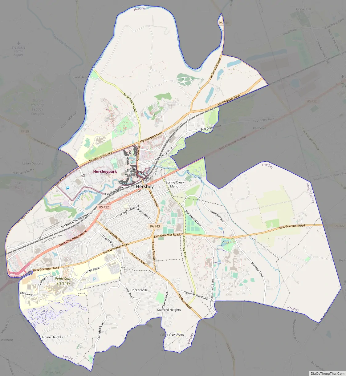
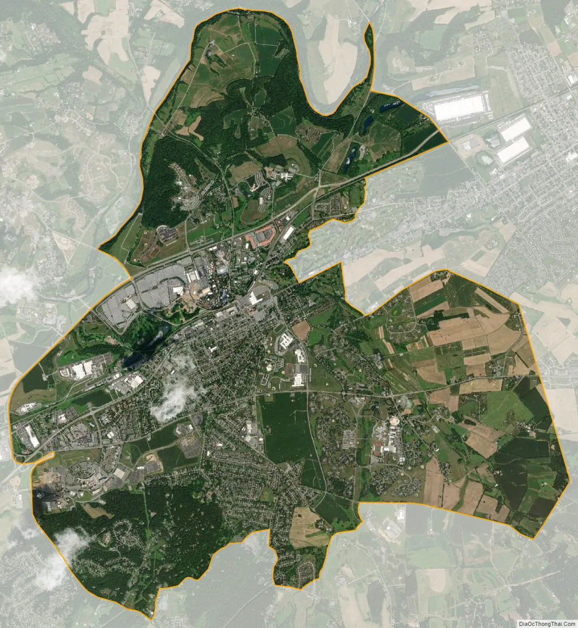
Hershey city Satellite Map
Geography
Hershey is located in southeastern Dauphin County, in the center and eastern parts of Derry Township. It is bordered to the east by Palmdale (also in Derry Township) and by Campbelltown (in South Londonderry Township, Lebanon County). To the west is the borough of Hummelstown. Over half the population of Derry Township is within the Hershey CDP.
According to the U.S. Census Bureau, the Hershey CDP has a total area of 14.4 square miles (37.3 km), of which 14.4 square miles (37.2 km) is land and 0.058 square miles (0.15 km), or 0.41%, is water.
See also
Map of Pennsylvania State and its subdivision:- Adams
- Allegheny
- Armstrong
- Beaver
- Bedford
- Berks
- Blair
- Bradford
- Bucks
- Butler
- Cambria
- Cameron
- Carbon
- Centre
- Chester
- Clarion
- Clearfield
- Clinton
- Columbia
- Crawford
- Cumberland
- Dauphin
- Delaware
- Elk
- Erie
- Fayette
- Forest
- Franklin
- Fulton
- Greene
- Huntingdon
- Indiana
- Jefferson
- Juniata
- Lackawanna
- Lancaster
- Lawrence
- Lebanon
- Lehigh
- Luzerne
- Lycoming
- Mc Kean
- Mercer
- Mifflin
- Monroe
- Montgomery
- Montour
- Northampton
- Northumberland
- Perry
- Philadelphia
- Pike
- Potter
- Schuylkill
- Snyder
- Somerset
- Sullivan
- Susquehanna
- Tioga
- Union
- Venango
- Warren
- Washington
- Wayne
- Westmoreland
- Wyoming
- York
- Alabama
- Alaska
- Arizona
- Arkansas
- California
- Colorado
- Connecticut
- Delaware
- District of Columbia
- Florida
- Georgia
- Hawaii
- Idaho
- Illinois
- Indiana
- Iowa
- Kansas
- Kentucky
- Louisiana
- Maine
- Maryland
- Massachusetts
- Michigan
- Minnesota
- Mississippi
- Missouri
- Montana
- Nebraska
- Nevada
- New Hampshire
- New Jersey
- New Mexico
- New York
- North Carolina
- North Dakota
- Ohio
- Oklahoma
- Oregon
- Pennsylvania
- Rhode Island
- South Carolina
- South Dakota
- Tennessee
- Texas
- Utah
- Vermont
- Virginia
- Washington
- West Virginia
- Wisconsin
- Wyoming