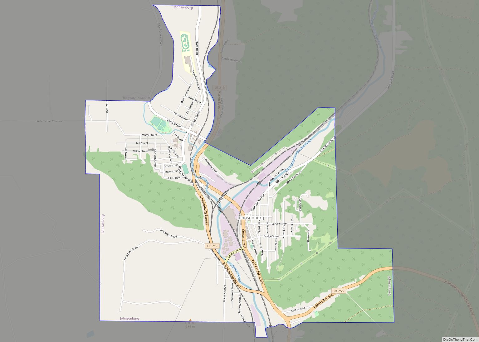
Johnsonburg is a borough in Elk County, Pennsylvania, 124 miles (200 km) northeast of Pittsburgh and 115 miles (185 km) south of Buffalo, New York, in a productive farming and lumbering region. Paper mills were once common in the borough, with the Domtar mill still operating. In 1910, 4,334 people lived here. The population was 2,483 at the 2010 census.
| Name: | Johnsonburg borough |
|---|---|
| LSAD Code: | 21 |
| LSAD Description: | borough (suffix) |
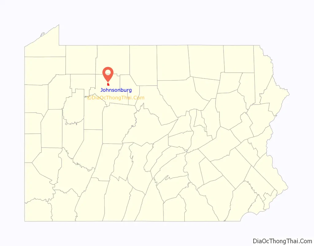
| State: | Pennsylvania |
| County: | Elk County |
| Elevation: | 1,444 ft (440 m) |
| Total Area: | 2.92 sq mi (7.57 km²) |
| Land Area: | 2.88 sq mi (7.47 km²) |
| Water Area: | 0.04 sq mi (0.10 km²) |
| Total Population: | 2,404 |
| Population Density: | 833.85/sq mi (322.00/km²) |
| Area code: | 814 |
| FIPS code: | 4238248 |
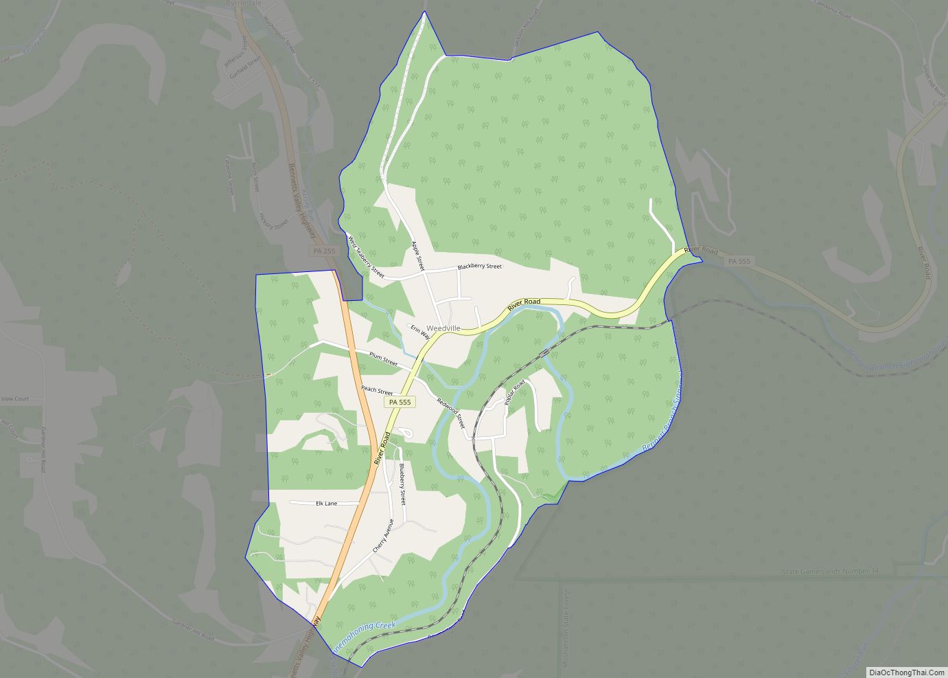
Online Interactive Map
Click on ![]() to view map in "full screen" mode.
to view map in "full screen" mode.
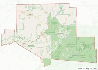
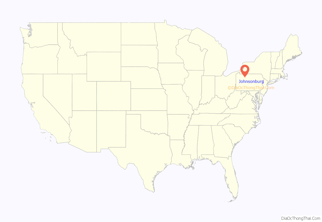
Johnsonburg location map. Where is Johnsonburg borough?
History
It was founded in 1810 and incorporated in 1891.
The Johnsonburg Commercial Historic District was listed on the National Register of Historic Places in 1999.
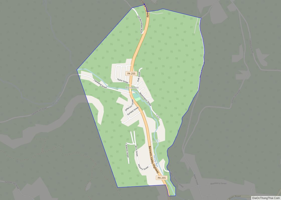
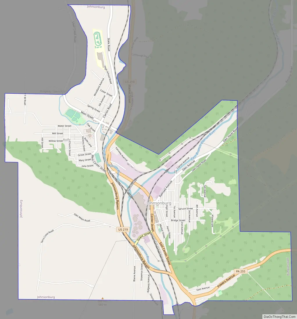
Johnsonburg Road Map
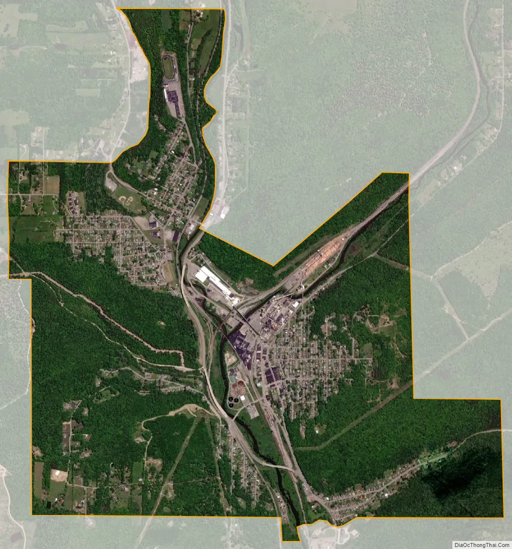
Johnsonburg city Satellite Map
Geography
Johnsonburg is located at 41°29′38″N 78°40′47″W / 41.49389°N 78.67972°W / 41.49389; -78.67972 (41.493950, -78.679600).
According to the United States Census Bureau, the borough has a total area of 2.94 square miles (7.6 km), 2.9 square miles (7.5 km) of it land and 0.04 square miles (0.10 km) (1.38%) of it water. It is also home to the Johnsonburg Area School.
See also
Map of Pennsylvania State and its subdivision:- Adams
- Allegheny
- Armstrong
- Beaver
- Bedford
- Berks
- Blair
- Bradford
- Bucks
- Butler
- Cambria
- Cameron
- Carbon
- Centre
- Chester
- Clarion
- Clearfield
- Clinton
- Columbia
- Crawford
- Cumberland
- Dauphin
- Delaware
- Elk
- Erie
- Fayette
- Forest
- Franklin
- Fulton
- Greene
- Huntingdon
- Indiana
- Jefferson
- Juniata
- Lackawanna
- Lancaster
- Lawrence
- Lebanon
- Lehigh
- Luzerne
- Lycoming
- Mc Kean
- Mercer
- Mifflin
- Monroe
- Montgomery
- Montour
- Northampton
- Northumberland
- Perry
- Philadelphia
- Pike
- Potter
- Schuylkill
- Snyder
- Somerset
- Sullivan
- Susquehanna
- Tioga
- Union
- Venango
- Warren
- Washington
- Wayne
- Westmoreland
- Wyoming
- York
- Alabama
- Alaska
- Arizona
- Arkansas
- California
- Colorado
- Connecticut
- Delaware
- District of Columbia
- Florida
- Georgia
- Hawaii
- Idaho
- Illinois
- Indiana
- Iowa
- Kansas
- Kentucky
- Louisiana
- Maine
- Maryland
- Massachusetts
- Michigan
- Minnesota
- Mississippi
- Missouri
- Montana
- Nebraska
- Nevada
- New Hampshire
- New Jersey
- New Mexico
- New York
- North Carolina
- North Dakota
- Ohio
- Oklahoma
- Oregon
- Pennsylvania
- Rhode Island
- South Carolina
- South Dakota
- Tennessee
- Texas
- Utah
- Vermont
- Virginia
- Washington
- West Virginia
- Wisconsin
- Wyoming