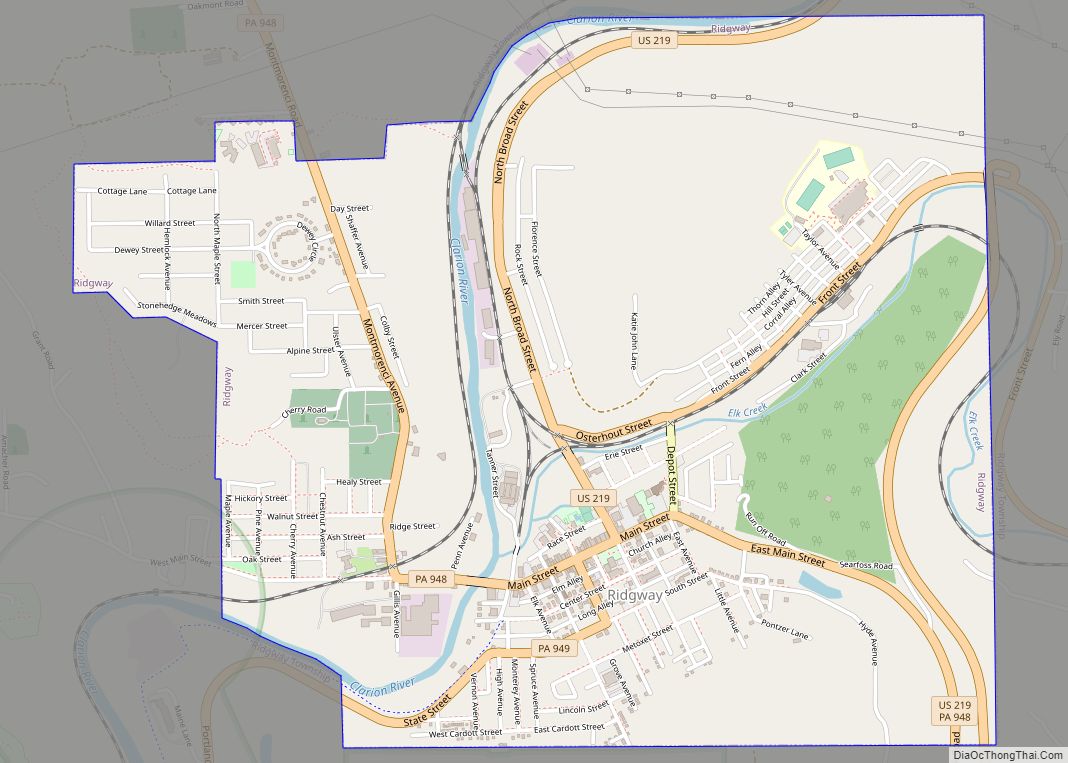
Ridgway is a borough in and the county seat of Elk County, Pennsylvania. As of the 2020 census it had a population of 4,039
| Name: | Ridgway borough |
|---|---|
| LSAD Code: | 21 |
| LSAD Description: | borough (suffix) |
| State: | Pennsylvania |
| County: | Elk County |
| Incorporated: | 1880 |
| Elevation: | 1,381 ft (421 m) |
| Total Area: | 2.67 sq mi (6.91 km²) |
| Land Area: | 2.61 sq mi (6.77 km²) |
| Water Area: | 0.06 sq mi (0.14 km²) |
| Total Population: | 4,039 |
| Population Density: | 1,436.06/sq mi (554.41/km²) |
| ZIP code: | 15853 |
| Area code: | 814 |
| FIPS code: | 4264784 |
| Website: | www.ridgwayborough.com |
Online Interactive Map
Click on ![]() to view map in "full screen" mode.
to view map in "full screen" mode.
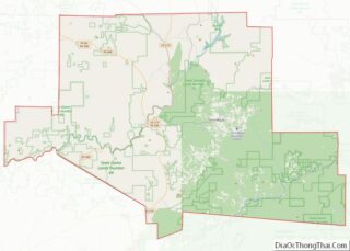
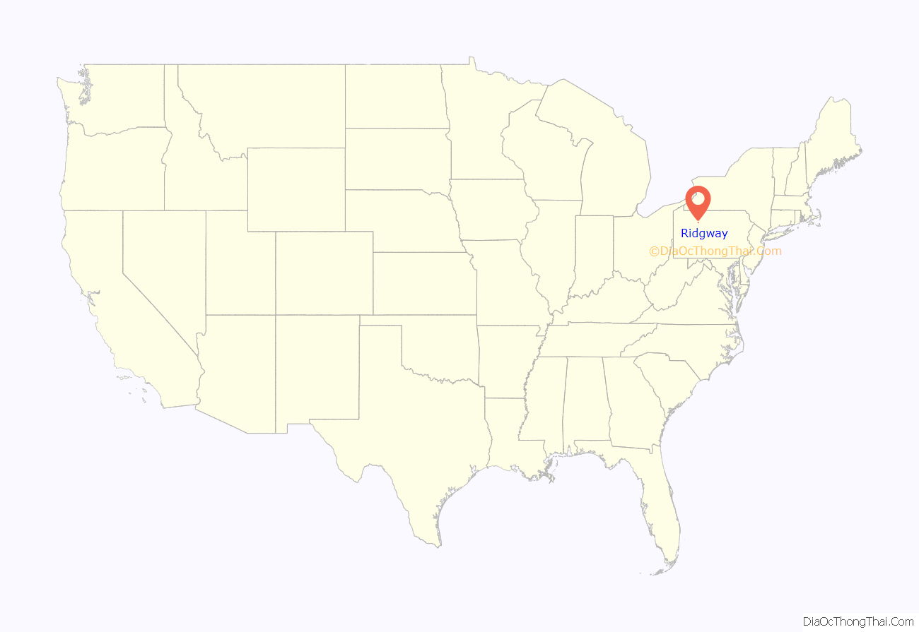
Ridgway location map. Where is Ridgway borough?
History
Ridgway was founded by Philadelphian shipping merchant Jacob Ridgway and James Gillis. Jacob Ridgway earned substantial wealth both in Philadelphia and abroad in London. He constantly sent sums of money back to be invested in property. In the early 19th century as part of a larger land purchase, Ridgway acquired 40,000 acres (160 km) that became Elk County. One of Jacob Ridgway’s nephews, James Gillis, convinced Ridgway that the area could become a very lucrative spot for a lumber camp due to the proximity of Elk Creek and the Clarion River, a tributary of the Allegheny River. Coal and natural gas abound in the district. In the past, the industrial interests were manufacturing leather, iron, clay, and lumber products, silk goods, railroad snow plows, dynamos, and machine tools. In 1900, the people living here numbered 3,515; in 1910, 5,408; in 1940, 6,253, and in 2010, 4,078.
Many historic structures are located within the boundaries of the Ridgway Historic District, added to the National Register of Historic Places in 2003. The O.B. Grant House and Ridgway Armory are also listed on the National Register of Historic Places.
The lumber industry continued to flourish in Ridgway, to the degree that around the start of the 20th century, the town claimed it had more millionaires per capita than any other town in the U.S.
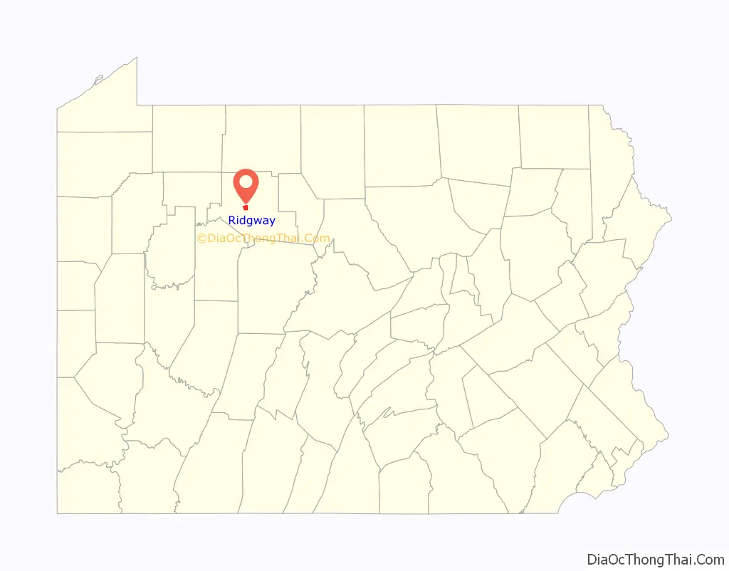
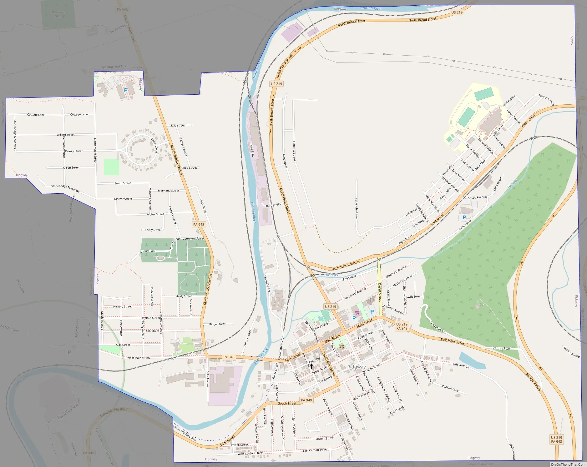
Ridgway Road Map
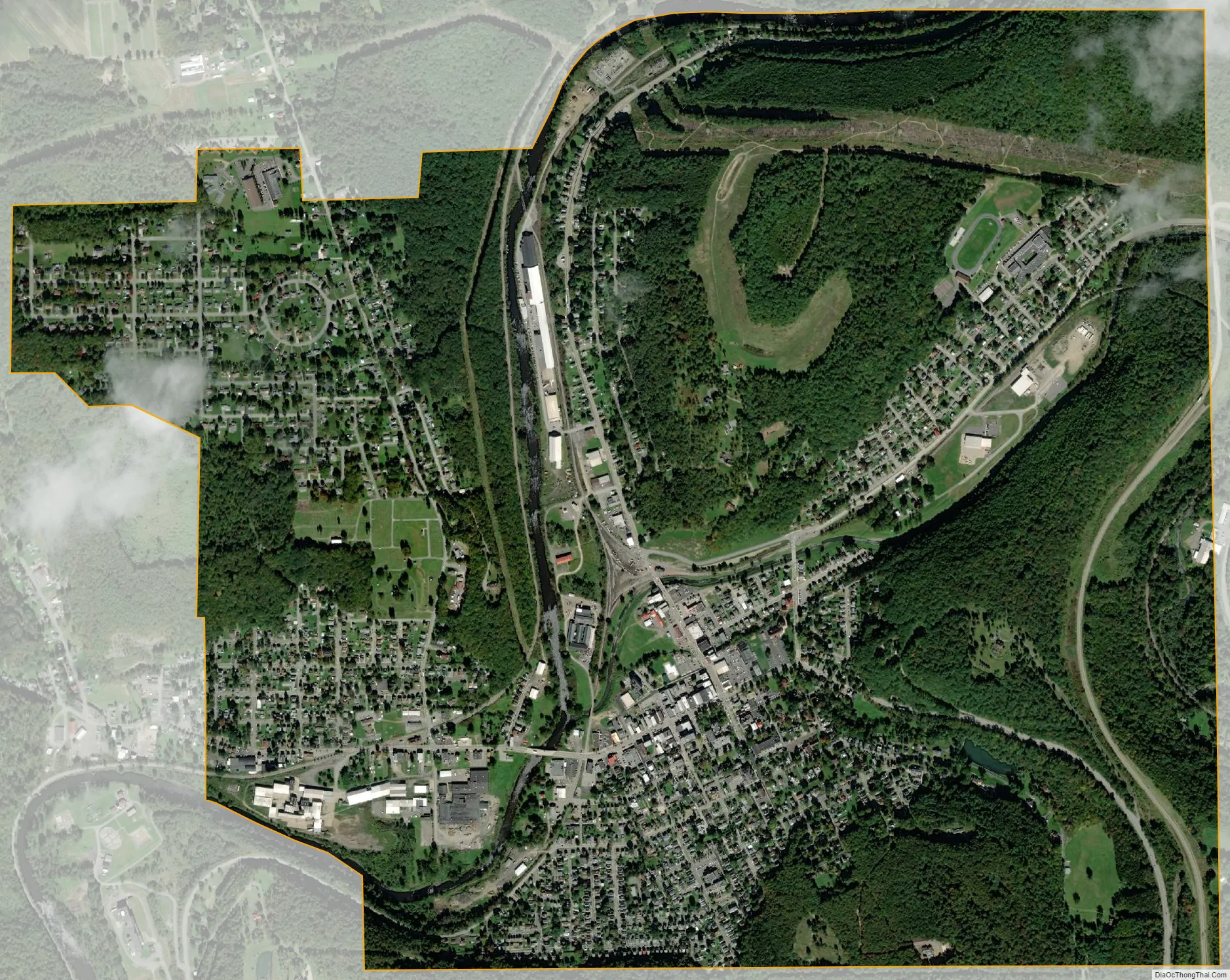
Ridgway city Satellite Map
Geography
Ridgway is located in central Elk County at 41°25′29″N 78°43′47″W / 41.42472°N 78.72972°W / 41.42472; -78.72972 (41.424739, -78.729733). It is surrounded by Ridgway Township.
The borough is in the valley of the Clarion River, where it is joined from the east by Elk Creek. U.S. Route 219 passes through the borough center, leading north 44 miles (71 km) to Bradford and south 28 miles (45 km) to DuBois.
According to the United States Census Bureau, the borough has a total area of 2.67 square miles (6.91 km), of which 2.61 square miles (6.77 km) is land and 0.054 square miles (0.14 km), or 2.07%, is water.
Climate
See also
Map of Pennsylvania State and its subdivision:- Adams
- Allegheny
- Armstrong
- Beaver
- Bedford
- Berks
- Blair
- Bradford
- Bucks
- Butler
- Cambria
- Cameron
- Carbon
- Centre
- Chester
- Clarion
- Clearfield
- Clinton
- Columbia
- Crawford
- Cumberland
- Dauphin
- Delaware
- Elk
- Erie
- Fayette
- Forest
- Franklin
- Fulton
- Greene
- Huntingdon
- Indiana
- Jefferson
- Juniata
- Lackawanna
- Lancaster
- Lawrence
- Lebanon
- Lehigh
- Luzerne
- Lycoming
- Mc Kean
- Mercer
- Mifflin
- Monroe
- Montgomery
- Montour
- Northampton
- Northumberland
- Perry
- Philadelphia
- Pike
- Potter
- Schuylkill
- Snyder
- Somerset
- Sullivan
- Susquehanna
- Tioga
- Union
- Venango
- Warren
- Washington
- Wayne
- Westmoreland
- Wyoming
- York
- Alabama
- Alaska
- Arizona
- Arkansas
- California
- Colorado
- Connecticut
- Delaware
- District of Columbia
- Florida
- Georgia
- Hawaii
- Idaho
- Illinois
- Indiana
- Iowa
- Kansas
- Kentucky
- Louisiana
- Maine
- Maryland
- Massachusetts
- Michigan
- Minnesota
- Mississippi
- Missouri
- Montana
- Nebraska
- Nevada
- New Hampshire
- New Jersey
- New Mexico
- New York
- North Carolina
- North Dakota
- Ohio
- Oklahoma
- Oregon
- Pennsylvania
- Rhode Island
- South Carolina
- South Dakota
- Tennessee
- Texas
- Utah
- Vermont
- Virginia
- Washington
- West Virginia
- Wisconsin
- Wyoming