Julian /dʒuːliˈæn/ is an unincorporated community and census-designated place (CDP) that is located in Centre County, Pennsylvania, United States. It is part of the State College, Pennsylvania Metropolitan Statistical Area. The population was 152 at the 2010 census. Most locals pronounce the name “Joo-lee-ānn”.
The community was named after Julia Ann Irvin, the wife of the proprietor of a local blast furnace.
| Name: | Julian CDP |
|---|---|
| LSAD Code: | 57 |
| LSAD Description: | CDP (suffix) |
| State: | Pennsylvania |
| County: | Centre County |
| Elevation: | 850 ft (260 m) |
| Total Area: | 0.15 sq mi (0.38 km²) |
| Land Area: | 0.15 sq mi (0.38 km²) |
| Water Area: | 0.00 sq mi (0.00 km²) |
| Total Population: | 146 |
| Population Density: | 986.49/sq mi (380.54/km²) |
| ZIP code: | 16844 |
| Area code: | 814 |
| FIPS code: | 4238528 |
| GNISfeature ID: | 1178189 |
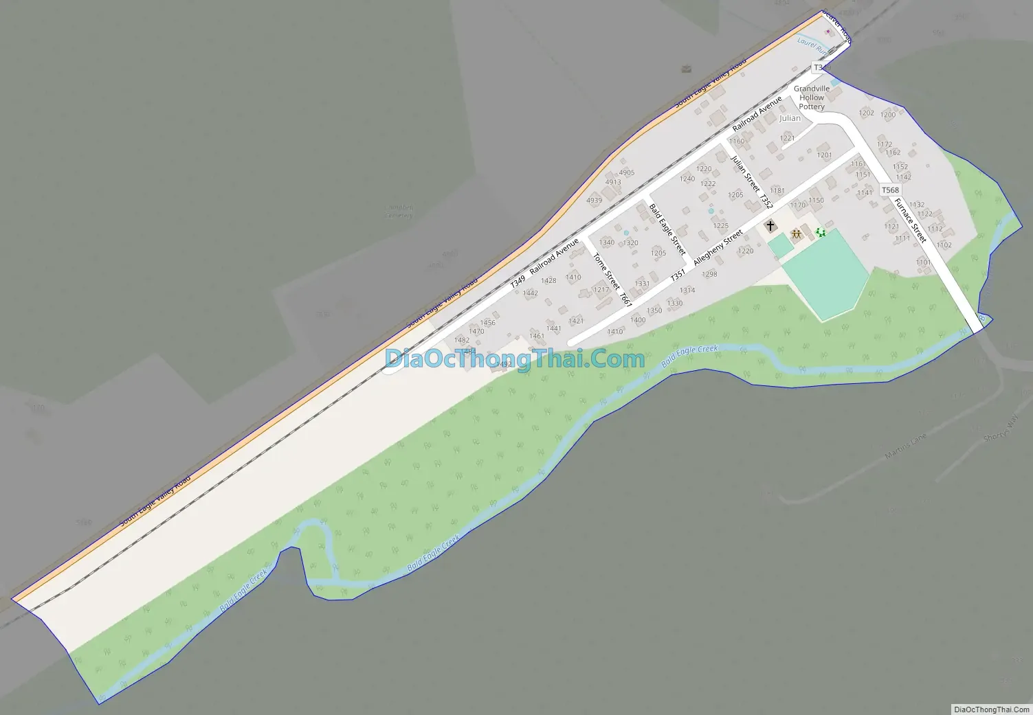
Online Interactive Map
Click on ![]() to view map in "full screen" mode.
to view map in "full screen" mode.
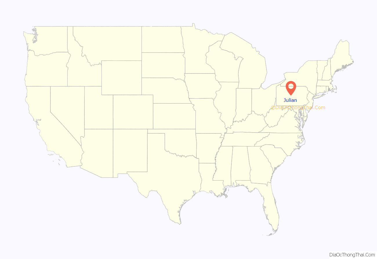
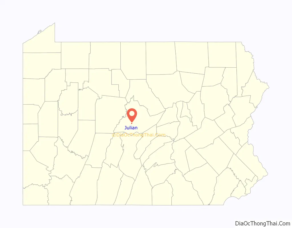
Julian location map. Where is Julian CDP?
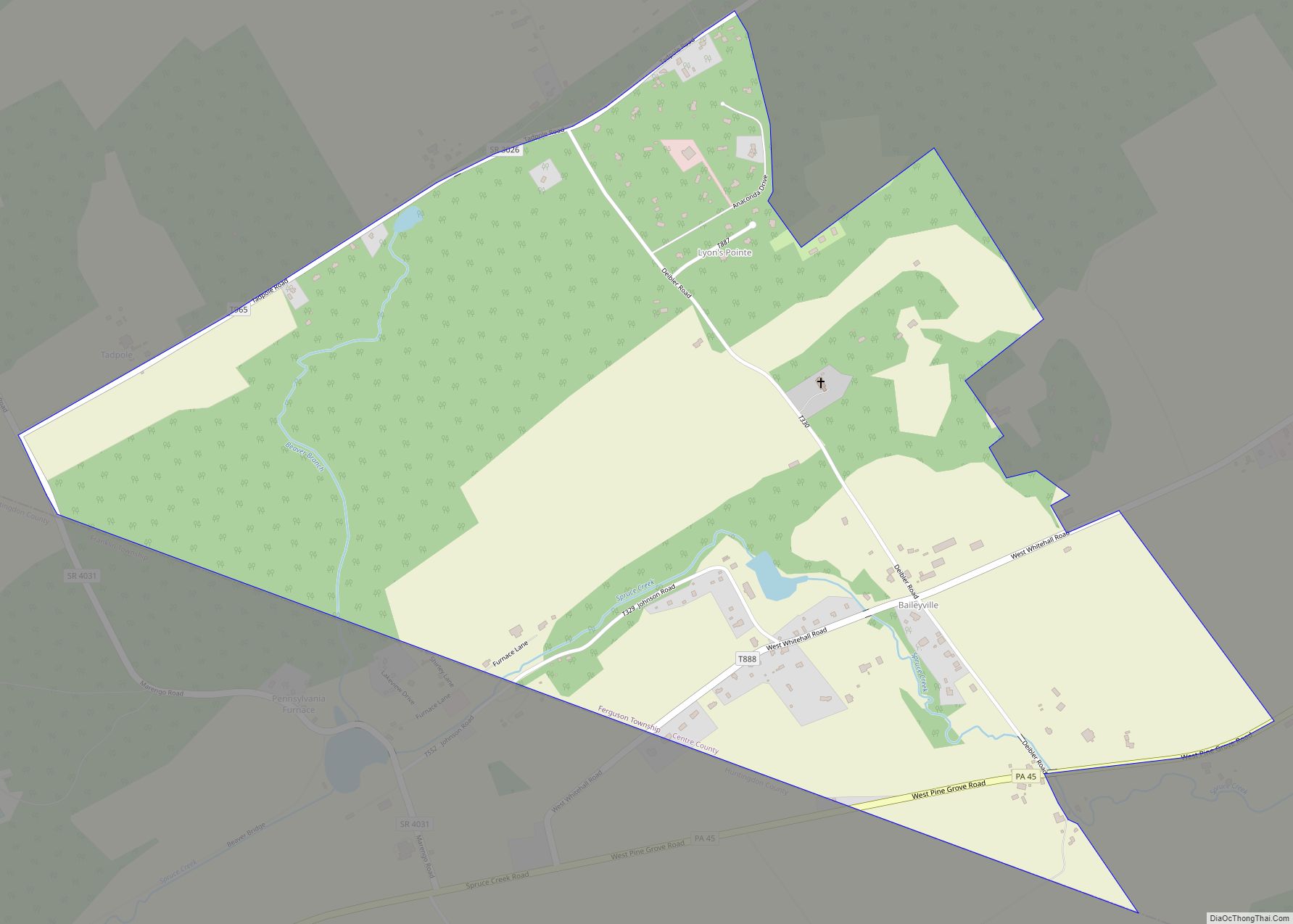
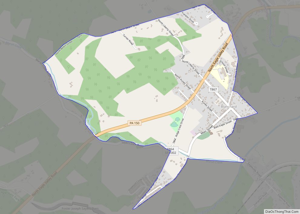
Julian Road Map
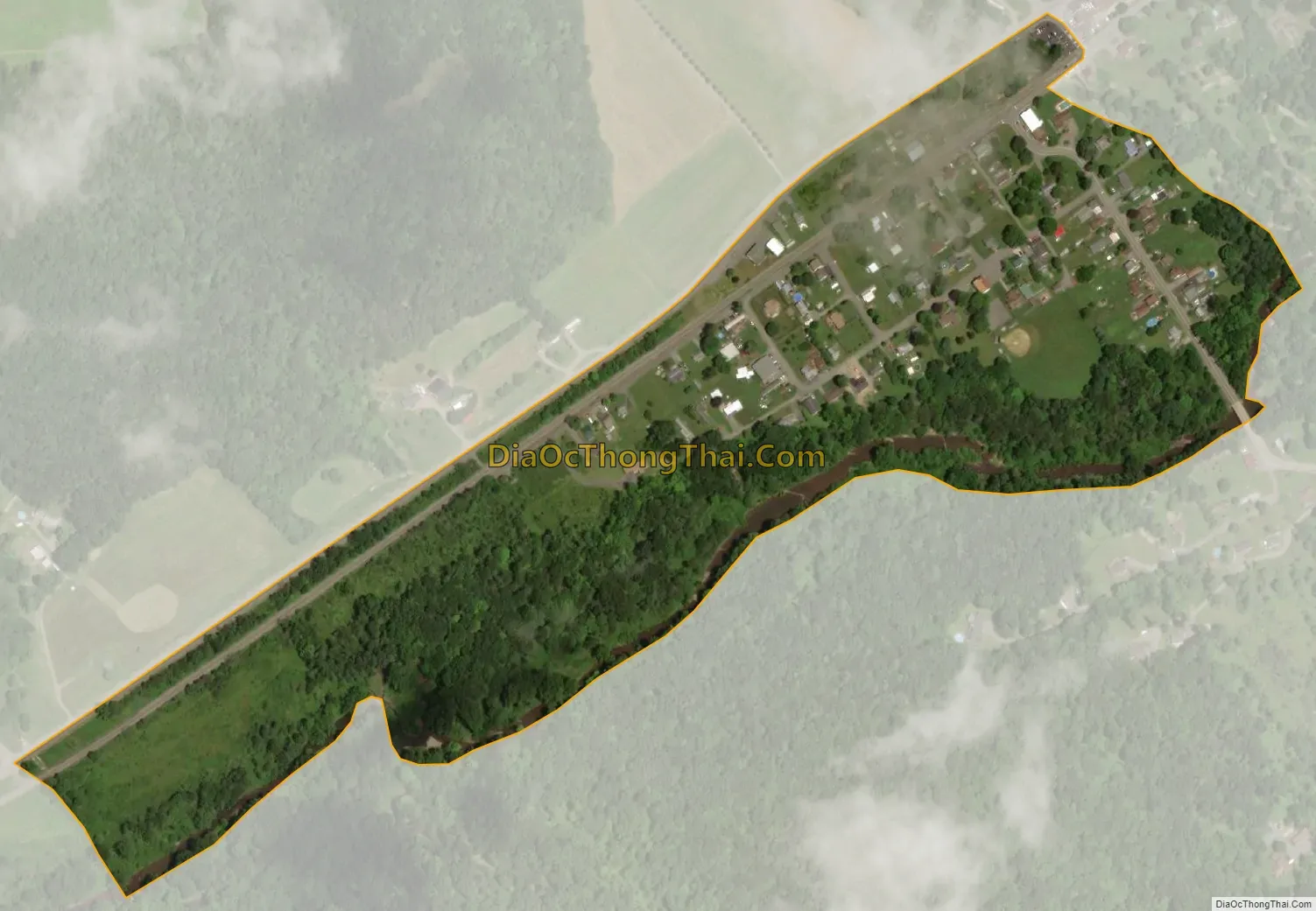
Julian city Satellite Map
Geography
Julian is located southwest of the center of Centre County at 40°51′48″N 77°56′26″W / 40.86333°N 77.94056°W / 40.86333; -77.94056 (40.863230, -77.940677), in southeastern Huston Township. It is in the valley of Bald Eagle Creek, with Bald Eagle Mountain rising to the southeast and foothills of the Allegheny Front to the northwest. U.S. Route 220 Alternate passes through the town, leading northeast 10 miles (16 km) to Milesburg and southwest 8 miles (13 km) to Port Matilda. State College is 10 miles (16 km) to the southeast across Bald Eagle Mountain.
According to the United States Census Bureau, the CDP has a total area of 4.20 square miles (10.9 km), all land.
See also
Map of Pennsylvania State and its subdivision:- Adams
- Allegheny
- Armstrong
- Beaver
- Bedford
- Berks
- Blair
- Bradford
- Bucks
- Butler
- Cambria
- Cameron
- Carbon
- Centre
- Chester
- Clarion
- Clearfield
- Clinton
- Columbia
- Crawford
- Cumberland
- Dauphin
- Delaware
- Elk
- Erie
- Fayette
- Forest
- Franklin
- Fulton
- Greene
- Huntingdon
- Indiana
- Jefferson
- Juniata
- Lackawanna
- Lancaster
- Lawrence
- Lebanon
- Lehigh
- Luzerne
- Lycoming
- Mc Kean
- Mercer
- Mifflin
- Monroe
- Montgomery
- Montour
- Northampton
- Northumberland
- Perry
- Philadelphia
- Pike
- Potter
- Schuylkill
- Snyder
- Somerset
- Sullivan
- Susquehanna
- Tioga
- Union
- Venango
- Warren
- Washington
- Wayne
- Westmoreland
- Wyoming
- York
- Alabama
- Alaska
- Arizona
- Arkansas
- California
- Colorado
- Connecticut
- Delaware
- District of Columbia
- Florida
- Georgia
- Hawaii
- Idaho
- Illinois
- Indiana
- Iowa
- Kansas
- Kentucky
- Louisiana
- Maine
- Maryland
- Massachusetts
- Michigan
- Minnesota
- Mississippi
- Missouri
- Montana
- Nebraska
- Nevada
- New Hampshire
- New Jersey
- New Mexico
- New York
- North Carolina
- North Dakota
- Ohio
- Oklahoma
- Oregon
- Pennsylvania
- Rhode Island
- South Carolina
- South Dakota
- Tennessee
- Texas
- Utah
- Vermont
- Virginia
- Washington
- West Virginia
- Wisconsin
- Wyoming