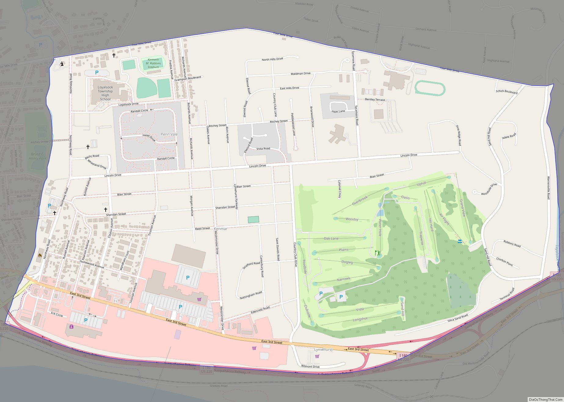
Kenmar is a census-designated place (CDP) in Loyalsock Township, Lycoming County, Pennsylvania, United States. As of the 2010 census, it had a population of 4,124. Kenmar is not a separately incorporated community, but is a part of Loyalsock Township (which is a municipality under Pennsylvania law).
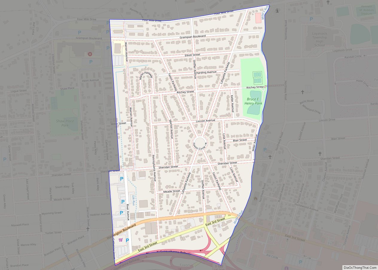
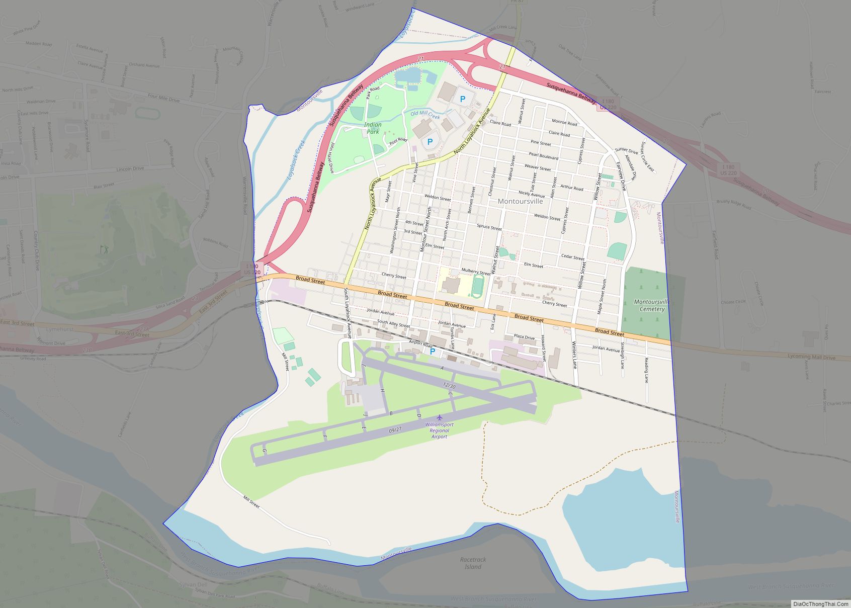
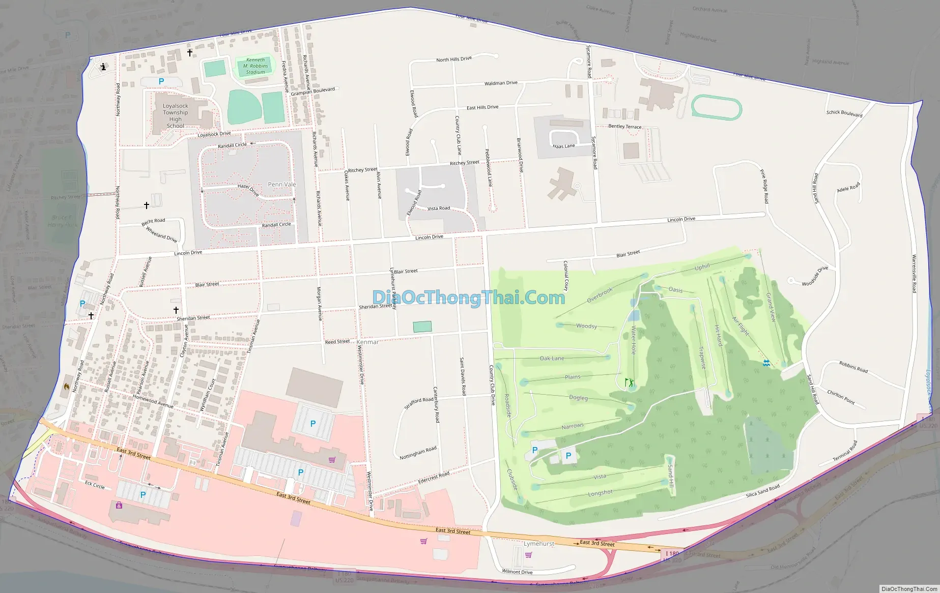
Kenmar is bordered by Four Mile Drive to the north, Miller Run and the CDP of Faxon to the west, Interstate 180 to the south, and Loyalsock Creek and the borough of Montoursville to the east.
Kenmar is east of Faxon; there was a previous CDP named “East Faxon” in Lycoming County, but it lost its status as a CDP in the 1990 Census.
| Name: | Kenmar CDP |
|---|---|
| LSAD Code: | 57 |
| LSAD Description: | CDP (suffix) |
| State: | Pennsylvania |
| County: | Lycoming County |
| Elevation: | 530 ft (160 m) |
| Total Area: | 2.06 sq mi (5.33 km²) |
| Land Area: | 2.05 sq mi (5.31 km²) |
| Water Area: | 0.01 sq mi (0.02 km²) |
| Total Population: | 4,241 |
| Population Density: | 2,070.80/sq mi (799.36/km²) |
| Area code: | 570 |
| FIPS code: | 4239280 |
| GNISfeature ID: | 1192706 |
Online Interactive Map
Click on ![]() to view map in "full screen" mode.
to view map in "full screen" mode.
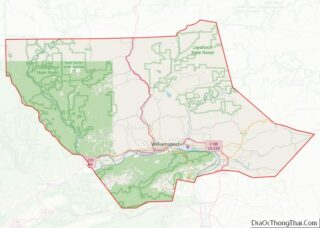
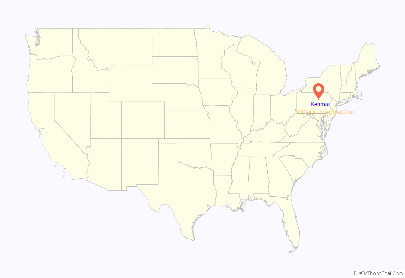
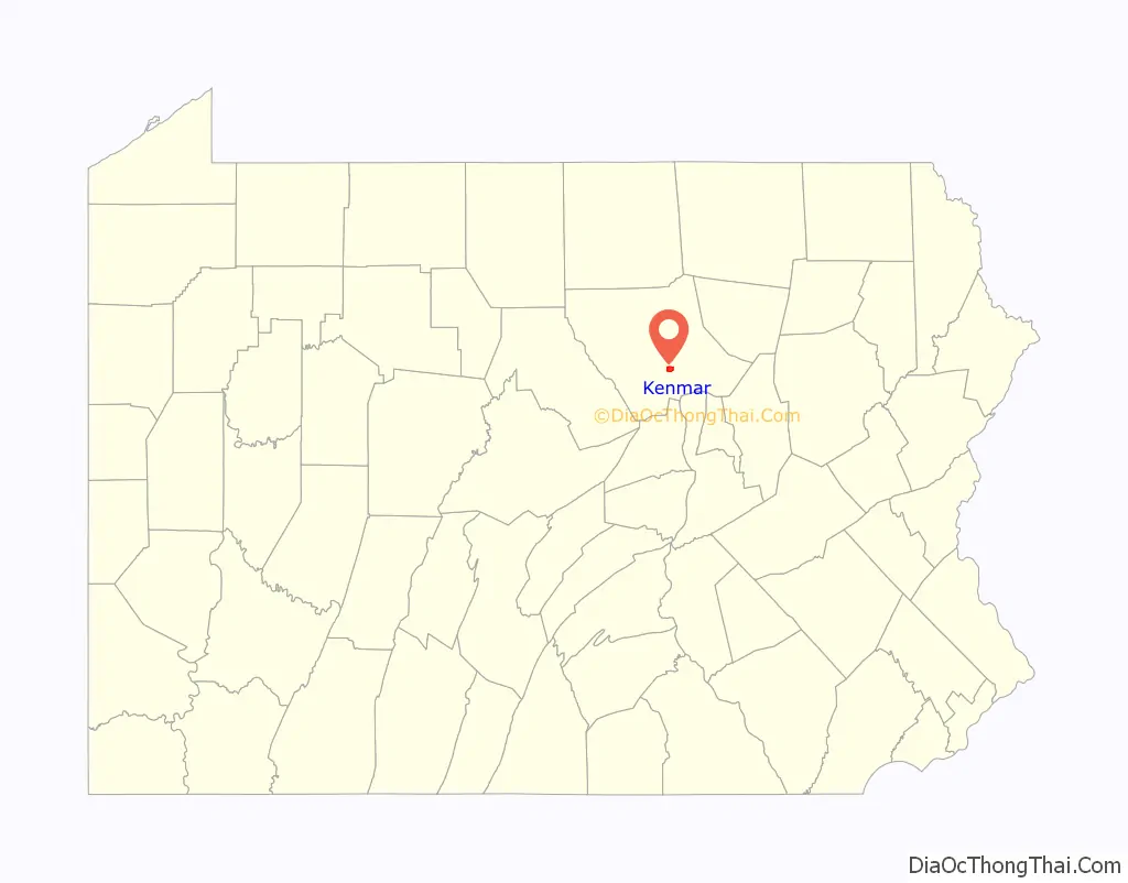
Kenmar location map. Where is Kenmar CDP?
Kenmar Road Map
Kenmar city Satellite Map

See also
Map of Pennsylvania State and its subdivision:- Adams
- Allegheny
- Armstrong
- Beaver
- Bedford
- Berks
- Blair
- Bradford
- Bucks
- Butler
- Cambria
- Cameron
- Carbon
- Centre
- Chester
- Clarion
- Clearfield
- Clinton
- Columbia
- Crawford
- Cumberland
- Dauphin
- Delaware
- Elk
- Erie
- Fayette
- Forest
- Franklin
- Fulton
- Greene
- Huntingdon
- Indiana
- Jefferson
- Juniata
- Lackawanna
- Lancaster
- Lawrence
- Lebanon
- Lehigh
- Luzerne
- Lycoming
- Mc Kean
- Mercer
- Mifflin
- Monroe
- Montgomery
- Montour
- Northampton
- Northumberland
- Perry
- Philadelphia
- Pike
- Potter
- Schuylkill
- Snyder
- Somerset
- Sullivan
- Susquehanna
- Tioga
- Union
- Venango
- Warren
- Washington
- Wayne
- Westmoreland
- Wyoming
- York
- Alabama
- Alaska
- Arizona
- Arkansas
- California
- Colorado
- Connecticut
- Delaware
- District of Columbia
- Florida
- Georgia
- Hawaii
- Idaho
- Illinois
- Indiana
- Iowa
- Kansas
- Kentucky
- Louisiana
- Maine
- Maryland
- Massachusetts
- Michigan
- Minnesota
- Mississippi
- Missouri
- Montana
- Nebraska
- Nevada
- New Hampshire
- New Jersey
- New Mexico
- New York
- North Carolina
- North Dakota
- Ohio
- Oklahoma
- Oregon
- Pennsylvania
- Rhode Island
- South Carolina
- South Dakota
- Tennessee
- Texas
- Utah
- Vermont
- Virginia
- Washington
- West Virginia
- Wisconsin
- Wyoming