Lansdale is a borough in Montgomery County, Pennsylvania, United States. It is a densely-populated commuter town, with many residents traveling daily to Philadelphia using SEPTA Regional Rail’s Lansdale/Doylestown Line. In 1900, 2,754 people lived here; in 1910, 3,551; and in 1940, 9,316 people were inhabitants of Lansdale. The population was 18,773 at the 2020 census.
Lansdale is the center of the North Penn Valley, a region which includes the surrounding townships and boroughs. It is located 27 miles (43 km) southeast of Allentown and 21 miles (34 km) north of Philadelphia.
| Name: | Lansdale borough |
|---|---|
| LSAD Code: | 21 |
| LSAD Description: | borough (suffix) |
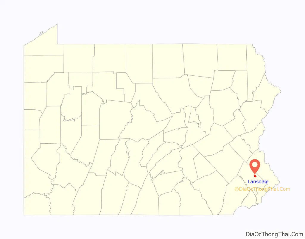
| State: | Pennsylvania |
| County: | Montgomery County |
| Elevation: | 361 ft (110 m) |
| Total Area: | 2.99 sq mi (7.75 km²) |
| Land Area: | 2.99 sq mi (7.75 km²) |
| Water Area: | 0.00 sq mi (0.00 km²) |
| Total Population: | 18,773 |
| Population Density: | 6,272.30/sq mi (2,422.12/km²) |
| ZIP code: | 19446 |
| FIPS code: | 4241432 |
| Website: | www.lansdale.org |
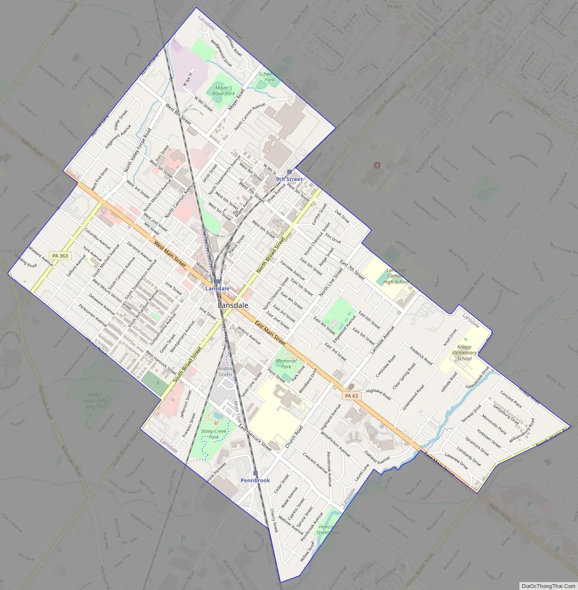
Online Interactive Map
Click on ![]() to view map in "full screen" mode.
to view map in "full screen" mode.
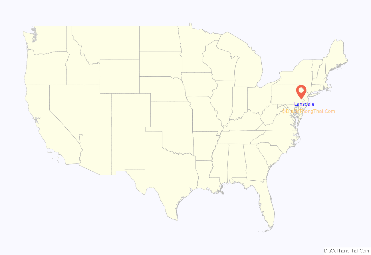
Lansdale location map. Where is Lansdale borough?
History
Founding
The earliest known settlers in Lansdale were members of the Jenkins family. At the peak of its growth, the Jenkins homestead occupied approximately 120 acres of land. The construction of the North Pennsylvania Railroad (later absorbed into the Reading Railroad) during the 1850s contributed to rapid growth and expansion in Lansdale. Employment opportunities generated by the railroad brought settlers, housing, and local businesses to the area.
Borough incorporation
By 1872, Lansdale Borough was officially incorporated and named after Phillip Lansdale Fox, chief surveyor of the North Penn Railroad. By the naming conventions of the time, it should have been called Jenkintown, since the land immediately surrounding the train station was owned by the Jenkins family, but there was already a town by that name along the rail line.
The Jenkins Homestead and Lansdale Silk Hosiery Compy-Interstate Hosiery Mills, Inc. are listed on the National Register of Historic Places.
Kugel ball
Lansdale is home to a Kugel ball, which is a 2,200 lb (1,000 kg) dark grey granite sphere supported by a very thin film of water pumped from beneath its base. The Kugel Ball is located in Railroad Plaza, adjacent to the SEPTA Lansdale/Doylestown Line train station in downtown Lansdale. The plaza consists of a bricked patio with benches centered on the Kugel Ball and closes at 11:00 pm. An annual 5k race is held in June, accordingly named the Kugel Ball race, which starts and ends at the actual Kugel Ball in Railroad Plaza.
Hometown heroes
The Lansdale Borough Hometown Heroes Banner Program is a living tribute created for the community to recognize and honor Lansdale Veterans who are serving or are veterans who have served in the United States Armed Forces.
Lansdale Road Map
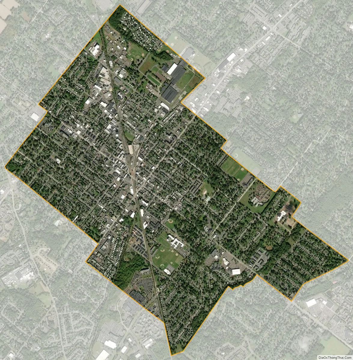
Lansdale city Satellite Map
Geography
According to the U.S. Census Bureau, the borough has a total area of 3.1 square miles (8.0 km), all land. It has a hot-summer humid continental climate (Dfa) and the hardiness zone is 6b. The average monthly temperature ranges from 30.2 °F in January to 74.7 °F in July. The average annual absolute minimum temperature is -0.4 °F.
See also
Map of Pennsylvania State and its subdivision:- Adams
- Allegheny
- Armstrong
- Beaver
- Bedford
- Berks
- Blair
- Bradford
- Bucks
- Butler
- Cambria
- Cameron
- Carbon
- Centre
- Chester
- Clarion
- Clearfield
- Clinton
- Columbia
- Crawford
- Cumberland
- Dauphin
- Delaware
- Elk
- Erie
- Fayette
- Forest
- Franklin
- Fulton
- Greene
- Huntingdon
- Indiana
- Jefferson
- Juniata
- Lackawanna
- Lancaster
- Lawrence
- Lebanon
- Lehigh
- Luzerne
- Lycoming
- Mc Kean
- Mercer
- Mifflin
- Monroe
- Montgomery
- Montour
- Northampton
- Northumberland
- Perry
- Philadelphia
- Pike
- Potter
- Schuylkill
- Snyder
- Somerset
- Sullivan
- Susquehanna
- Tioga
- Union
- Venango
- Warren
- Washington
- Wayne
- Westmoreland
- Wyoming
- York
- Alabama
- Alaska
- Arizona
- Arkansas
- California
- Colorado
- Connecticut
- Delaware
- District of Columbia
- Florida
- Georgia
- Hawaii
- Idaho
- Illinois
- Indiana
- Iowa
- Kansas
- Kentucky
- Louisiana
- Maine
- Maryland
- Massachusetts
- Michigan
- Minnesota
- Mississippi
- Missouri
- Montana
- Nebraska
- Nevada
- New Hampshire
- New Jersey
- New Mexico
- New York
- North Carolina
- North Dakota
- Ohio
- Oklahoma
- Oregon
- Pennsylvania
- Rhode Island
- South Carolina
- South Dakota
- Tennessee
- Texas
- Utah
- Vermont
- Virginia
- Washington
- West Virginia
- Wisconsin
- Wyoming


