Leechburg is a borough in southern Armstrong County in the U.S. state of Pennsylvania, 35 miles (56 km) northeast of Pittsburgh. A population of 2,149 residents live within the borough limits as of the 2020 census, according to US Census Bureau. Leechburg was founded by David Leech, for whom it was named, and was incorporated as a borough in 1850. Located along the Kiskiminetas River, Leechburg was a major port of the Pennsylvania Canal. Early in the 20th century, it was the site of extensive steel sheet works, foundries, cement plants, and productive coal mines. Leechburg was the first place where natural gas was used for industrial purposes.
| Name: | Leechburg borough |
|---|---|
| LSAD Code: | 21 |
| LSAD Description: | borough (suffix) |
| State: | Pennsylvania |
| County: | Armstrong County |
| Incorporated: | 1850 |
| Elevation: | 790 ft (240 m) |
| Total Area: | 0.48 sq mi (1.25 km²) |
| Land Area: | 0.44 sq mi (1.14 km²) |
| Water Area: | 0.04 sq mi (0.11 km²) |
| Total Population: | 2,149 |
| Population Density: | 4,895.22/sq mi (1,888.62/km²) |
| Area code: | 724 |
| FIPS code: | 4242280 |
| Website: | leechburgborough.org |
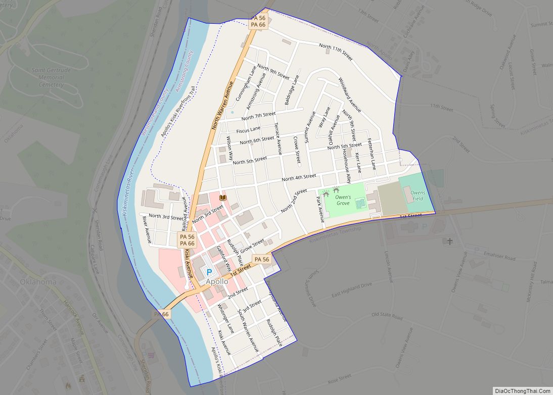
Online Interactive Map
Click on ![]() to view map in "full screen" mode.
to view map in "full screen" mode.
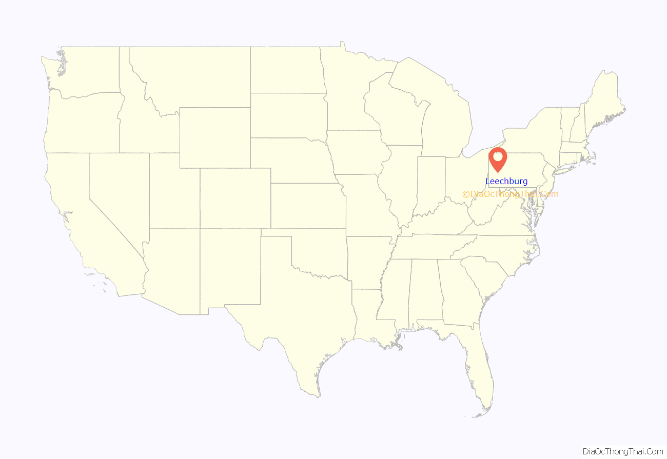
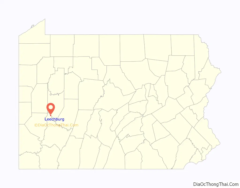
Leechburg location map. Where is Leechburg borough?
History
Leechburg was founded in 1850 by David Leech. Prior to 1850, the settlement was known as White Plains. David Leech purchased the land from a local Native American known as White Maddock.
Leechburg Road Map
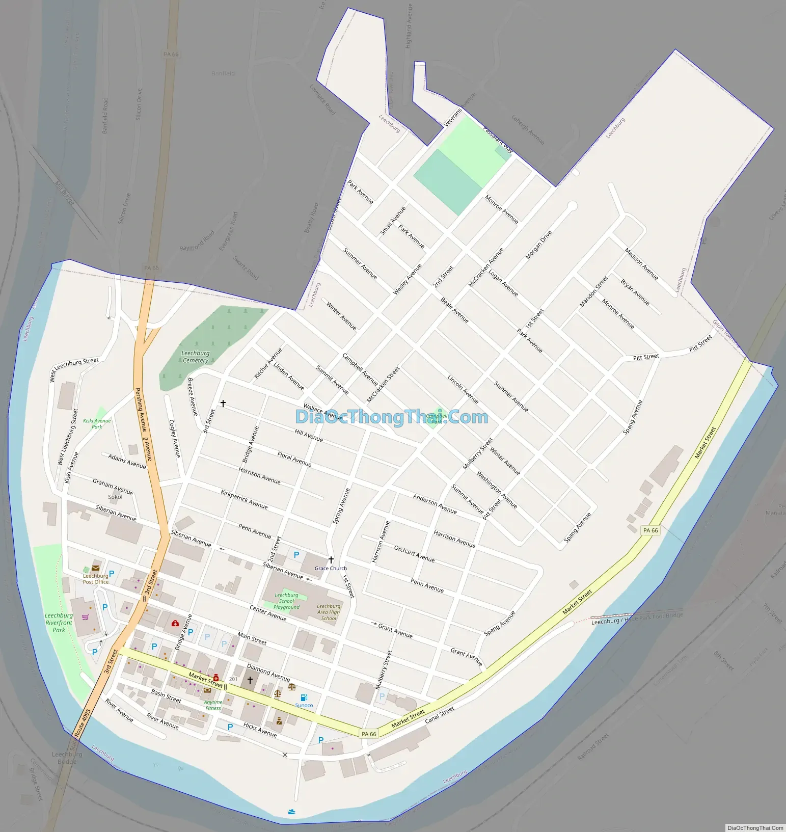
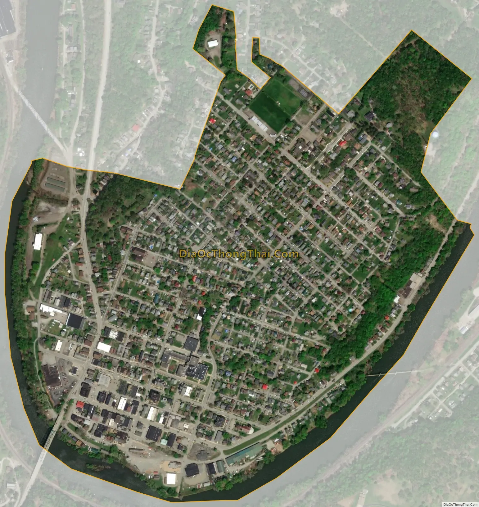
Leechburg city Satellite Map
Geography
Leechburg is located at 40°37′45″N 79°36′13″W / 40.62917°N 79.60361°W / 40.62917; -79.60361 (40.629304, -79.603727). Elevations range from 780 feet (240 m) to 1,080 feet (330 m) above sea level.
According to the United States Census Bureau, the borough has a total area of 0.46 square miles (1.2 km), of which 0.42 square miles (1.1 km) is land and 0.039 square miles (0.1 km), or 8.62%, is water.
The town is bordered by the Kiskiminetas River to the south, on the border of Westmoreland County, and Gilpin Township to the north.
See also
Map of Pennsylvania State and its subdivision:- Adams
- Allegheny
- Armstrong
- Beaver
- Bedford
- Berks
- Blair
- Bradford
- Bucks
- Butler
- Cambria
- Cameron
- Carbon
- Centre
- Chester
- Clarion
- Clearfield
- Clinton
- Columbia
- Crawford
- Cumberland
- Dauphin
- Delaware
- Elk
- Erie
- Fayette
- Forest
- Franklin
- Fulton
- Greene
- Huntingdon
- Indiana
- Jefferson
- Juniata
- Lackawanna
- Lancaster
- Lawrence
- Lebanon
- Lehigh
- Luzerne
- Lycoming
- Mc Kean
- Mercer
- Mifflin
- Monroe
- Montgomery
- Montour
- Northampton
- Northumberland
- Perry
- Philadelphia
- Pike
- Potter
- Schuylkill
- Snyder
- Somerset
- Sullivan
- Susquehanna
- Tioga
- Union
- Venango
- Warren
- Washington
- Wayne
- Westmoreland
- Wyoming
- York
- Alabama
- Alaska
- Arizona
- Arkansas
- California
- Colorado
- Connecticut
- Delaware
- District of Columbia
- Florida
- Georgia
- Hawaii
- Idaho
- Illinois
- Indiana
- Iowa
- Kansas
- Kentucky
- Louisiana
- Maine
- Maryland
- Massachusetts
- Michigan
- Minnesota
- Mississippi
- Missouri
- Montana
- Nebraska
- Nevada
- New Hampshire
- New Jersey
- New Mexico
- New York
- North Carolina
- North Dakota
- Ohio
- Oklahoma
- Oregon
- Pennsylvania
- Rhode Island
- South Carolina
- South Dakota
- Tennessee
- Texas
- Utah
- Vermont
- Virginia
- Washington
- West Virginia
- Wisconsin
- Wyoming