Lemont is an unincorporated community and census-designated place (CDP) in Centre County, Pennsylvania, United States, and is the location of the only remaining granary in Pennsylvania. It is part of the State College, Pennsylvania Metropolitan Statistical Area. The population was 2,270 at the 2010 census.
| Name: | Lemont CDP |
|---|---|
| LSAD Code: | 57 |
| LSAD Description: | CDP (suffix) |
| State: | Pennsylvania |
| County: | Centre County |
| Elevation: | 1,046 ft (319 m) |
| Total Area: | 1.25 sq mi (3.23 km²) |
| Land Area: | 1.25 sq mi (3.23 km²) |
| Water Area: | 0.00 sq mi (0.00 km²) |
| Total Population: | 2,276 |
| Population Density: | 1,828.11/sq mi (705.58/km²) |
| ZIP code: | 16851 |
| Area code: | 814 |
| FIPS code: | 4242632 |
| GNISfeature ID: | 1198221 |
Online Interactive Map
Click on ![]() to view map in "full screen" mode.
to view map in "full screen" mode.
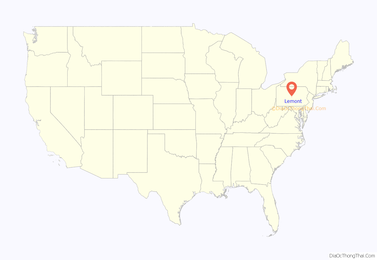
Lemont location map. Where is Lemont CDP?

Lemont Road Map
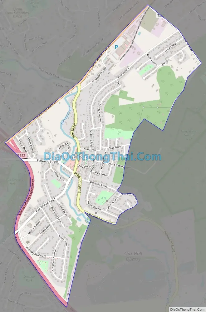
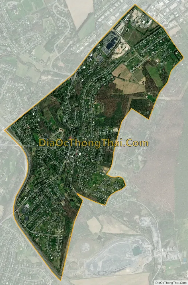
Lemont city Satellite Map
Geography
Lemont is located in southern Centre County at 40°48′36″N 77°49′5″W / 40.81000°N 77.81806°W / 40.81000; -77.81806 (40.809911, -77.818152), in the center of College Township. It is located 2 miles (3 km) northeast of the borough of State College. U.S. Route 322, the borough bypass, forms the western edge of Lemont. It is bordered by Houserville to the north.
The community is in the valley of Spring Creek, a northward-flowing tributary of Bald Eagle Creek and part of the Susquehanna River watershed. The southwestern end of Mount Nittany rises above the eastern edge of the village.
According to the United States Census Bureau, the Lemont CDP has a total area of 1.27 square miles (3.28 km), all land.
See also
Map of Pennsylvania State and its subdivision:- Adams
- Allegheny
- Armstrong
- Beaver
- Bedford
- Berks
- Blair
- Bradford
- Bucks
- Butler
- Cambria
- Cameron
- Carbon
- Centre
- Chester
- Clarion
- Clearfield
- Clinton
- Columbia
- Crawford
- Cumberland
- Dauphin
- Delaware
- Elk
- Erie
- Fayette
- Forest
- Franklin
- Fulton
- Greene
- Huntingdon
- Indiana
- Jefferson
- Juniata
- Lackawanna
- Lancaster
- Lawrence
- Lebanon
- Lehigh
- Luzerne
- Lycoming
- Mc Kean
- Mercer
- Mifflin
- Monroe
- Montgomery
- Montour
- Northampton
- Northumberland
- Perry
- Philadelphia
- Pike
- Potter
- Schuylkill
- Snyder
- Somerset
- Sullivan
- Susquehanna
- Tioga
- Union
- Venango
- Warren
- Washington
- Wayne
- Westmoreland
- Wyoming
- York
- Alabama
- Alaska
- Arizona
- Arkansas
- California
- Colorado
- Connecticut
- Delaware
- District of Columbia
- Florida
- Georgia
- Hawaii
- Idaho
- Illinois
- Indiana
- Iowa
- Kansas
- Kentucky
- Louisiana
- Maine
- Maryland
- Massachusetts
- Michigan
- Minnesota
- Mississippi
- Missouri
- Montana
- Nebraska
- Nevada
- New Hampshire
- New Jersey
- New Mexico
- New York
- North Carolina
- North Dakota
- Ohio
- Oklahoma
- Oregon
- Pennsylvania
- Rhode Island
- South Carolina
- South Dakota
- Tennessee
- Texas
- Utah
- Vermont
- Virginia
- Washington
- West Virginia
- Wisconsin
- Wyoming