Malvern is a borough in Chester County, Pennsylvania, United States. It is twenty-five miles (40 km) west of Philadelphia. The population was 3,419 at the 2020 census.
| Name: | Malvern borough |
|---|---|
| LSAD Code: | 21 |
| LSAD Description: | borough (suffix) |
| State: | Pennsylvania |
| County: | Chester County |
| Incorporated: | 1889 |
| Elevation: | 551 ft (168 m) |
| Total Area: | 1.27 sq mi (3.28 km²) |
| Land Area: | 1.26 sq mi (3.26 km²) |
| Water Area: | 0.01 sq mi (0.02 km²) |
| Total Population: | 3,419 |
| Population Density: | 2,713.49/sq mi (1,047.33/km²) |
| ZIP code: | 19355 |
| FIPS code: | 4246792 |
| Website: | www.malvern.org |
Online Interactive Map
Click on ![]() to view map in "full screen" mode.
to view map in "full screen" mode.
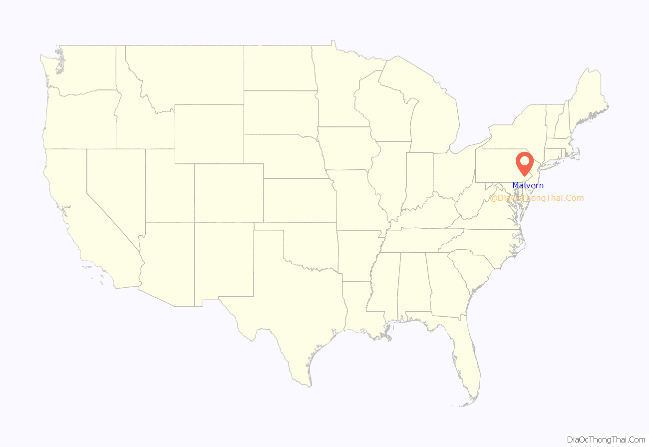
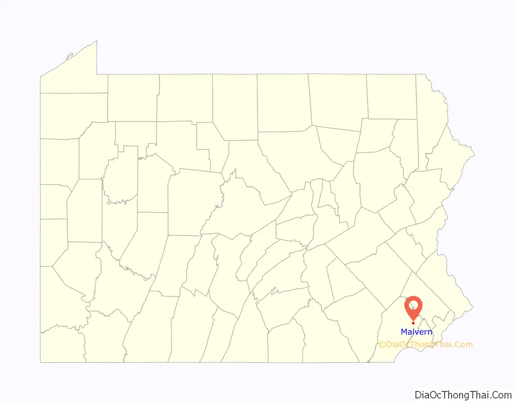
Malvern location map. Where is Malvern borough?
History
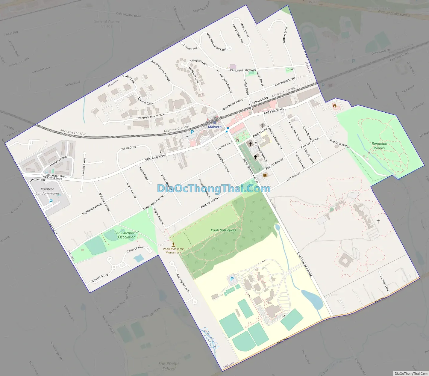
The area was originally settled in the 17th century by Welsh immigrants who purchased land from William Penn. Malvern is the site of the Paoli Massacre, which occurred September 20, 1777, during the American Revolutionary War under the command of General Anthony Wayne of nearby Easttown. In 1835, the East Whiteland Baptist Church moved to what is now its church and cemetery property, bounded by Channing, South Warren, and East First Avenues, and Roberts Lane. Changing its name to the Willistown Baptist Church, this institution then became the First Baptist Church of Malvern in 1900.
The church, trains, and a few businesses were the nucleus of this village, which was known for a long period as West Chester Intersection due to its position at the junction of the Philadelphia and Columbia Railroad and the West Chester Railroad. In 1873, the community’s name was changed to Malvern when the Philadelphia and Columbia’s successor, the Pennsylvania Railroad, straightened its tracks through the village. In 1879, the Malvern Friends Meeting was built at the northwest corner of Woodland Avenue and Roberts Lane, followed by the arrival of the Presbyterians and the Methodists prior to 1900. The village’s status as a railroad junction came to an end in March 1880 when the West Chester Railroad’s northern terminal was moved west to Frazer, Pennsylvania. Malvern Borough has a mix of residential styles and neighborhoods, retail and industrial businesses, dedicated open land, and numerous civic, cultural, and religious organizations.
Malvern was incorporated August 13, 1889, having separated from the northern portion of Willistown Township. On April 22, 2008, the borough converted to a home rule form of government.
A monument to the Paoli Massacre, the preserved battlefield, and a parade grounds are located in Malvern. Other sites of interest in neighboring townships include the Wharton Esherick Studio, listed on the National Register of Historic Places in 1973. It was designated a National Historic Landmark in 1993.
Malvern Road Map
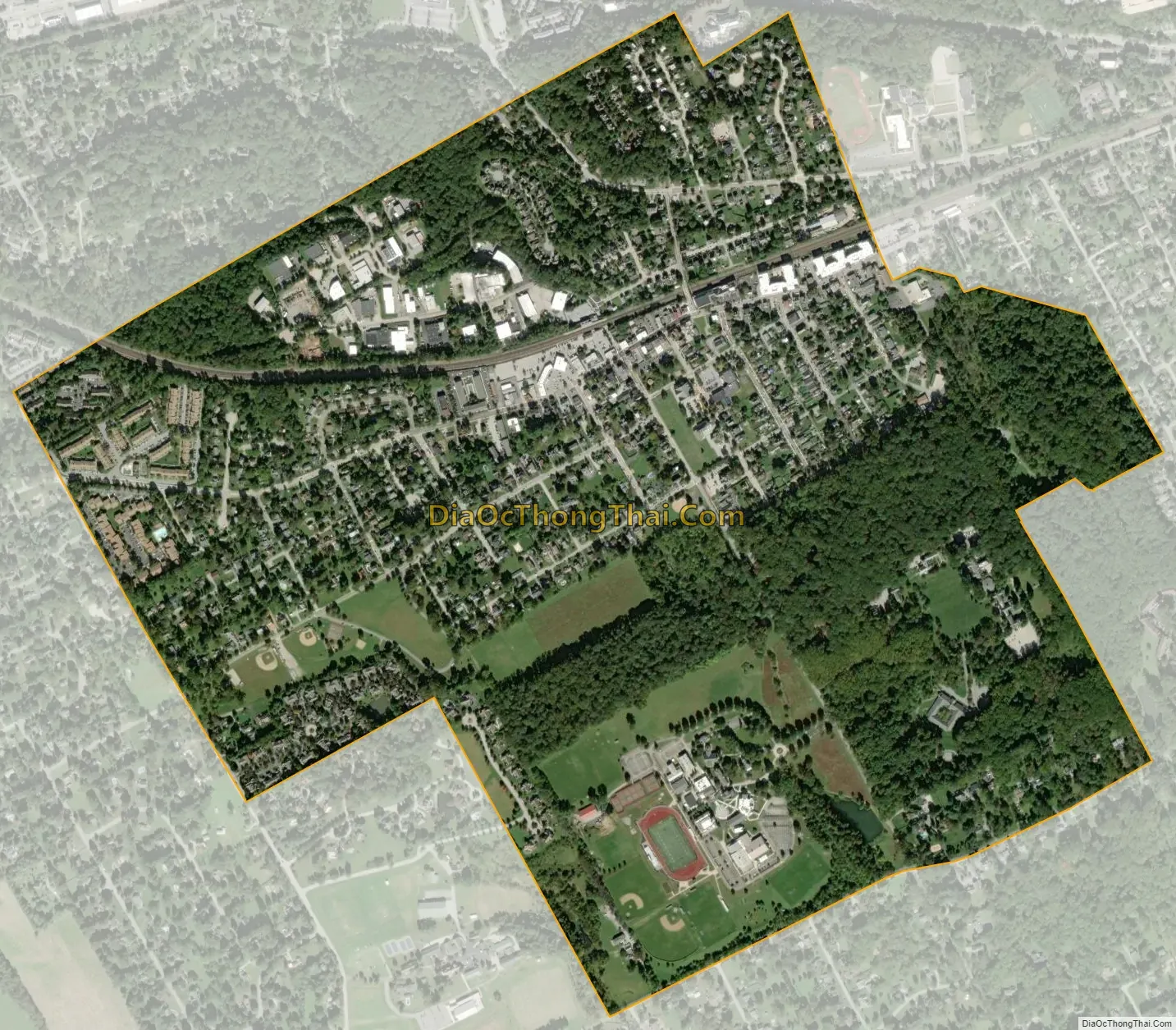
Malvern city Satellite Map
Geography
According to the U.S. Census Bureau, the borough has a total area of 1.2 square miles (3.1 km), all land.
The borough is bordered by Paoli Pike on the south, Sugartown Road on the west, Willistown Township on the east, and East Whiteland Township on the north.
The Malvern ZIP code covers Malvern and all or parts of East Whiteland, Charlestown, Willistown, East Goshen, East Pikeland, and Tredyffrin Townships. Malvern Borough is between Paoli on the east, and Immaculata University and Exton on the west.
See also
Map of Pennsylvania State and its subdivision:- Adams
- Allegheny
- Armstrong
- Beaver
- Bedford
- Berks
- Blair
- Bradford
- Bucks
- Butler
- Cambria
- Cameron
- Carbon
- Centre
- Chester
- Clarion
- Clearfield
- Clinton
- Columbia
- Crawford
- Cumberland
- Dauphin
- Delaware
- Elk
- Erie
- Fayette
- Forest
- Franklin
- Fulton
- Greene
- Huntingdon
- Indiana
- Jefferson
- Juniata
- Lackawanna
- Lancaster
- Lawrence
- Lebanon
- Lehigh
- Luzerne
- Lycoming
- Mc Kean
- Mercer
- Mifflin
- Monroe
- Montgomery
- Montour
- Northampton
- Northumberland
- Perry
- Philadelphia
- Pike
- Potter
- Schuylkill
- Snyder
- Somerset
- Sullivan
- Susquehanna
- Tioga
- Union
- Venango
- Warren
- Washington
- Wayne
- Westmoreland
- Wyoming
- York
- Alabama
- Alaska
- Arizona
- Arkansas
- California
- Colorado
- Connecticut
- Delaware
- District of Columbia
- Florida
- Georgia
- Hawaii
- Idaho
- Illinois
- Indiana
- Iowa
- Kansas
- Kentucky
- Louisiana
- Maine
- Maryland
- Massachusetts
- Michigan
- Minnesota
- Mississippi
- Missouri
- Montana
- Nebraska
- Nevada
- New Hampshire
- New Jersey
- New Mexico
- New York
- North Carolina
- North Dakota
- Ohio
- Oklahoma
- Oregon
- Pennsylvania
- Rhode Island
- South Carolina
- South Dakota
- Tennessee
- Texas
- Utah
- Vermont
- Virginia
- Washington
- West Virginia
- Wisconsin
- Wyoming