Masontown is a borough in Fayette County, Pennsylvania, United States. It is part of the Pittsburgh Metro Area. The population of the borough was 3,274 at the 2020 census. It is served by the Albert Gallatin Area School District. Masontown is a small crossroads for the rural portions of western Fayette County, and it contains a small shopping center and a grocery store within its business district.
| Name: | Masontown borough |
|---|---|
| LSAD Code: | 21 |
| LSAD Description: | borough (suffix) |
| State: | Pennsylvania |
| County: | Fayette County |
| Elevation: | 1,020 ft (310 m) |
| Total Area: | 1.53 sq mi (3.95 km²) |
| Land Area: | 1.50 sq mi (3.87 km²) |
| Water Area: | 0.03 sq mi (0.08 km²) |
| Total Population: | 3,276 |
| Population Density: | 2,191.30/sq mi (846.24/km²) |
| ZIP code: | 15461 |
| Area code: | 724 |
| FIPS code: | 4248000 |
| Website: | masontownpa.com |
Online Interactive Map
Click on ![]() to view map in "full screen" mode.
to view map in "full screen" mode.
Masontown location map. Where is Masontown borough?


History
Fort Mason was built as a blockhouse from 1774 to 1778 by John Mason, also known as Johannes Phillip Maurer (1730-1812). Masontown became a town in 1798. He later moved to Ohio and is buried on a family farm in Columbiana County.
Masontown Road Map

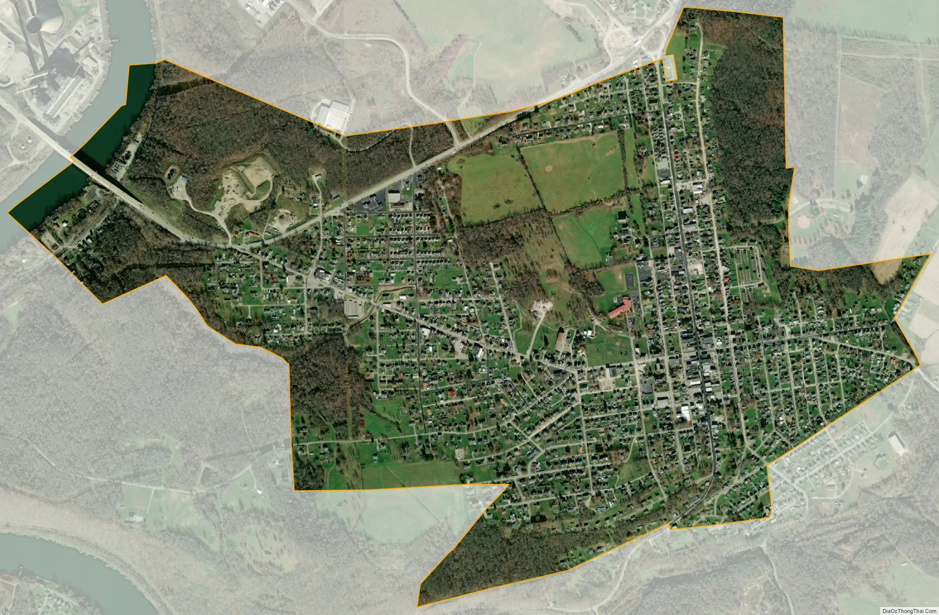
Masontown city Satellite Map
Geography
Masontown is located in southwestern Fayette County at 39°50′46″N 79°54′13″W / 39.84611°N 79.90361°W / 39.84611; -79.90361 (39.846228, -79.903492). The borough’s western border is the Monongahela River, which forms the Green County line, but the main settled part of the borough is 1 mile (1.6 km) east of and 200 feet (60 m) higher than the river.
Pennsylvania Route 21 passes through the northern and western part of the borough, leading east 12 miles (19 km) to Uniontown, the Fayette county seat, and west across the Monongahela 16 miles (26 km) to Waynesburg. Pennsylvania Route 166 passes through the center of Masontown as Main Street and leads south 10 miles (16 km) to Point Marion at the confluence of the Monongahela and Cheat rivers.
According to the United States Census Bureau, Masontown has a total area of 1.54 square miles (4.00 km), of which 1.51 square miles (3.91 km) is land and 0.03 square miles (0.08 km), or 2.10%, is water.
See also
Map of Pennsylvania State and its subdivision:- Adams
- Allegheny
- Armstrong
- Beaver
- Bedford
- Berks
- Blair
- Bradford
- Bucks
- Butler
- Cambria
- Cameron
- Carbon
- Centre
- Chester
- Clarion
- Clearfield
- Clinton
- Columbia
- Crawford
- Cumberland
- Dauphin
- Delaware
- Elk
- Erie
- Fayette
- Forest
- Franklin
- Fulton
- Greene
- Huntingdon
- Indiana
- Jefferson
- Juniata
- Lackawanna
- Lancaster
- Lawrence
- Lebanon
- Lehigh
- Luzerne
- Lycoming
- Mc Kean
- Mercer
- Mifflin
- Monroe
- Montgomery
- Montour
- Northampton
- Northumberland
- Perry
- Philadelphia
- Pike
- Potter
- Schuylkill
- Snyder
- Somerset
- Sullivan
- Susquehanna
- Tioga
- Union
- Venango
- Warren
- Washington
- Wayne
- Westmoreland
- Wyoming
- York
- Alabama
- Alaska
- Arizona
- Arkansas
- California
- Colorado
- Connecticut
- Delaware
- District of Columbia
- Florida
- Georgia
- Hawaii
- Idaho
- Illinois
- Indiana
- Iowa
- Kansas
- Kentucky
- Louisiana
- Maine
- Maryland
- Massachusetts
- Michigan
- Minnesota
- Mississippi
- Missouri
- Montana
- Nebraska
- Nevada
- New Hampshire
- New Jersey
- New Mexico
- New York
- North Carolina
- North Dakota
- Ohio
- Oklahoma
- Oregon
- Pennsylvania
- Rhode Island
- South Carolina
- South Dakota
- Tennessee
- Texas
- Utah
- Vermont
- Virginia
- Washington
- West Virginia
- Wisconsin
- Wyoming