Mifflinburg is a borough in Union County, located in the Susquehanna River Valley of central Pennsylvania, United States. Mifflinburg was first settled in 1792 by Elias and Catharina Jungman (later Youngman) and their two children. They divided the land into 60′ by 120′ plots that were sold to other settlers, many of them German, and the village of Youngmanstown was formed.
A few years later, George Rote (Rhoade) laid out a village just east of Youngmanstown, known as Greenville or Rotestown, after his death. Eventually, the two settlements merged at Third Street. In 1827, the two villages combined and were incorporated, the combined village was named Mifflinburg, in honor of Thomas Mifflin, the first Governor of Pennsylvania after the 1790 Constitution. Historically the town was known for the manufacture of horse-drawn vehicles, known as buggies.
As of the 2010 census, there were 3,540 people, 1,506 households, and 1,028 families living in the borough. The population density was 1,976.0 people per square mile (762.4/km). There were 1,605 housing units at an average density of 882.4 per square mile (340.5/km). As of 2010, the racial makeup of the borough was 97.5% White alone, 0.9% Hispanic, 0.6% Black alone, 0.5% two or more races, 0.3% Asian alone, 0.08% Hawaiian or Pacific Islander alone, 0.06% other race alone, and 0.03% American Indian alone.
Major tourist attractions include
- Mifflinburg Buggy Museum, which celebrates the era (circa 1880 – 1915) when Mifflinburg was known as “Buggytown, USA” due to its reputation as a major manufacturer of quality horse-drawn carriages and sleighs
- Annual “Christkindl Market” (a traditional German Christmas festival).
- Annual Fireman’s Carnival and Parade, held in the last week of July, featuring an hours-long parade with local businesses, bands, tractors and clubs.
| Name: | Mifflinburg borough |
|---|---|
| LSAD Code: | 21 |
| LSAD Description: | borough (suffix) |
| State: | Pennsylvania |
| County: | Union County |
| Total Area: | 1.80 sq mi (4.67 km²) |
| Land Area: | 1.80 sq mi (4.67 km²) |
| Water Area: | 0.00 sq mi (0.00 km²) |
| Total Population: | 3,485 |
| Population Density: | 1,931.82/sq mi (745.86/km²) |
| ZIP code: | 17844 |
| Area code: | 570 and 272 |
| FIPS code: | 4249288 |
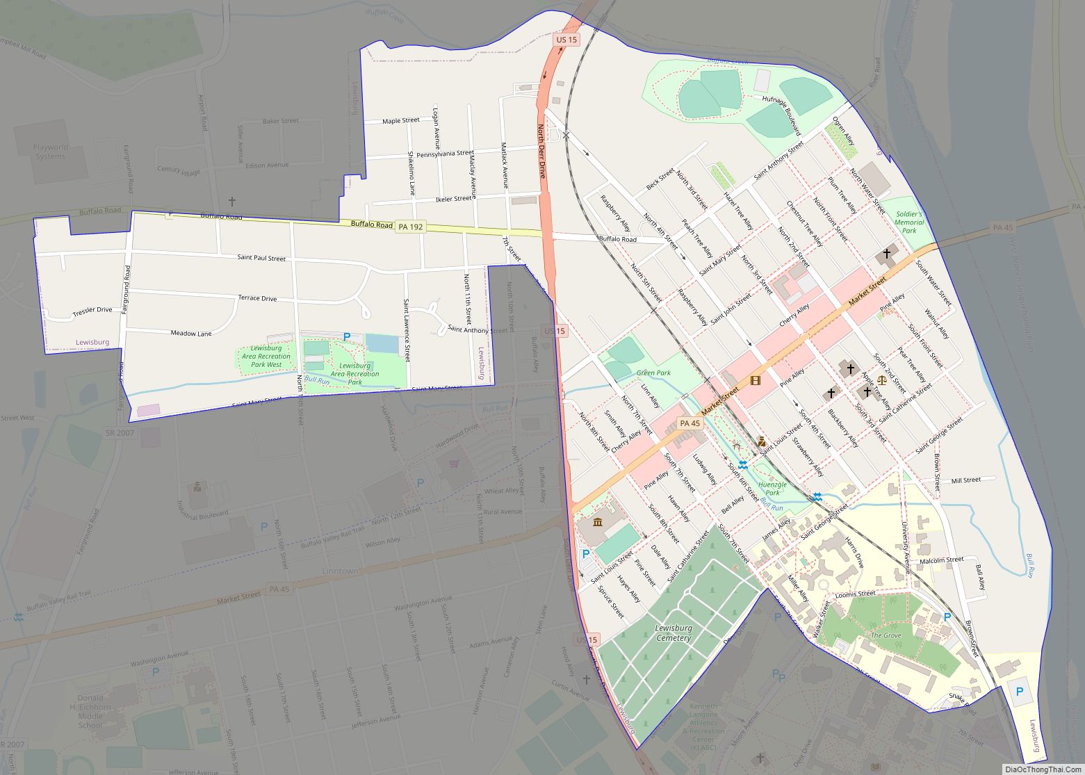
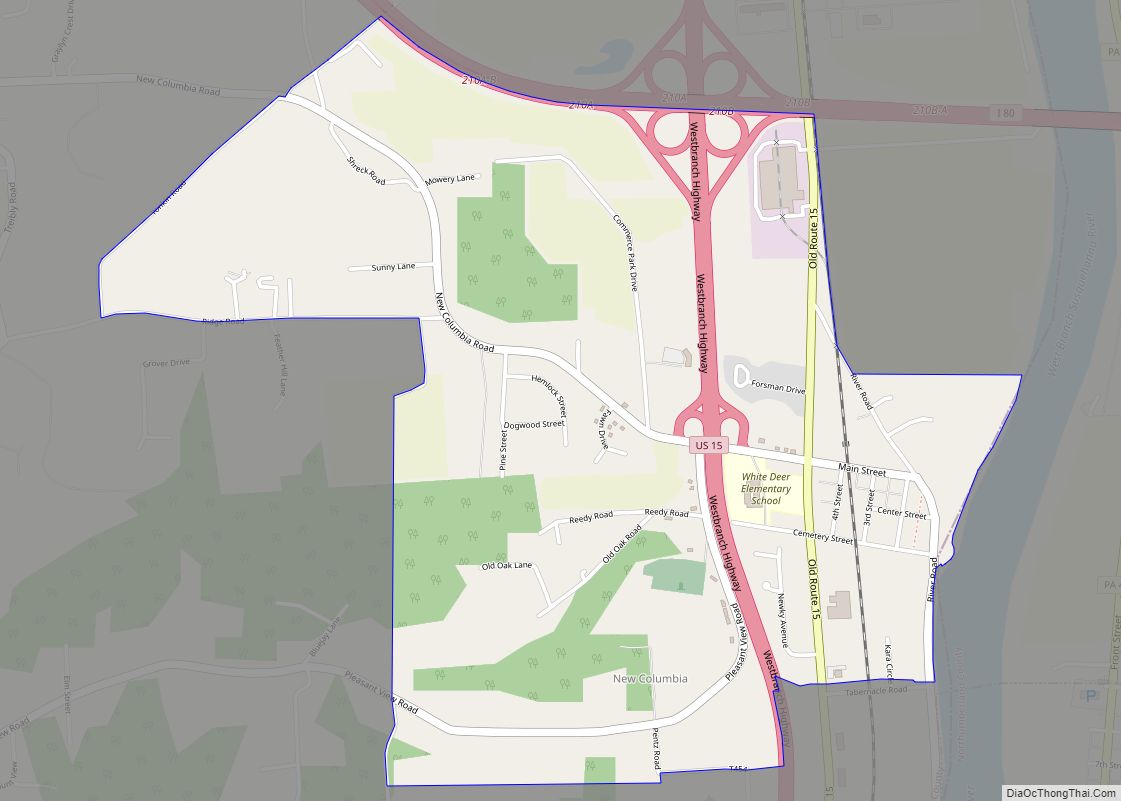
Online Interactive Map
Click on ![]() to view map in "full screen" mode.
to view map in "full screen" mode.
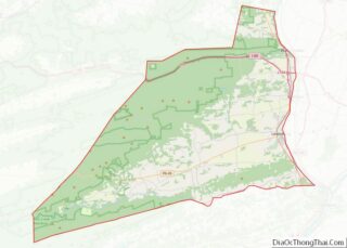
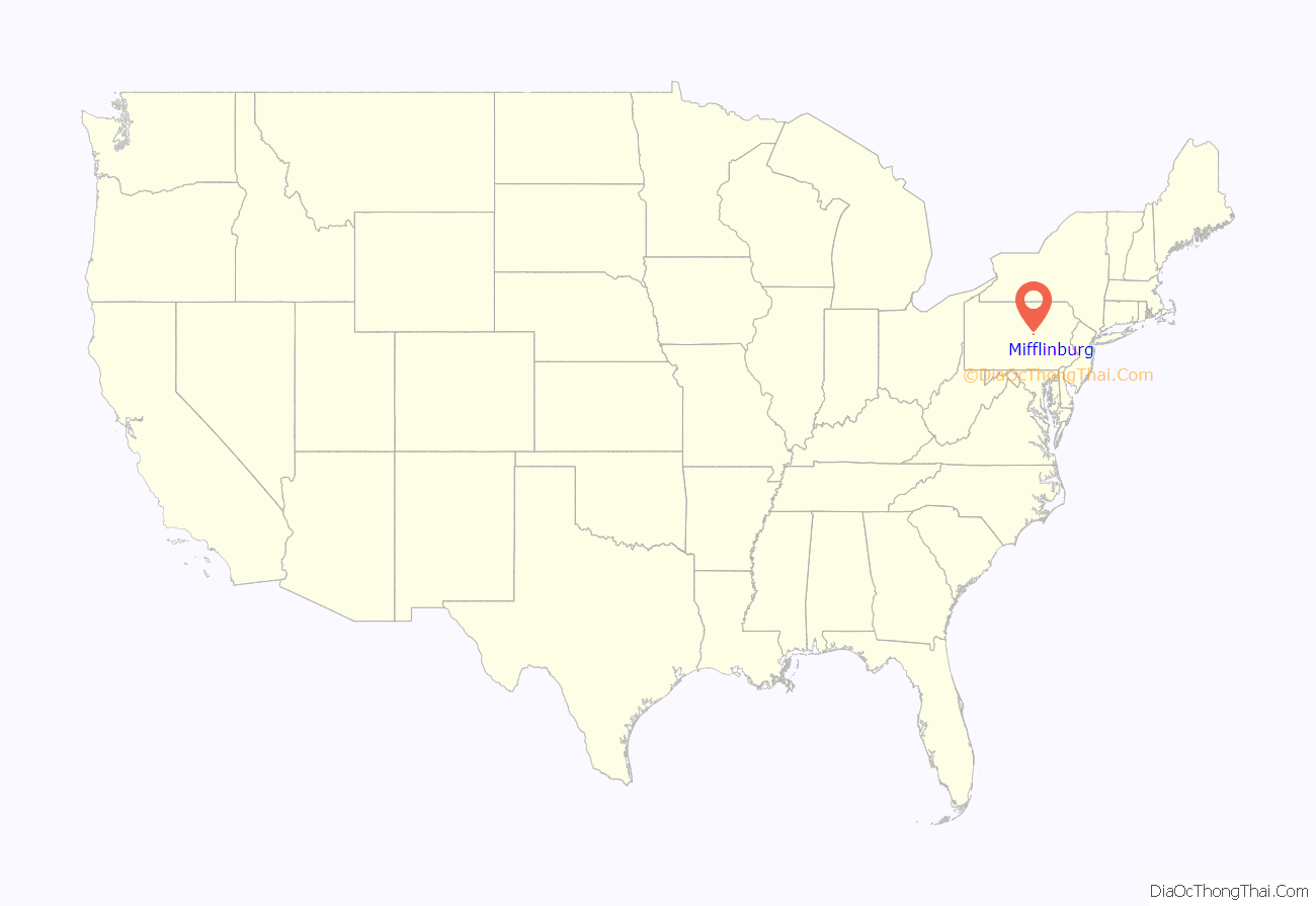
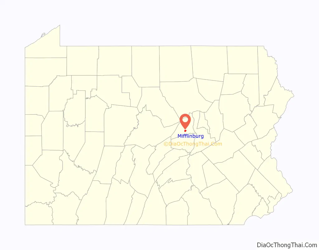
Mifflinburg location map. Where is Mifflinburg borough?
History
The borough is situated on lands that were originally granted in 1769 to the veteran officers who served under Colonel Henry Bouquet during Pontiac’s War (1763-1766) in lieu of payment for their service and ultimate victory at the Battle of Bushy Run just east of Pittsburgh. In 1792, Elias and Catharina Jungman (Youngman) and their two children, came from Fort Augusta (now Sunbury) Pennsylvania to the Buffalo Valley to settle on land given to them by Catharina’s father. They divided the land into 60′ by 120′ plots that were sold to other adventurous settlers, many of them German, and the village of Youngmanstown was formed. A few years later George Rote (Rhoade) laid out a village just east of Youngmanstown, known as Greenville or Rotestown, after George’s death. Eventually, the two settlements merged at Third Street. In 1827, the two villages combined and were incorporated. The combined village was named Mifflinburg, in honor of Thomas Mifflin, the first Governor of Pennsylvania after the 1790 Constitution. The merged towns were known as Mifflinburg before 1827 however, because when Union County was formed from Northumberland County on March 22, 1813, that PA legislative act also established Mifflinburg as the seat of government of the newly formed county, with the first courthouse located at 406 Green Street and other government offices located in various other buildings throughout the town. It remained the county seat until 1815 when it was moved to New Berlin, and then to Lewisburg in 1855 where it remains today.
In 1845, George Swentzel set up Mifflinburg’s first buggy business. Soon other buggy manufacturers set up their own shops in Mifflinburg, and by 1855, with a population of 800, Mifflinburg hosted thirteen coachmakers. By the 1880s, with more than fifty buggy and sleigh factories, Mifflinburg became known as “Buggy Town” because its buggy makers produced more horse-drawn vehicles per capita than any other town in the state.
The Mifflinburg Historic District, Hassenplug Bridge, and William A. Heiss House and Buggy Shop are listed on the National Register of Historic Places.
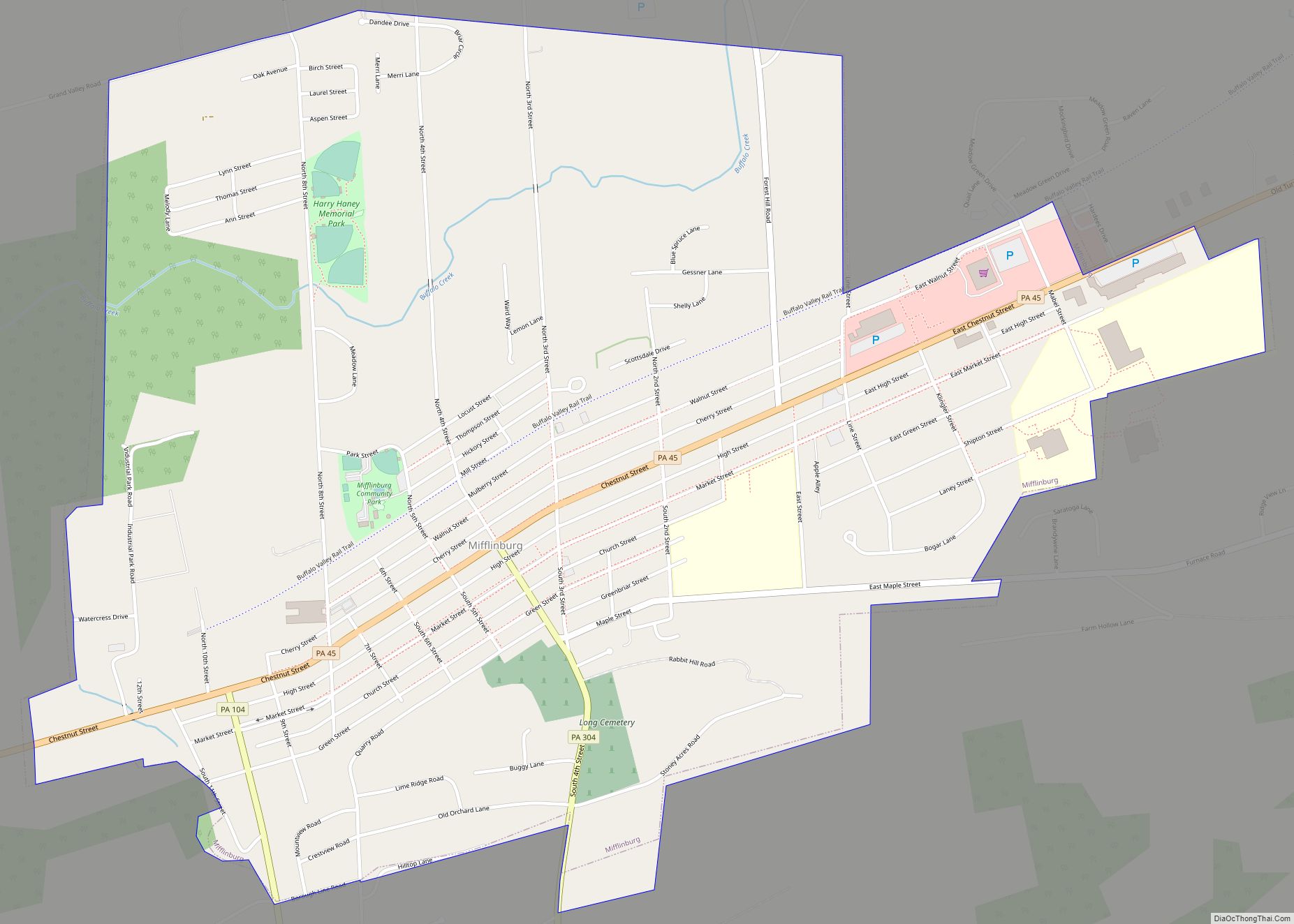
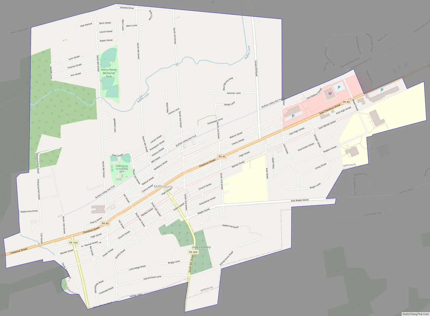
Mifflinburg Road Map
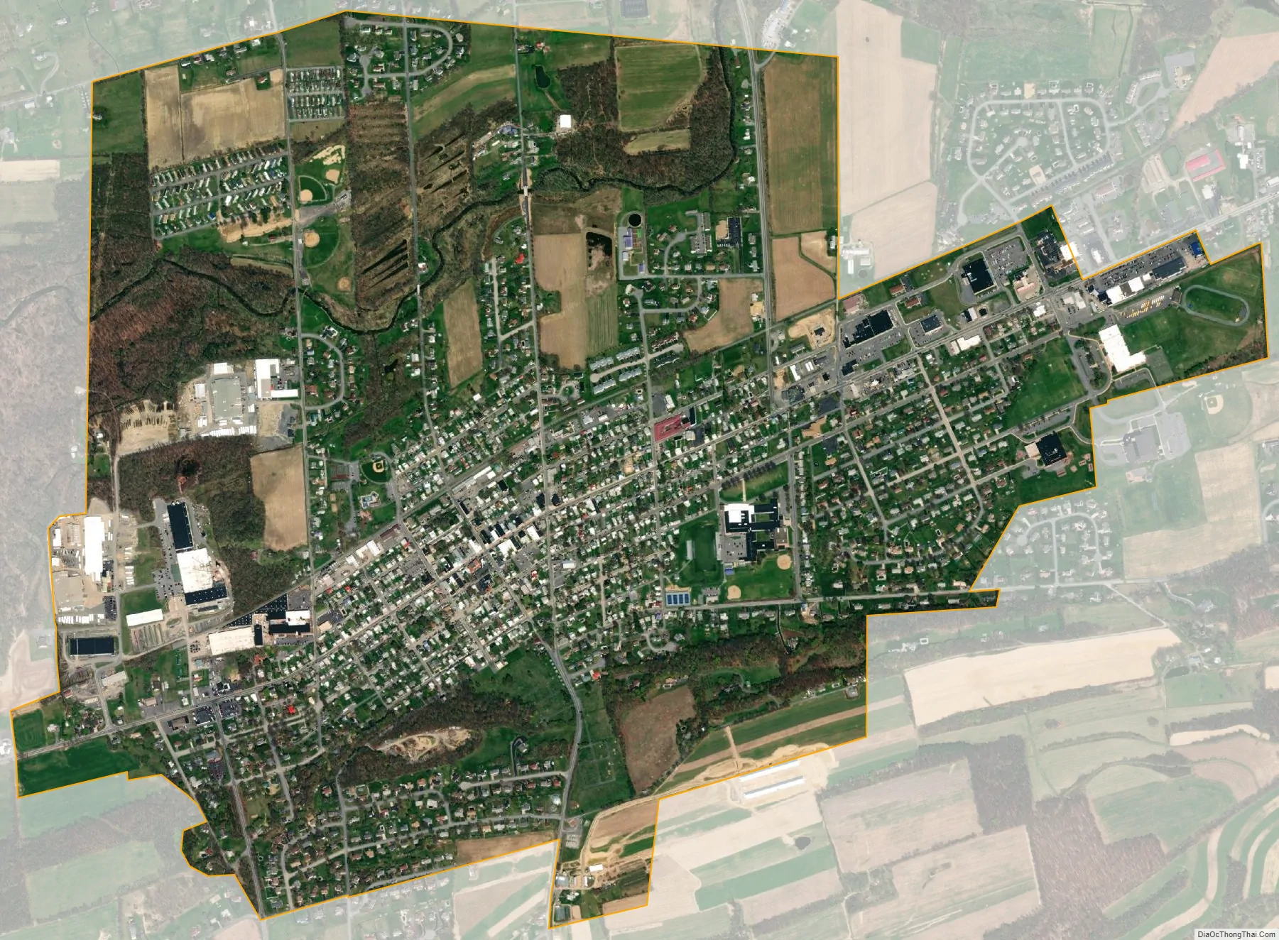
Mifflinburg city Satellite Map
Geography
Mifflinburg is located at 40°55′8″N 77°2′48″W / 40.91889°N 77.04667°W / 40.91889; -77.04667 (40.918939, -77.046800), approximately 25 miles (40 km) southwest of Williamsport.
According to the United States Census Bureau, the borough has a total area of 1.8 square miles (4.7 km), all land.
Climate
See also
Map of Pennsylvania State and its subdivision:- Adams
- Allegheny
- Armstrong
- Beaver
- Bedford
- Berks
- Blair
- Bradford
- Bucks
- Butler
- Cambria
- Cameron
- Carbon
- Centre
- Chester
- Clarion
- Clearfield
- Clinton
- Columbia
- Crawford
- Cumberland
- Dauphin
- Delaware
- Elk
- Erie
- Fayette
- Forest
- Franklin
- Fulton
- Greene
- Huntingdon
- Indiana
- Jefferson
- Juniata
- Lackawanna
- Lancaster
- Lawrence
- Lebanon
- Lehigh
- Luzerne
- Lycoming
- Mc Kean
- Mercer
- Mifflin
- Monroe
- Montgomery
- Montour
- Northampton
- Northumberland
- Perry
- Philadelphia
- Pike
- Potter
- Schuylkill
- Snyder
- Somerset
- Sullivan
- Susquehanna
- Tioga
- Union
- Venango
- Warren
- Washington
- Wayne
- Westmoreland
- Wyoming
- York
- Alabama
- Alaska
- Arizona
- Arkansas
- California
- Colorado
- Connecticut
- Delaware
- District of Columbia
- Florida
- Georgia
- Hawaii
- Idaho
- Illinois
- Indiana
- Iowa
- Kansas
- Kentucky
- Louisiana
- Maine
- Maryland
- Massachusetts
- Michigan
- Minnesota
- Mississippi
- Missouri
- Montana
- Nebraska
- Nevada
- New Hampshire
- New Jersey
- New Mexico
- New York
- North Carolina
- North Dakota
- Ohio
- Oklahoma
- Oregon
- Pennsylvania
- Rhode Island
- South Carolina
- South Dakota
- Tennessee
- Texas
- Utah
- Vermont
- Virginia
- Washington
- West Virginia
- Wisconsin
- Wyoming