Williamsport is a city in, and the county seat of, Lycoming County, Pennsylvania, United States. As of the 2020 census, it had a population of 27,754. It is the principal city of the Williamsport Metropolitan Statistical Area, which has a population of about 114,000. Williamsport is the larger principal city of the Williamsport-Lock Haven Combined Statistical Area, which includes Lycoming and Clinton counties.
The city is the cultural, financial, and commercial center of Central Pennsylvania. It is 131 miles (211 km) from Philadelphia, 166 miles (267 km) from Pittsburgh and 85 miles (137 km) from Harrisburg. It is known for its sports, arts scene and food. Williamsport was settled by Americans in the late 18th century, and began to prosper due to its lumber industry. By the early 20th century, it reached the height of its prosperity. The population has since declined by approximately 40 percent from its peak of around 45,000 in 1950.
As county seat, Williamsport has the county courthouse, county prison, sheriff’s office headquarters and federal courthouse, all downtown. It is also home to two institutions of higher learning, the Pennsylvania College of Technology, also known as Penn College, and Lycoming College. Williamsport is the birthplace of Little League Baseball. South Williamsport, a town across the West Branch Susquehanna River, is the headquarters of Little League Baseball and annually hosts the Little League World Series in late summer. Other points of interest include the Hiawatha riverboat, Millionaires’ Row, Peter J. McGovern Little League Museum, the Community Arts Center, the Genetti Hotel, the Susquehanna Riverwalk, and The Gallery at Penn College.
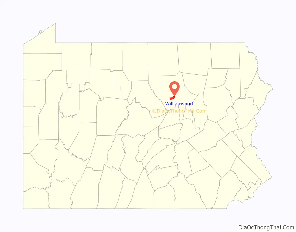
Williamsport is located 129.2 miles (207.9 km) northwest of Allentown and 86.3 miles (138.9 km) north of Harrisburg.
| Name: | Williamsport city |
|---|---|
| LSAD Code: | 25 |
| LSAD Description: | city (suffix) |
| State: | Pennsylvania |
| County: | Lycoming County |
| Incorporated: | 1806 (borough) |
| Total Area: | 9.47 sq mi (24.53 km²) |
| Land Area: | 8.78 sq mi (22.73 km²) |
| Water Area: | 0.69 sq mi (1.80 km²) |
| Total Population: | 27,754 |
| Population Density: | 3,162.13/sq mi (1,220.89/km²) |
| Area code: | 570 and 272 |
| FIPS code: | 4285312 |
| GNISfeature ID: | 1213655 |
| Website: | cityofwilliamsport.org |
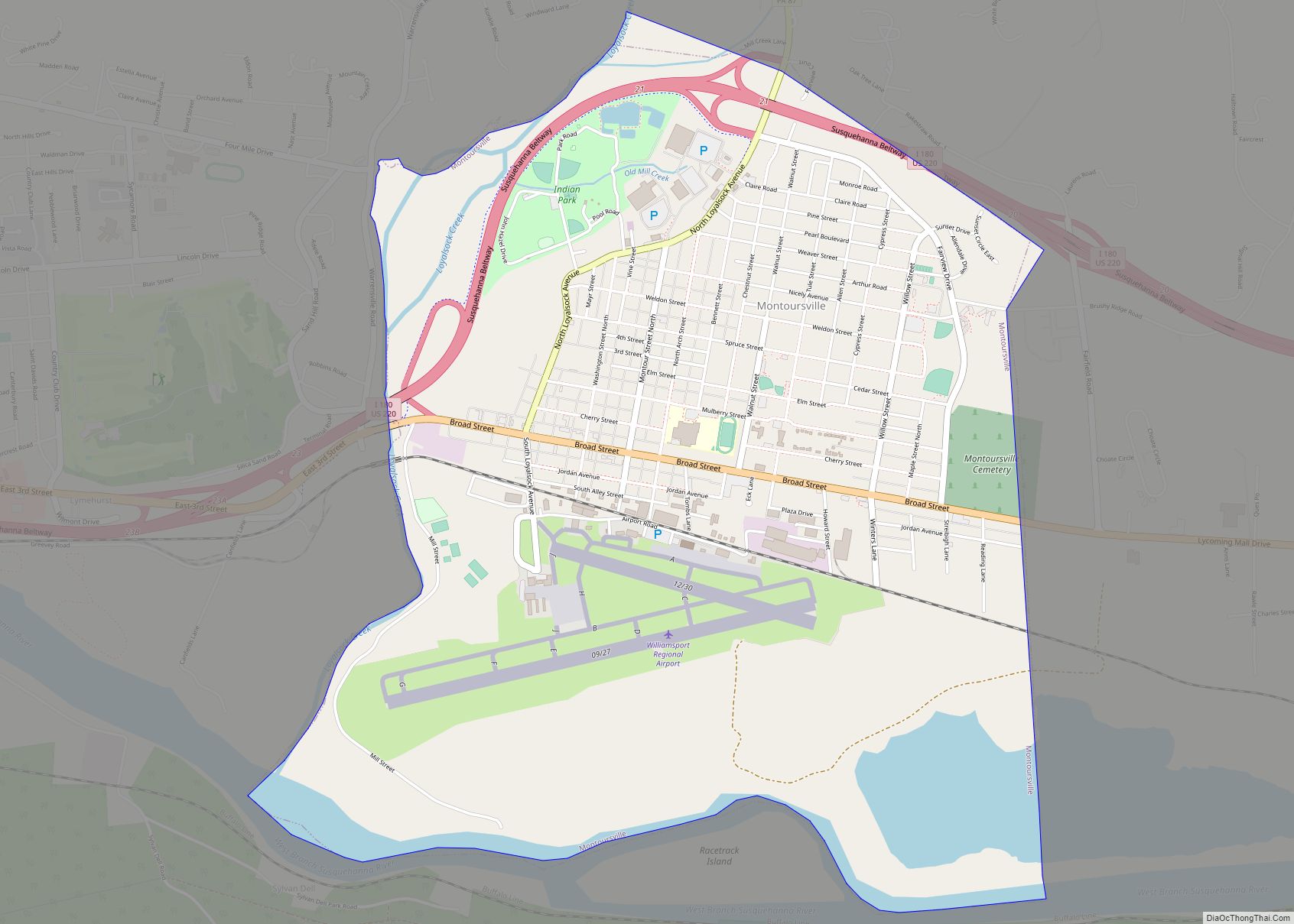
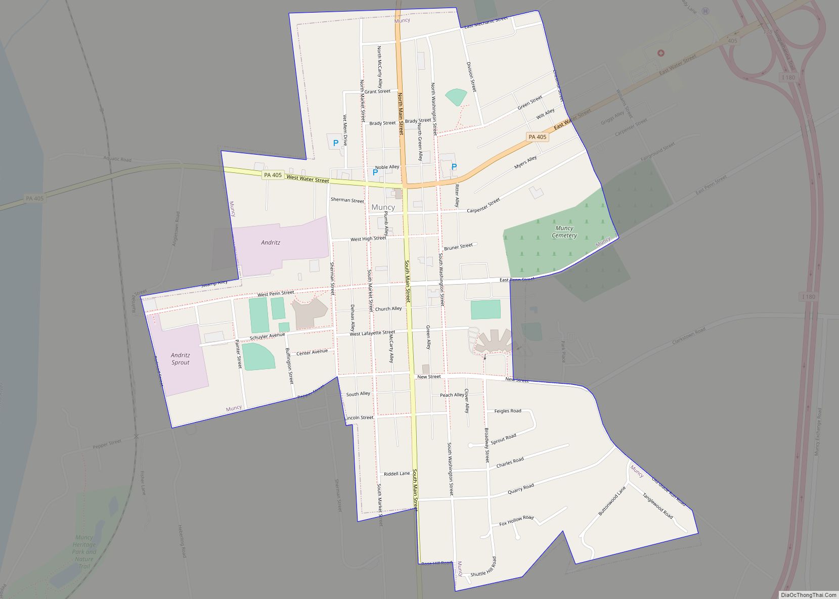
Online Interactive Map
Click on ![]() to view map in "full screen" mode.
to view map in "full screen" mode.
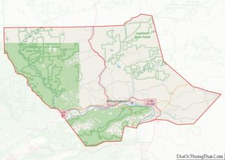
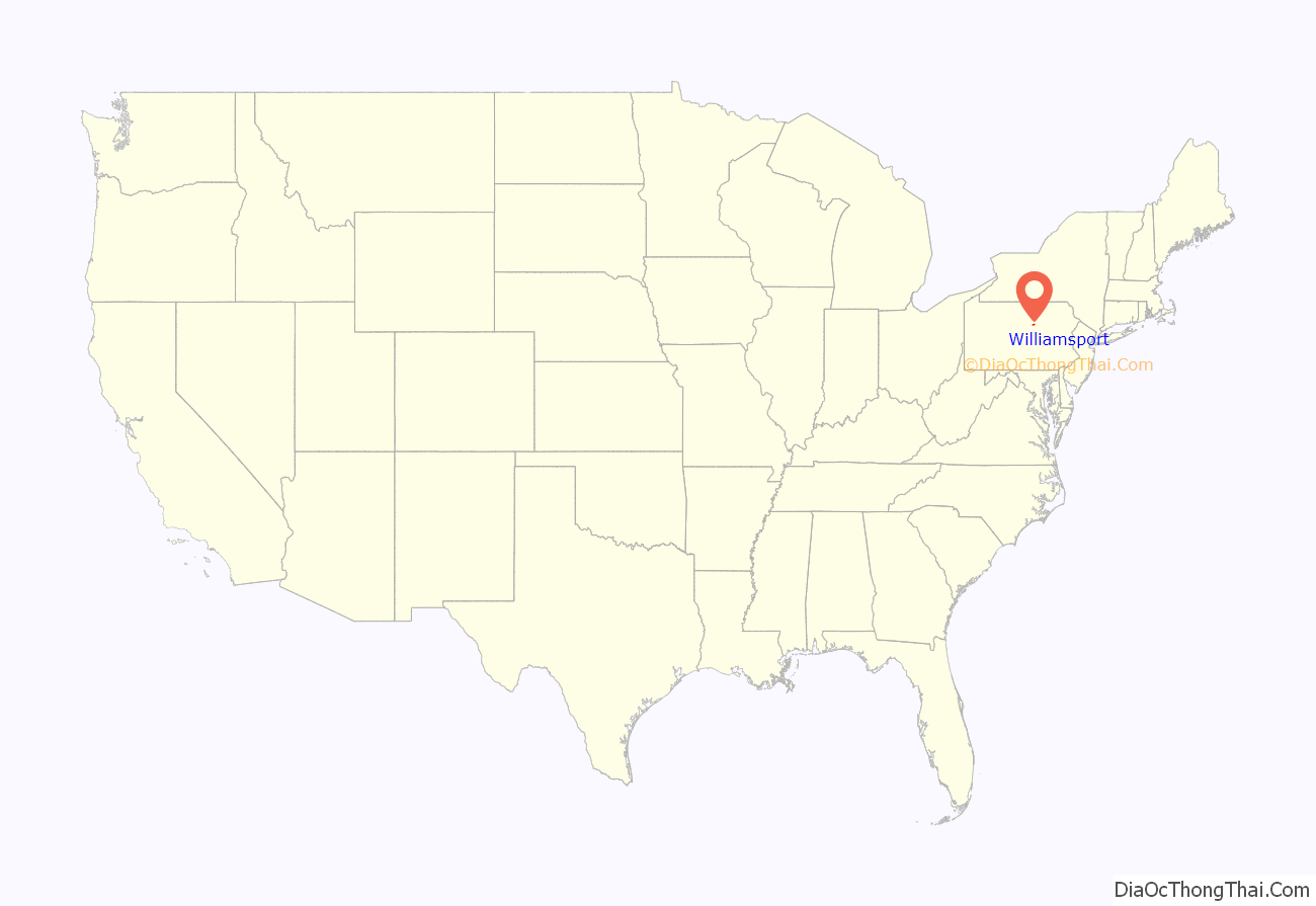
Williamsport location map. Where is Williamsport city?
History
Early history
In 1763, the Battle of Muncy Hills took place during the French and Indian War. It was a clash between the Native Americans and colonists seeking homestead sites in Native American territory. In 1768, at the Treaty of Fort Stanwix, the British purchased the land that became Lycoming County from the Iroquois Nation who controlled the lands.
In March 1796 the first house was built in Williamsport. James Russell built his inn on what is now the northeastern corner of East Third and Mulberry Streets in downtown. On April 13, 1795 Lycoming County was formed from Northumberland County. It encompassed all the lands of Northumberland County situated west of Muncy Hills and was a domain of 12,500 square miles (32,000 km), comprising most of north central Pennsylvania. In 1796 the first recorded childbirth in Williamsport was James Russell, the son of Mr. and Mrs. William Russell and grandson of James Russell of the Russell Inn, and the first school was built as a one-room log addition to the building that would eventually become the first Lycoming County Courthouse. In 1798 the first brick house in Williamsport was erected on Front Street, between Market and Mulberry, by Andrew Tulloh, a lawyer. The bricks were made on the banks of Grafius Run where that stream crossed Hepburn Street.
In 1799, a post office opened at the corner of Third and State Streets in what is now downtown, and the following year, a jail was constructed at the northeast corner of William and Third Streets. The post office was later converted to a saloon.
In 1801, the town’s first store was opened by William Winter on Third Street. In 1831 Jacob L. Mussina established the Repasz Band, the oldest brass band in America still in existence. On Oct. 15 1834 The West Branch Canal opened and the first boat to pass through the canal en route to Jersey Shore was that of George Aughenbaugh. The first freight carried into town was iron for the foundry of John B. Hall. The same year the enactment of the common school law by Pennsylvania Legislature led to public education here. In May 1835, the first public schools opened in Williamsport and also the town’s first bank, the West Branch National Bank.
The Underground Railroad, used by enslaved African-Americans to obtain their freedom in the 30 years before the Civil War (1860–1865) included routes from states in the South, which supported slavery, to “free” states in the North and Canada. From 1830 until 1865, the underground railroad, a system of safe houses and routes for slaves escaping to freedom, operated in Lycoming County; many local abolitionists, including Daniel Hughes, served as conductors and agents.
Based on the oral history of Mamie Sweeting Diggs (1933–2011), fourth generation descent and great-granddaughter, Hughes, was a river raftsman on the Susquehanna river who had migrated from Oswego, New York. He lived on the Muncy Indian Reservation until he acquired land off Freedom Road. During his trips transporting logs to Maryland, he brought escaped slaves back on foot from Baltimore, over Bald Eagle Mountain and hid them at his home and in the caves on Freedom Road.
Mamie’s grandfather, Robert, helped his father, Daniel Hughes, hide escaped slaves in the caves behind their home on Freedom Road. They fed them, nursed the sick back to health and delivered them safely to the next “station”, The Apker House in Trout Run. The Apker House was the home of Robert Fairies, abolitionist and president of the Williamsport-Elmira Railroad. The railroad ran through his property where escaped slaves were hidden in the barn and house and then loaded into railway baggage cars for the trip to Elmira, NY, the next “station.”
Mamie’s grandfather, Robert passed the stories to his children, including Mamie’s mother, Marion. Marion tended the family homestead, maintained Freedom Road Cemetery (where nine black Civil War vets are buried) and passed Daniel’s stories down to her children.
In 1849, the Market Street Bridge was built over the West Branch Susquehanna River. It was opened as a toll bridge to cover the state’s costs of $23,797. In 1854, a brewery opened. The brewery was sold to Henry Flock in 1865. This brewery was run by the Flock family until the 1940s. The Flocks’ business survived Prohibition by converting to a dairy.
In 1875, the first tower clock in the United States to sound the Cambridge Quarters (Westminster Chime) was installed at Trinity Episcopal Church, a gift of Peter Herdic with bells given by the Honorable Judge J. W. Maynard. The following year, the Williamsport Hospital opened its first facility April 1 at Elmira and Edwin Streets.
In 1881, a state law ended racial segregation in Pennsylvania schools. By 1948, all schools in this area were integrated. In 1895, Harry Houdini appeared in one of his earliest performances, at the Old Fair Grounds with The Welch Brothers Circus.
Williamsport was the birthplace of the national newspaper Grit in 1882. Williamsport purportedly once had more millionaires per-capita than anywhere else in the world. For this reason, the area’s local high school, the Williamsport Area High School, uses “Millionaires” as its team mascot.
Modern history
The Flood of March 17–18, 1936 caused the river to crest at 33.9′. Flood waters reached High Street. It was known locally as the Hello, Al flood because Al Glaes, operating a short-wave radio station from his home on High Street, kept the city in touch with the rest of the world after the flood disrupted electricity and telephone service.
On June 6, 1939 the first Little League Baseball game was played on a sandlot outside Bowman Field in Williamsport. Carl Stotz conceived the idea of a Little League, and he and Bert and George Bebble managed the first three teams. In 1941 the U.S. entered World War II after the Japanese attacked Pearl Harbor. Williamsport native Joe Lockard, stationed on Oahu, gave warning of the impending attack based on radar readings. His readings were dismissed as American B17 bombers coming in from the mainland. Also in 1941 the Williamsport School Board created the Williamsport Technical Institute for high school and post-high school students. It grew into the Williamsport Area Community College, and later became Pennsylvania College of Technology.
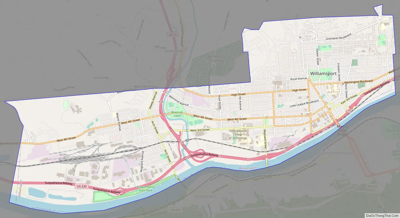
Williamsport Road Map
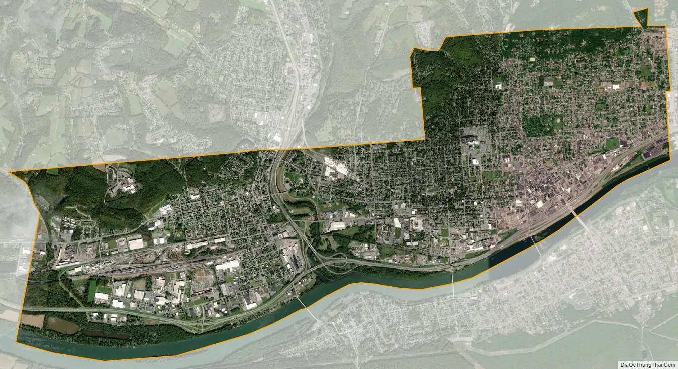
Williamsport city Satellite Map
Geography
Geography
Williamsport is located at 41°14′40″N 77°1′7″W / 41.24444°N 77.01861°W / 41.24444; -77.01861 (41.244428, −77.018738), and is bordered by the West Branch Susquehanna River to the south (with Armstrong Township, South Williamsport, Duboistown and Susquehanna Township south of the river), Loyalsock Township to the east and north, Old Lycoming Township to the north and Woodward Township to the west. As the crow flies, Lycoming County is about 130 miles (209 km) northwest of Philadelphia and 165 miles (266 km) east-northeast of Pittsburgh.
The Peter Herdic House, Hart Building, Millionaire’s Row Historic District, City Hall, Williamsport Armory, and Old City Hall are listed on the National Register of Historic Places.
Neighborhoods of Williamsport include:
- Downtown, between Hepburn Street and Basin Street, south of Little League Blvd
- Grampian Hills, the area around and north of Grampian Blvd.
- Millionaire’s Row, along W. 4th Street
- Newberry, west of Lycoming Creek
- Park Avenue, south of Williamsport Hospital
- Vallamont, the area north of Rural Ave and west of Market St.
- East End, the area south of Grampian Blvd. and east of Market St.
- West Hills, the hillside and hilltop north of Dewey and west of Round Hill Road.
According to the United States Census Bureau, the city has a total area of 9.5 square miles (25 km), of which 8.9 square miles (23 km) is land and 0.7 square miles (1.8 km) (6.92%) is water.
Climate
Under the Köppen climate classification, Williamsport falls within either a hot-summer humid continental climate (Dfa) if the 0 °C (32 °F) isotherm is used or a humid subtropical climate (Cfa) if the −3 °C (27 °F) isotherm is used. Williamsport has four distinct seasons, and lies in USDA hardiness zone 6b, with areas away from the West Branch Susquehanna River falling in zone 6a. Winters are cold and comparatively dry but typically bring a mix of rain, sleet, and snow with occasional heavy snowfall and icing. January is the coldest month with an average mean temperature of 26.8 °F (−2.9 °C), with temperatures on average dropping to or below 0 °F (−18 °C) on 2.8 days and staying at or below freezing on 29 days per year. Snowfall averages 36.0 inches (91 cm) per season. The snowiest month on record was 40.1 inches (102 cm) in January 1987, while winter snowfall amounts have ranged from 85.9 in (218 cm) in 1995–96 to 7.0 in (18 cm) in 1988–89. Summers are typically very warm and humid with temperatures exceeding 90 °F (32 °C) on 15 days per year on average; the annual count has been as high as 42 days in 1988, while only 1907 and 1979 did not reach that mark. July is the warmest month with an average mean temperature of 72.7 °F (23 °C).
The all-time record high temperature in Williamsport of 106 °F (41 °C) was established on July 9, 1936, which occurred during the Dust Bowl, and the all-time record low temperature of −20 °F (−29 °C) was set on January 21, 1994. The first and last freezes of the season on average fall on October 16 and April 30, respectively, allowing a growing season of 168 days. The normal annual mean temperature is 50.4 °F (10.2 °C). Normal yearly precipitation based on the 30-year average from 1981–2010 is 41.28 inches (1,049 mm), falling on an average 133 days. Monthly precipitation has ranged from 16.80 in (427 mm) in June 1972 (due to heavy rainfall from Hurricane Agnes) to 0.16 in (4.1 mm) in September 1943, while for annual precipitation the historical range is 70.26 in (1,785 mm) in 2011 to 27.68 in (703 mm) in 1930.
See also
Map of Pennsylvania State and its subdivision:- Adams
- Allegheny
- Armstrong
- Beaver
- Bedford
- Berks
- Blair
- Bradford
- Bucks
- Butler
- Cambria
- Cameron
- Carbon
- Centre
- Chester
- Clarion
- Clearfield
- Clinton
- Columbia
- Crawford
- Cumberland
- Dauphin
- Delaware
- Elk
- Erie
- Fayette
- Forest
- Franklin
- Fulton
- Greene
- Huntingdon
- Indiana
- Jefferson
- Juniata
- Lackawanna
- Lancaster
- Lawrence
- Lebanon
- Lehigh
- Luzerne
- Lycoming
- Mc Kean
- Mercer
- Mifflin
- Monroe
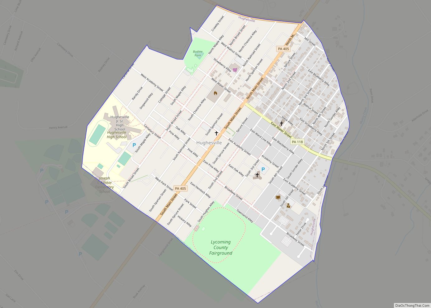
- Montgomery
- Montour
- Northampton
- Northumberland
- Perry
- Philadelphia
- Pike
- Potter
- Schuylkill
- Snyder
- Somerset
- Sullivan
- Susquehanna
- Tioga
- Union
- Venango
- Warren
- Washington
- Wayne
- Westmoreland
- Wyoming
- York
- Alabama
- Alaska
- Arizona
- Arkansas
- California
- Colorado
- Connecticut
- Delaware
- District of Columbia
- Florida
- Georgia
- Hawaii
- Idaho
- Illinois
- Indiana
- Iowa
- Kansas
- Kentucky
- Louisiana
- Maine
- Maryland
- Massachusetts
- Michigan
- Minnesota
- Mississippi
- Missouri
- Montana
- Nebraska
- Nevada
- New Hampshire
- New Jersey
- New Mexico
- New York
- North Carolina
- North Dakota
- Ohio
- Oklahoma
- Oregon
- Pennsylvania
- Rhode Island
- South Carolina
- South Dakota
- Tennessee
- Texas
- Utah
- Vermont
- Virginia
- Washington
- West Virginia
- Wisconsin
- Wyoming