Mount Gretna is a borough in Lebanon County, Pennsylvania, United States. It is part of the Lebanon, PA, Metropolitan Statistical Area. The population was 188 at the 2020 census. It was founded by the Pennsylvania Chautauqua Society, which was attracted by the area’s natural landscape and beauty, by the 1890s.
It is a popular destination in the summer, for it has a nationally ranked juried art show (third weekend in August), jazz and chamber music concerts, lectures, book reviews, and an annual tour of historic homes and cottages (first Saturday in August). The Connewago Lake features a Victorian-era bathhouse with high-dive, floating docks and a sandy beach area. The community also has a roller rink, open-air playhouse, miniature golf course, several restaurants, playgrounds, and an award-winning ice cream parlor known as the Jigger Shop. Gretna Theatre, the independent professional non-profit theatre company performing at the Mount Gretna Playhouse, is one of the country’s oldest summer stock theatres, having opened in 1927. The surrounding area, which includes seven distinct neighborhoods, has a year-round population estimated at 1,500 persons. Summertime population increases to about 2,500.
| Name: | Mount Gretna borough |
|---|---|
| LSAD Code: | 21 |
| LSAD Description: | borough (suffix) |
| State: | Pennsylvania |
| County: | Lebanon County |
| Incorporated: | 1926 |
| Total Area: | 0.14 sq mi (0.37 km²) |
| Land Area: | 0.14 sq mi (0.37 km²) |
| Water Area: | 0.00 sq mi (0.00 km²) |
| Total Population: | 193 |
| Population Density: | 1,340.28/sq mi (516.93/km²) |
| ZIP code: | 17064 |
| Area code: | 717 |
| FIPS code: | 4251568 |
| Website: | borough.mtgretna.com |
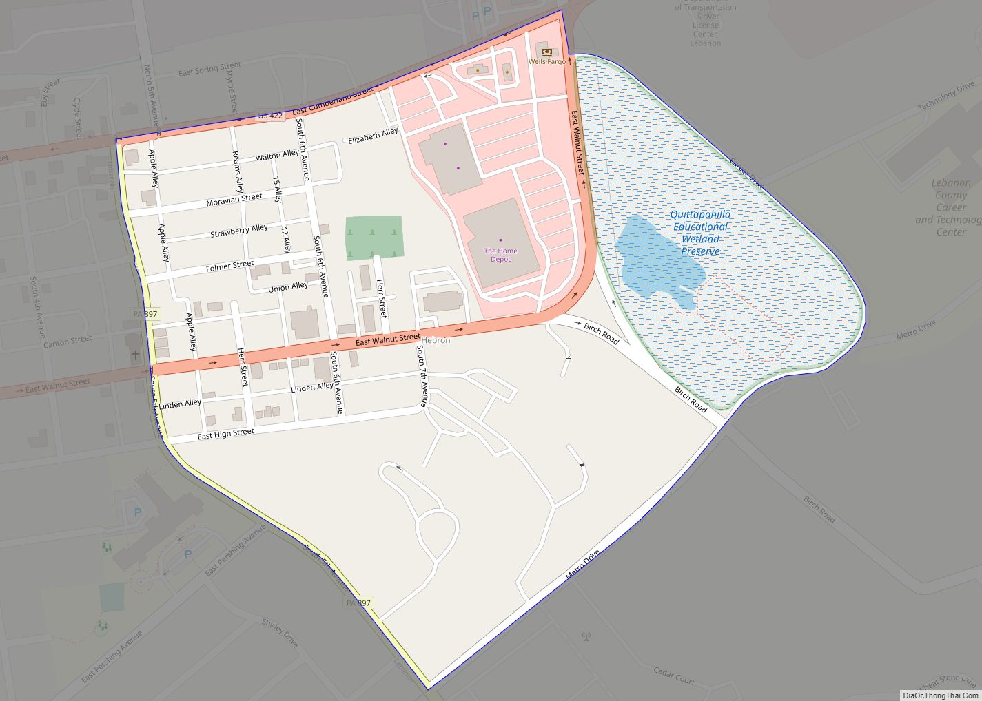
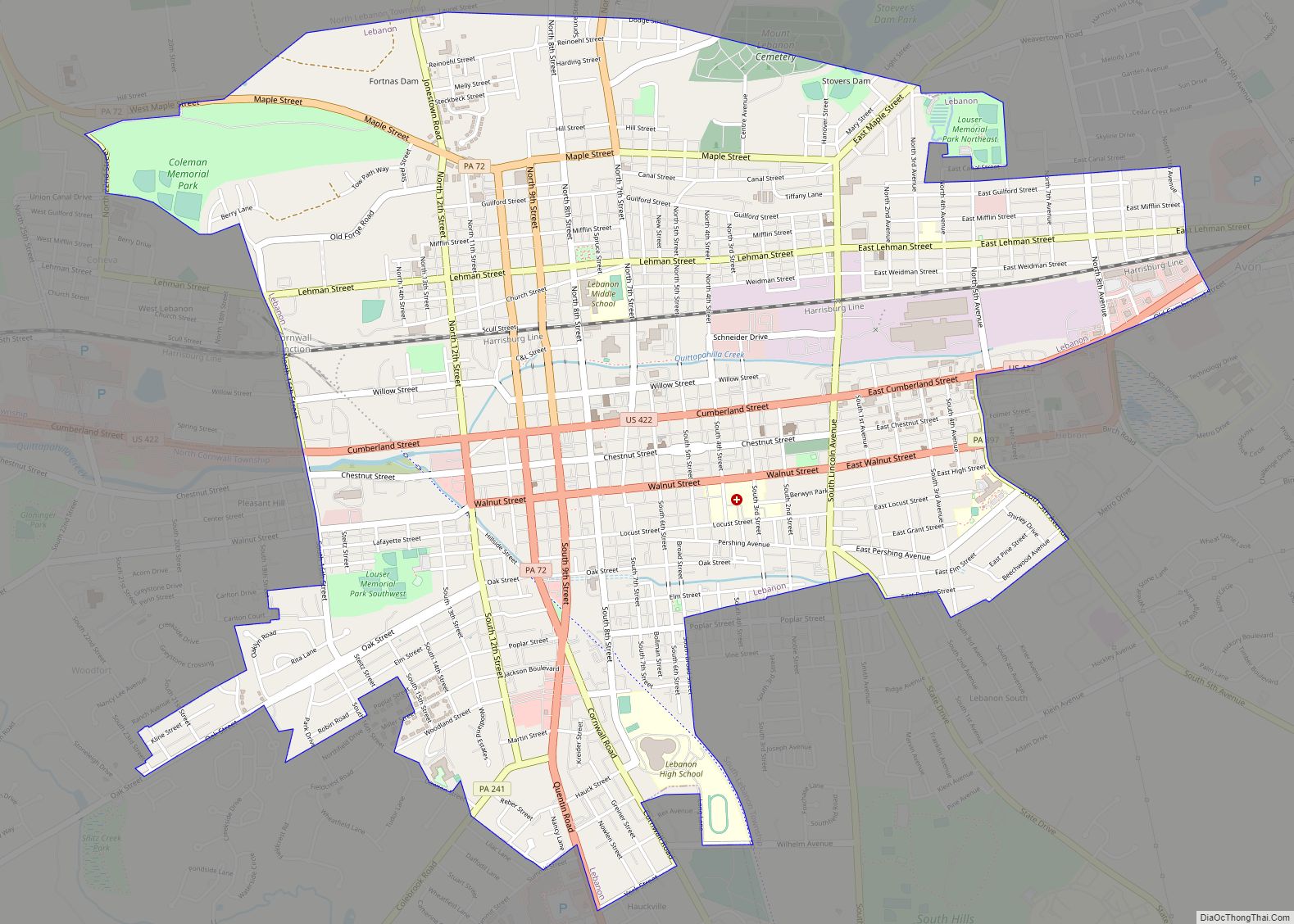
Online Interactive Map
Click on ![]() to view map in "full screen" mode.
to view map in "full screen" mode.
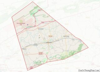
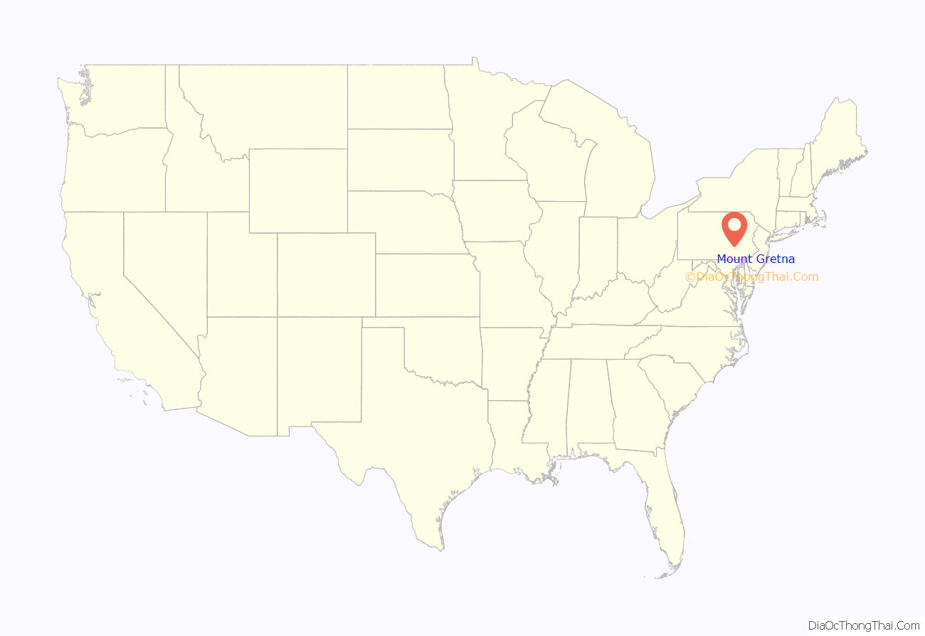
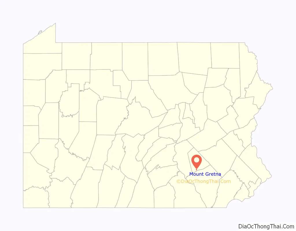
Mount Gretna location map. Where is Mount Gretna borough?
History
Pursuant to a letter written by Hugh Maxwell, an official of the Cornwall and Lebanon Railroad, and sent by him to the Lebanon County Historical Society “and read before them on April 26, 1901” the name “Mount Gretna” was suggested by his wife, subsequently adopted by the board, and “On September 21st 1883 that name appears in public print for the first time in the Lebanon Daily News.”
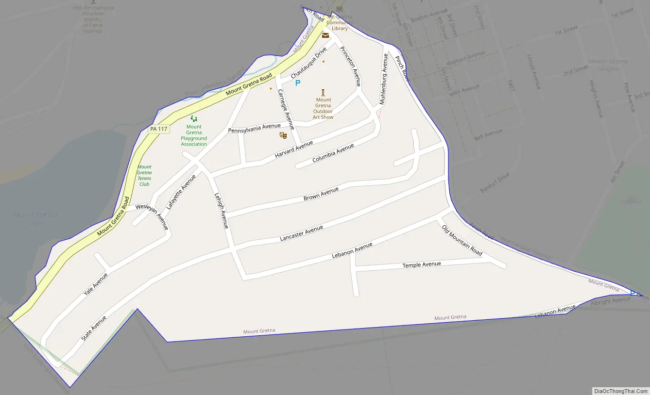
Mount Gretna Road Map
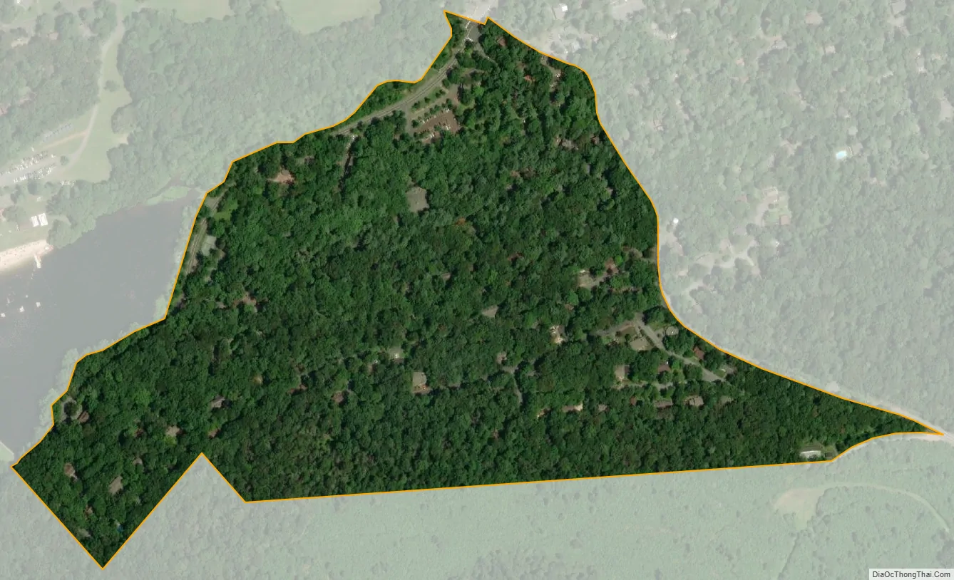
Mount Gretna city Satellite Map
Geography
Mount Gretna is located at 40°14′47″N 76°28′22″W / 40.24639°N 76.47278°W / 40.24639; -76.47278 (40.246525, -76.472899).
According to the United States Census Bureau, the borough has a total area of 0.2 square mile (0.4 km²), all land.
Mount Gretna is divided into seven different sections. These include Mount Gretna Heights, where the Mount Gretna Inn is located; Stoberdale; Campmeeting, where the Tabernacle and church are located, and Chautauqua, where the post office, playhouse, playground, and Jigger Shop are located. The area which includes Conewago Lake and the Timbers Restaurant is called Timber Hills. Conewago Hill, Timber Bridge and Conewago Lake are not technically in Mount Gretna, but are rather located within South Londonderry Township.
Mount Gretna is bordered to the east by West Cornwall Township (0.82 mi), and to the west by South Londonderry Township (1.06 mi).
See also
Map of Pennsylvania State and its subdivision:- Adams
- Allegheny
- Armstrong
- Beaver
- Bedford
- Berks
- Blair
- Bradford
- Bucks
- Butler
- Cambria
- Cameron
- Carbon
- Centre
- Chester
- Clarion
- Clearfield
- Clinton
- Columbia
- Crawford
- Cumberland
- Dauphin
- Delaware
- Elk
- Erie
- Fayette
- Forest
- Franklin
- Fulton
- Greene
- Huntingdon
- Indiana
- Jefferson
- Juniata
- Lackawanna
- Lancaster
- Lawrence
- Lebanon
- Lehigh
- Luzerne
- Lycoming
- Mc Kean
- Mercer
- Mifflin
- Monroe
- Montgomery
- Montour
- Northampton
- Northumberland
- Perry
- Philadelphia
- Pike
- Potter
- Schuylkill
- Snyder
- Somerset
- Sullivan
- Susquehanna
- Tioga
- Union
- Venango
- Warren
- Washington
- Wayne
- Westmoreland
- Wyoming
- York
- Alabama
- Alaska
- Arizona
- Arkansas
- California
- Colorado
- Connecticut
- Delaware
- District of Columbia
- Florida
- Georgia
- Hawaii
- Idaho
- Illinois
- Indiana
- Iowa
- Kansas
- Kentucky
- Louisiana
- Maine
- Maryland
- Massachusetts
- Michigan
- Minnesota
- Mississippi
- Missouri
- Montana
- Nebraska
- Nevada
- New Hampshire
- New Jersey
- New Mexico
- New York
- North Carolina
- North Dakota
- Ohio
- Oklahoma
- Oregon
- Pennsylvania
- Rhode Island
- South Carolina
- South Dakota
- Tennessee
- Texas
- Utah
- Vermont
- Virginia
- Washington
- West Virginia
- Wisconsin
- Wyoming