Mount Penn is a borough in Berks County, Pennsylvania, United States. The population was 3,106 at the 2010 census. The borough shares a name with a 1,120-foot-high (340 m) mountain that rises to the north and overlooks the city of Reading. The peak is sometimes recognized as the southern end of the Reading Prong group of mountains.
| Name: | Mount Penn borough |
|---|---|
| LSAD Code: | 21 |
| LSAD Description: | borough (suffix) |
| State: | Pennsylvania |
| County: | Berks County |
| Elevation: | 482 ft (147 m) |
| Total Area: | 0.41 sq mi (1.06 km²) |
| Land Area: | 0.41 sq mi (1.06 km²) |
| Water Area: | 0.00 sq mi (0.00 km²) |
| Total Population: | 3,240 |
| Population Density: | 7,902.44/sq mi (3,047.88/km²) |
| ZIP code: | 19606 |
| FIPS code: | 4251760 |
| Website: | mtpennborough.net |
Online Interactive Map
Click on ![]() to view map in "full screen" mode.
to view map in "full screen" mode.
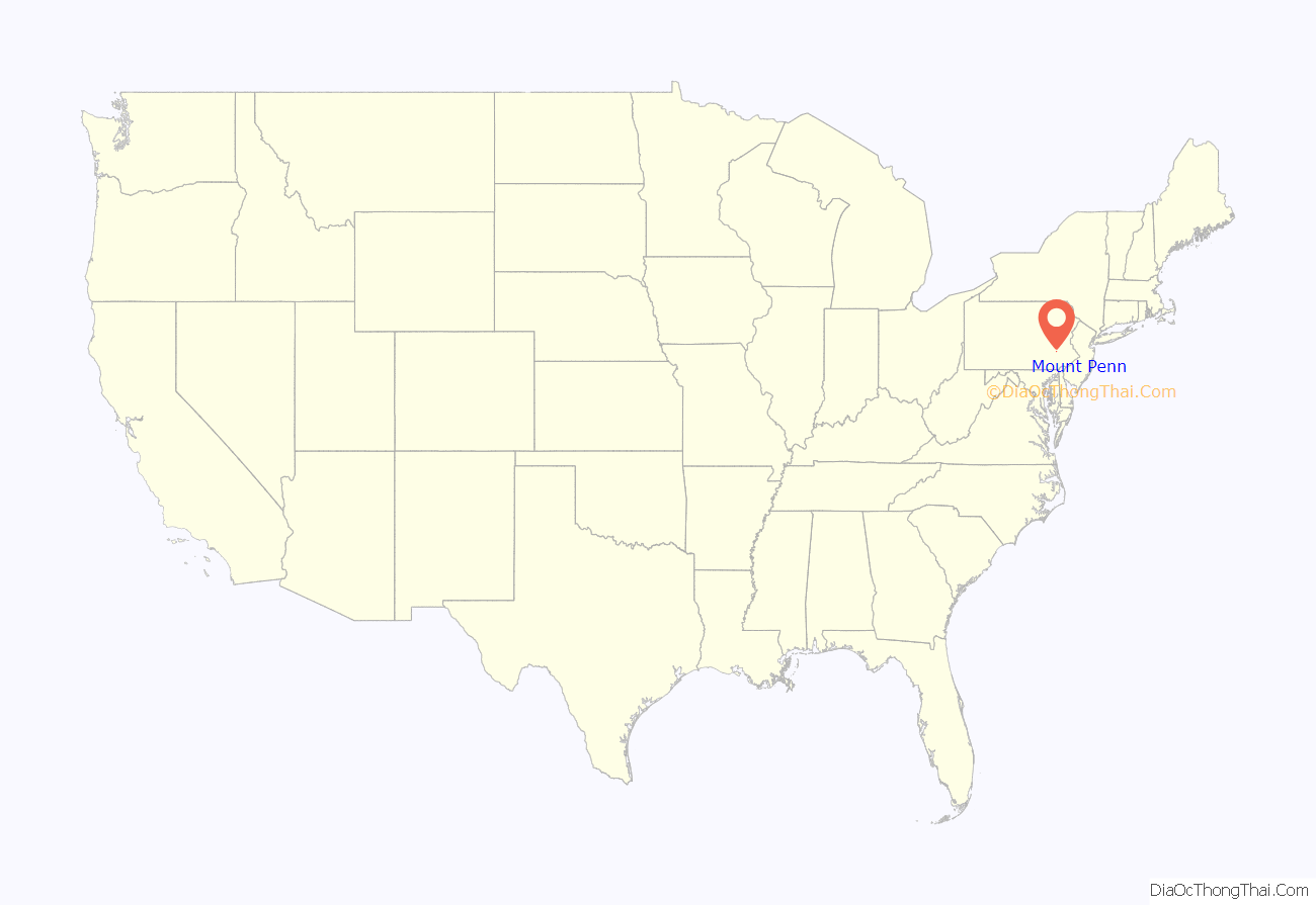
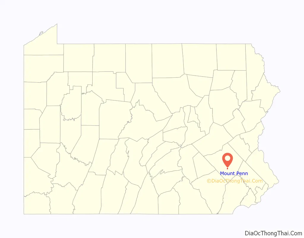
Mount Penn location map. Where is Mount Penn borough?
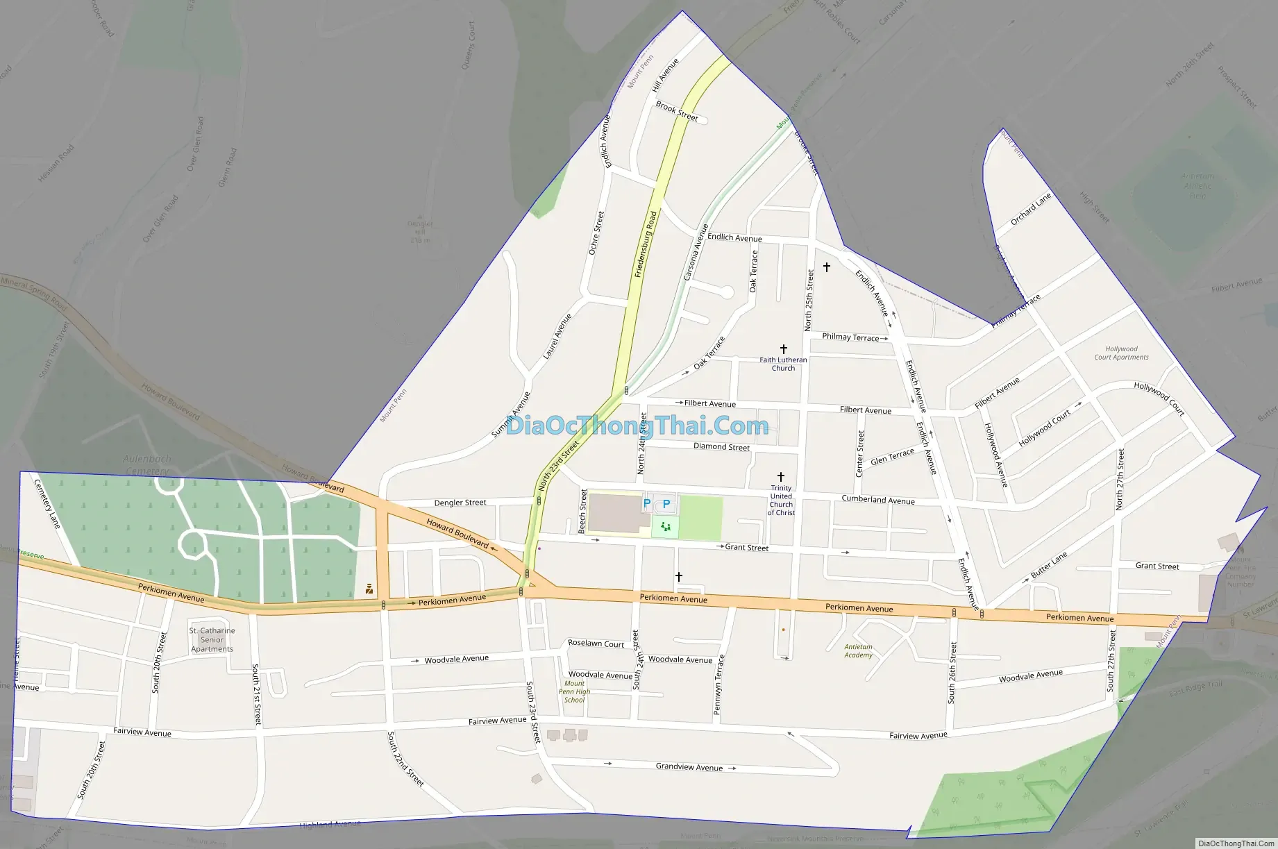
Mount Penn Road Map
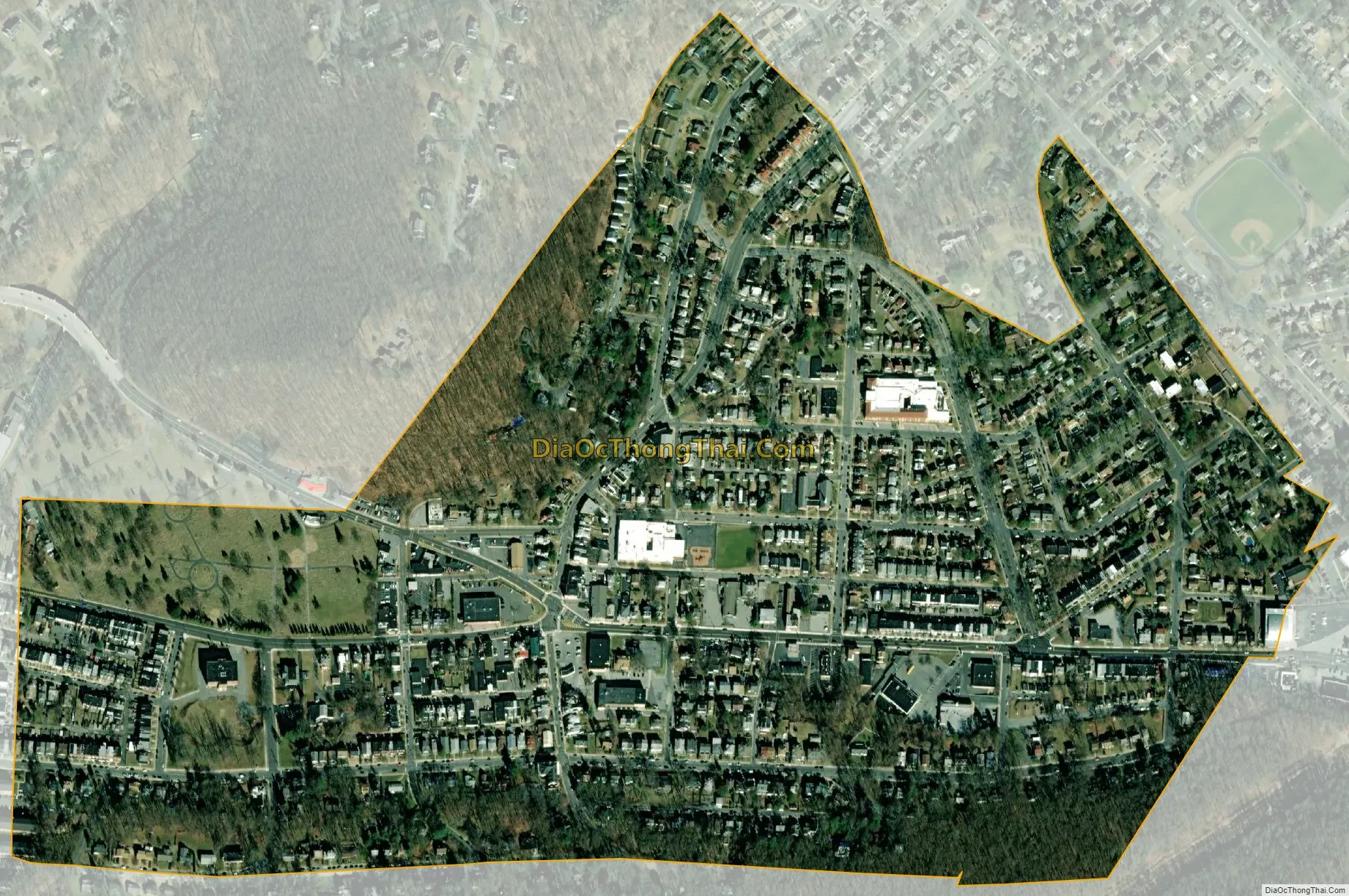
Mount Penn city Satellite Map
Geography
Mount Penn Borough is located in central Berks County at 40°19′46″N 75°53′26″W / 40.32944°N 75.89056°W / 40.32944; -75.89056 (40.329359, -75.890691), bordered by the city of Reading to the west. The borough of St. Lawrence borders Mount Penn to the east. The unincorporated community of Pennside lies to the north in Lower Alsace Township. A non-contiguous piece of Lower Alsace Township also borders the south side of Mount Penn.
The borough is in a small saddle between the peak of Mount Penn to the north and 900-foot-high (270 m) Neversink Mountain to the south.
According to the United States Census Bureau, the borough has a total area of 0.42 square miles (1.1 km), all land.
The Mount Penn Preserve is an area that covers the Mount Penn slopes, north of the borough. Attractions in the Preserve include the Pagoda, the William Penn Memorial Fire Tower, Antietam Lake Park, and numerous businesses and restaurants.
See also
Map of Pennsylvania State and its subdivision:- Adams
- Allegheny
- Armstrong
- Beaver
- Bedford
- Berks
- Blair
- Bradford
- Bucks
- Butler
- Cambria
- Cameron
- Carbon
- Centre
- Chester
- Clarion
- Clearfield
- Clinton
- Columbia
- Crawford
- Cumberland
- Dauphin
- Delaware
- Elk
- Erie
- Fayette
- Forest
- Franklin
- Fulton
- Greene
- Huntingdon
- Indiana
- Jefferson
- Juniata
- Lackawanna
- Lancaster
- Lawrence
- Lebanon
- Lehigh
- Luzerne
- Lycoming
- Mc Kean
- Mercer
- Mifflin
- Monroe
- Montgomery
- Montour
- Northampton
- Northumberland
- Perry
- Philadelphia
- Pike
- Potter
- Schuylkill
- Snyder
- Somerset
- Sullivan
- Susquehanna
- Tioga
- Union
- Venango
- Warren
- Washington
- Wayne
- Westmoreland
- Wyoming
- York
- Alabama
- Alaska
- Arizona
- Arkansas
- California
- Colorado
- Connecticut
- Delaware
- District of Columbia
- Florida
- Georgia
- Hawaii
- Idaho
- Illinois
- Indiana
- Iowa
- Kansas
- Kentucky
- Louisiana
- Maine
- Maryland
- Massachusetts
- Michigan
- Minnesota
- Mississippi
- Missouri
- Montana
- Nebraska
- Nevada
- New Hampshire
- New Jersey
- New Mexico
- New York
- North Carolina
- North Dakota
- Ohio
- Oklahoma
- Oregon
- Pennsylvania
- Rhode Island
- South Carolina
- South Dakota
- Tennessee
- Texas
- Utah
- Vermont
- Virginia
- Washington
- West Virginia
- Wisconsin
- Wyoming


