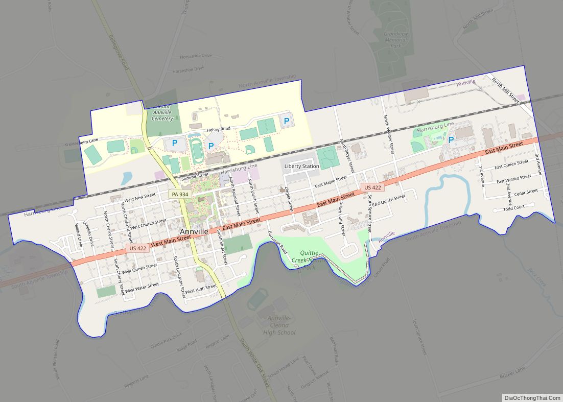
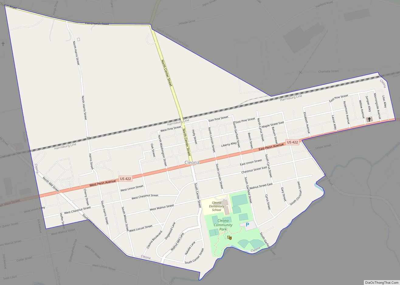
Myerstown (Pennsylvania Dutch: Moyerschteddel) is a borough located in Lebanon County, Pennsylvania. It is part of the Lebanon, Pennsylvania Metropolitan statistical area. The population was 3,103 at the 2020 census. It is home to over 100 businesses, including a Bayer manufacturing plant, a GAF manufacturing plant, Farmer Boy Ag, Stoneridge Towne Centre and Wengers of Myerstown. The Evangelical Seminary is located on South College Street.
| Name: | Myerstown borough |
|---|---|
| LSAD Code: | 21 |
| LSAD Description: | borough (suffix) |
| State: | Pennsylvania |
| County: | Lebanon County |
| Incorporated: | 1912 |
| Total Area: | 0.86 sq mi (2.22 km²) |
| Land Area: | 0.86 sq mi (2.22 km²) |
| Water Area: | 0.00 sq mi (0.00 km²) |
| Total Population: | 3,094 |
| Population Density: | 3,614.49/sq mi (1,394.82/km²) |
| ZIP code: | 17067 |
| Area code: | 717 and 223 |
| FIPS code: | 4252488 |
| Website: | myerstownpa.org |
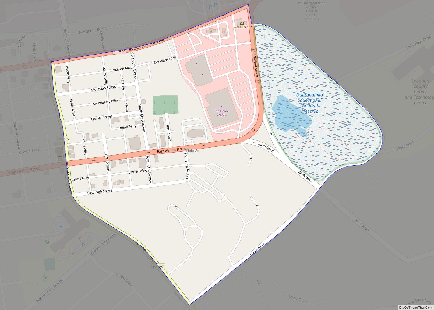
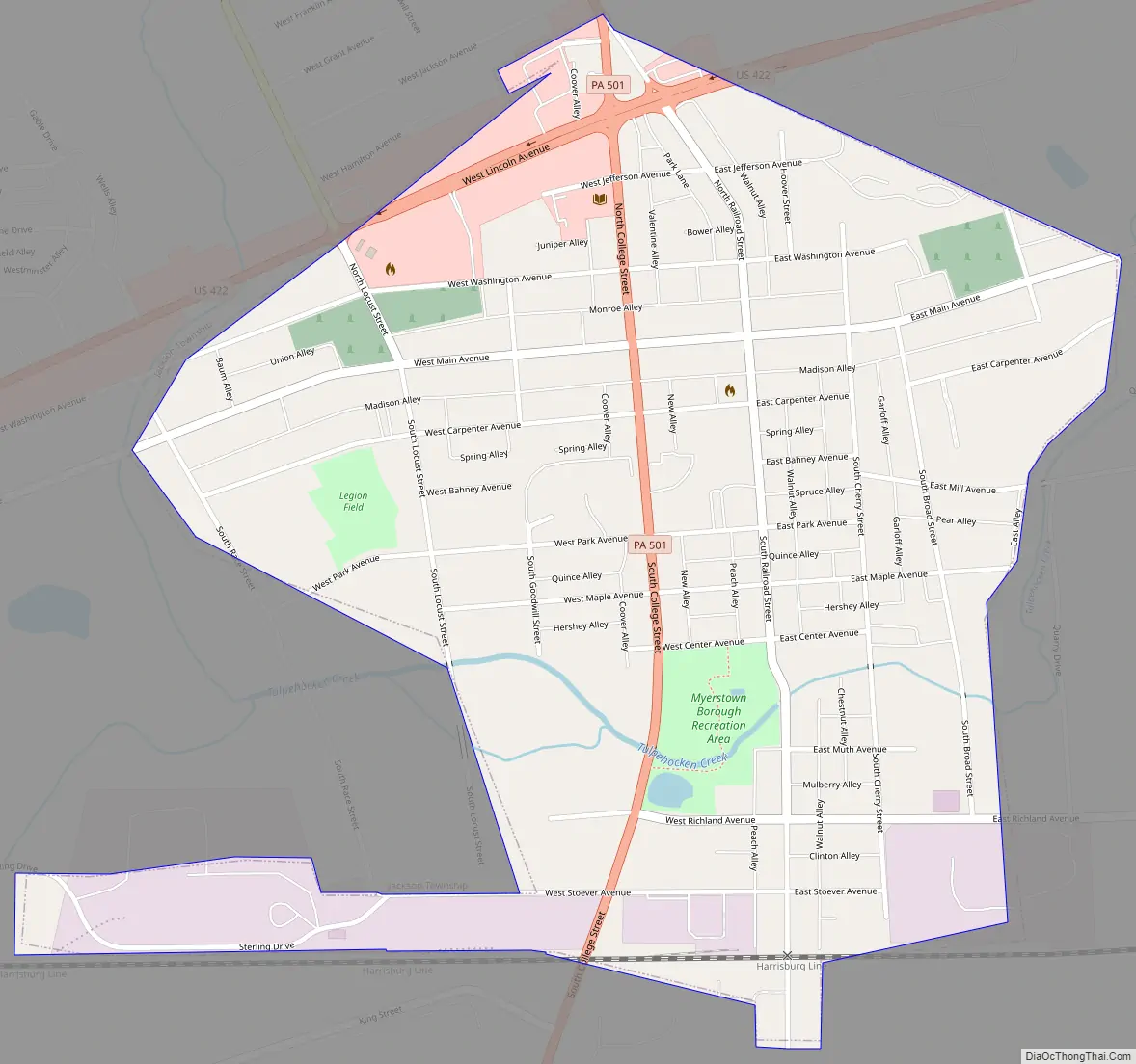
Online Interactive Map
Click on ![]() to view map in "full screen" mode.
to view map in "full screen" mode.
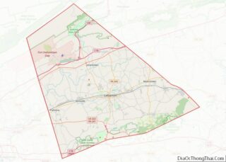
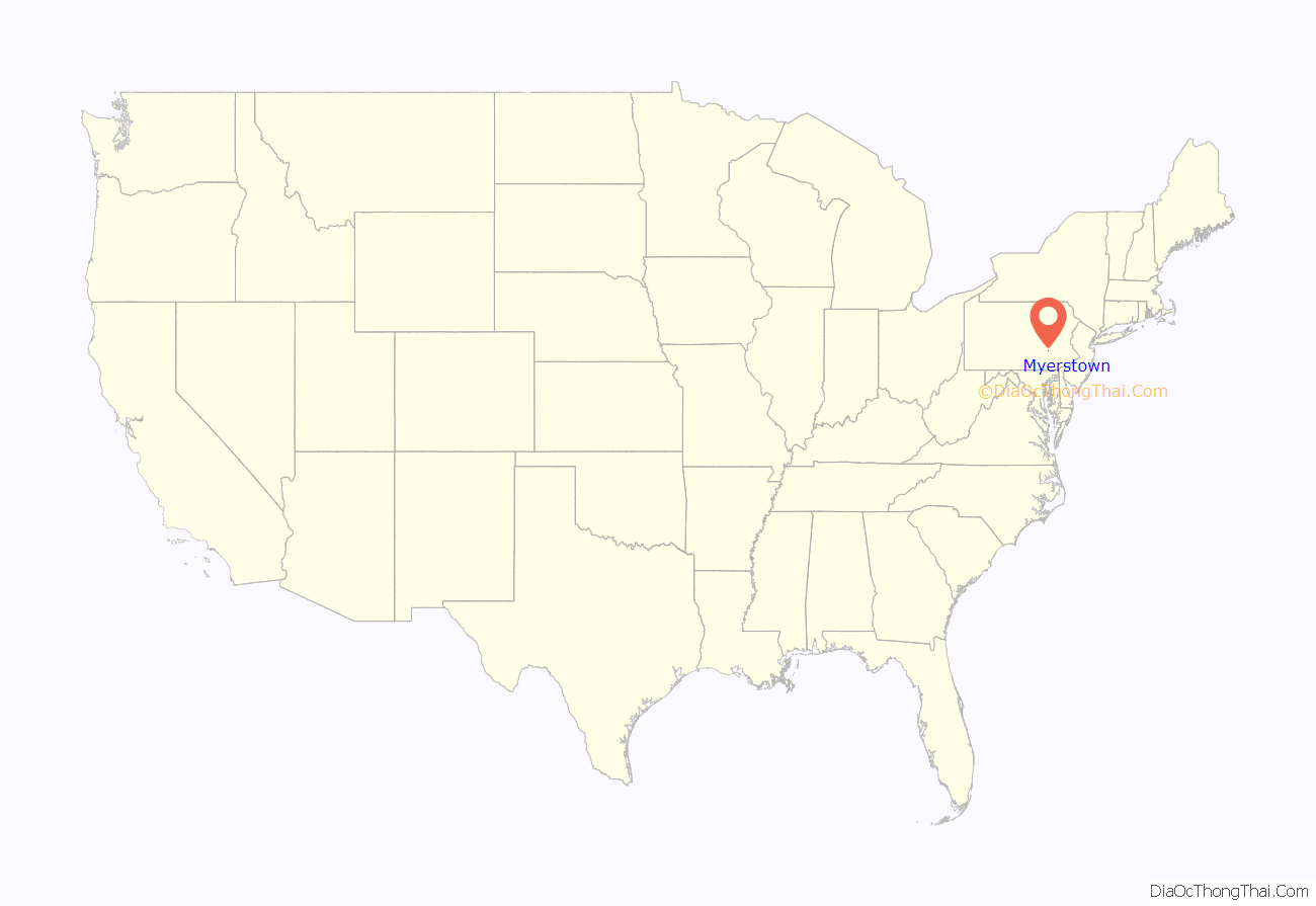
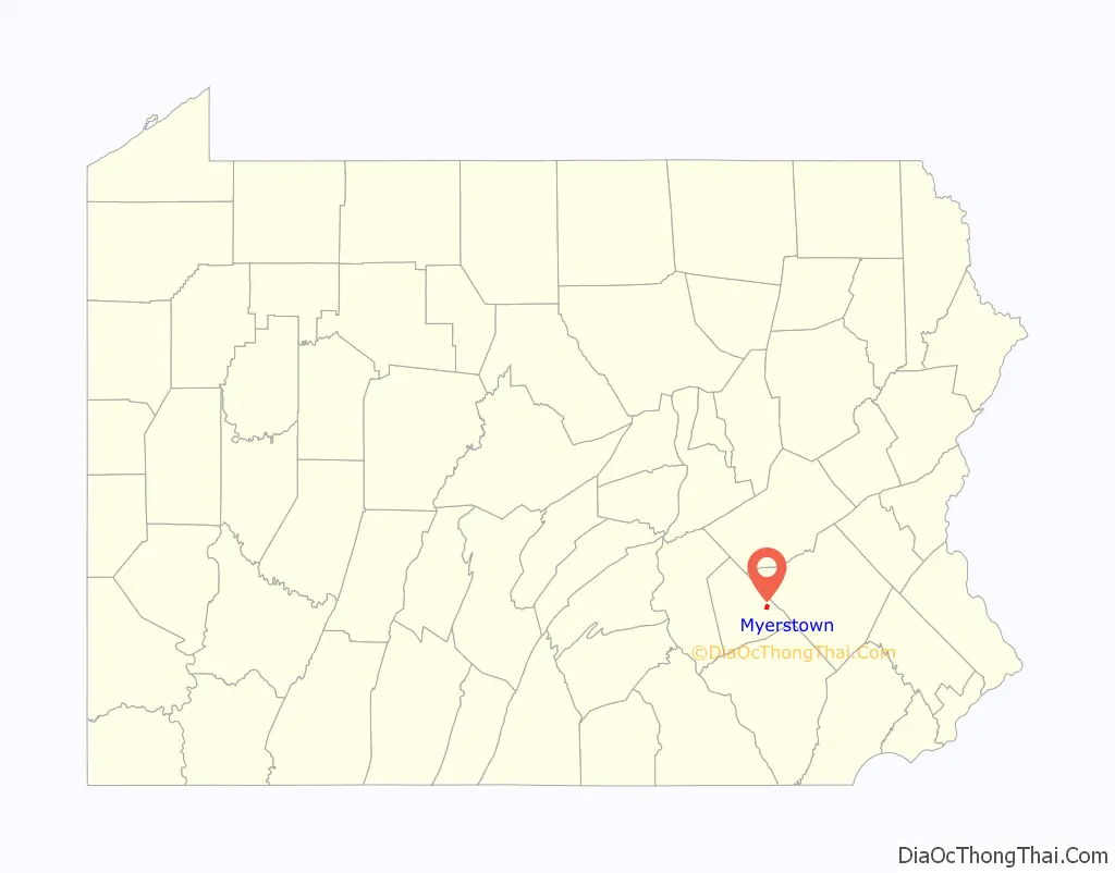
Myerstown location map. Where is Myerstown borough?
History
On December 24, 1757, 249 acres (1.01 km) of land was deeded to Isaac Meier and wife Catherine, who built their house at the Hergelrode site on South College Street. As early as 1763 he began deeding out lots and planned to make a town which he called Tulpehocken Town, after the Tulpehocken Creek, which runs through the borough.
Meier was fatally shot by an unknown assassin on July 14, 1770, at the Henry Buch House on 40 West Main Street which was a tavern at that time. After his death the citizens of Tulpehocken Town began to call it Meier’s Town after him.
The Isaac Meier Homestead was added to the National Register of Historic Places in 1973.
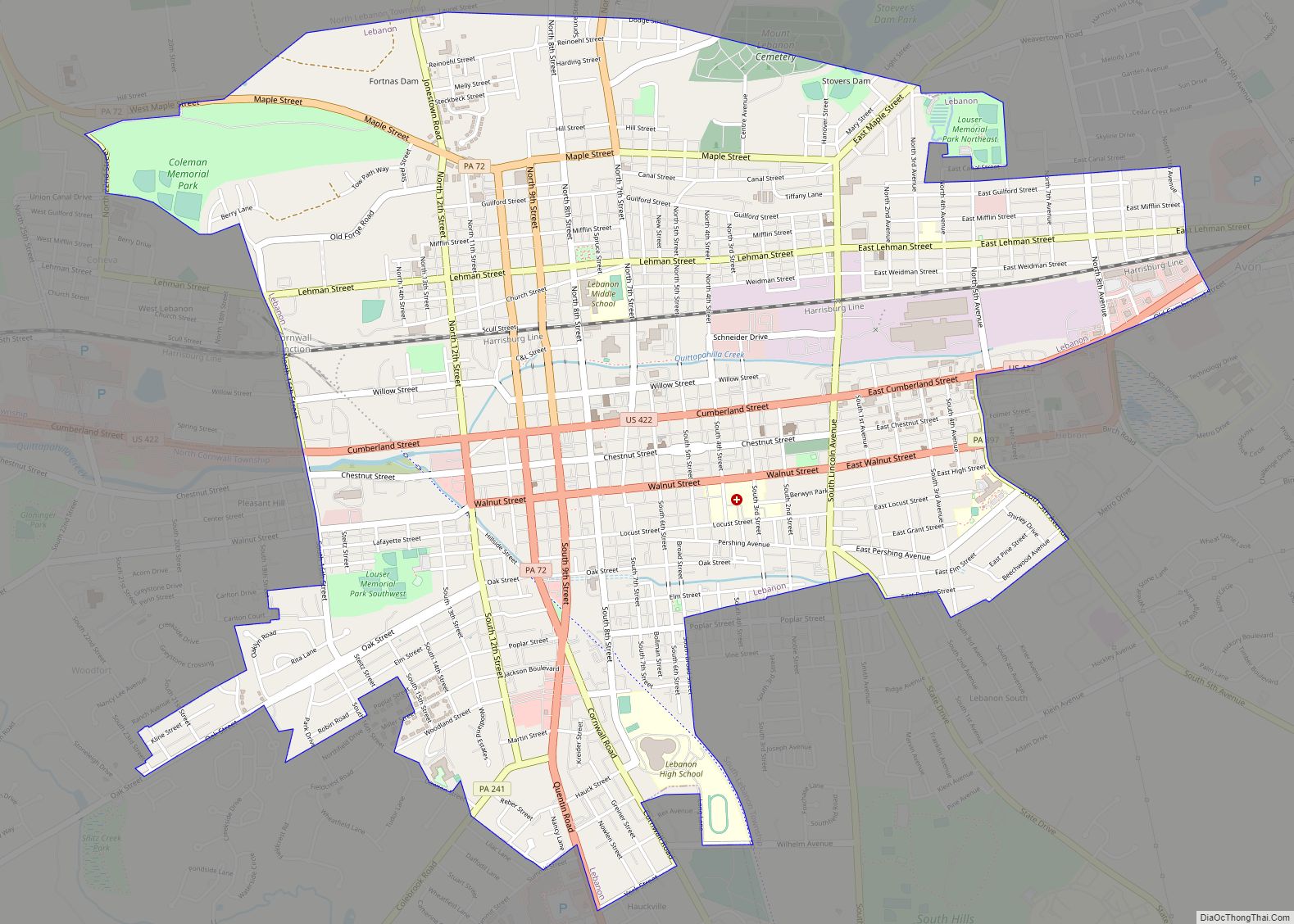
Myerstown Road Map
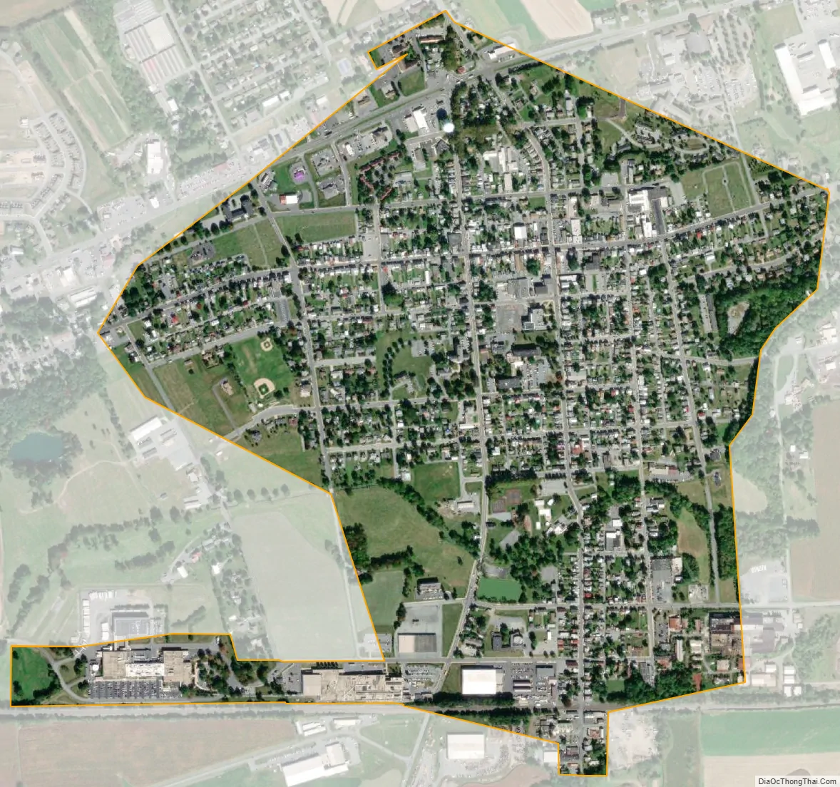
Myerstown city Satellite Map
Geography
Myerstown is located at 40°22’19” North, 76°18’15” West (40.372058, -76.304208). According to the U.S. Census Bureau, the borough has a total area of 0.9 square miles (2.3 km), all land.
Myerstown is completely surrounded by Jackson Township. It has a hot-summer humid continental climate (Dfa) and the local hardiness zone is 6b. Average monthly temperatures range from 29.2 °F in January to 74.1 °F in July.
See also
Map of Pennsylvania State and its subdivision:- Adams
- Allegheny
- Armstrong
- Beaver
- Bedford
- Berks
- Blair
- Bradford
- Bucks
- Butler
- Cambria
- Cameron
- Carbon
- Centre
- Chester
- Clarion
- Clearfield
- Clinton
- Columbia
- Crawford
- Cumberland
- Dauphin
- Delaware
- Elk
- Erie
- Fayette
- Forest
- Franklin
- Fulton
- Greene
- Huntingdon
- Indiana
- Jefferson
- Juniata
- Lackawanna
- Lancaster
- Lawrence
- Lebanon
- Lehigh
- Luzerne
- Lycoming
- Mc Kean
- Mercer
- Mifflin
- Monroe
- Montgomery
- Montour
- Northampton
- Northumberland
- Perry
- Philadelphia
- Pike
- Potter
- Schuylkill
- Snyder
- Somerset
- Sullivan
- Susquehanna
- Tioga
- Union
- Venango
- Warren
- Washington
- Wayne
- Westmoreland
- Wyoming
- York
- Alabama
- Alaska
- Arizona
- Arkansas
- California
- Colorado
- Connecticut
- Delaware
- District of Columbia
- Florida
- Georgia
- Hawaii
- Idaho
- Illinois
- Indiana
- Iowa
- Kansas
- Kentucky
- Louisiana
- Maine
- Maryland
- Massachusetts
- Michigan
- Minnesota
- Mississippi
- Missouri
- Montana
- Nebraska
- Nevada
- New Hampshire
- New Jersey
- New Mexico
- New York
- North Carolina
- North Dakota
- Ohio
- Oklahoma
- Oregon
- Pennsylvania
- Rhode Island
- South Carolina
- South Dakota
- Tennessee
- Texas
- Utah
- Vermont
- Virginia
- Washington
- West Virginia
- Wisconsin
- Wyoming