New Columbus is a borough in Luzerne County, Pennsylvania, United States. The population was 219 at the 2020 census.
| Name: | New Columbus borough |
|---|---|
| LSAD Code: | 21 |
| LSAD Description: | borough (suffix) |
| State: | Pennsylvania |
| County: | Luzerne County |
| Incorporated: | 1859 |
| Total Area: | 3.10 sq mi (8.04 km²) |
| Land Area: | 3.10 sq mi (8.04 km²) |
| Water Area: | 0.00 sq mi (0.00 km²) |
| Total Population: | 222 |
| Population Density: | 71.54/sq mi (27.62/km²) |
| Area code: | 570 |
| FIPS code: | 4253448 |
Online Interactive Map
Click on ![]() to view map in "full screen" mode.
to view map in "full screen" mode.
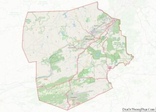
New Columbus location map. Where is New Columbus borough?
History
New Columbus was first settled in 1819. It was later incorporated as a borough in 1859. The community has not changed much since its founding; farming is still a major way of life for most of the borough.
New Columbus Road Map
New Columbus city Satellite Map
Geography
New Columbus is located at 41°10′21″N 76°17′22″W / 41.17250°N 76.28944°W / 41.17250; -76.28944 (41.1734, -76.2935).
It is a small farming town located in western Luzerne County (just south of Ricketts Glen State Park). There are small clusters of houses scattered throughout the borough; most of the community consists of farmland. Downtown New Columbus, which consists of a few homes and businesses, is located at the intersection of Old Tioga Turnpike and Academy Street. According to the United States Census Bureau, the borough has a total area of 3.1 square miles (7.9 km), all land.
See also
Map of Pennsylvania State and its subdivision:- Adams
- Allegheny
- Armstrong
- Beaver
- Bedford
- Berks
- Blair
- Bradford
- Bucks
- Butler
- Cambria
- Cameron
- Carbon
- Centre
- Chester
- Clarion
- Clearfield
- Clinton
- Columbia
- Crawford
- Cumberland
- Dauphin
- Delaware
- Elk
- Erie
- Fayette
- Forest
- Franklin
- Fulton
- Greene
- Huntingdon
- Indiana
- Jefferson
- Juniata
- Lackawanna
- Lancaster
- Lawrence
- Lebanon
- Lehigh
- Luzerne
- Lycoming
- Mc Kean
- Mercer
- Mifflin
- Monroe
- Montgomery
- Montour
- Northampton
- Northumberland
- Perry
- Philadelphia
- Pike
- Potter
- Schuylkill
- Snyder
- Somerset
- Sullivan
- Susquehanna
- Tioga
- Union
- Venango
- Warren
- Washington
- Wayne
- Westmoreland
- Wyoming
- York
- Alabama
- Alaska
- Arizona
- Arkansas
- California
- Colorado
- Connecticut
- Delaware
- District of Columbia
- Florida
- Georgia
- Hawaii
- Idaho
- Illinois
- Indiana
- Iowa
- Kansas
- Kentucky
- Louisiana
- Maine
- Maryland
- Massachusetts
- Michigan
- Minnesota
- Mississippi
- Missouri
- Montana
- Nebraska
- Nevada
- New Hampshire
- New Jersey
- New Mexico
- New York
- North Carolina
- North Dakota
- Ohio
- Oklahoma
- Oregon
- Pennsylvania
- Rhode Island
- South Carolina
- South Dakota
- Tennessee
- Texas
- Utah
- Vermont
- Virginia
- Washington
- West Virginia
- Wisconsin
- Wyoming


