New Milford is a borough in Susquehanna County, Pennsylvania, United States. The population was 817 at the 2020 census. Children living in New Milford are served by the schools in the Blue Ridge School District, including Blue Ridge High School.
| Name: | New Milford borough |
|---|---|
| LSAD Code: | 21 |
| LSAD Description: | borough (suffix) |
| State: | Pennsylvania |
| County: | Susquehanna County |
| Incorporated: | 1859 |
| Total Area: | 1.02 sq mi (2.63 km²) |
| Land Area: | 1.02 sq mi (2.63 km²) |
| Water Area: | 0.00 sq mi (0.00 km²) |
| Total Population: | 812 |
| Population Density: | 799.21/sq mi (308.63/km²) |
| Area code: | 570 |
| FIPS code: | 4253880 |
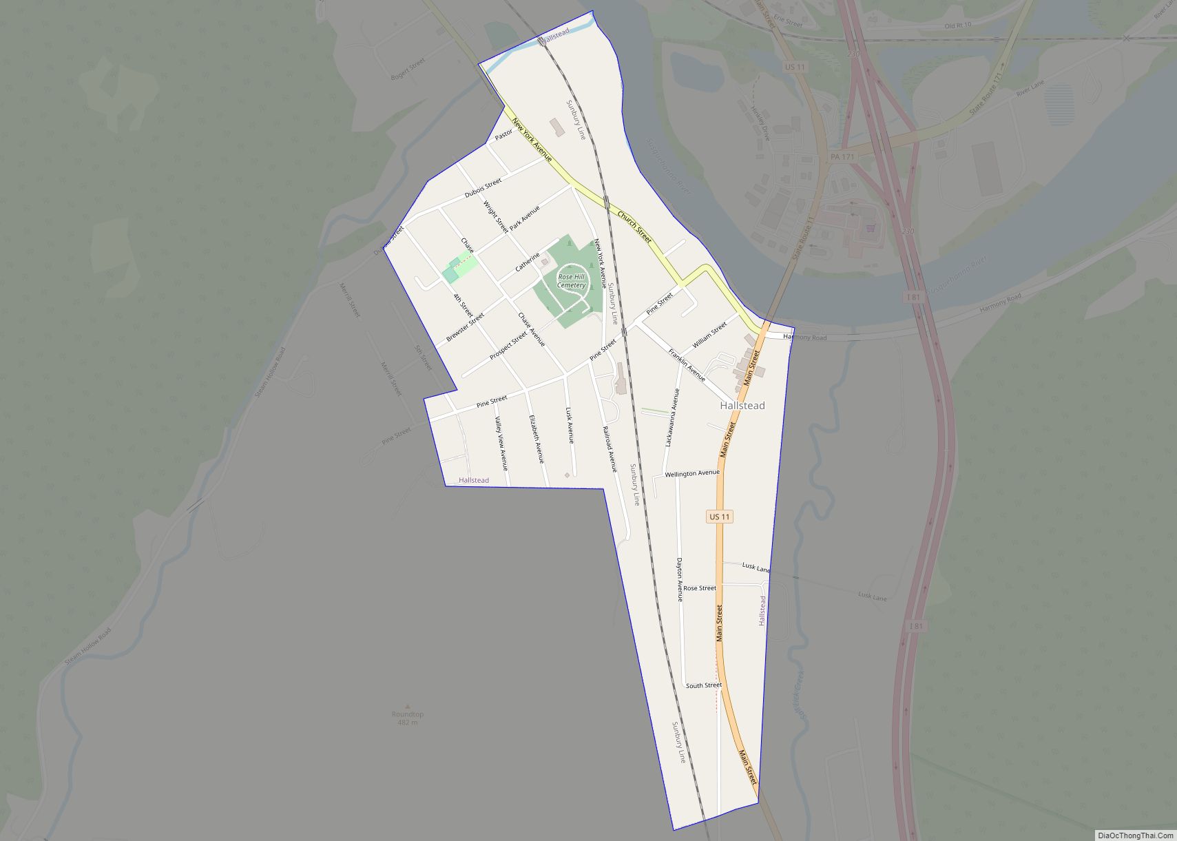
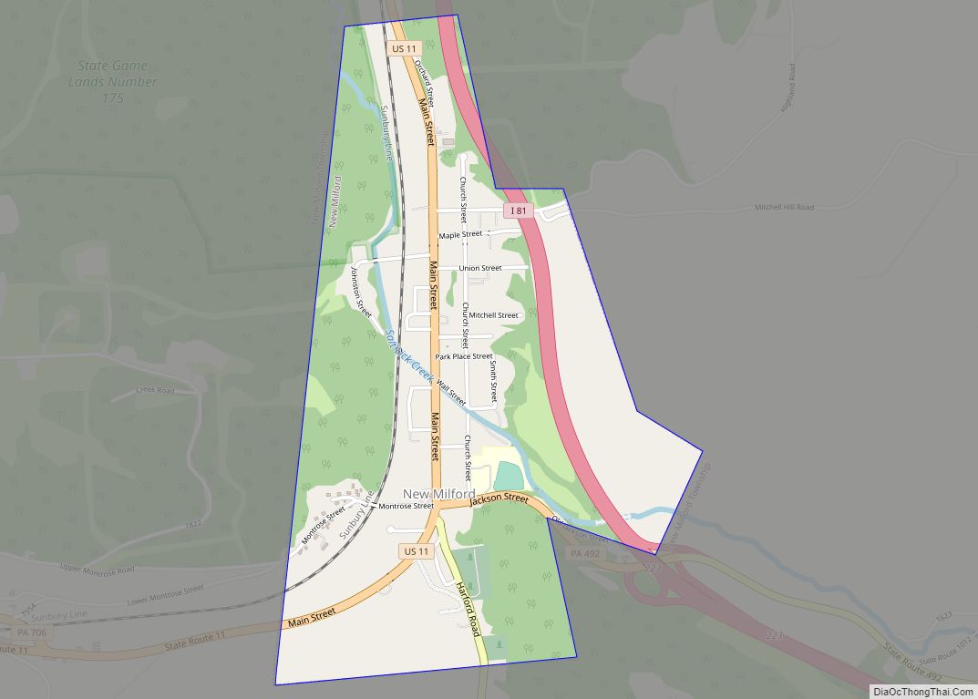
Online Interactive Map
Click on ![]() to view map in "full screen" mode.
to view map in "full screen" mode.
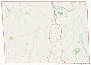
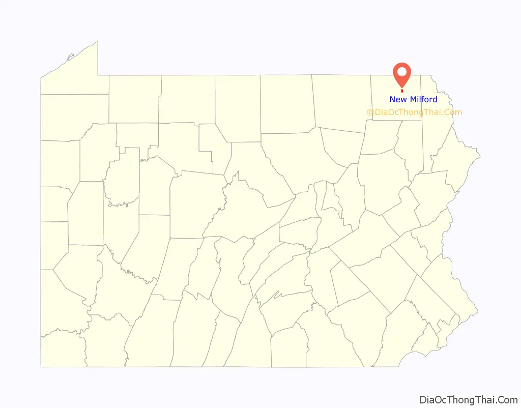
New Milford location map. Where is New Milford borough?

History
The borough of New Milford was formed from part of New Milford Township in December 1859.
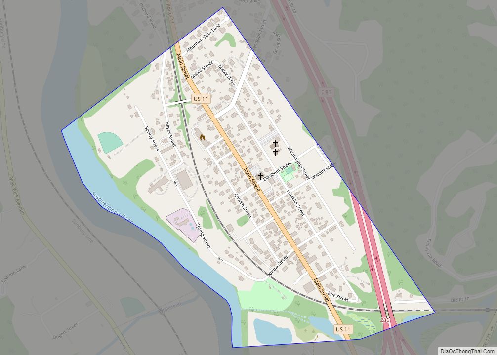
New Milford Road Map

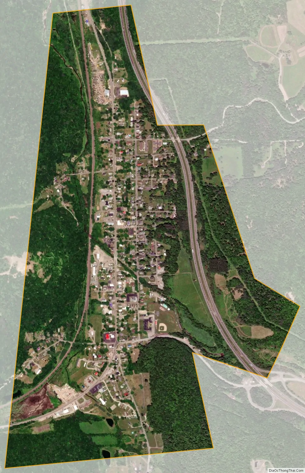
New Milford city Satellite Map
Geography
New Milford is located at 41°52′35″N 75°43′35″W / 41.876447°N 75.726445°W / 41.876447; -75.726445.
According to the United States Census Bureau, the borough has a total area of 1.0 square mile (2.6 km), all land.
See also
Map of Pennsylvania State and its subdivision:- Adams
- Allegheny
- Armstrong
- Beaver
- Bedford
- Berks
- Blair
- Bradford
- Bucks
- Butler
- Cambria
- Cameron
- Carbon
- Centre
- Chester
- Clarion
- Clearfield
- Clinton
- Columbia
- Crawford
- Cumberland
- Dauphin
- Delaware
- Elk
- Erie
- Fayette
- Forest
- Franklin
- Fulton
- Greene
- Huntingdon
- Indiana
- Jefferson
- Juniata
- Lackawanna
- Lancaster
- Lawrence
- Lebanon
- Lehigh
- Luzerne
- Lycoming
- Mc Kean
- Mercer
- Mifflin
- Monroe
- Montgomery
- Montour
- Northampton
- Northumberland
- Perry
- Philadelphia
- Pike
- Potter
- Schuylkill
- Snyder
- Somerset
- Sullivan
- Susquehanna
- Tioga
- Union
- Venango
- Warren
- Washington
- Wayne
- Westmoreland
- Wyoming
- York
- Alabama
- Alaska
- Arizona
- Arkansas
- California
- Colorado
- Connecticut
- Delaware
- District of Columbia
- Florida
- Georgia
- Hawaii
- Idaho
- Illinois
- Indiana
- Iowa
- Kansas
- Kentucky
- Louisiana
- Maine
- Maryland
- Massachusetts
- Michigan
- Minnesota
- Mississippi
- Missouri
- Montana
- Nebraska
- Nevada
- New Hampshire
- New Jersey
- New Mexico
- New York
- North Carolina
- North Dakota
- Ohio
- Oklahoma
- Oregon
- Pennsylvania
- Rhode Island
- South Carolina
- South Dakota
- Tennessee
- Texas
- Utah
- Vermont
- Virginia
- Washington
- West Virginia
- Wisconsin
- Wyoming