New Morgan is a borough in Berks County, Pennsylvania. The population was 71 at the 2010 census.
| Name: | New Morgan borough |
|---|---|
| LSAD Code: | 21 |
| LSAD Description: | borough (suffix) |
| State: | Pennsylvania |
| County: | Berks County |
| Incorporated: | April 1988 |
| Elevation: | 630 ft (190 m) |
| Total Area: | 5.79 sq mi (14.99 km²) |
| Land Area: | 5.51 sq mi (14.27 km²) |
| Water Area: | 0.28 sq mi (0.72 km²) |
| Total Population: | 54 |
| Population Density: | 9.80/sq mi (3.79/km²) |
| FIPS code: | 4253916 |
| Website: | www.newmorganboro.org |
Online Interactive Map
Click on ![]() to view map in "full screen" mode.
to view map in "full screen" mode.
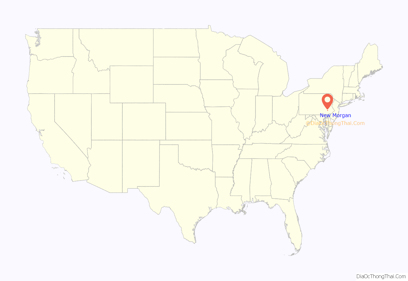
New Morgan location map. Where is New Morgan borough?
History
In 1987, Raymond Carr, the sole owner of Morgantown Properties, petitioned Berks County Court to create a new borough from 3,500 acres (14 km) in Caernarvon and Robeson townships. The fate of the proposal was determined by the ten residents living within the boundaries of the proposed borough, most of whom were Carr’s tenants. In an April 1988 election, those residents voted 9–1 in favor of forming the new borough. The state’s procedures on formation of a new borough have since been revised to require new boroughs to have at least 500 residents.
According to court documents, “[a]side from the landfill and trash to steam plant, Carr propose[d] to develop the new borough with a Victorian village, planned residential developments, a cultural center, a mixed use center, commercial areas, agricultural areas and open space areas. The Victorian village would include a 1,000 room hotel and 18-hole golf course, and would operate year round.” Most of the borough’s developed land is currently taken up by the Conestoga Landfill, while the Victorian village has yet to be built. There are currently plans in the works for the construction of a new residential area in the borough, called Bryn Eyre, as well as a hospital.
New Morgan Road Map
New Morgan city Satellite Map
Geography
New Morgan is located near the southern corner of Berks County at 40°10′50″N 75°52′14″W / 40.18056°N 75.87056°W / 40.18056; -75.87056 (40.180693, -75.870694). It is bordered to the south by Caernarvon Township and to the north by Robeson Township. The unincorporated community of Morgantown is nearby to the south.
According to the U.S. Census Bureau, the borough has a total area of 5.8 square miles (14.9 km), of which 5.5 square miles (14.2 km) is land and 0.27 square miles (0.7 km), or 4.57%, is water.
See also
Map of Pennsylvania State and its subdivision:- Adams
- Allegheny
- Armstrong
- Beaver
- Bedford
- Berks
- Blair
- Bradford
- Bucks
- Butler
- Cambria
- Cameron
- Carbon
- Centre
- Chester
- Clarion
- Clearfield
- Clinton
- Columbia
- Crawford
- Cumberland
- Dauphin
- Delaware
- Elk
- Erie
- Fayette
- Forest
- Franklin
- Fulton
- Greene
- Huntingdon
- Indiana
- Jefferson
- Juniata
- Lackawanna
- Lancaster
- Lawrence
- Lebanon
- Lehigh
- Luzerne
- Lycoming
- Mc Kean
- Mercer
- Mifflin
- Monroe
- Montgomery
- Montour
- Northampton
- Northumberland
- Perry
- Philadelphia
- Pike
- Potter
- Schuylkill
- Snyder
- Somerset
- Sullivan
- Susquehanna
- Tioga
- Union
- Venango
- Warren
- Washington
- Wayne
- Westmoreland
- Wyoming
- York
- Alabama
- Alaska
- Arizona
- Arkansas
- California
- Colorado
- Connecticut
- Delaware
- District of Columbia
- Florida
- Georgia
- Hawaii
- Idaho
- Illinois
- Indiana
- Iowa
- Kansas
- Kentucky
- Louisiana
- Maine
- Maryland
- Massachusetts
- Michigan
- Minnesota
- Mississippi
- Missouri
- Montana
- Nebraska
- Nevada
- New Hampshire
- New Jersey
- New Mexico
- New York
- North Carolina
- North Dakota
- Ohio
- Oklahoma
- Oregon
- Pennsylvania
- Rhode Island
- South Carolina
- South Dakota
- Tennessee
- Texas
- Utah
- Vermont
- Virginia
- Washington
- West Virginia
- Wisconsin
- Wyoming
