Morgantown is a census-designated place in Caernarvon Township, located in southern Berks County, Pennsylvania, United States. It is located partially in Caernarvon Township in Lancaster County. As of the 2010 census, the population was 826 residents.
| Name: | Morgantown CDP |
|---|---|
| LSAD Code: | 57 |
| LSAD Description: | CDP (suffix) |
| State: | Pennsylvania |
| County: | Berks County, Lancaster County |
| Elevation: | 600 ft (200 m) |
| Total Area: | 1.14 sq mi (2.95 km²) |
| Land Area: | 1.14 sq mi (2.95 km²) |
| Water Area: | 0.00 sq mi (0.00 km²) |
| Total Population: | 1,614 |
| Population Density: | 1,419.53/sq mi (548.00/km²) |
| ZIP code: | 19543 |
| Area code: | 610 and 484 |
| FIPS code: | 4251016 |
| GNISfeature ID: | 1181556 |
Online Interactive Map
Click on ![]() to view map in "full screen" mode.
to view map in "full screen" mode.
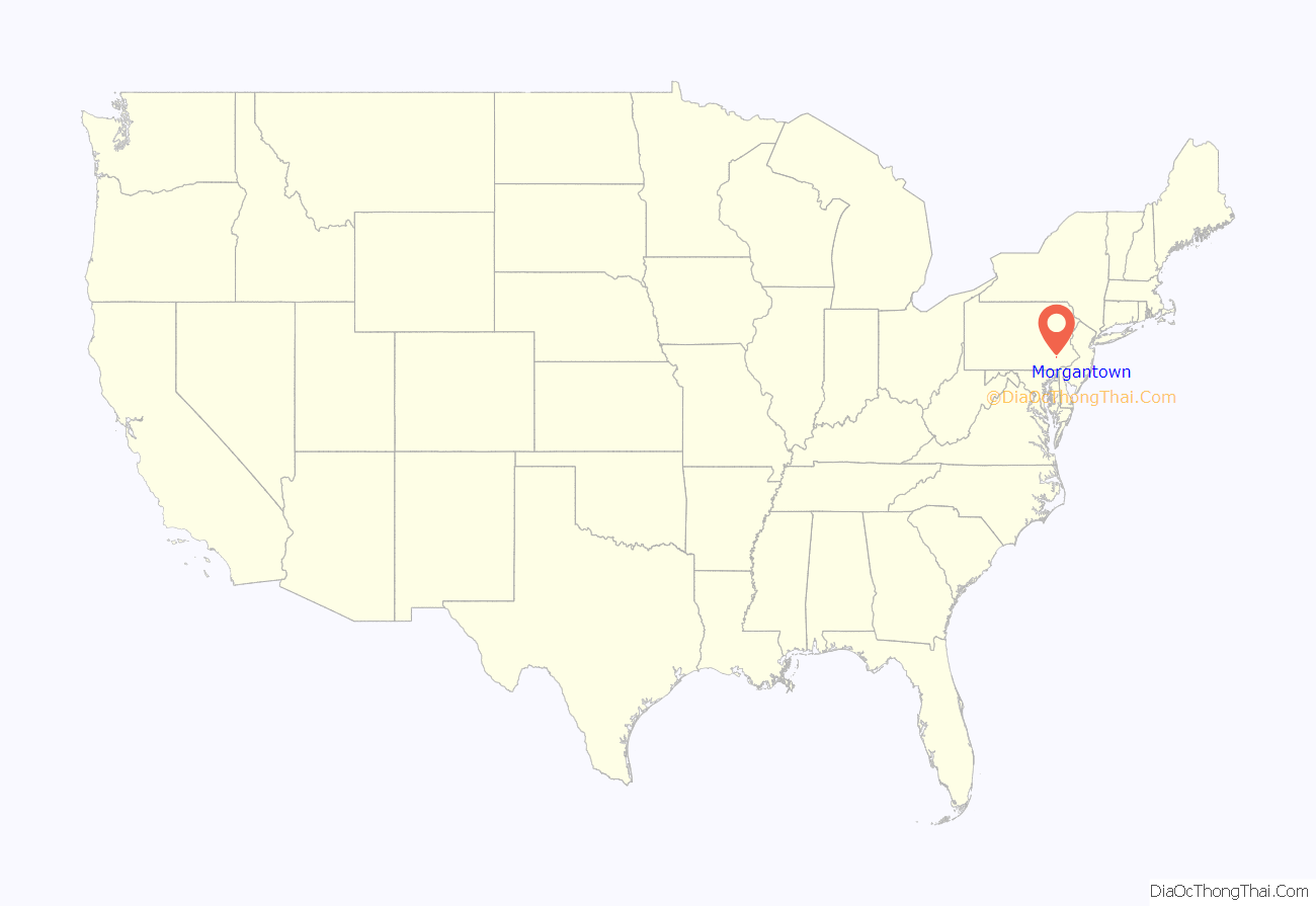
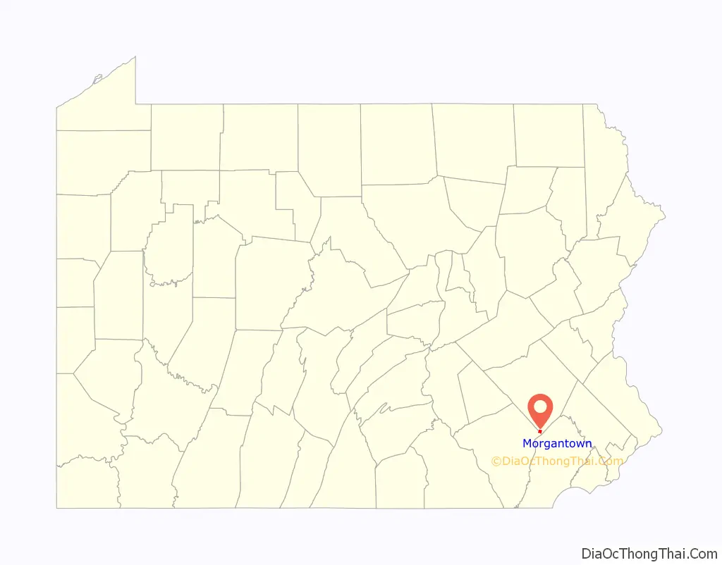
Morgantown location map. Where is Morgantown CDP?
History
Morgantown was named after Colonel Jacob Morgan, who laid out the town around 1770. His father, Thomas Morgan, had been a native of Wales, a captain in the French and Indian War, and owner of a large tract of choice land in Caernarvon Township. Jacob Morgan settled in this area around 1765, building a large stone house, which still stands on Hartz Road between Mineview Drive and Shiloh Road. It is rumored to have housed George Washington during a brief overnight visit. The house has been restored by its owners.
Morgantown was, until the arrival of the Pennsylvania Turnpike, a mostly agriculture-based settlement. Now it is much larger and busier with the settlement of several manufacturing companies, including Timet, Morgan Corp. Stoltzfus Spreaders, Viwinco Windows and McNeilus cement mixers. Other aspects of the town have grown too, especially the roads. In the 1970s the Morgantown Expressway Interstate 176 was built to interstate highway standards, providing a link between Morgantown and PA 23 and Reading and US 422.
Conestoga Christian School and High Point Baptist Academy are based in the area. Also, although not actually in Morgantown but part of its neighboring town, Elverson, Twin Valley High School overlooks parts of Morgantown and is where most of the town’s children attend school.
In 1987, an entrepreneur named Raymond Carr laid out plans for New Morgan which was incorporated into a borough in 1988. The borough currently has 35 residents, and the actual town has yet to be built.
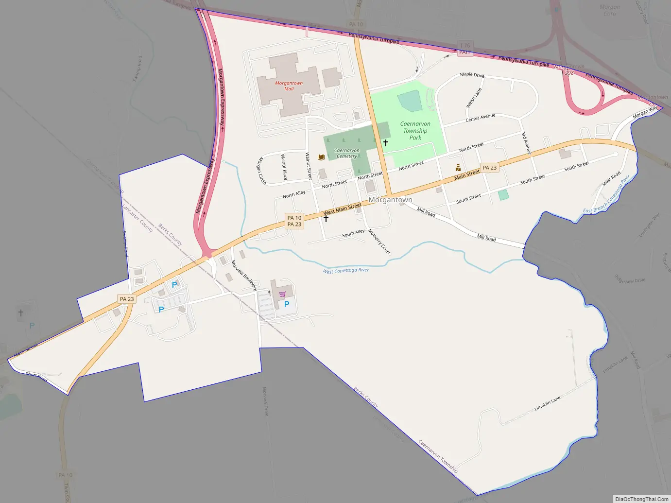
Morgantown Road Map
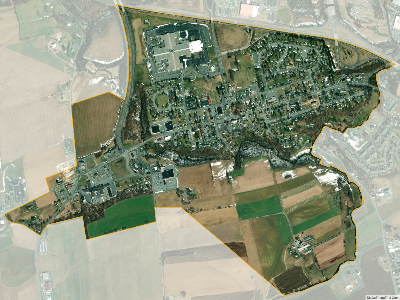
Morgantown city Satellite Map
Geography
Morgantown is drained by the Conestoga River, which flows westward into the Susquehanna River. The confluence of multiple sources occurs in Morgantown. It has a hot-summer humid continental climate (Dfa) and is in hardiness zone 6b. Average monthly temperatures range from 29.6 °F in January to 73.8 °F in July. [1]
See also
Map of Pennsylvania State and its subdivision:- Adams
- Allegheny
- Armstrong
- Beaver
- Bedford
- Berks
- Blair
- Bradford
- Bucks
- Butler
- Cambria
- Cameron
- Carbon
- Centre
- Chester
- Clarion
- Clearfield
- Clinton
- Columbia
- Crawford
- Cumberland
- Dauphin
- Delaware
- Elk
- Erie
- Fayette
- Forest
- Franklin
- Fulton
- Greene
- Huntingdon
- Indiana
- Jefferson
- Juniata
- Lackawanna
- Lancaster
- Lawrence
- Lebanon
- Lehigh
- Luzerne
- Lycoming
- Mc Kean
- Mercer
- Mifflin
- Monroe
- Montgomery
- Montour
- Northampton
- Northumberland
- Perry
- Philadelphia
- Pike
- Potter
- Schuylkill
- Snyder
- Somerset
- Sullivan
- Susquehanna
- Tioga
- Union
- Venango
- Warren
- Washington
- Wayne
- Westmoreland
- Wyoming
- York
- Alabama
- Alaska
- Arizona
- Arkansas
- California
- Colorado
- Connecticut
- Delaware
- District of Columbia
- Florida
- Georgia
- Hawaii
- Idaho
- Illinois
- Indiana
- Iowa
- Kansas
- Kentucky
- Louisiana
- Maine
- Maryland
- Massachusetts
- Michigan
- Minnesota
- Mississippi
- Missouri
- Montana
- Nebraska
- Nevada
- New Hampshire
- New Jersey
- New Mexico
- New York
- North Carolina
- North Dakota
- Ohio
- Oklahoma
- Oregon
- Pennsylvania
- Rhode Island
- South Carolina
- South Dakota
- Tennessee
- Texas
- Utah
- Vermont
- Virginia
- Washington
- West Virginia
- Wisconsin
- Wyoming


