New Ringgold is a borough in Schuylkill County, Pennsylvania, United States. The population was 253 at the time of the 2020 census.
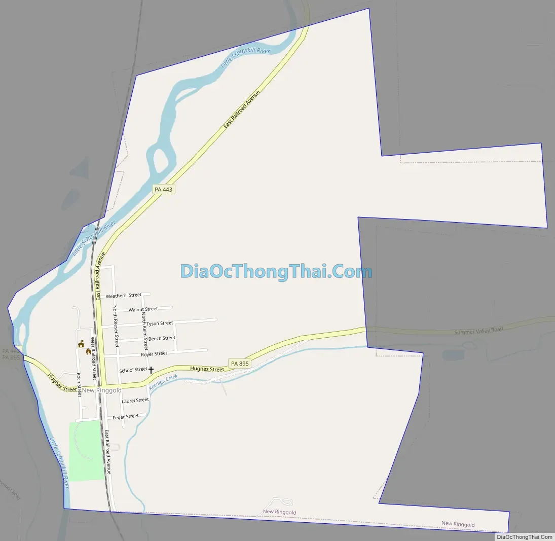
ZIP Code 17960 serves the borough and portions of East Brunswick Township and West Penn Township. The town serves as a crossroad between state routes 443 and 895. The crossroads create a minor problem for trucks turning onto PA 895, because there is no stop light and cars are not required to stop.
The Reading Blue Mountain and Northern Railroad runs through the heart of the town.
| Name: | New Ringgold borough |
|---|---|
| LSAD Code: | 21 |
| LSAD Description: | borough (suffix) |
| State: | Pennsylvania |
| County: | Schuylkill County |
| Incorporated: | 1877 |
| Total Area: | 0.80 sq mi (2.07 km²) |
| Land Area: | 0.80 sq mi (2.07 km²) |
| Water Area: | 0.00 sq mi (0.00 km²) |
| Total Population: | 253 |
| Population Density: | 316.65/sq mi (122.27/km²) |
| ZIP code: | 17960 |
| FIPS code: | 4254016 |
Online Interactive Map
Click on ![]() to view map in "full screen" mode.
to view map in "full screen" mode.
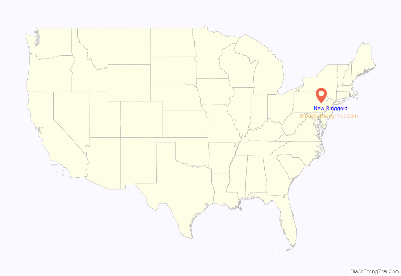
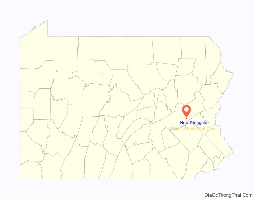
New Ringgold location map. Where is New Ringgold borough?
New Ringgold Road Map
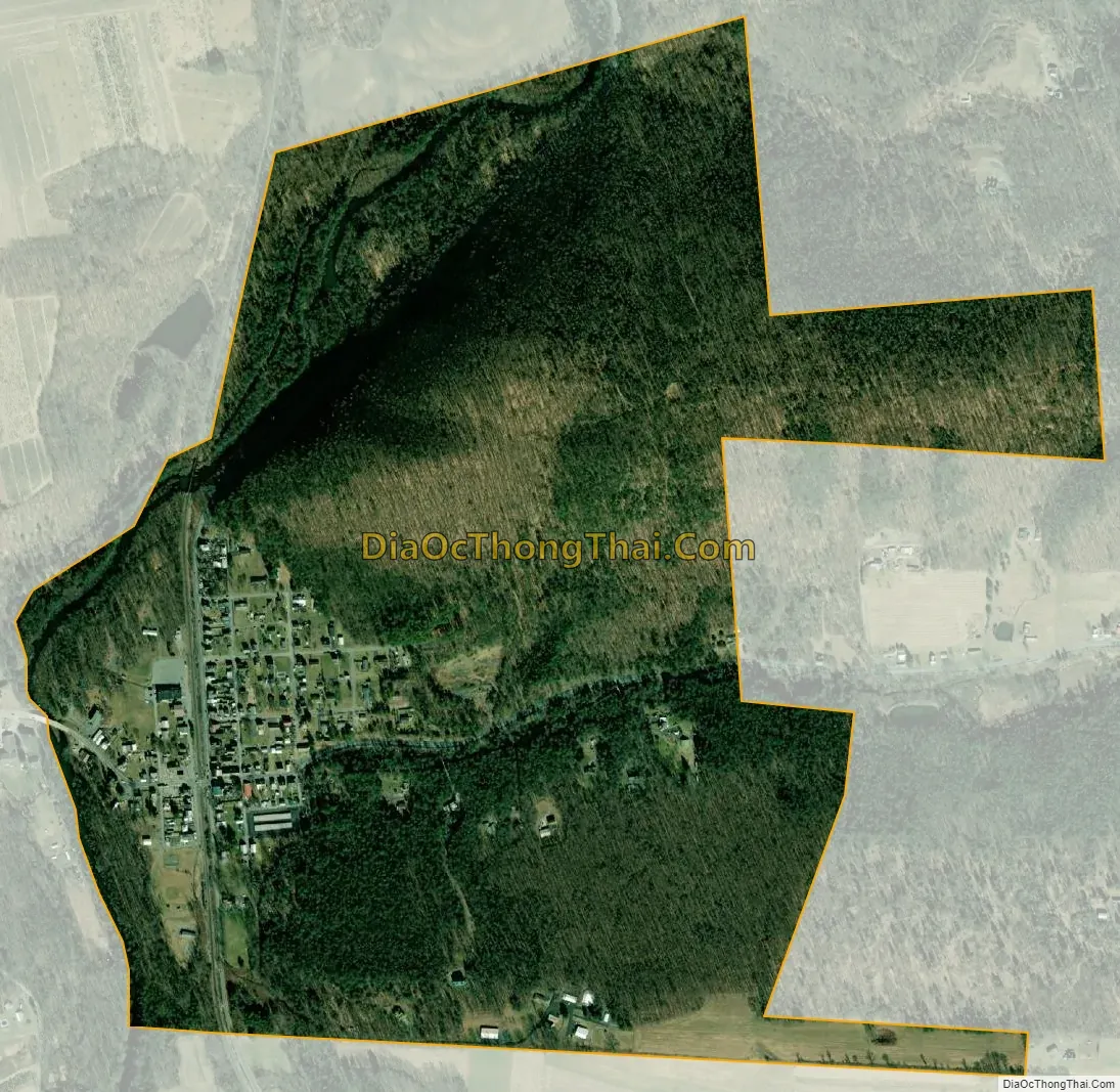
New Ringgold city Satellite Map
Geography
New Ringgold is located at 40°41′13″N 75°59′53″W / 40.68694°N 75.99806°W / 40.68694; -75.99806 (40.686969, -75.998000).
According to the United States Census Bureau, the borough has a total area of 0.9 square miles (2.3 km), all of it land.
The Little Schuylkill River flows southward through New Ringgold to meet the Schuylkill River in Port Clinton.
The borough is served by Routes 443 and 895.
New Ringgold has a hot-summer humid continental climate (Dfa) and average monthly temperatures range from 27.7° F in January to 72.6° F in July. [1] The hardiness zone is 6b.
See also
Map of Pennsylvania State and its subdivision:- Adams
- Allegheny
- Armstrong
- Beaver
- Bedford
- Berks
- Blair
- Bradford
- Bucks
- Butler
- Cambria
- Cameron
- Carbon
- Centre
- Chester
- Clarion
- Clearfield
- Clinton
- Columbia
- Crawford
- Cumberland
- Dauphin
- Delaware
- Elk
- Erie
- Fayette
- Forest
- Franklin
- Fulton
- Greene
- Huntingdon
- Indiana
- Jefferson
- Juniata
- Lackawanna
- Lancaster
- Lawrence
- Lebanon
- Lehigh
- Luzerne
- Lycoming
- Mc Kean
- Mercer
- Mifflin
- Monroe
- Montgomery
- Montour
- Northampton
- Northumberland
- Perry
- Philadelphia
- Pike
- Potter
- Schuylkill
- Snyder
- Somerset
- Sullivan
- Susquehanna
- Tioga
- Union
- Venango
- Warren
- Washington
- Wayne
- Westmoreland
- Wyoming
- York
- Alabama
- Alaska
- Arizona
- Arkansas
- California
- Colorado
- Connecticut
- Delaware
- District of Columbia
- Florida
- Georgia
- Hawaii
- Idaho
- Illinois
- Indiana
- Iowa
- Kansas
- Kentucky
- Louisiana
- Maine
- Maryland
- Massachusetts
- Michigan
- Minnesota
- Mississippi
- Missouri
- Montana
- Nebraska
- Nevada
- New Hampshire
- New Jersey
- New Mexico
- New York
- North Carolina
- North Dakota
- Ohio
- Oklahoma
- Oregon
- Pennsylvania
- Rhode Island
- South Carolina
- South Dakota
- Tennessee
- Texas
- Utah
- Vermont
- Virginia
- Washington
- West Virginia
- Wisconsin
- Wyoming


