Northern Cambria is a borough in Cambria County, Pennsylvania, United States. It is part of the Johnstown, Pennsylvania Metropolitan Statistical Area. The population was 3,835 at the 2010 census.
| Name: | Northern Cambria borough |
|---|---|
| LSAD Code: | 21 |
| LSAD Description: | borough (suffix) |
| State: | Pennsylvania |
| County: | Cambria County |
| Incorporated: | 2000 |
| Elevation: | 1,601 ft (488 m) |
| Total Area: | 3.09 sq mi (8.00 km²) |
| Land Area: | 3.09 sq mi (8.00 km²) |
| Water Area: | 0.00 sq mi (0.00 km²) |
| Total Population: | 3,560 |
| Population Density: | 1,152.10/sq mi (444.89/km²) |
| ZIP code: | 15714 |
| Area code: | 814 |
| FIPS code: | 4255000 |
| GNISfeature ID: | 2086609 |
| Website: | northerncambriaborough.com |
Online Interactive Map
Click on ![]() to view map in "full screen" mode.
to view map in "full screen" mode.
Northern Cambria location map. Where is Northern Cambria borough?


History
The borough of Northern Cambria was incorporated on January 1, 2000. It was formed from the merger of two smaller municipalities, Barnesboro and Spangler. The merger proposal was taken to residents in the 1997 election, passing in Spangler 410-243 and in Barnesboro 466-324. The area was first settled by Europeans in the early-to-middle 19th century. The presence of the West Branch of the Susquehanna River allowed loggers to move their harvest downstream. Small farms developed, but the area changed in the 1890s when mining of the extensive bituminous coal fields in the area became the dominant industry. The mining companies required skilled workers, and many came from Great Britain and Eastern Europe. Railroads were built to transport the coal out, and the town flourished with the influx of money. In the 1980s, the coal industry began a decline, and there has been a subsequent decline in the population of the area. In November 1922, the Reilly Shaft No. 1 mine explosion occurred, killing 78 coal miners.
A pumpkin weighing 1,469 pounds (666 kg) was grown by resident Larry Checkon in 2005 (a world record at that time).
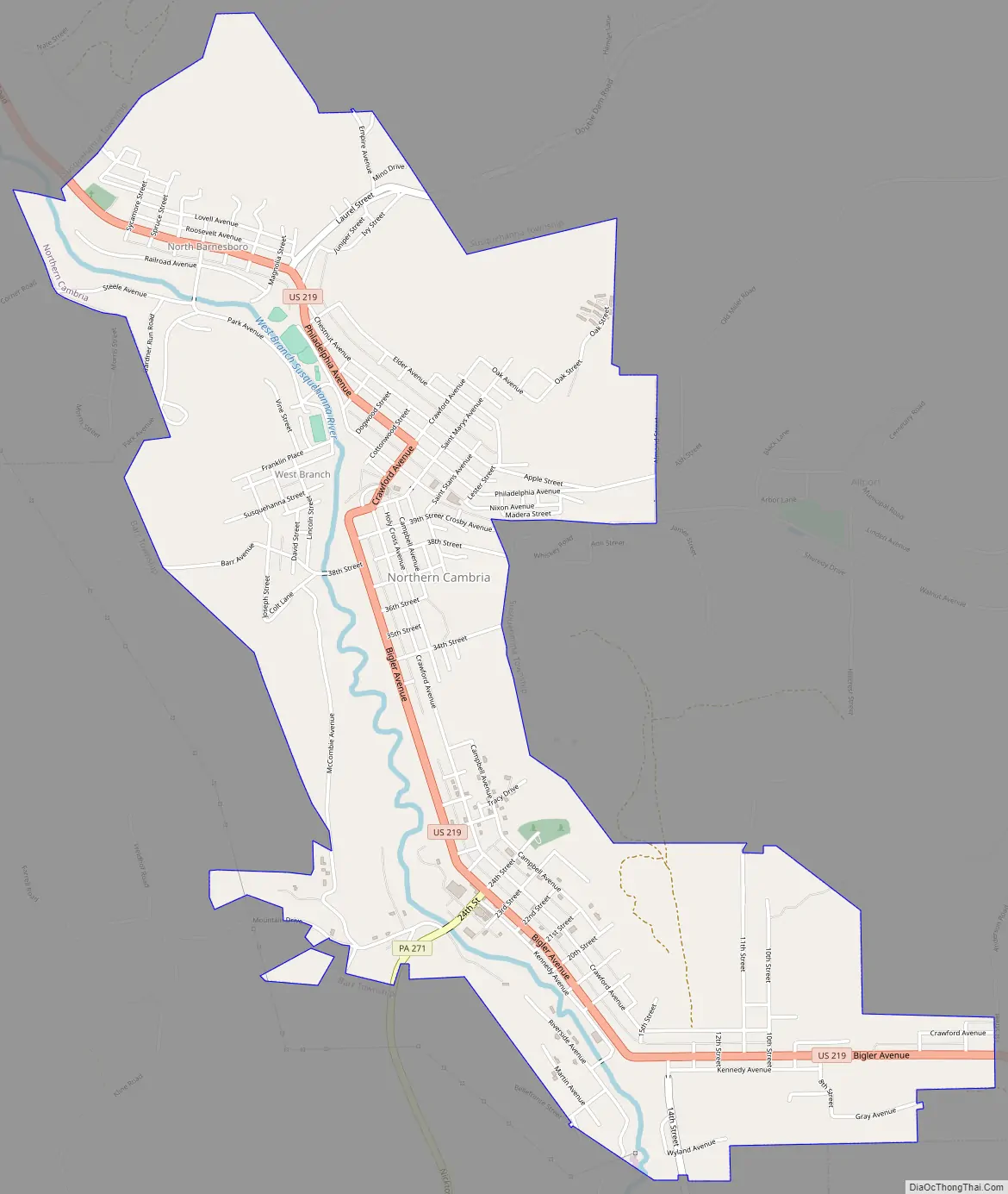
Northern Cambria Road Map
Northern Cambria city Satellite Map

Geography
Northern Cambria is located near the northwest corner of Cambria County at 40°39′21″N 78°46′46″W / 40.65583°N 78.77944°W / 40.65583; -78.77944 (40.655813, -78.779472), in the valley of the West Branch of the Susquehanna River, near its headwaters. U.S. Route 219 passes through the borough, leading south 15 miles (24 km) to Ebensburg, the county seat, and north 47 miles (76 km) to DuBois.
According to the United States Census Bureau, Northern Cambria has a total area of 3.0 square miles (7.7 km), all land.
See also
Map of Pennsylvania State and its subdivision:- Adams
- Allegheny
- Armstrong
- Beaver
- Bedford
- Berks
- Blair
- Bradford
- Bucks
- Butler
- Cambria
- Cameron
- Carbon
- Centre
- Chester
- Clarion
- Clearfield
- Clinton
- Columbia
- Crawford
- Cumberland
- Dauphin
- Delaware
- Elk
- Erie
- Fayette
- Forest
- Franklin
- Fulton
- Greene
- Huntingdon
- Indiana
- Jefferson
- Juniata
- Lackawanna
- Lancaster
- Lawrence
- Lebanon
- Lehigh
- Luzerne
- Lycoming
- Mc Kean
- Mercer
- Mifflin
- Monroe
- Montgomery
- Montour
- Northampton
- Northumberland
- Perry
- Philadelphia
- Pike
- Potter
- Schuylkill
- Snyder
- Somerset
- Sullivan
- Susquehanna
- Tioga
- Union
- Venango
- Warren
- Washington
- Wayne
- Westmoreland
- Wyoming
- York
- Alabama
- Alaska
- Arizona
- Arkansas
- California
- Colorado
- Connecticut
- Delaware
- District of Columbia
- Florida
- Georgia
- Hawaii
- Idaho
- Illinois
- Indiana
- Iowa
- Kansas
- Kentucky
- Louisiana
- Maine
- Maryland
- Massachusetts
- Michigan
- Minnesota
- Mississippi
- Missouri
- Montana
- Nebraska
- Nevada
- New Hampshire
- New Jersey
- New Mexico
- New York
- North Carolina
- North Dakota
- Ohio
- Oklahoma
- Oregon
- Pennsylvania
- Rhode Island
- South Carolina
- South Dakota
- Tennessee
- Texas
- Utah
- Vermont
- Virginia
- Washington
- West Virginia
- Wisconsin
- Wyoming


