Paoli (/peɪˈoʊli/ pay-OH-lee) is a census-designated place (CDP) in Chester County near Philadelphia, Pennsylvania, United States. It is situated in portions of two townships: Tredyffrin and Willistown. At the 2020 census, it had a total population of 6,002.
| Name: | Paoli CDP |
|---|---|
| LSAD Code: | 57 |
| LSAD Description: | CDP (suffix) |
| State: | Pennsylvania |
| County: | Chester County |
| Elevation: | 509 ft (155 m) |
| Total Area: | 2.02 sq mi (5.23 km²) |
| Land Area: | 2.02 sq mi (5.22 km²) |
| Water Area: | 0.00 sq mi (0.01 km²) |
| Total Population: | 6,002 |
| Population Density: | 2,978.66/sq mi (1,150.24/km²) |
| ZIP code: | 19301 |
| FIPS code: | 4257816 |
Online Interactive Map
Click on ![]() to view map in "full screen" mode.
to view map in "full screen" mode.
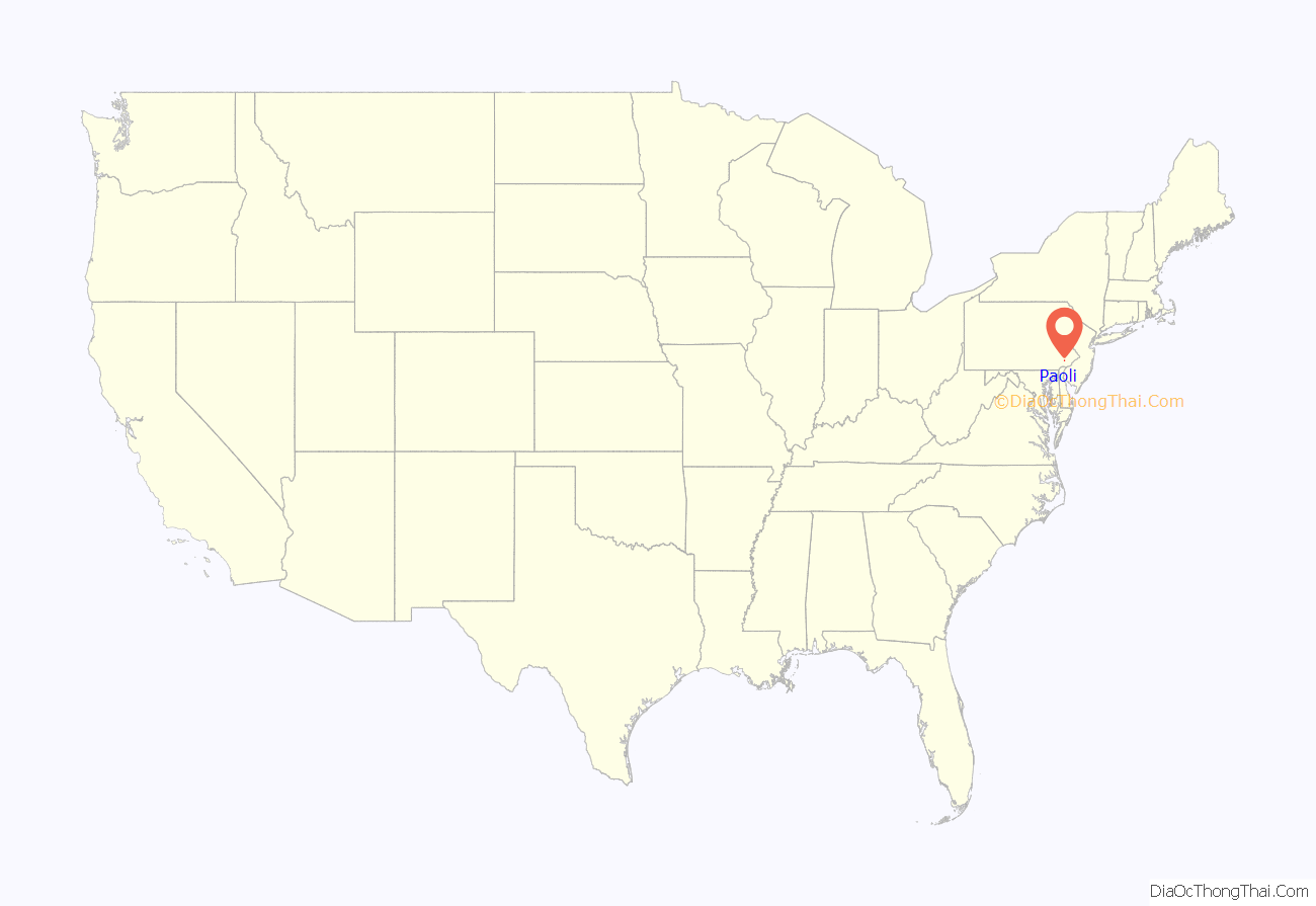
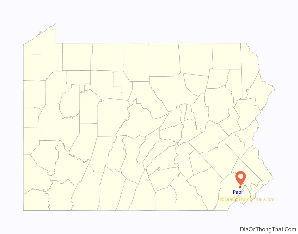
Paoli location map. Where is Paoli CDP?
History
The town of Paoli grew around an inn kept in 1769 by Joshua Evans, whose father bought 500 acres (200 ha) from William Penn in 1719 near the current site of the Paoli Post Office. Evans named his inn after General Pasquale Paoli, a Corsican, after Paoli had received the 45th and final toast at a Saint Patrick’s Day celebration. The inn’s location on the Philadelphia and Lancaster Turnpike, about 20 miles (one day’s drive for a horse-drawn wagon) from Philadelphia, contributed to its success.
Battle of Paoli
On the evening of September 20, 1777, near Paoli, General Charles Grey and nearly 5,000 British soldiers launched a surprise attack on a Patriot encampment, which became known as the Battle of Paoli. Having intercepted General Washington’s orders to General Wayne regarding British rearguard actions, Grey directed his troops to assault the small regiment of Americans commanded by Anthony Wayne in an area near his residence. Not wanting to lose the element of surprise, Grey ordered his troops to remove the flint from their muskets and to use only bayonets or swords to launch a surprise sneak attack on the Americans under the cover of darkness.
With the help of a Loyalist spy who provided a secret password, “here we are and there they go” and led them to the camp, General “No-flint” Grey and the British overran several American pickets and launched their successful attack on the Continental Army camp. 201 American soldiers were killed or injured, while 71 were captured. The British suffered only 4 killed and 7 injured in comparison. Wayne’s reputation was tarnished by the high casualties suffered in the battle, and he demanded a formal court-martial to clear his name. On November 1, a board of 13 officers declared that Wayne had acted with honor. The site of the battle is now part of nearby Malvern, Pennsylvania.
Philadelphia Main Line
The construction of the Main Line of Public Works across Pennsylvania enhanced the village’s stature, as the Philadelphia and Columbia Railroad passed through it. This became the Pennsylvania Railroad, which built suburban commuter lines out from Philadelphia in the late 19th century, spurring the growth of that city’s suburbs. The largest and longest of these commuter lines, the “Main Line”, terminated in Paoli.
Philadelphia Folk Festival
“The Homestead,” the fifteen-acre farm of Colley Wilson, on the south side of Swedesford Road, was the scene of the first annual Philadelphia Folk Festival in 1962, and remained at that site until 1965. It outgrew the space when an estimated 15,000 people attended the final year. The site has been subdivided. Gene Shay, a member of the Festival committee, observed after the first Festival, the site “with its spacious grassy valleys, clean running brooks, shaded hillsides and rustic barns, supplied the perfect background for all of the musical activity.” In those few years Acts such as Pete Seeger, Judy Collins, Mississippi John Hurt, Phil Ochs, Bill Monroe, Tom Rush, Tom Paxton, Rev. Gary Davis, Rambling Jack Elliott, Buffy Sainte-Marie, and The Paul Butterfield Blues Band were among the many performers.
Paoli Road Map
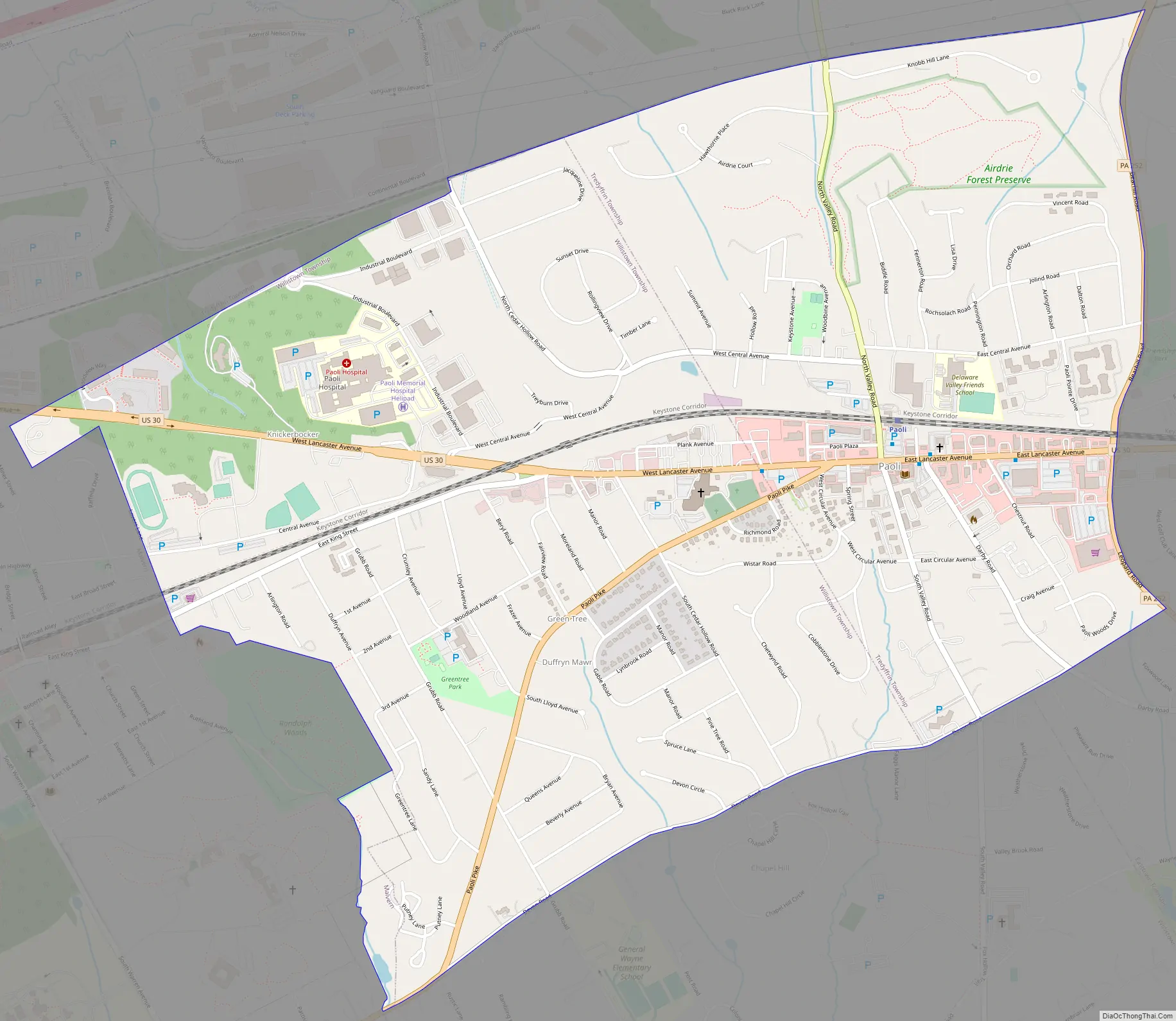
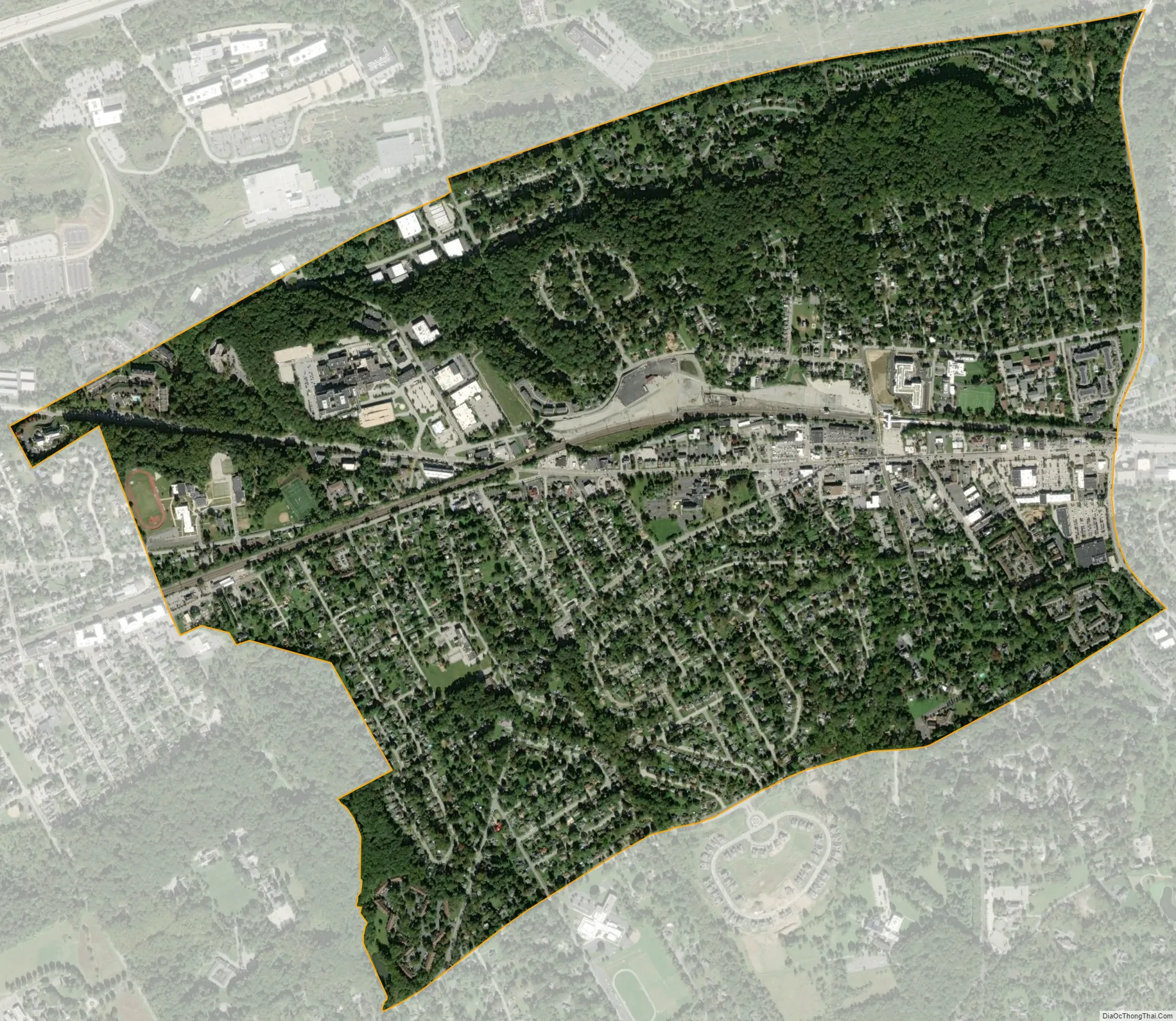
Paoli city Satellite Map
Geography
According to the United States Census Bureau, the CDP has a total area of 2.0 square miles (5.2 km), all land. Paoli borders other towns, such as Berwyn and Malvern. These three towns belong to either the Tredyffrin/Easttown or the Great Valley school districts.
See also
Map of Pennsylvania State and its subdivision:- Adams
- Allegheny
- Armstrong
- Beaver
- Bedford
- Berks
- Blair
- Bradford
- Bucks
- Butler
- Cambria
- Cameron
- Carbon
- Centre
- Chester
- Clarion
- Clearfield
- Clinton
- Columbia
- Crawford
- Cumberland
- Dauphin
- Delaware
- Elk
- Erie
- Fayette
- Forest
- Franklin
- Fulton
- Greene
- Huntingdon
- Indiana
- Jefferson
- Juniata
- Lackawanna
- Lancaster
- Lawrence
- Lebanon
- Lehigh
- Luzerne
- Lycoming
- Mc Kean
- Mercer
- Mifflin
- Monroe
- Montgomery
- Montour
- Northampton
- Northumberland
- Perry
- Philadelphia
- Pike
- Potter
- Schuylkill
- Snyder
- Somerset
- Sullivan
- Susquehanna
- Tioga
- Union
- Venango
- Warren
- Washington
- Wayne
- Westmoreland
- Wyoming
- York
- Alabama
- Alaska
- Arizona
- Arkansas
- California
- Colorado
- Connecticut
- Delaware
- District of Columbia
- Florida
- Georgia
- Hawaii
- Idaho
- Illinois
- Indiana
- Iowa
- Kansas
- Kentucky
- Louisiana
- Maine
- Maryland
- Massachusetts
- Michigan
- Minnesota
- Mississippi
- Missouri
- Montana
- Nebraska
- Nevada
- New Hampshire
- New Jersey
- New Mexico
- New York
- North Carolina
- North Dakota
- Ohio
- Oklahoma
- Oregon
- Pennsylvania
- Rhode Island
- South Carolina
- South Dakota
- Tennessee
- Texas
- Utah
- Vermont
- Virginia
- Washington
- West Virginia
- Wisconsin
- Wyoming