Park Forest Village is an unincorporated area and census-designated place (CDP) in Patton and Ferguson townships, Centre County, Pennsylvania, United States. It is part of the State College, Pennsylvania Metropolitan Statistical Area. The population was 8,831 at the 2020 census.
| Name: | Park Forest Village CDP |
|---|---|
| LSAD Code: | 57 |
| LSAD Description: | CDP (suffix) |
| State: | Pennsylvania |
| County: | Centre County |
| Elevation: | 1,350 ft (410 m) |
| Total Area: | 2.49 sq mi (6.46 km²) |
| Land Area: | 2.49 sq mi (6.46 km²) |
| Water Area: | 0.00 sq mi (0.00 km²) |
| Total Population: | 8,831 |
| Population Density: | 3,543.74/sq mi (1,368.08/km²) |
| ZIP code: | 16803 |
| Area code: | 814 |
| FIPS code: | 4258036 |
| GNISfeature ID: | 1183297 |
Online Interactive Map
Click on ![]() to view map in "full screen" mode.
to view map in "full screen" mode.
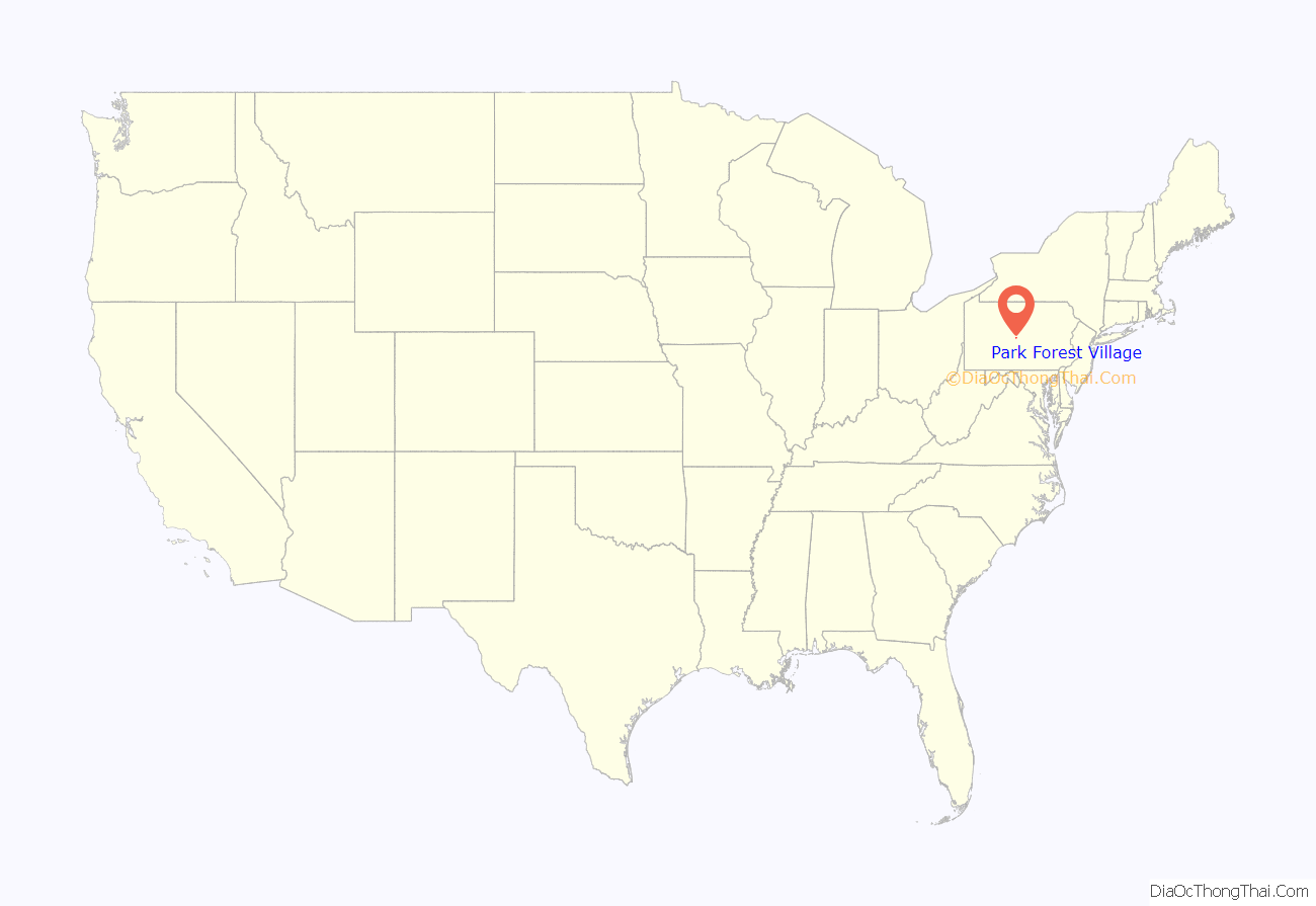
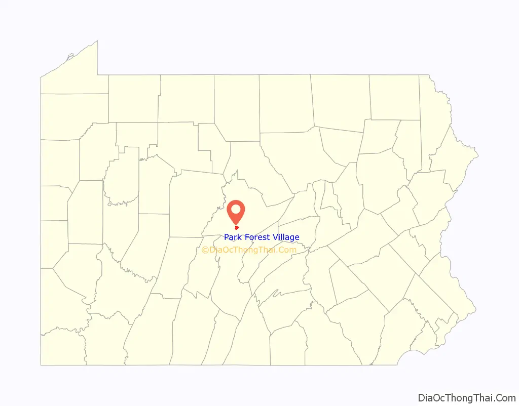
Park Forest Village location map. Where is Park Forest Village CDP?
History
Park Forest Village, created in 1956, was the first large suburban development near State College. This neighborhood won several national awards for its design, which moved away from the straight streets and clear cutting typical of post World War II suburban developments. The use of gracefully curved streets and the retention of trees established a pattern for future developments everywhere.
The subdivision was originally developed on 1,000 acres (4.0 km) of land known as part of the Barrens in Patton Township by J. Alvin Hawbaker, a well-known real estate developer in State College. Mr. Hawbaker’s assistant designer was a noted architect/landscape architect Carl W. Wild, who insisted on focusing on street tree-plantings to define each street and maintaining as many naturally growing trees, as possible. Through their company, Park Forest Enterprises, they created the cul de sac and curved streets design of Park Forest Village which ended up yielding more housing units per square mile than the conventional city grid pattern. Park Forest Village also utilized several localized parks so that common recreation areas would be accessible to each neighborhood in the subdivision. The landscaping of each homesite also retained as many native trees on the original land as possible, giving each property abundant trees and a mature, long-term, lived in look as opposed to young sapling trees planted at the time most conventional homes were constructed that took years to grow and mature. As the building of the subdivision progressed, utility lines were buried so that telephone and power line poles became unnecessary, giving the streets a cleaner design and look. J. Alvin Hawbaker also pioneered the “Gallery of Homes” real estate marketing approach, which resulted in the sale of thousands of housing units within the area now known as Park Forest Village.
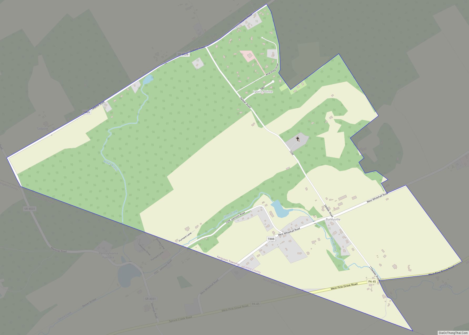
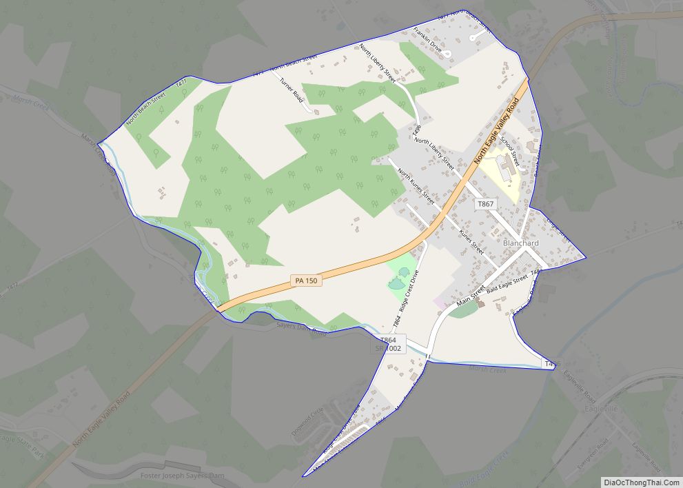
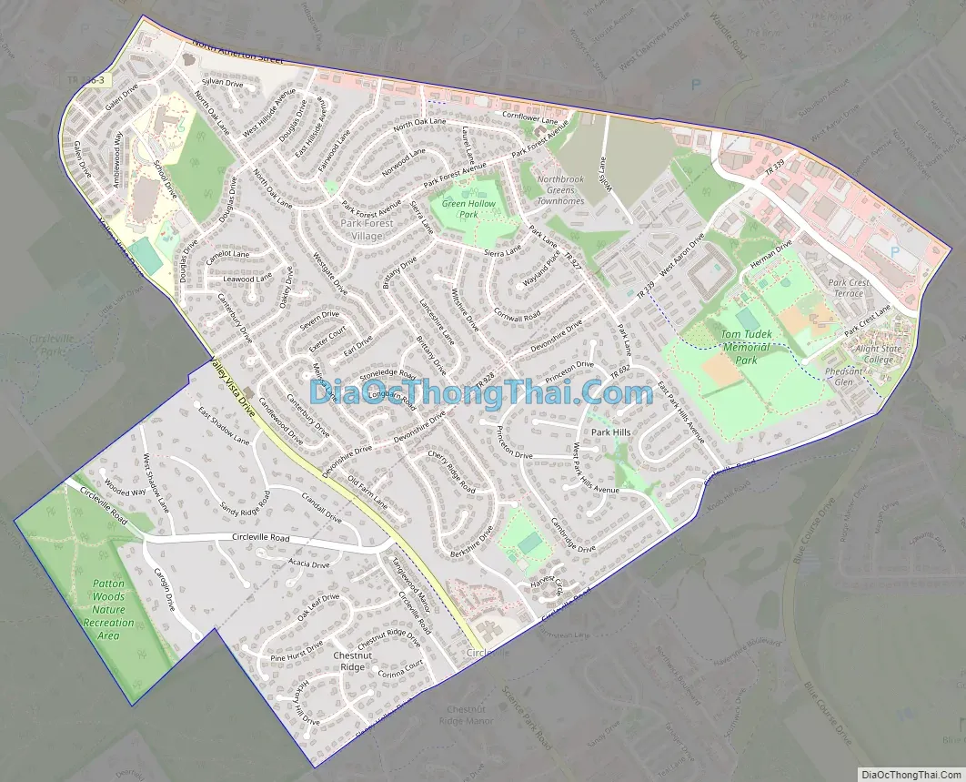
Park Forest Village Road Map
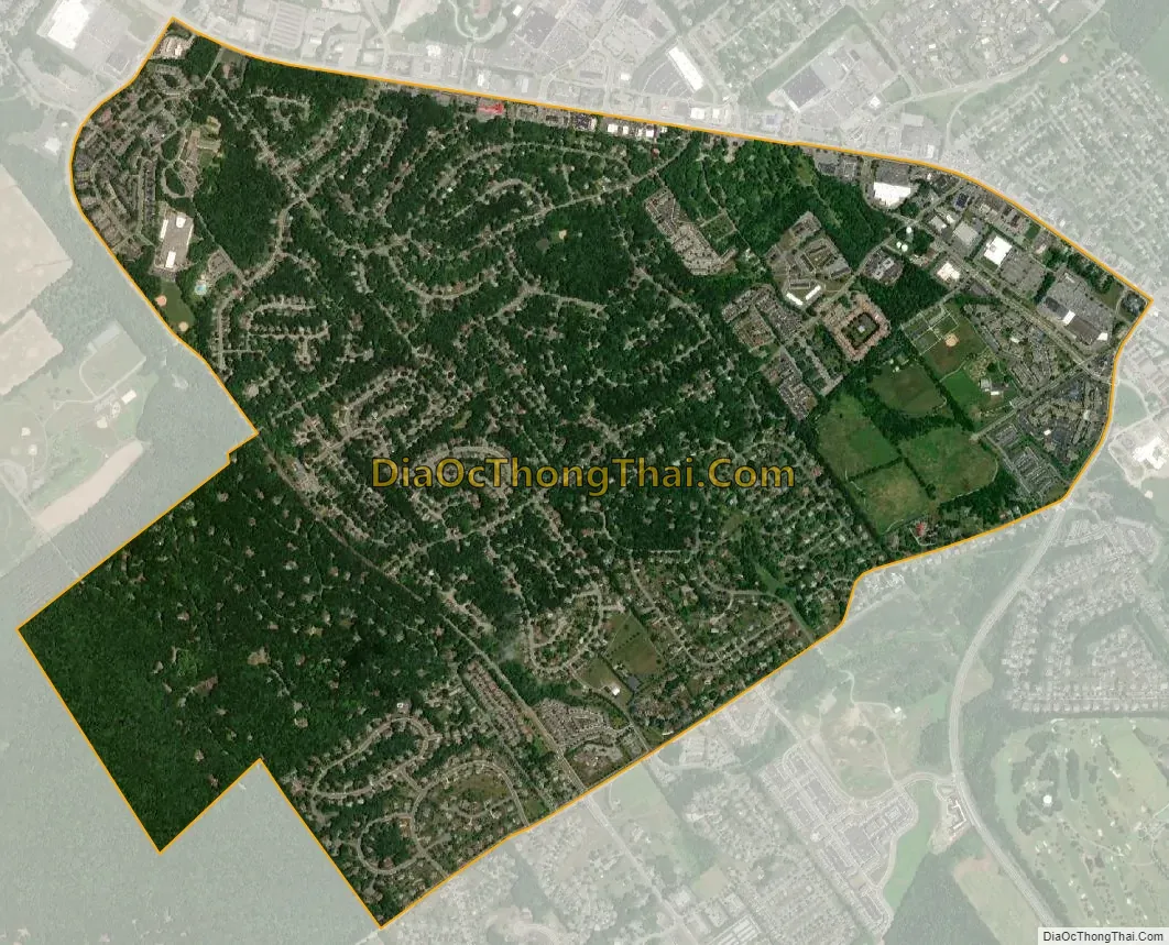
Park Forest Village city Satellite Map
Geography
Park Forest Village is located in southern Centre County at 40°48′4″N 77°54′34″W / 40.80111°N 77.90944°W / 40.80111; -77.90944 (40.801060, -77.909423). The eastern end of the community touches the northwestern corner of the borough of State College. The northern edge of the community is defined by U.S. Route 322 Business (North Atherton Street). The entire CDP is located within State College Area School District.
According to the United States Census Bureau, the CDP has a total area of 2.45 square miles (6.35 km), all land.
See also
Map of Pennsylvania State and its subdivision:- Adams
- Allegheny
- Armstrong
- Beaver
- Bedford
- Berks
- Blair
- Bradford
- Bucks
- Butler
- Cambria
- Cameron
- Carbon
- Centre
- Chester
- Clarion
- Clearfield
- Clinton
- Columbia
- Crawford
- Cumberland
- Dauphin
- Delaware
- Elk
- Erie
- Fayette
- Forest
- Franklin
- Fulton
- Greene
- Huntingdon
- Indiana
- Jefferson
- Juniata
- Lackawanna
- Lancaster
- Lawrence
- Lebanon
- Lehigh
- Luzerne
- Lycoming
- Mc Kean
- Mercer
- Mifflin
- Monroe
- Montgomery
- Montour
- Northampton
- Northumberland
- Perry
- Philadelphia
- Pike
- Potter
- Schuylkill
- Snyder
- Somerset
- Sullivan
- Susquehanna
- Tioga
- Union
- Venango
- Warren
- Washington
- Wayne
- Westmoreland
- Wyoming
- York
- Alabama
- Alaska
- Arizona
- Arkansas
- California
- Colorado
- Connecticut
- Delaware
- District of Columbia
- Florida
- Georgia
- Hawaii
- Idaho
- Illinois
- Indiana
- Iowa
- Kansas
- Kentucky
- Louisiana
- Maine
- Maryland
- Massachusetts
- Michigan
- Minnesota
- Mississippi
- Missouri
- Montana
- Nebraska
- Nevada
- New Hampshire
- New Jersey
- New Mexico
- New York
- North Carolina
- North Dakota
- Ohio
- Oklahoma
- Oregon
- Pennsylvania
- Rhode Island
- South Carolina
- South Dakota
- Tennessee
- Texas
- Utah
- Vermont
- Virginia
- Washington
- West Virginia
- Wisconsin
- Wyoming