Plymouth Meeting is a census-designated place (CDP) that straddles Plymouth and Whitemarsh Townships in Montgomery County, Pennsylvania, United States. The settlement was founded in 1686.
The population of Plymouth Meeting was 6,177 in the 2010 census. Plymouth Meeting is home to the Colonial School District, the Plymouth Meeting Mall and several large office parks and shopping centers. It is home to IKEA’s U.S. headquarters. The confluence of the Pennsylvania Turnpike (I-276), the Mid-County Expressway/”Blue Route” (I-476) and the Northeast Extension of the Pennsylvania Turnpike (I-476) at the Mid-County Interchange occur in Plymouth Meeting. This interchange contributes to regional commerce and was a major driver for business and retail development.
Plymouth Meeting is located 47 miles (76 km) southeast of Allentown and 18.7 miles (30.1 km) northwest of Philadelphia.
| Name: | Plymouth Meeting CDP |
|---|---|
| LSAD Code: | 57 |
| LSAD Description: | CDP (suffix) |
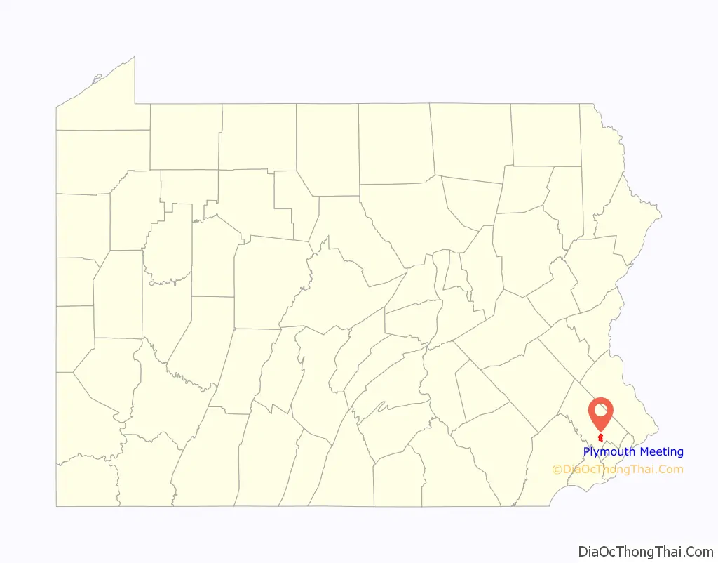
| State: | Pennsylvania |
| County: | Montgomery County |
| Founded: | 1686 |
| Elevation: | 184 ft (56 m) |
| Total Area: | 3.91 sq mi (10.12 km²) |
| Land Area: | 3.91 sq mi (10.12 km²) |
| Water Area: | 0.00 sq mi (0.00 km²) |
| Total Population: | 7,452 |
| Population Density: | 1,906.86/sq mi (736.24/km²) |
| ZIP code: | 19462 |
| Area code: | 610 and 484 |
| FIPS code: | 4261688 |
| GNISfeature ID: | 1184137 |
Online Interactive Map
Click on ![]() to view map in "full screen" mode.
to view map in "full screen" mode.
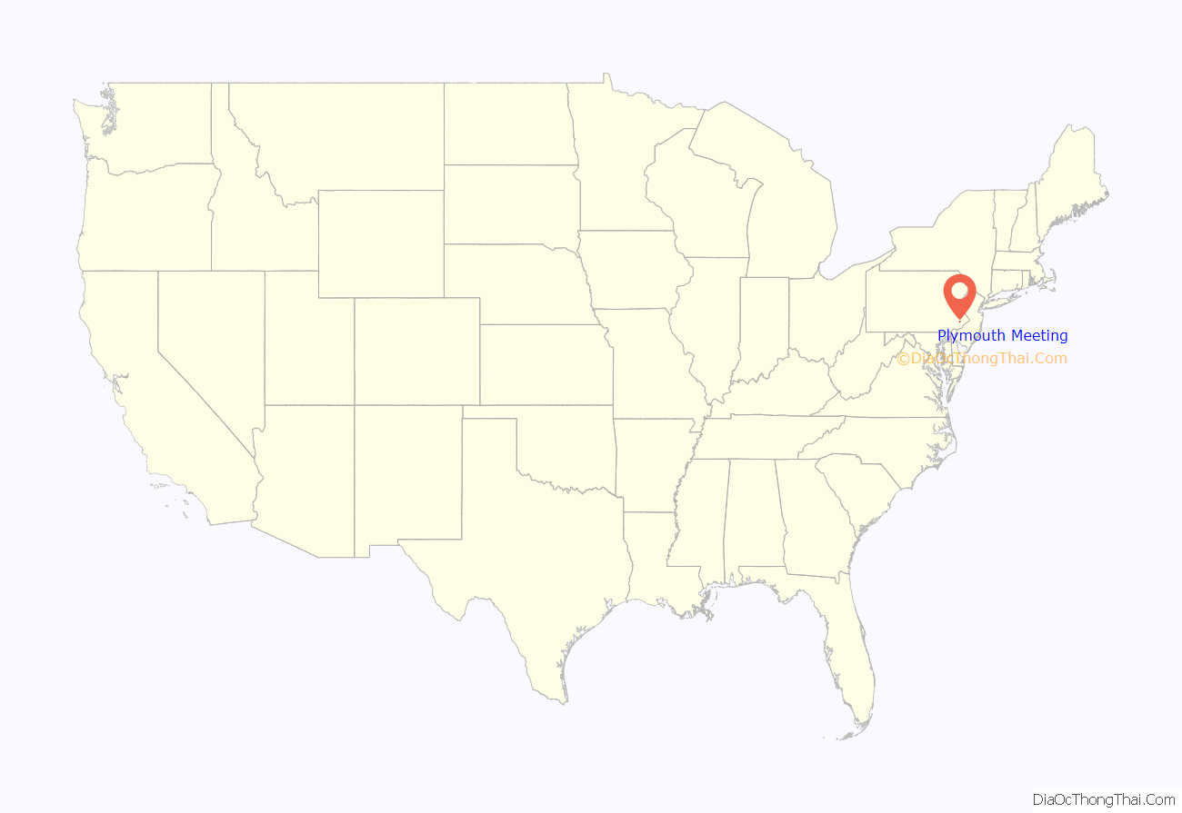
Plymouth Meeting location map. Where is Plymouth Meeting CDP?
History
The area was originally settled by members of the Religious Society of Friends, or Quakers, who built the Plymouth Friends Meetinghouse in 1708. They sailed from Devonshire, England, on the ship Desire, arriving in Philadelphia on June 23, 1686. The settlement takes its name from the founders’ hometown of Plymouth in Devon.
During the Revolutionary War, in May 1778, the Plymouth Friends Meetinghouse served as a temporary military hospital. General George Washington, then at Valley Forge, learned that a British force intended to seize the area and cut off movement of the Continental Army. He sent Marquis de Lafayette and 2,100 troops to counter. They camped around the meetinghouse on the night before the May 19 Battle of Barren Hill. The next morning the British arrived with a massive force of 16,000, and tried to cut off any escape route. Lafayette instead took advantage of the Americans’ knowledge of local roads, and escaped with minimal casualties.
Slave holding was condemned by the Society of Friends in 1754. Few slaves were held in Plymouth Township, and only one remained by 1830. The Maulsby and Corson families were early abolitionists, sheltering runaway slaves beginning in the 1810s and turning their properties into stations on the Underground Railroad. The Fugitive Slave Act of 1850 increased the penalties for giving assistance to an escaped slave to six months in prison and a $1,000 fine. It allowed slavecatchers to pursue a fugitive across state lines into every U.S. state and territory. Local resident George Corson was involved in hiding Jane Johnson, whose 1855 escape exposed a loophole in the federal law. When the doors to local churches and schools were closed to Abolitionist speakers, Corson built Abolition Hall (1856) on his farm at Germantown and Butler Pikes. The hall could accommodate up to 200 people, and hosted speakers such as Frederick Douglass, Harriet Beecher Stowe, Lucretia Mott, Mrs. Stephen Foster and William Lloyd Garrison.
In later years (1881-1895) Abolition Hall became the art studio of painter Thomas Hovenden. Married to George Corson’s daughter, Helen (Corson) Hovenden, Hovenden was best known for painting realistic scenes taken out of American life as he experienced it in the farmlands of Plymouth Meeting. His depictions of everyday life during the Civil War seem like photographs rather than oil paintings. One of his most famous paintings,“Breaking Home Ties,” (shown below) as well as several others, can be seen in the Philadelphia Museum of Art. Hovenden succeeded Thomas Eakins as the principal painting instructor at the Pennsylvania Academy of Fine Arts in 1886 after the latter was forced to resign for inappropriate use of nude models.
Growth continued for Plymouth Meeting during the 1900s which led to the advent of the Pennsylvania Turnpike, the Plymouth Meeting Mall, high-rise and garden apartment complexes, industries and office buildings.
What is now Germantown Pike was ordered laid out by the Provincial Government in 1687 as a “cart road” from Philadelphia to Plymouth Meeting. The actual road was finished in 1804, at a cost of $11,287. A road from Plymouth Meeting to Gwynedd appears to have been built in 1751. What is now Chemical Road, following Plymouth Creek, was opened in 1759 to provide access to a new gristmill.
In the early 19th century the Hickorytown Hotel, on Germantown Pike opposite Hickory Road, was a prominent road house. Robert Kennedy, an officer in the Revolution, operated the inn in 1801. In 1806 it was kept by Frederick Dull and in 1825, Jacob Hart. In the beginning of the 19th century it was a training place for the 36th Regiment of the Pennsylvania Militia and the Second Battalion of Montgomery County. The Friendship Company for the Protection against Horse Stealing was organized there in 1807. Township elections were held there, and a post office was established there in May 1857. The Plymouth Meeting Post Office appears to have been established sometime prior to 1827.
In 1754, Benjamin Davis received a license to keep an inn on Ridge Pike at Plymouth Creek. This inn, the Seven Stars, was shown on maps as early as 1759. The inn was demolished in 1975 to make way for the Midcounty Expressway.
Early records indicate that one person was elected as “road supervisor” and tax collector. The roads were mostly dirt, and repair and maintenance was often auctioned off to the lowest bidder, usually a farmer who had large properties and kept many men and horses, and the smaller farmers worked on the roads for them.
Tax records show that many taxpayers worked out their taxes on the roads. From 1846 to 1854 the road supervisor was paid one dollar per day for his work as supervisor and collector of taxes. Men working on the roads received $.80 per day and boys received $.40 per day. For the use of a double team of horses with a wagon or cart, one was paid $1.75 per day.
Among early industries in Plymouth Township was the Hickorytown Forge operated by the Wood family, and a forerunner of the present Alan Wood Steel Company. The name Plymouth Furnace appears in the records about 1847 and was engaged in the manufacture of nails.
In 1863, a company named Plymouth Iron Company was organized with a capital of $30,000.00. The company purchased the property of Colwell Furnace, which is located just west of the present Colwell Lane adjoining the development known as Farmview Village.
The Plymouth Railroad was built in 1836 to serve some 20 lime kilns operating along the route between Conshohocken and Cold Point. In 1870, the line was acquired by the Philadelphia and Reading Railroad and was rebuilt and extended to Oreland at a junction with the North Penn Railroad. The line was abandoned by the 1970s.
Prior to the building of the Plymouth Railroad, the Philadelphia, Germantown, and Norristown Railroad was built along the Schuylkill River through Plymouth Township and commenced operation in 1835. For most of its history, this railroad was part of the Reading Railroad system. Today these tracks are SEPTA’s Manayunk/Norristown Line.
The Schuylkill Valley Division of the Pennsylvania Railroad was built parallel to the Reading Railroad tracks along the Schuylkill River, opening for service in 1884. Rail service ended in the 1970s and the track-bed is now occupied by the multi-use (pedestrian and bicycle) Schuylkill River Trail.
The Trenton Cutoff branch of the Pennsylvania Railroad was built in 1891. The Trenton Cutoff is now owned by Norfolk Southern and is known as the Morrisville Line.
Later in the 1890s electric trolley lines were built through Plymouth Meeting. The trolleys that ran on the shoulder of Germantown Pike connected Chestnut Hill and Norristown. The trolley on the shoulder of Butler Pike was a short shuttle known as the Harmanville Dinkey, running between Germantown Pike and Ridge Pike (0.7 miles). Dinkey passengers transferred to Conshohocken-bound trolleys at the corner of Ridge Pike and Butler Pike. For most of their existence the trolley lines were operated by the Reading Transit & Light Company (no relation to the Reading Railroad). In addition to passengers, during the 1910s freight was handled by the RT&L trolleys; an abandoned wooden track-side freight platform near the northwest corner of Germantown Pike and Butler Pike survived into the 1950s. The Harmanville Dinkey was replaced with buses in 1927. The Germantown Pike trolleys ceased operation in December 1931. The trolley that ran from Norristown to Conshohocken through Black Horse, Seven Stars and Harmanville was replaced with buses in September 1933. The roadside trolley tracks were quickly torn up and the adjacent two-lane Ridge Pike, and Butler Pike south of Ridge Pike, were widened to accommodate ever-increasing motor vehicle traffic.
The first school in the township was established by the Plymouth Meeting Society of Friends in 1780, although some records indicate an earlier school. A school was established at Cold Point in 1821. Public schools, established under the system authorized by the legislature in 1834, included Cold Point School, Plymouth Valley School, the Eight Square school, the Sandy Hill school and the North Star school.
Plymouth became a township of the first class in January 1922. Isaac J. Sheppard became township secretary from that time until his retirement in 1952. Under the new form of government the board changed from “road supervisors” to “Township Commissioners”.
In 1925, the Board of Health was organized. Plumbing inspection began in 1934. In 1939, Plymouth adopted a “modern” zoning ordinance. A building code ordinance was adopted. In 1947, the first subdivision ordinance was adopted. In 1952, the Township Planning Commission was created, and a Recreation Committee was established to study recreation needs.
Plymouth Township adopted a Home Rule Charter in 1972. This allows a municipality to take any governmental or administrative actions it requires, unless such actions are prohibited by general laws of the Commonwealth.
From as early as 1688, lime kilns have been a large, productive and profitable business there.
The Plymouth Meeting Historic District, Alan West Corson Homestead, Plymouth Friends Meetinghouse, and Hovenden House, Barn and Abolition Hall were listed on the National Register of Historic Places in 1971.
Plymouth Meeting Road Map
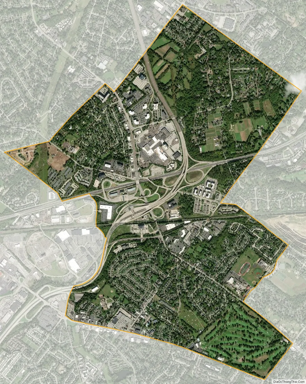
Plymouth Meeting city Satellite Map
Geography
Plymouth Meeting is located primarily within Plymouth Township, with a smaller portion lying within Whitemarsh Township. According to the United States Census Bureau, the CDP has a total area of 3.8 square miles (9.8 km), all land. Plymouth Township is immediately adjacent to the Schuylkill River, but all river frontage is occupied by industry. Currently a bike trail is under development for river access.
Interstate 476 and the Pennsylvania Turnpike pass through the township. The area is easily accessible to Interstate 76 and the “Main Line” points across the river.
See also
Map of Pennsylvania State and its subdivision:- Adams
- Allegheny
- Armstrong
- Beaver
- Bedford
- Berks
- Blair
- Bradford
- Bucks
- Butler
- Cambria
- Cameron
- Carbon
- Centre
- Chester
- Clarion
- Clearfield
- Clinton
- Columbia
- Crawford
- Cumberland
- Dauphin
- Delaware
- Elk
- Erie
- Fayette
- Forest
- Franklin
- Fulton
- Greene
- Huntingdon
- Indiana
- Jefferson
- Juniata
- Lackawanna
- Lancaster
- Lawrence
- Lebanon
- Lehigh
- Luzerne
- Lycoming
- Mc Kean
- Mercer
- Mifflin
- Monroe
- Montgomery
- Montour
- Northampton
- Northumberland
- Perry
- Philadelphia
- Pike
- Potter
- Schuylkill
- Snyder
- Somerset
- Sullivan
- Susquehanna
- Tioga
- Union
- Venango
- Warren
- Washington
- Wayne
- Westmoreland
- Wyoming
- York
- Alabama
- Alaska
- Arizona
- Arkansas
- California
- Colorado
- Connecticut
- Delaware
- District of Columbia
- Florida
- Georgia
- Hawaii
- Idaho
- Illinois
- Indiana
- Iowa
- Kansas
- Kentucky
- Louisiana
- Maine
- Maryland
- Massachusetts
- Michigan
- Minnesota
- Mississippi
- Missouri
- Montana
- Nebraska
- Nevada
- New Hampshire
- New Jersey
- New Mexico
- New York
- North Carolina
- North Dakota
- Ohio
- Oklahoma
- Oregon
- Pennsylvania
- Rhode Island
- South Carolina
- South Dakota
- Tennessee
- Texas
- Utah
- Vermont
- Virginia
- Washington
- West Virginia
- Wisconsin
- Wyoming


