Point Marion is a borough in Fayette County, Pennsylvania, United States. The population was 1,152 at the 2020 census, a decline from the figure of 1,159 tabulated in 2010. It is served by the Albert Gallatin Area School District.
| Name: | Point Marion borough |
|---|---|
| LSAD Code: | 21 |
| LSAD Description: | borough (suffix) |
| State: | Pennsylvania |
| County: | Fayette County |
| Elevation: | 810 ft (250 m) |
| Total Area: | 0.49 sq mi (1.27 km²) |
| Land Area: | 0.41 sq mi (1.05 km²) |
| Water Area: | 0.08 sq mi (0.22 km²) |
| Total Population: | 1,156 |
| Population Density: | 2,854.32/sq mi (1,101.94/km²) |
| ZIP code: | 15474 |
| Area code: | 724 |
| FIPS code: | 4261864 |
Online Interactive Map
Click on ![]() to view map in "full screen" mode.
to view map in "full screen" mode.
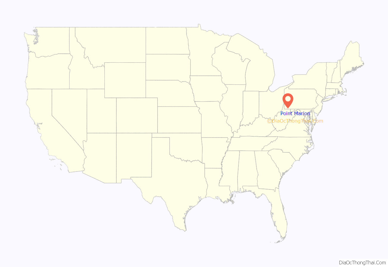
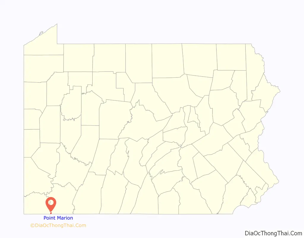
Point Marion location map. Where is Point Marion borough?
History
Point Marion is located at the confluence of the Monongahela and Cheat rivers. Approximately 3 miles (5 km) north of Point Marion is Friendship Hill National Historic Site, home of early American politician Albert Gallatin. Point Marion was settled in the mid-18th century and named in 1842 for its geographic location and Revolutionary War hero Francis Marion, the “Swamp Fox”, a South Carolinian who never saw the town.
Houze Glass Co., located in the borough, was the primary employer. The company was founded by Leon Houze, a Belgian immigrant, in 1902 as a glassware manufacturer, but later branched into silkscreen printing and decorating. The company closed in 2004 and the plant was later auctioned off.
The Albert Gallatin Memorial Bridge across the Monongahela River was listed on the National Register of Historic Places as the Marion Bridge in 1988. It was demolished November 16, 2009, and replaced with a new bridge.
In November 2013, the town disbanded its two-man police department. The department’s insurer dropped coverage after settling a case involving Officer Kevin Lukart. Lukart arrested a man who was recording the policeman. This resulted in a lawsuit and then the end of the policy. Lukart had been previously fired by the police in Apollo, Pennsylvania, after he was charged with exposing himself to a minor, and by police in Braddock, Pennsylvania, when he was filmed attacking a handcuffed man.
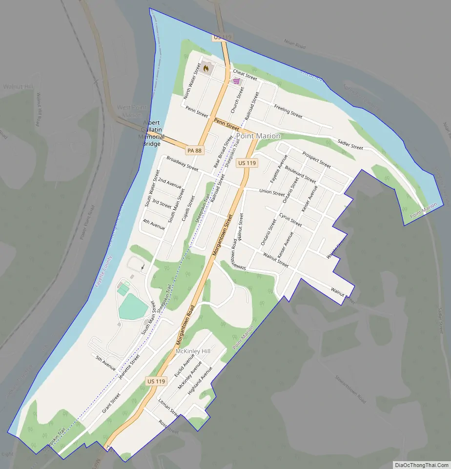
Point Marion Road Map
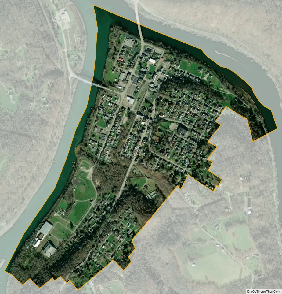
Point Marion city Satellite Map
Geography
Point Marion is located near the southwestern corner of Fayette County at 39°44′9″N 79°53′59″W / 39.73583°N 79.89972°W / 39.73583; -79.89972 (39.735711, -79.899698). It lies within the angle formed by the confluence of the Cheat and Monongahela rivers; the Cheat forms the northeastern boundary of the borough, and the Monongahela forms the western boundary as well as the border with Greene County.
U.S. Route 119 passes through the borough, crossing the Cheat River and leading northeast 17 miles (27 km) to Uniontown, the Fayette County seat, and leading south 10 miles (16 km) to Morgantown, West Virginia. The West Virginia border is 1.5 miles (2.4 km) south of the center of town. Pennsylvania Route 88 crosses the Monongahela River leaving town and leads north 14 miles (23 km) to Carmichaels.
According to the United States Census Bureau, the borough of Point Marion has a total area of 0.47 square miles (1.21 km), of which 0.39 square miles (1.02 km) is land and 0.07 square miles (0.19 km), or 15.77%, is water.
See also
Map of Pennsylvania State and its subdivision:- Adams
- Allegheny
- Armstrong
- Beaver
- Bedford
- Berks
- Blair
- Bradford
- Bucks
- Butler
- Cambria
- Cameron
- Carbon
- Centre
- Chester
- Clarion
- Clearfield
- Clinton
- Columbia
- Crawford
- Cumberland
- Dauphin
- Delaware
- Elk
- Erie
- Fayette
- Forest
- Franklin
- Fulton
- Greene
- Huntingdon
- Indiana
- Jefferson
- Juniata
- Lackawanna
- Lancaster
- Lawrence
- Lebanon
- Lehigh
- Luzerne
- Lycoming
- Mc Kean
- Mercer
- Mifflin
- Monroe
- Montgomery
- Montour
- Northampton
- Northumberland
- Perry
- Philadelphia
- Pike
- Potter
- Schuylkill
- Snyder
- Somerset
- Sullivan
- Susquehanna
- Tioga
- Union
- Venango
- Warren
- Washington
- Wayne
- Westmoreland
- Wyoming
- York
- Alabama
- Alaska
- Arizona
- Arkansas
- California
- Colorado
- Connecticut
- Delaware
- District of Columbia
- Florida
- Georgia
- Hawaii
- Idaho
- Illinois
- Indiana
- Iowa
- Kansas
- Kentucky
- Louisiana
- Maine
- Maryland
- Massachusetts
- Michigan
- Minnesota
- Mississippi
- Missouri
- Montana
- Nebraska
- Nevada
- New Hampshire
- New Jersey
- New Mexico
- New York
- North Carolina
- North Dakota
- Ohio
- Oklahoma
- Oregon
- Pennsylvania
- Rhode Island
- South Carolina
- South Dakota
- Tennessee
- Texas
- Utah
- Vermont
- Virginia
- Washington
- West Virginia
- Wisconsin
- Wyoming