Pomeroy is a census-designated place (CDP) in Sadsbury Township, Chester County, Pennsylvania, United States. The population was 401 at the 2010 census.
It was once the northern terminus of the Pomeroy and Newark Railroad.
| Name: | Pomeroy CDP |
|---|---|
| LSAD Code: | 57 |
| LSAD Description: | CDP (suffix) |
| State: | Pennsylvania |
| County: | Chester County |
| Elevation: | 484 ft (148 m) |
| Total Area: | 0.47 sq mi (1.21 km²) |
| Land Area: | 0.47 sq mi (1.20 km²) |
| Water Area: | 0.00 sq mi (0.01 km²) |
| Total Population: | 1,085 |
| Population Density: | 2,333.33/sq mi (901.77/km²) |
| ZIP code: | 19367 |
| Area code: | 610 and 484 |
| FIPS code: | 4261968 |
Online Interactive Map
Click on ![]() to view map in "full screen" mode.
to view map in "full screen" mode.
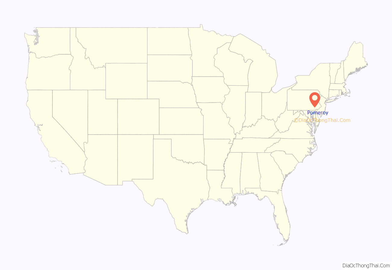
Pomeroy location map. Where is Pomeroy CDP?
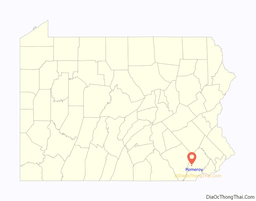
Pomeroy Road Map
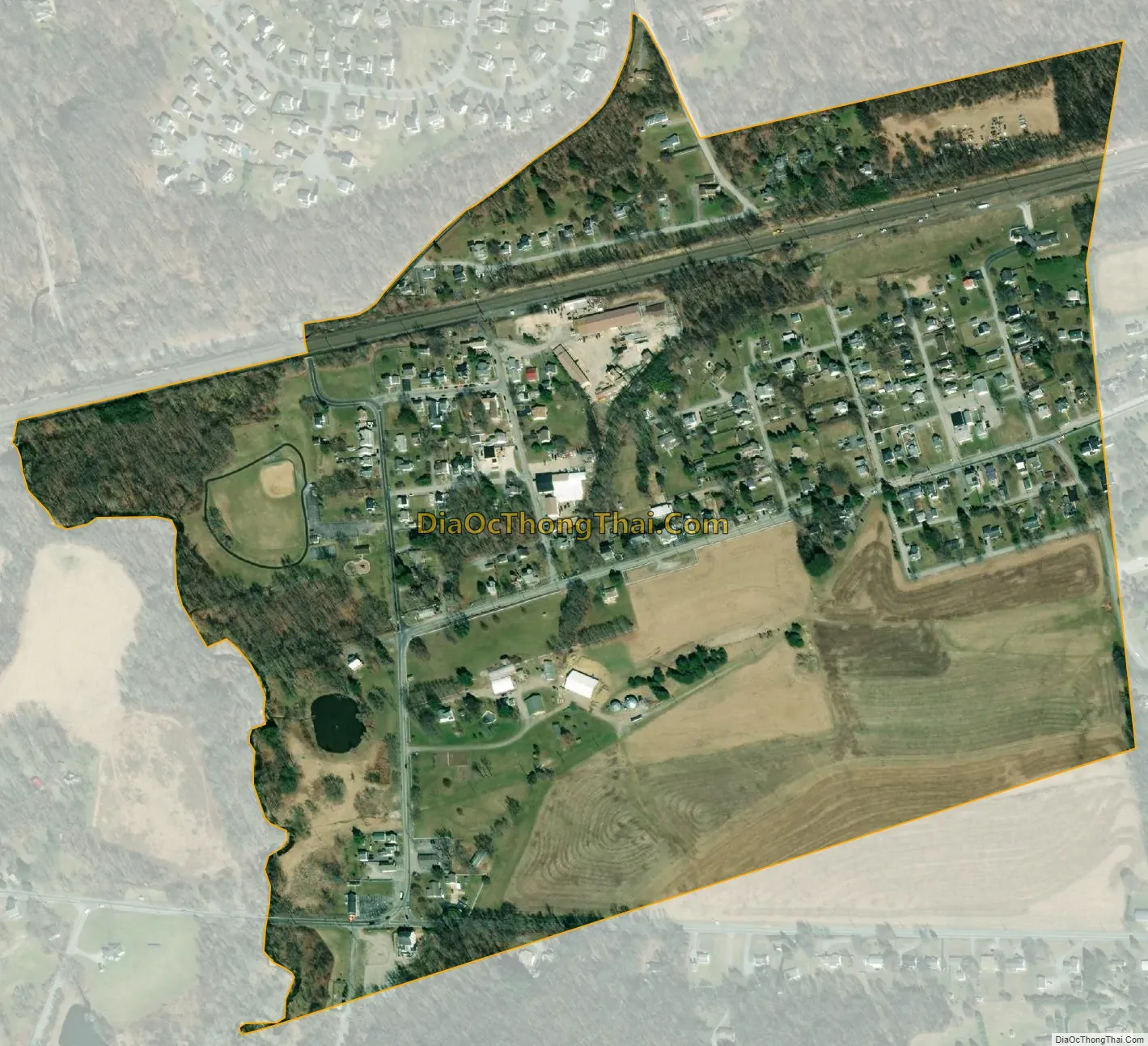
Pomeroy city Satellite Map
Geography
Pomeroy is located at 39°57′51″N 75°53′11″W / 39.96417°N 75.88639°W / 39.96417; -75.88639 in the southeast corner of Sadsbury Township. Pennsylvania Route 372 passes through the center of the village, connecting Coatesville 3 miles (5 km) to the east with Parkesburg 1 mile (1.6 km) to the west.
According to the United States Census Bureau, the CDP has a total area of 0.33 square miles (0.86 km), of which 0.33 square miles (0.85 km) is land and 0.004 square miles (0.01 km), or 0.88%, is water.
See also
Map of Pennsylvania State and its subdivision:- Adams
- Allegheny
- Armstrong
- Beaver
- Bedford
- Berks
- Blair
- Bradford
- Bucks
- Butler
- Cambria
- Cameron
- Carbon
- Centre
- Chester
- Clarion
- Clearfield
- Clinton
- Columbia
- Crawford
- Cumberland
- Dauphin
- Delaware
- Elk
- Erie
- Fayette
- Forest
- Franklin
- Fulton
- Greene
- Huntingdon
- Indiana
- Jefferson
- Juniata
- Lackawanna
- Lancaster
- Lawrence
- Lebanon
- Lehigh
- Luzerne
- Lycoming
- Mc Kean
- Mercer
- Mifflin
- Monroe
- Montgomery
- Montour
- Northampton
- Northumberland
- Perry
- Philadelphia
- Pike
- Potter
- Schuylkill
- Snyder
- Somerset
- Sullivan
- Susquehanna
- Tioga
- Union
- Venango
- Warren
- Washington
- Wayne
- Westmoreland
- Wyoming
- York
- Alabama
- Alaska
- Arizona
- Arkansas
- California
- Colorado
- Connecticut
- Delaware
- District of Columbia
- Florida
- Georgia
- Hawaii
- Idaho
- Illinois
- Indiana
- Iowa
- Kansas
- Kentucky
- Louisiana
- Maine
- Maryland
- Massachusetts
- Michigan
- Minnesota
- Mississippi
- Missouri
- Montana
- Nebraska
- Nevada
- New Hampshire
- New Jersey
- New Mexico
- New York
- North Carolina
- North Dakota
- Ohio
- Oklahoma
- Oregon
- Pennsylvania
- Rhode Island
- South Carolina
- South Dakota
- Tennessee
- Texas
- Utah
- Vermont
- Virginia
- Washington
- West Virginia
- Wisconsin
- Wyoming