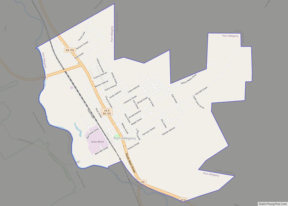
Port Allegany is a borough in McKean County, Pennsylvania, United States. The population was 2,116 at the 2020 census.
The town’s tree-lined streets lie in the foothills of the Appalachian Mountains, 30 miles west of the Allegheny River’s headwaters.
| Name: | Port Allegany borough |
|---|---|
| LSAD Code: | 21 |
| LSAD Description: | borough (suffix) |
| State: | Pennsylvania |
| County: | McKean County |
| Incorporated: | 1882 |
| Total Area: | 1.78 sq mi (4.61 km²) |
| Land Area: | 1.77 sq mi (4.59 km²) |
| Water Area: | 0.01 sq mi (0.02 km²) |
| Total Population: | 2,135 |
| Population Density: | 1,204.17/sq mi (464.83/km²) |
| Area code: | 814 |
| FIPS code: | 4262088 |
Online Interactive Map
Click on ![]() to view map in "full screen" mode.
to view map in "full screen" mode.
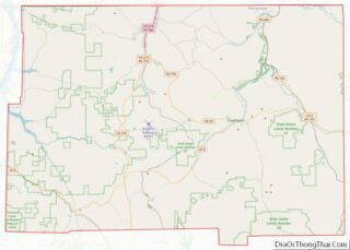
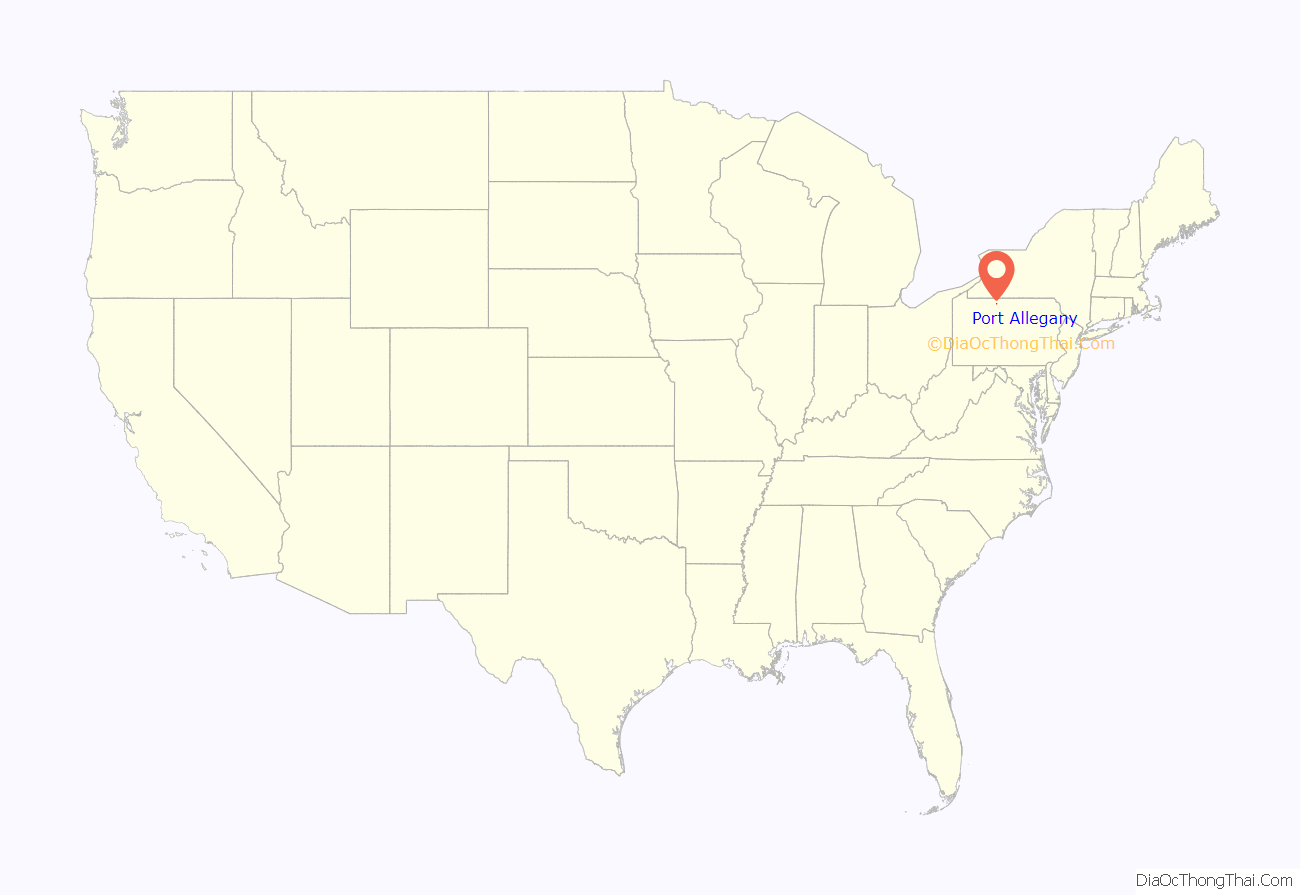
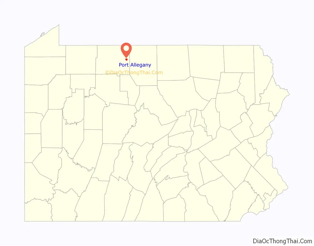
Port Allegany location map. Where is Port Allegany borough?
History
Originally known as Canoe Place, the town’s name was changed to Port Allegany in 1838. It is unusual among places in Pennsylvania that make reference to the Allegheny River; it used the spelling “Allegany,” more commonly encountered in place names in neighboring New York.
The town developed as a port on the Allegheny River, and provided a place where travelers coming overland from the Susquehanna River could continue by boat.
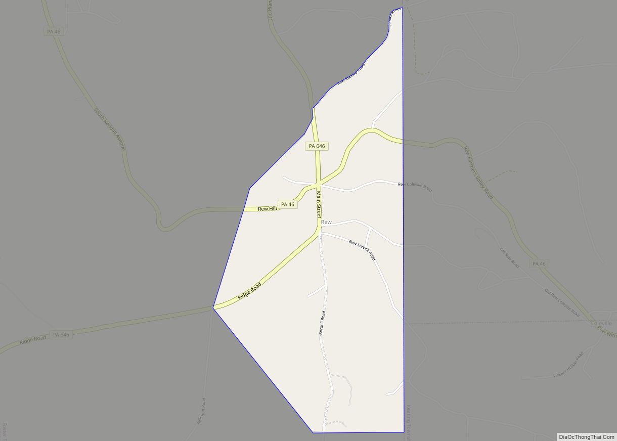
Port Allegany Road Map

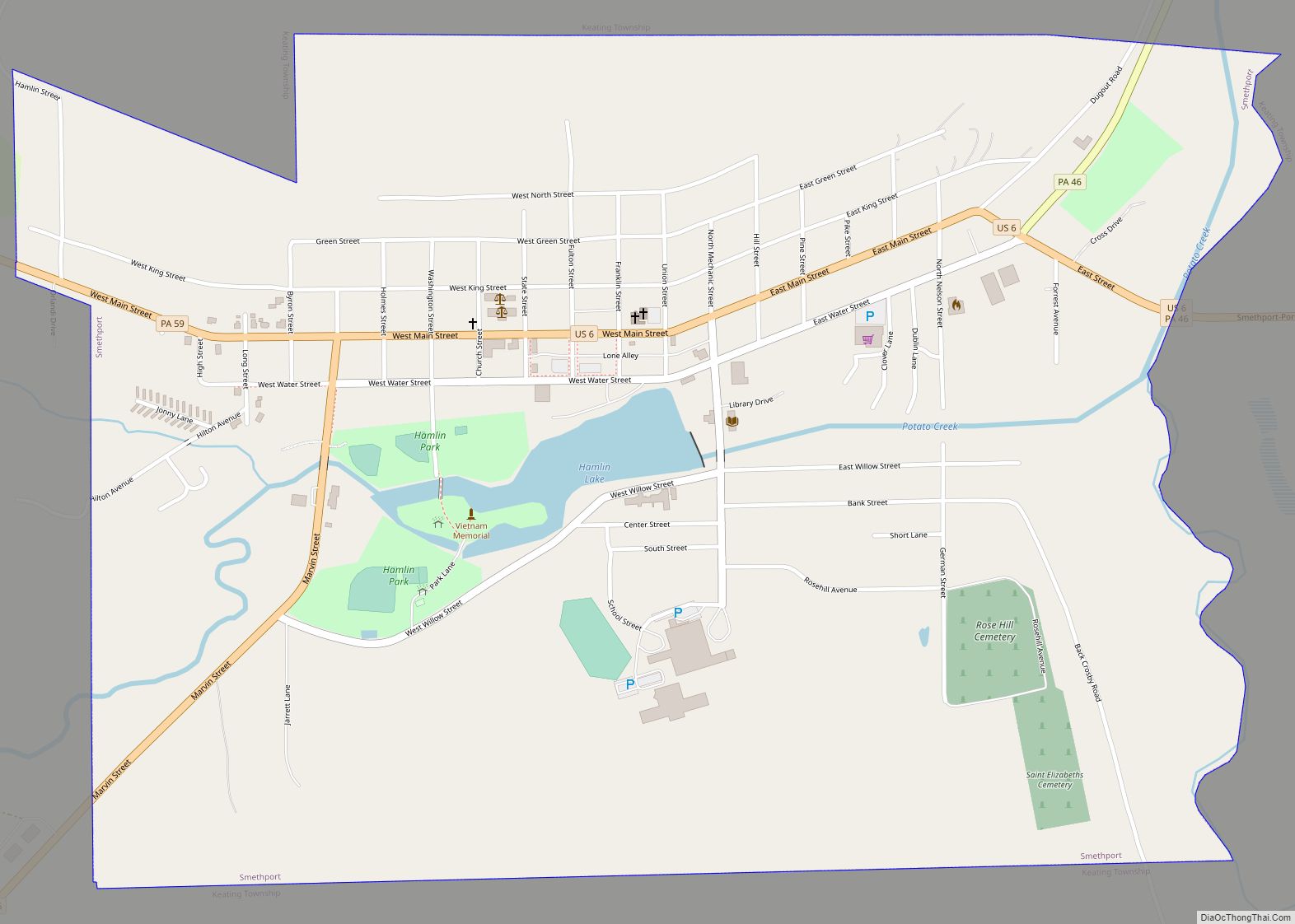
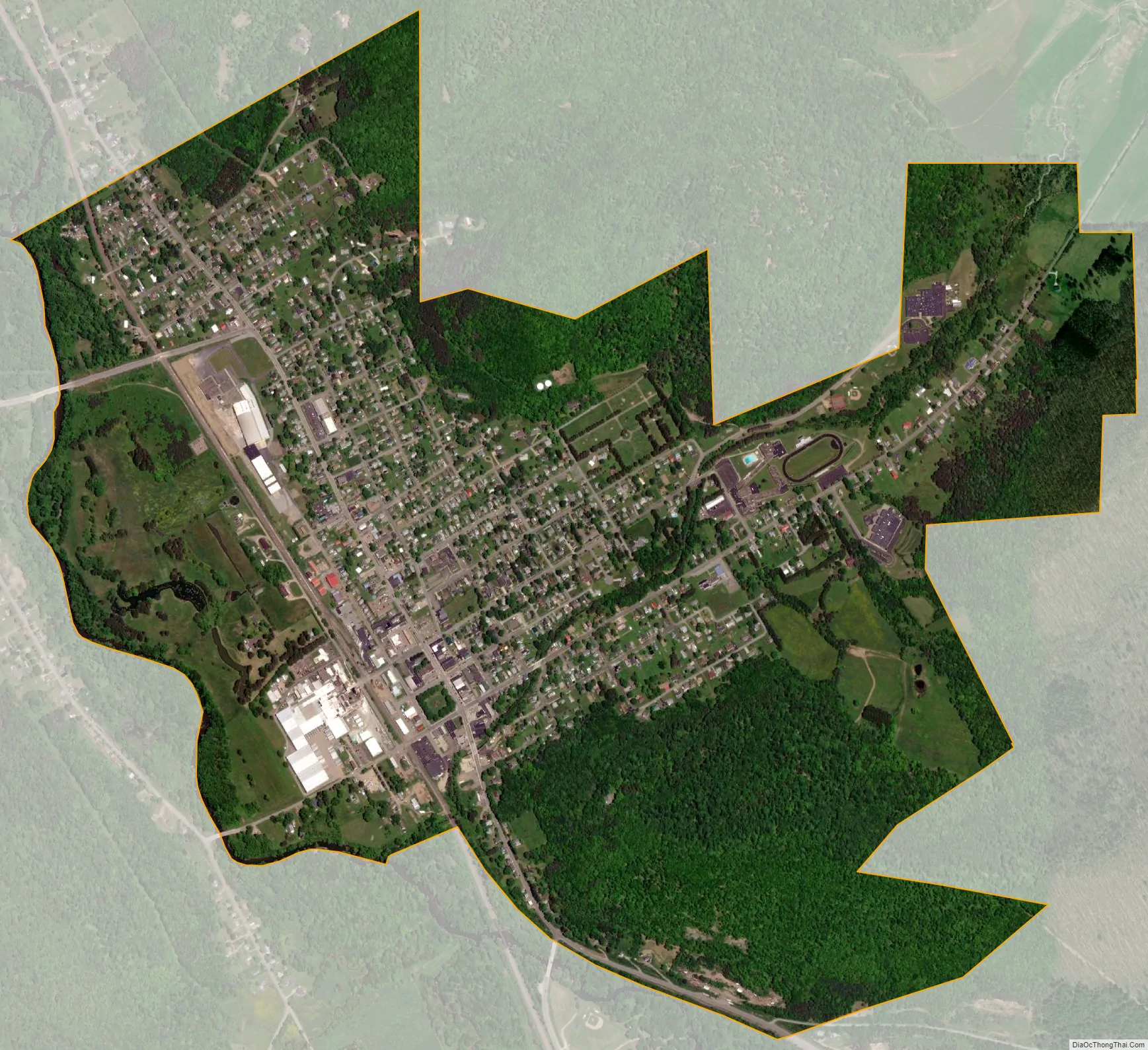
Port Allegany city Satellite Map
Geography
Port Allegany is located at 41°48′54″N 78°16′45″W / 41.81500°N 78.27917°W / 41.81500; -78.27917 (41.814919, -78.279218).
According to the United States Census Bureau, the borough has a total area of 1.8 square miles (4.7 km), all land.
Port Allegany is located in McKean County, which is generally considered to be part of the Northern Pennsylvania region (and sometimes part of the Northern Tier region). This part of the state is rural and heavily forested.
Before the arrival of the first European settlers, the area was densely forested with Eastern Hemlock. Many of these sometimes massive trees were cut for lumber or sometimes only for their bark, which was used in the tanning industry. The rough and ready lifestyles and skills of the men who did this work are commemorated each year at the “Barkpeelers’ Festival” at the Pennsylvania Lumber Museum in nearby Ulysses, Pennsylvania. Many older homes, barns and other buildings in the region were at least partly built with hemlock lumber.
The contemporary forests in the region produce high quality black cherry lumber, valued in the furniture and cabinetry industries. While there are currently no working furniture factories in the region, the trade in black cherry continues.
See also
Map of Pennsylvania State and its subdivision:- Adams
- Allegheny
- Armstrong
- Beaver
- Bedford
- Berks
- Blair
- Bradford
- Bucks
- Butler
- Cambria
- Cameron
- Carbon
- Centre
- Chester
- Clarion
- Clearfield
- Clinton
- Columbia
- Crawford
- Cumberland
- Dauphin
- Delaware
- Elk
- Erie
- Fayette
- Forest
- Franklin
- Fulton
- Greene
- Huntingdon
- Indiana
- Jefferson
- Juniata
- Lackawanna
- Lancaster
- Lawrence
- Lebanon
- Lehigh
- Luzerne
- Lycoming
- Mc Kean
- Mercer
- Mifflin
- Monroe
- Montgomery
- Montour
- Northampton
- Northumberland
- Perry
- Philadelphia
- Pike
- Potter
- Schuylkill
- Snyder
- Somerset
- Sullivan
- Susquehanna
- Tioga
- Union
- Venango
- Warren
- Washington
- Wayne
- Westmoreland
- Wyoming
- York
- Alabama
- Alaska
- Arizona
- Arkansas
- California
- Colorado
- Connecticut
- Delaware
- District of Columbia
- Florida
- Georgia
- Hawaii
- Idaho
- Illinois
- Indiana
- Iowa
- Kansas
- Kentucky
- Louisiana
- Maine
- Maryland
- Massachusetts
- Michigan
- Minnesota
- Mississippi
- Missouri
- Montana
- Nebraska
- Nevada
- New Hampshire
- New Jersey
- New Mexico
- New York
- North Carolina
- North Dakota
- Ohio
- Oklahoma
- Oregon
- Pennsylvania
- Rhode Island
- South Carolina
- South Dakota
- Tennessee
- Texas
- Utah
- Vermont
- Virginia
- Washington
- West Virginia
- Wisconsin
- Wyoming