Rockhill or Rockhill Furnace is a borough in Huntingdon County, Pennsylvania, United States. The population was 371 at the 2010 census, down from 414 at the 2000 census. It is the site of the East Broad Top Railroad and the Rockhill Trolley Museum.
Although the community was long known as “Rockhill Furnace”, its name has always officially been “Rockhill”.
| Name: | Rockhill borough |
|---|---|
| LSAD Code: | 21 |
| LSAD Description: | borough (suffix) |
| State: | Pennsylvania |
| County: | Huntingdon County |
| Total Area: | 0.29 sq mi (0.75 km²) |
| Land Area: | 0.29 sq mi (0.75 km²) |
| Water Area: | 0.00 sq mi (0.00 km²) |
| Total Population: | 379 |
| Population Density: | 1,302.41/sq mi (502.91/km²) |
| ZIP code: | 17249 |
| Area code: | 814 |
| FIPS code: | 4265496 |
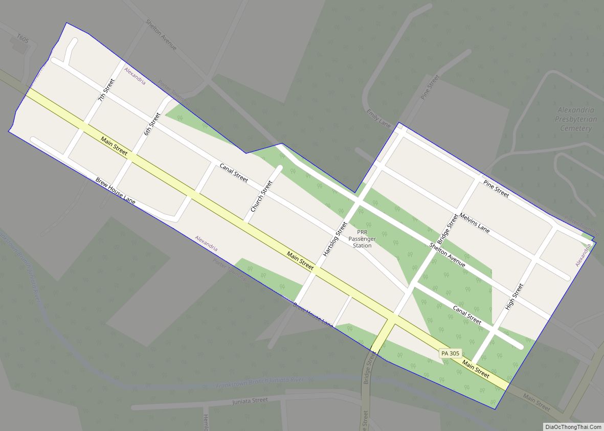
Online Interactive Map
Click on ![]() to view map in "full screen" mode.
to view map in "full screen" mode.
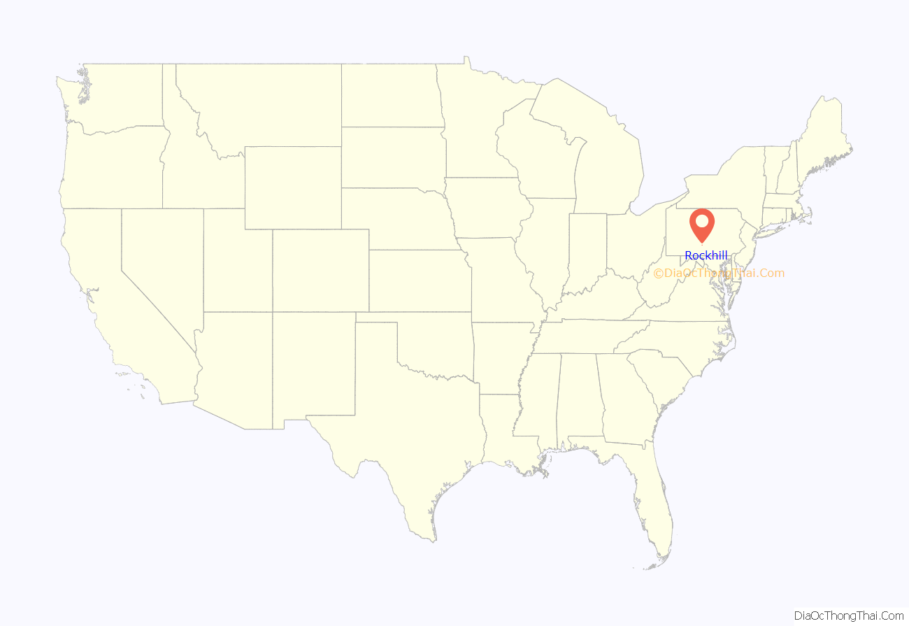
Rockhill location map. Where is Rockhill borough?
History
The narrow-gauge East Broad Top Railroad was constructed through the community in 1873. Rockhill was selected as the location of the railroad’s maintenance facility. The parent company Rockhill Iron and Coal located their dual-stack coke-fired iron furnace here. Rockhill as it exists today was created by the coal company and the railroad as a support community for their infrastructure.
The iron furnace shut down for the last time in 1907, and the railroad became the primary employer. The EBT shut down in 1956, but a portion from Rockhill north to Shirleysburg was reactivated in 1960 as a tourist operation. In the late 2000s the track to the south was rehabilitated to PA 475 sufficiently for speeders to operate and give rides to the public. In 2022, trackage was restored to the wye at Colgate Grove, with reproduction passenger cars powered by a small diesel locomotive. On February 18, 2023, their steam locomotive, #16, rode the rails again for the first time since 1956, carrying passengers to Colgate Grove.
Friends of the East Broad Top, Inc. have been working to provide rehabilitation to the facilities in Rockhill. Tours inside the East Broad Top shop complex are offered during the summer months.
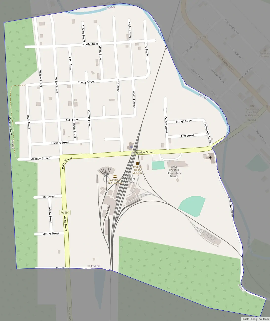
Rockhill Road Map
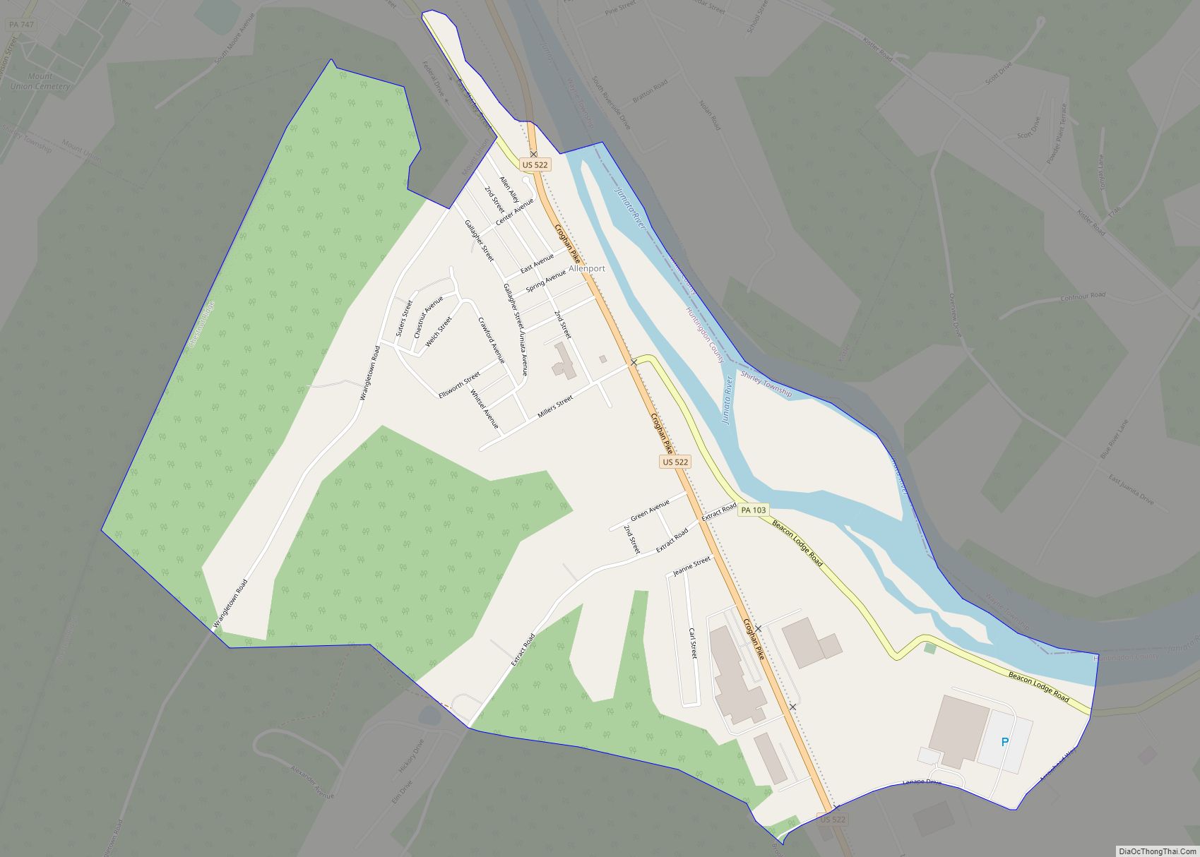
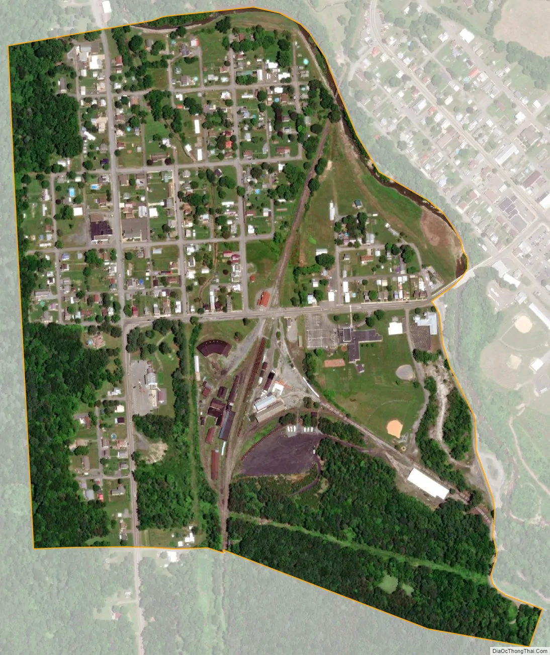
Rockhill city Satellite Map
Geography
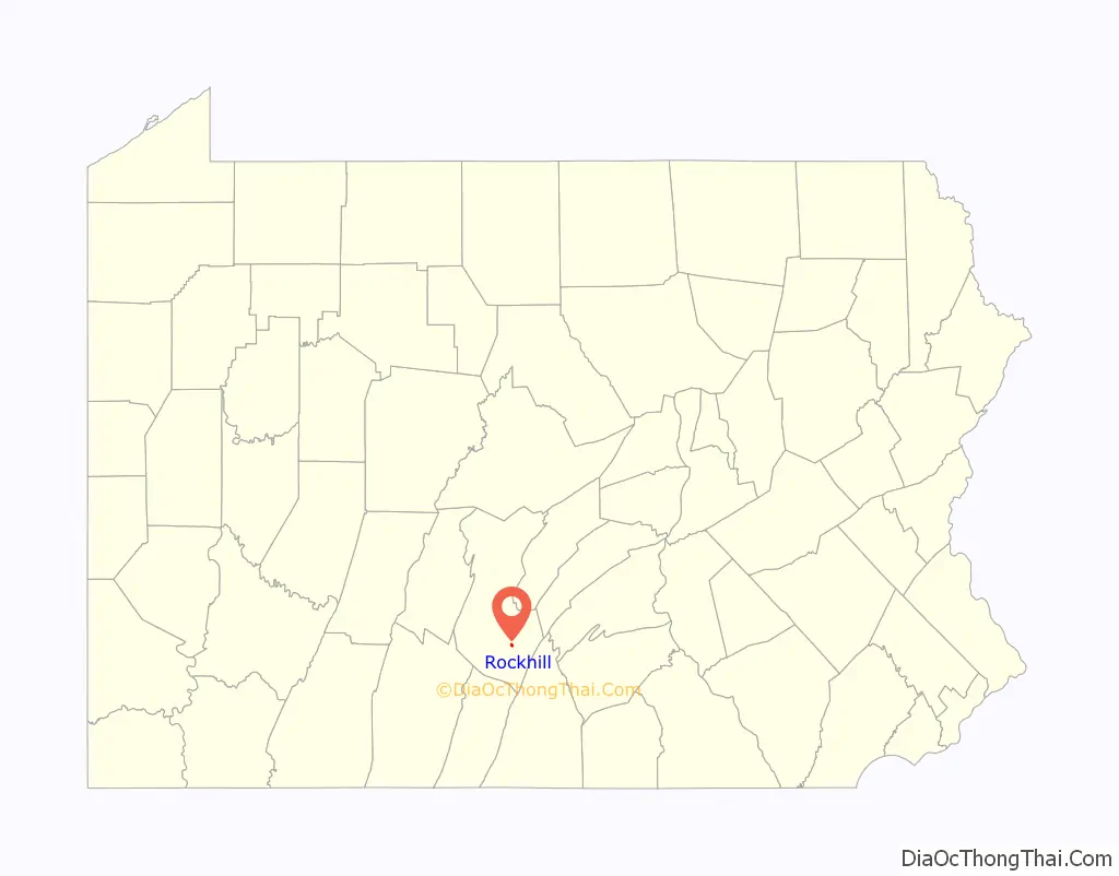
Rockhill is located in southern Huntingdon County at 40°14′35″N 77°54′2″W / 40.24306°N 77.90056°W / 40.24306; -77.90056 (40.242927, -77.900433). It sits on the southwestern side of Blacklog Creek, across from its neighbor, the borough of Orbisonia. It is bordered to the west by 920-foot-high (280 m) Saddle Back Ridge. Pennsylvania Route 994 passes through Rockhill, ending to the north in Orbisonia at U.S. Route 522 and leading southwest 6 miles (10 km) to Three Springs.
According to the United States Census Bureau, Rockhill borough has a total area of 0.29 square miles (0.75 km), all land.
See also
Map of Pennsylvania State and its subdivision:- Adams
- Allegheny
- Armstrong
- Beaver
- Bedford
- Berks
- Blair
- Bradford
- Bucks
- Butler
- Cambria
- Cameron
- Carbon
- Centre
- Chester
- Clarion
- Clearfield
- Clinton
- Columbia
- Crawford
- Cumberland
- Dauphin
- Delaware
- Elk
- Erie
- Fayette
- Forest
- Franklin
- Fulton
- Greene
- Huntingdon
- Indiana
- Jefferson
- Juniata
- Lackawanna
- Lancaster
- Lawrence
- Lebanon
- Lehigh
- Luzerne
- Lycoming
- Mc Kean
- Mercer
- Mifflin
- Monroe
- Montgomery
- Montour
- Northampton
- Northumberland
- Perry
- Philadelphia
- Pike
- Potter
- Schuylkill
- Snyder
- Somerset
- Sullivan
- Susquehanna
- Tioga
- Union
- Venango
- Warren
- Washington
- Wayne
- Westmoreland
- Wyoming
- York
- Alabama
- Alaska
- Arizona
- Arkansas
- California
- Colorado
- Connecticut
- Delaware
- District of Columbia
- Florida
- Georgia
- Hawaii
- Idaho
- Illinois
- Indiana
- Iowa
- Kansas
- Kentucky
- Louisiana
- Maine
- Maryland
- Massachusetts
- Michigan
- Minnesota
- Mississippi
- Missouri
- Montana
- Nebraska
- Nevada
- New Hampshire
- New Jersey
- New Mexico
- New York
- North Carolina
- North Dakota
- Ohio
- Oklahoma
- Oregon
- Pennsylvania
- Rhode Island
- South Carolina
- South Dakota
- Tennessee
- Texas
- Utah
- Vermont
- Virginia
- Washington
- West Virginia
- Wisconsin
- Wyoming