Roseville is a borough in Tioga County, Pennsylvania, United States. The population was 177 at the 2020 census.
| Name: | Roseville borough |
|---|---|
| LSAD Code: | 21 |
| LSAD Description: | borough (suffix) |
| State: | Pennsylvania |
| County: | Tioga County |
| Elevation: | 1,342 ft (409 m) |
| Total Area: | 0.47 sq mi (1.23 km²) |
| Land Area: | 0.47 sq mi (1.23 km²) |
| Water Area: | 0.00 sq mi (0.00 km²) |
| Total Population: | 177 |
| Population Density: | 387.37/sq mi (149.43/km²) |
| Area code: | 570 |
| FIPS code: | 4266232 |
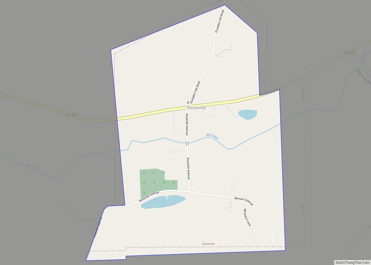
Online Interactive Map
Click on ![]() to view map in "full screen" mode.
to view map in "full screen" mode.
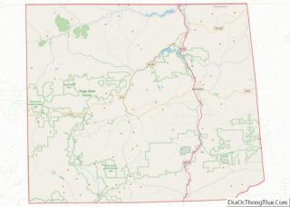
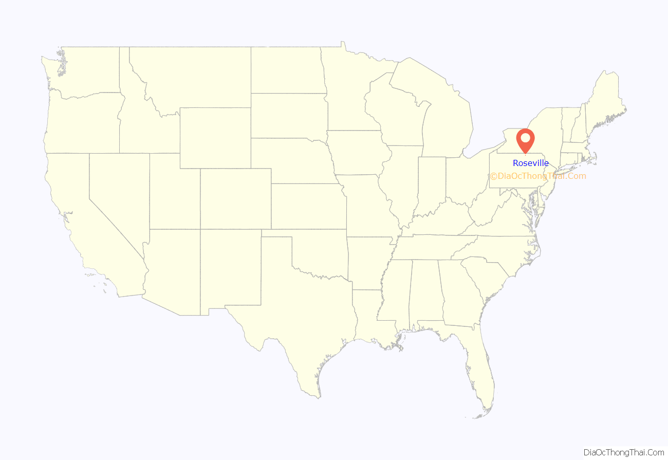
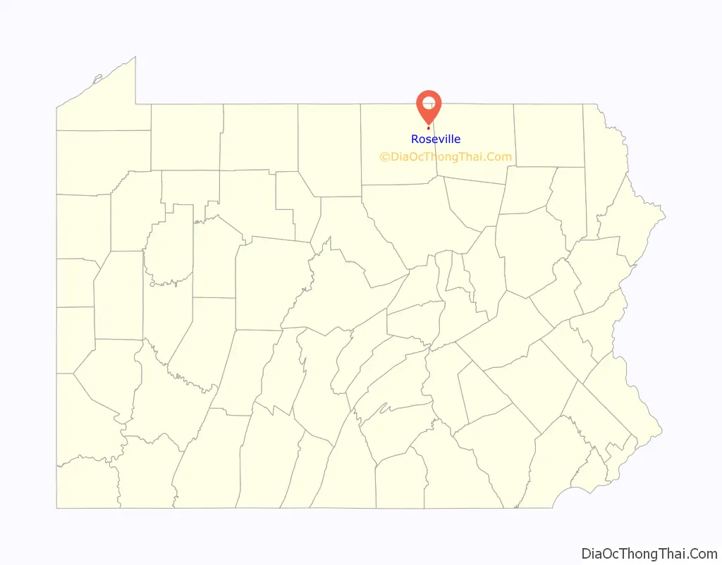
Roseville location map. Where is Roseville borough?
History
Roseville was first settled by its namesake, Dr. William Rose in 1806. Dr. Rose migrated to Tioga County from Rutland, Vermont. He served as a frontier doctor for the citizens of eastern Tioga and western Bradford Counties. Rose built a distillery at Roseville in 1822, soon after his son, William Rose Jr., opened a tavern. The tavern quickly became the center of commerce in Roseville. The tavern was replaced by a hotel built to serve the needs to travelers between Mansfield and Elmira, New York.
Roseville was home to several businesses that served the needs of the people of Tioga County during the late 1800s and early 1900s. A gristmill was opened as was a cheese factory and a paint plant, but the principal form of business remained in the taverns along the highway. A devastating fire in 1888 destroyed 23 buildings in Roseville, thus ending the tavern era.
Roseville formerly had a post office and a public school. The post office, Rutland Post Office, was closed in 1957. The public school was closed in 1966 when Roseville’s school system became part of the Mansfield school system, which later was consolidated into the Southern Tioga School District.
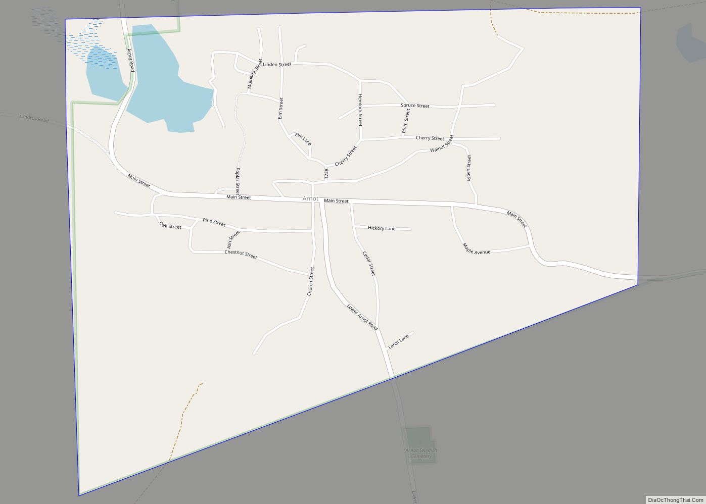
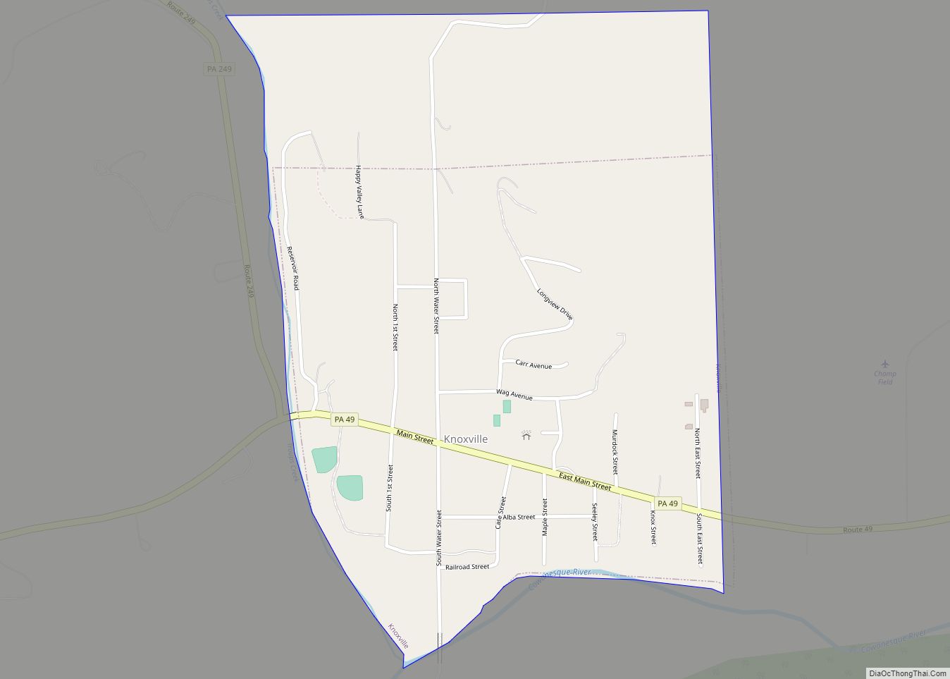
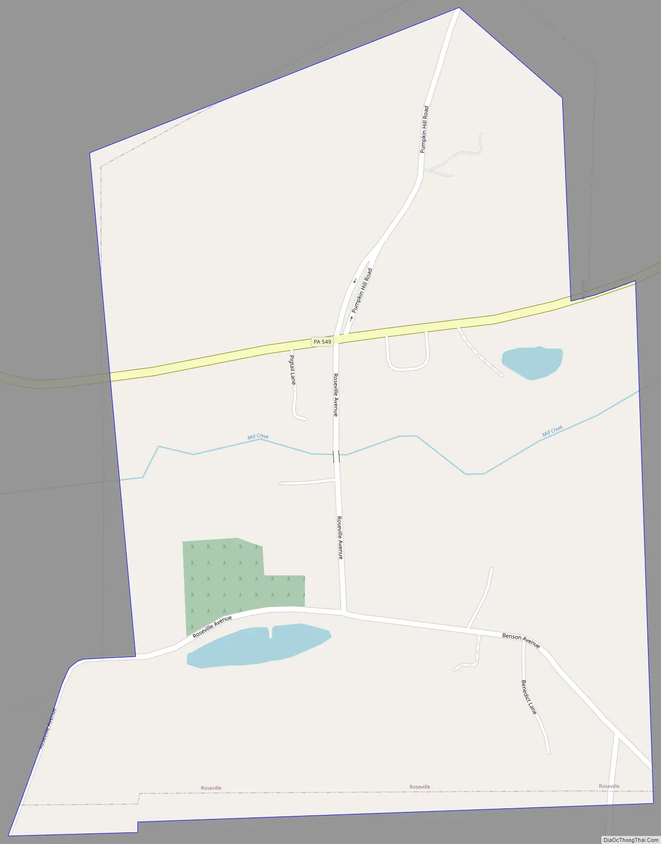
Roseville Road Map
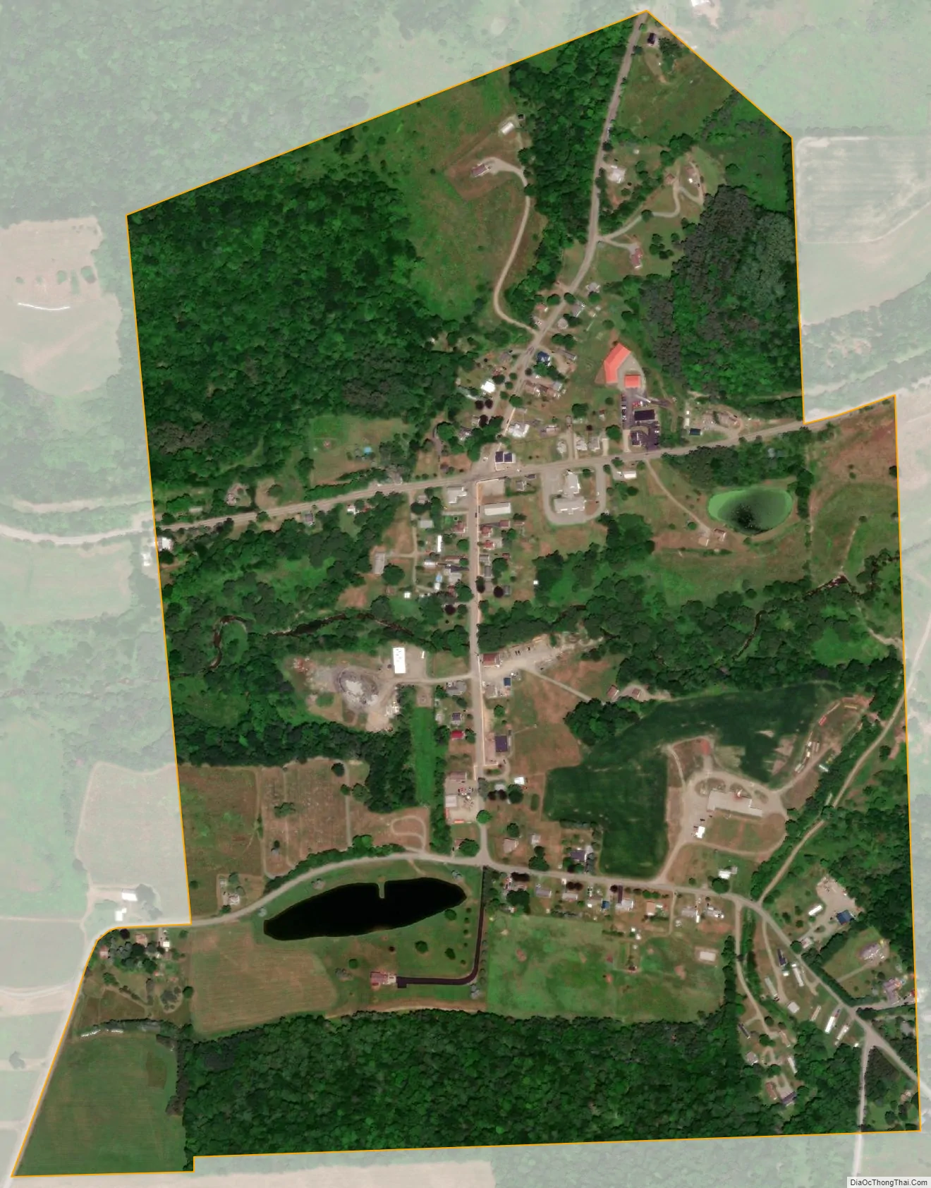
Roseville city Satellite Map
Geography
Roseville is located at 41°51′51″N 76°57′34″W / 41.86417°N 76.95944°W / 41.86417; -76.95944 (41.864305, -76.959348).
According to the United States Census Bureau, the borough has a total area of 0.5 square miles (1.3 km), all land.
Roseville is surrounded by Rutland Township.
See also
Map of Pennsylvania State and its subdivision:- Adams
- Allegheny
- Armstrong
- Beaver
- Bedford
- Berks
- Blair
- Bradford
- Bucks
- Butler
- Cambria
- Cameron
- Carbon
- Centre
- Chester
- Clarion
- Clearfield
- Clinton
- Columbia
- Crawford
- Cumberland
- Dauphin
- Delaware
- Elk
- Erie
- Fayette
- Forest
- Franklin
- Fulton
- Greene
- Huntingdon
- Indiana
- Jefferson
- Juniata
- Lackawanna
- Lancaster
- Lawrence
- Lebanon
- Lehigh
- Luzerne
- Lycoming
- Mc Kean
- Mercer
- Mifflin
- Monroe
- Montgomery
- Montour
- Northampton
- Northumberland
- Perry
- Philadelphia
- Pike
- Potter
- Schuylkill
- Snyder
- Somerset
- Sullivan
- Susquehanna
- Tioga
- Union
- Venango
- Warren
- Washington
- Wayne
- Westmoreland
- Wyoming
- York
- Alabama
- Alaska
- Arizona
- Arkansas
- California
- Colorado
- Connecticut
- Delaware
- District of Columbia
- Florida
- Georgia
- Hawaii
- Idaho
- Illinois
- Indiana
- Iowa
- Kansas
- Kentucky
- Louisiana
- Maine
- Maryland
- Massachusetts
- Michigan
- Minnesota
- Mississippi
- Missouri
- Montana
- Nebraska
- Nevada
- New Hampshire
- New Jersey
- New Mexico
- New York
- North Carolina
- North Dakota
- Ohio
- Oklahoma
- Oregon
- Pennsylvania
- Rhode Island
- South Carolina
- South Dakota
- Tennessee
- Texas
- Utah
- Vermont
- Virginia
- Washington
- West Virginia
- Wisconsin
- Wyoming