Sand Hill is an unincorporated community and census-designated place (CDP) in Lebanon County, Pennsylvania, United States. The population was 2,496 at the 2010 census.
| Name: | Sand Hill CDP |
|---|---|
| LSAD Code: | 57 |
| LSAD Description: | CDP (suffix) |
| State: | Pennsylvania |
| County: | Lebanon County |
| Elevation: | 620 ft (190 m) |
| Total Area: | 1.01 sq mi (2.61 km²) |
| Land Area: | 1.01 sq mi (2.61 km²) |
| Water Area: | 0.0 sq mi (0.0 km²) |
| Total Population: | 2,496 |
| Population Density: | 2,478/sq mi (956.6/km²) |
| FIPS code: | 4267744 |
| GNISfeature ID: | 1186905 |
Online Interactive Map
Click on ![]() to view map in "full screen" mode.
to view map in "full screen" mode.
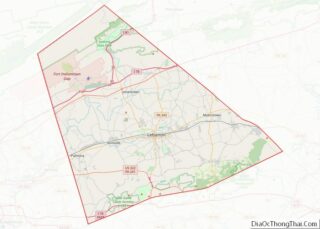
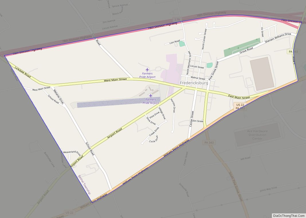
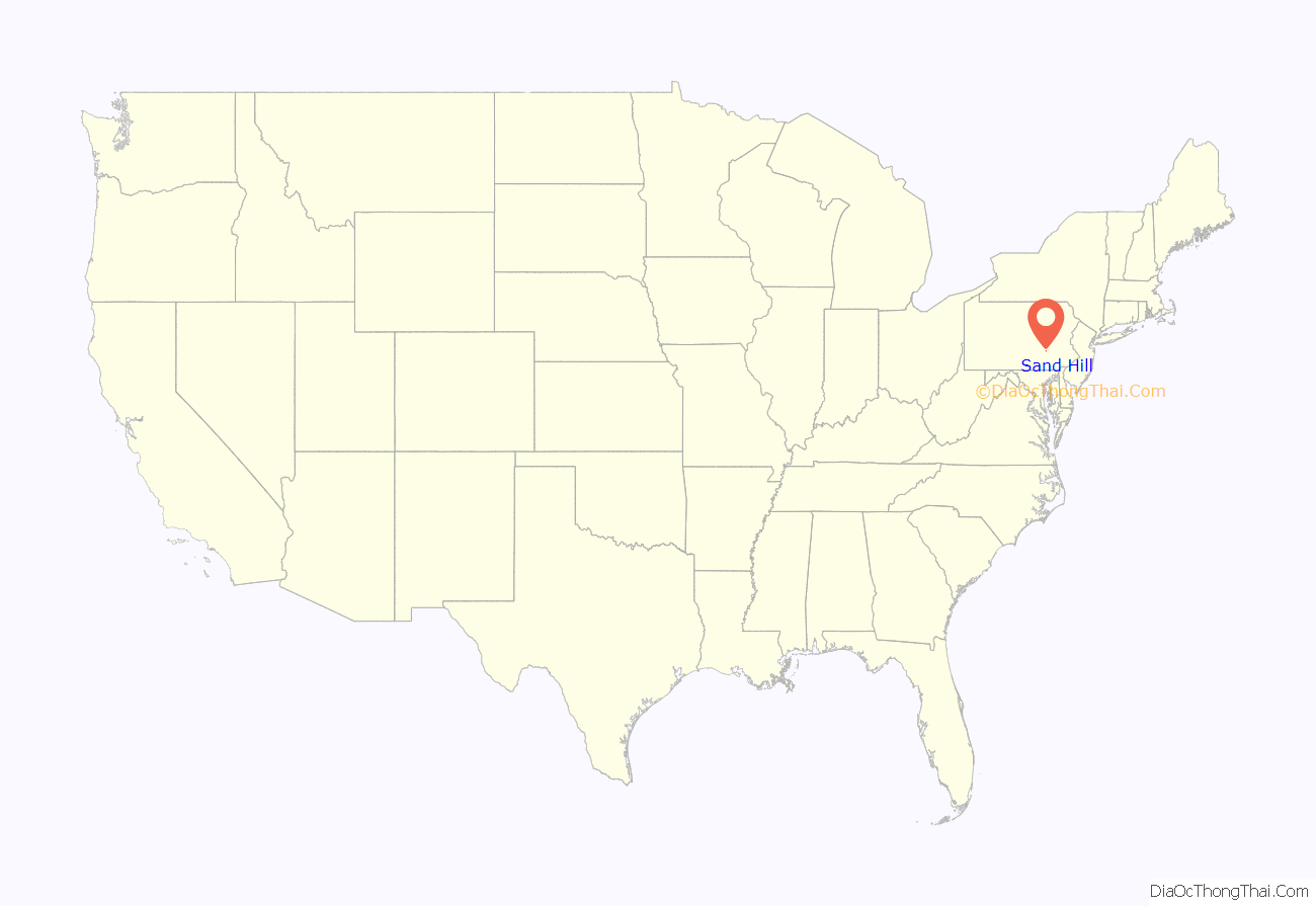
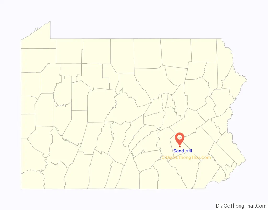
Sand Hill location map. Where is Sand Hill CDP?
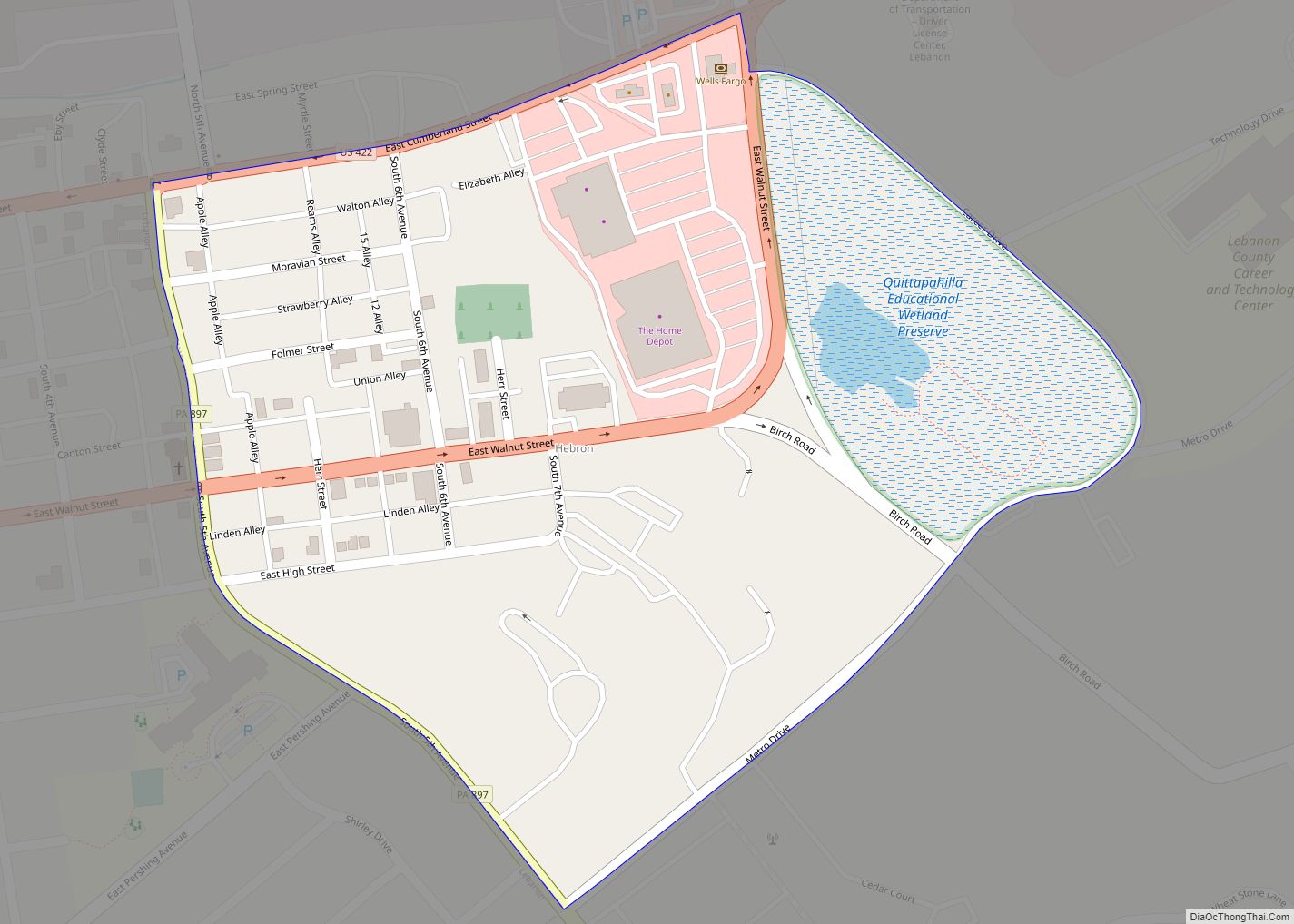
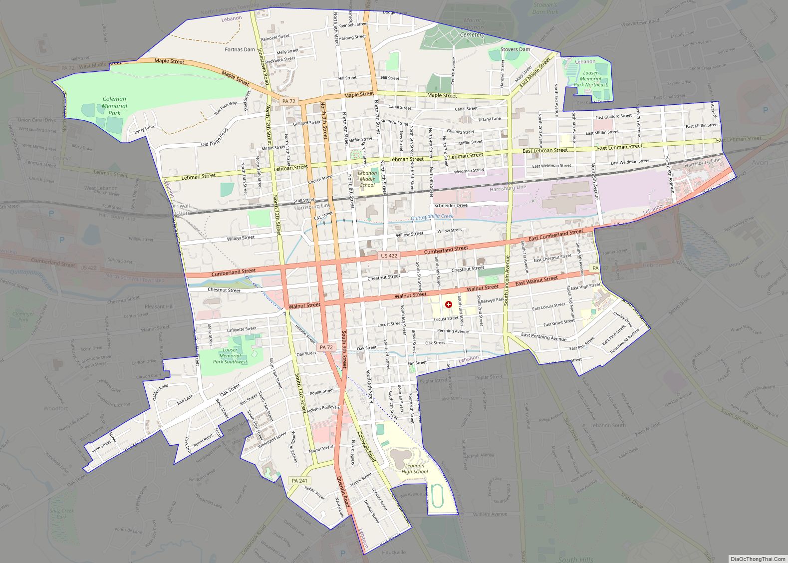
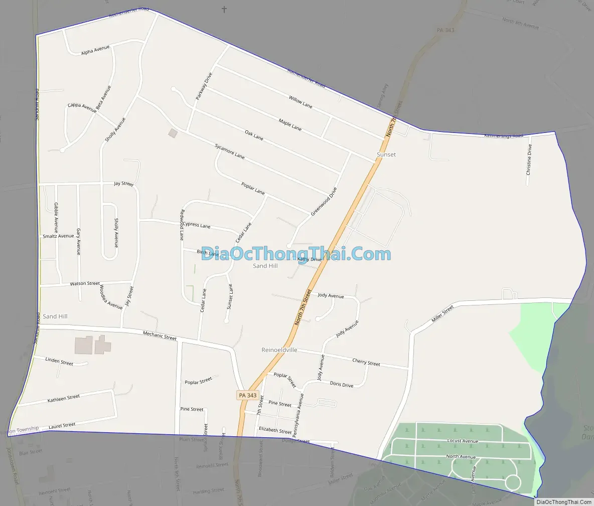
Sand Hill Road Map
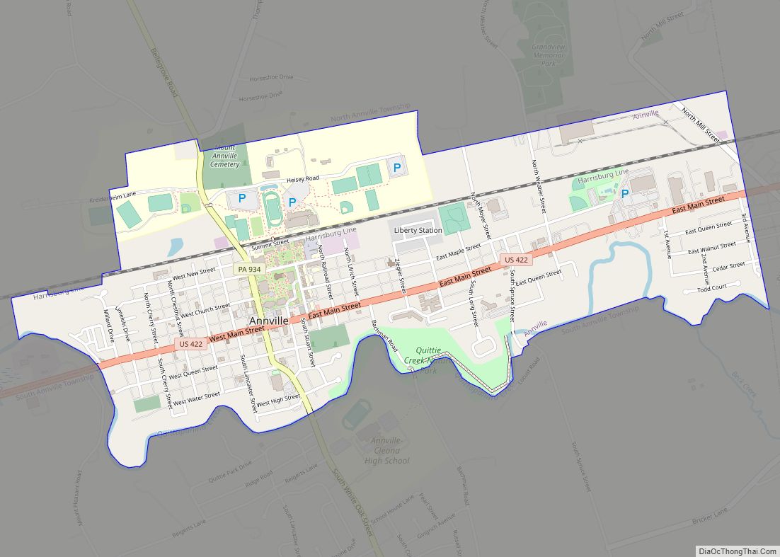
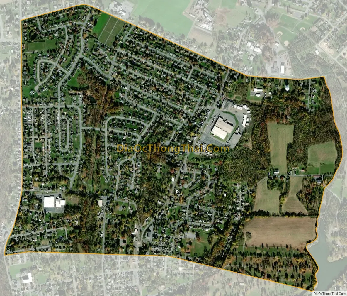
Sand Hill city Satellite Map
Geography
Sand Hill is located in central Lebanon County, in main North Lebanon Township. It is bordered to the south by the city of Lebanon, the county seat. The Sand Hill CDP includes the neighborhoods of Sand Hill, Sunset, and Reinohlsville. Pennsylvania Route 343 (North 7th Street) passes through the community, leading north 6 miles (10 km) to Fredericksburg and south into Lebanon.
According to the United States Census Bureau, the CDP has a total area of 1.0 square mile (2.6 km), all land. The community sits on the slopes of the hill that forms the north side of the Lebanon Valley. Streams in the CDP drain south to Brandywine Creek, which continues south to Quittapahilla Creek in the center of the valley.
See also
Map of Pennsylvania State and its subdivision:- Adams
- Allegheny
- Armstrong
- Beaver
- Bedford
- Berks
- Blair
- Bradford
- Bucks
- Butler
- Cambria
- Cameron
- Carbon
- Centre
- Chester
- Clarion
- Clearfield
- Clinton
- Columbia
- Crawford
- Cumberland
- Dauphin
- Delaware
- Elk
- Erie
- Fayette
- Forest
- Franklin
- Fulton
- Greene
- Huntingdon
- Indiana
- Jefferson
- Juniata
- Lackawanna
- Lancaster
- Lawrence
- Lebanon
- Lehigh
- Luzerne
- Lycoming
- Mc Kean
- Mercer
- Mifflin
- Monroe
- Montgomery
- Montour
- Northampton
- Northumberland
- Perry
- Philadelphia
- Pike
- Potter
- Schuylkill
- Snyder
- Somerset
- Sullivan
- Susquehanna
- Tioga
- Union
- Venango
- Warren
- Washington
- Wayne
- Westmoreland
- Wyoming
- York
- Alabama
- Alaska
- Arizona
- Arkansas
- California
- Colorado
- Connecticut
- Delaware
- District of Columbia
- Florida
- Georgia
- Hawaii
- Idaho
- Illinois
- Indiana
- Iowa
- Kansas
- Kentucky
- Louisiana
- Maine
- Maryland
- Massachusetts
- Michigan
- Minnesota
- Mississippi
- Missouri
- Montana
- Nebraska
- Nevada
- New Hampshire
- New Jersey
- New Mexico
- New York
- North Carolina
- North Dakota
- Ohio
- Oklahoma
- Oregon
- Pennsylvania
- Rhode Island
- South Carolina
- South Dakota
- Tennessee
- Texas
- Utah
- Vermont
- Virginia
- Washington
- West Virginia
- Wisconsin
- Wyoming