Saxton is a borough in Bedford County, Pennsylvania, United States. The population was 722 at the 2020 census.
| Name: | Saxton borough |
|---|---|
| LSAD Code: | 21 |
| LSAD Description: | borough (suffix) |
| State: | Pennsylvania |
| County: | Bedford County |
| Incorporated: | 1867 |
| Elevation: | 1,716 ft (523 m) |
| Total Area: | 0.41 sq mi (1.05 km²) |
| Land Area: | 0.41 sq mi (1.05 km²) |
| Water Area: | 0.00 sq mi (0.00 km²) |
| Total Population: | 722 |
| Population Density: | 1,677.34/sq mi (646.96/km²) |
| Area code: | 814 |
| FIPS code: | 4268072 |
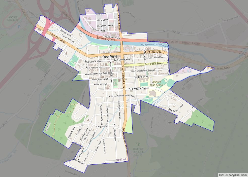
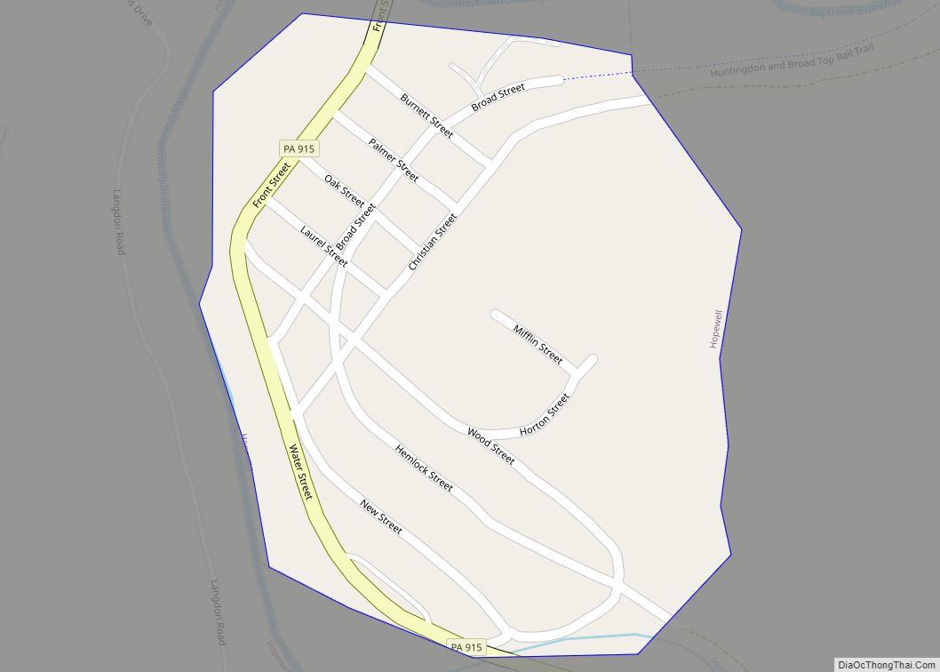
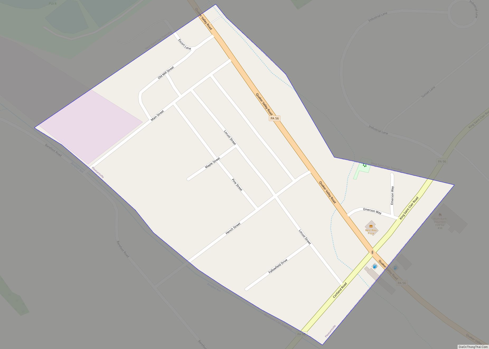
Online Interactive Map
Click on ![]() to view map in "full screen" mode.
to view map in "full screen" mode.
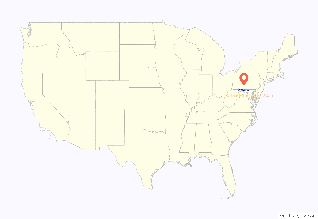
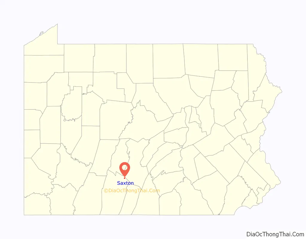
Saxton location map. Where is Saxton borough?
History
Saxton was once a thriving town of several thousand people. Officially founded in 1855 by James Saxton, the area now known as Saxton has been inhabited for centuries. Before Anglos arrived, Native Americans camped along the river that flows through the area. As the United States grew and pushed the frontier west, a few settlers began building homesteads, farms, and mills throughout the valley that Saxton is located in. The region being rich in bituminous coal, a railroad was soon built to export the commodity. Saxton was the hub of the Huntingdon and Broad Top Railroad (H&BT) and for almost 100 years it shipped coal from Saxton to places like Bedford, Huntingdon and Everett. From there it went on to industrial centers, such as Pittsburgh or Baltimore.
The thriving railroad attracted thousands of workers and their families to the town and surrounding area. In its heyday Saxton had a bowling alley, a toy factory, a candy factory, a coal power plant, dozens of shops and businesses, and even a 7 Up bottling plant. Saxton and the surrounding area were full of industry and other businesses. These included a pig iron furnace, coke ovens, a tannery, brickyards, dairies, and others. However, the prosperity would not last, as the mines began to become exhausted of coal after World War II. This in conjunction with the recession of 1949 caused the railroad to shut down in 1955. Most of the buildings and infrastructure owned by the railroad were abandoned, and has subsequently been salvaged or left to erode away.
Saxton was chosen to be the home of the Saxton Nuclear Generating Station, the nation’s fourth nuclear power plant, which was commissioned in 1961. It was one of the first test facilities for peace-time plutonium use, as well as cooling methods that would be used to relieve meltdown situations such as the Fukushima Daiichi nuclear disaster in 2011. The facility was decommissioned in 1972, and the radioactive core removed in 2005.
Saxton Road Map

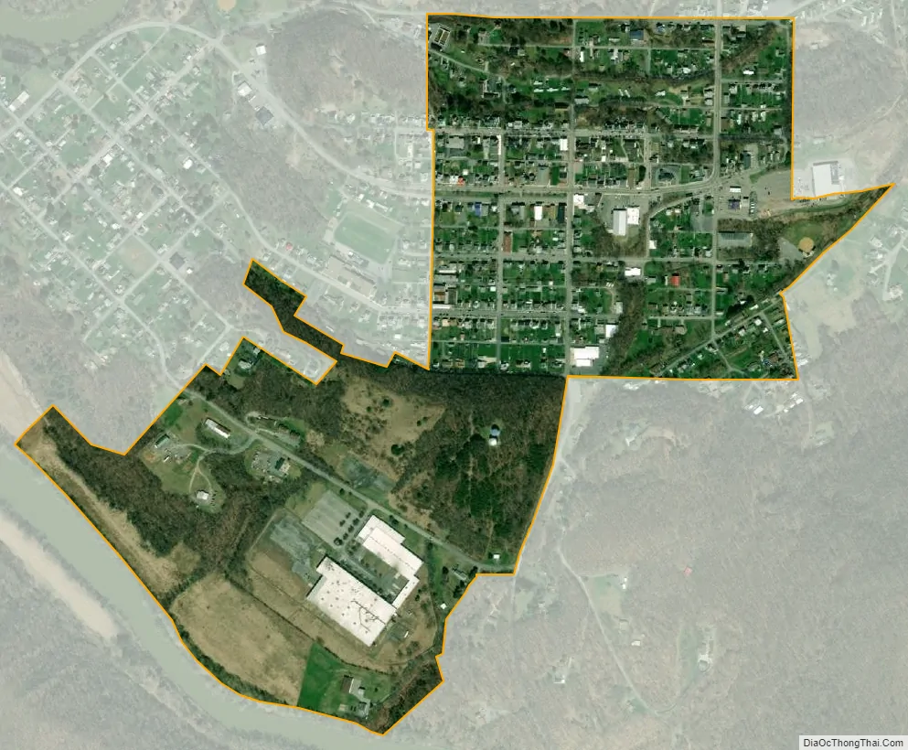
Saxton city Satellite Map
Geography
Saxton is located in northwestern Bedford County at 40°12′53″N 78°14′43″W / 40.21472°N 78.24528°W / 40.21472; -78.24528 (40.214584, -78.245241), at the northern edge of an area known as the Broad Top in the Appalachian Mountains. Saxton is located in Woodcock Valley, along the Raystown Branch of the Juniata River. Known as “The River” locally, it supplies the town with a secondary source of drinking water. It flows into Raystown Lake just north of town. Saxton Mountain is a small, sharp ridge which rises above the town to the east, behind which is the Broad Top plateau. Approximately mile to the west of Saxton is Tussey Mountain, which runs south to north.
Saxton is bordered to the west by the unincorporated community of Stonerstown. Pennsylvania Route 913 passes through Saxton, leading west through Stonerstown and across the Raystown Branch to end at Pennsylvania Route 26, and leading east to Broad Top City atop the plateau. Via PA-26, it is 22 miles (35 km) south to Everett and 27 miles (43 km) north to Huntingdon.
According to the United States Census Bureau, Saxton has a total area of 0.41 square miles (1.05 km), all land.
See also
Map of Pennsylvania State and its subdivision:- Adams
- Allegheny
- Armstrong
- Beaver
- Bedford
- Berks
- Blair
- Bradford
- Bucks
- Butler
- Cambria
- Cameron
- Carbon
- Centre
- Chester
- Clarion
- Clearfield
- Clinton
- Columbia
- Crawford
- Cumberland
- Dauphin
- Delaware
- Elk
- Erie
- Fayette
- Forest
- Franklin
- Fulton
- Greene
- Huntingdon
- Indiana
- Jefferson
- Juniata
- Lackawanna
- Lancaster
- Lawrence
- Lebanon
- Lehigh
- Luzerne
- Lycoming
- Mc Kean
- Mercer
- Mifflin
- Monroe
- Montgomery
- Montour
- Northampton
- Northumberland
- Perry
- Philadelphia
- Pike
- Potter
- Schuylkill
- Snyder
- Somerset
- Sullivan
- Susquehanna
- Tioga
- Union
- Venango
- Warren
- Washington
- Wayne
- Westmoreland
- Wyoming
- York
- Alabama
- Alaska
- Arizona
- Arkansas
- California
- Colorado
- Connecticut
- Delaware
- District of Columbia
- Florida
- Georgia
- Hawaii
- Idaho
- Illinois
- Indiana
- Iowa
- Kansas
- Kentucky
- Louisiana
- Maine
- Maryland
- Massachusetts
- Michigan
- Minnesota
- Mississippi
- Missouri
- Montana
- Nebraska
- Nevada
- New Hampshire
- New Jersey
- New Mexico
- New York
- North Carolina
- North Dakota
- Ohio
- Oklahoma
- Oregon
- Pennsylvania
- Rhode Island
- South Carolina
- South Dakota
- Tennessee
- Texas
- Utah
- Vermont
- Virginia
- Washington
- West Virginia
- Wisconsin
- Wyoming