Shiremanstown is a borough in Cumberland County, Pennsylvania, United States. Bordered to the north by Hampden Township and to the south by Lower Allen Township, it is part of the Harrisburg–Carlisle Metropolitan Statistical Area.
The population was one thousand five hundred and sixty-nine at the time of the 2010 census.
| Name: | Shiremanstown borough |
|---|---|
| LSAD Code: | 21 |
| LSAD Description: | borough (suffix) |
| State: | Pennsylvania |
| County: | Cumberland County |
| Elevation: | 420 ft (130 m) |
| Total Area: | 0.31 sq mi (0.79 km²) |
| Land Area: | 0.31 sq mi (0.79 km²) |
| Water Area: | 0.00 sq mi (0.00 km²) |
| Total Population: | 1,569 |
| Population Density: | 5,320.26/sq mi (2,052.32/km²) |
| ZIP code: | 17011 |
| Area code: | 717 |
| FIPS code: | 4270384 |
Online Interactive Map
Click on ![]() to view map in "full screen" mode.
to view map in "full screen" mode.
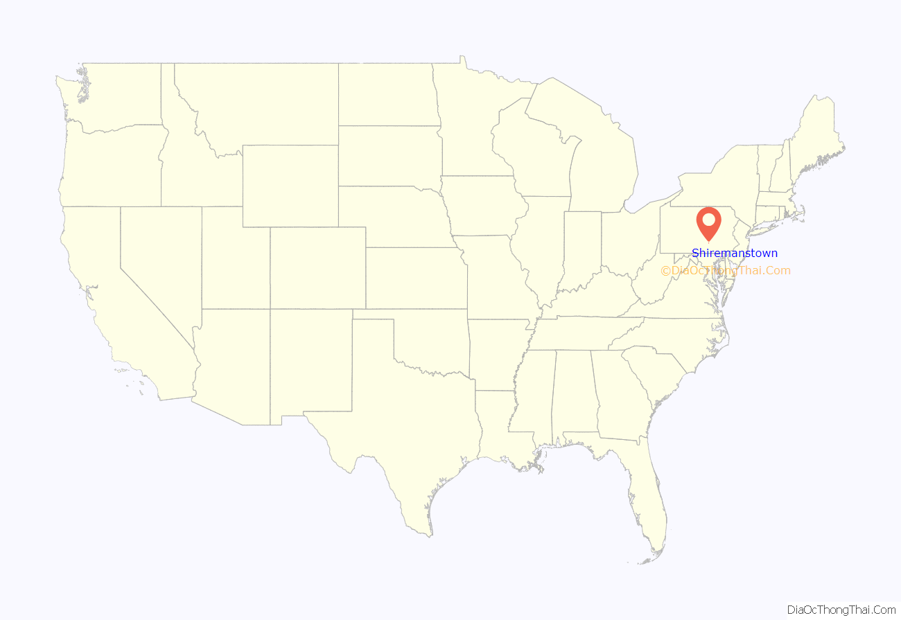
Shiremanstown location map. Where is Shiremanstown borough?
History
Sometime before 1797, a German Reformed church and school were established near the community of Shiremanstown in Cumberland County, Pennsylvania. It became known as the “Peace Church.” Nearly one hundred years later, the log structure was still in use, but only as a school by that time. As the surrounding communities grew over the years, the church’s congregation also continued to grow. Eventually, the congregation became known as St. John’s Evangelical Lutheran Church. in 1897, leaders of the congregation expanded the church further by purchasing the old Messiah church located in Shiremanstown. Initially used for evening services, that building also became the congregation’s home during the winter months, and was in use regularly until it was destroyed by fire on September 2, 1908.
Shiremanstown Road Map
Shiremanstown city Satellite Map
Geography
Located in eastern Cumberland County at 40°13′22″N 76°57′15″W / 40.222889°N 76.954159°W / 40.222889; -76.954159. Shiremanstown is bordered to the north by Hampden Township and to the south by Lower Allen Township. It is 6 miles (10 km) southwest of the center of Harrisburg, the state capital.
According to the United States Census Bureau, the borough has a total area of 0.30 square miles (0.77 km), all land.
See also
Map of Pennsylvania State and its subdivision:- Adams
- Allegheny
- Armstrong
- Beaver
- Bedford
- Berks
- Blair
- Bradford
- Bucks
- Butler
- Cambria
- Cameron
- Carbon
- Centre
- Chester
- Clarion
- Clearfield
- Clinton
- Columbia
- Crawford
- Cumberland
- Dauphin
- Delaware
- Elk
- Erie
- Fayette
- Forest
- Franklin
- Fulton
- Greene
- Huntingdon
- Indiana
- Jefferson
- Juniata
- Lackawanna
- Lancaster
- Lawrence
- Lebanon
- Lehigh
- Luzerne
- Lycoming
- Mc Kean
- Mercer
- Mifflin
- Monroe
- Montgomery
- Montour
- Northampton
- Northumberland
- Perry
- Philadelphia
- Pike
- Potter
- Schuylkill
- Snyder
- Somerset
- Sullivan
- Susquehanna
- Tioga
- Union
- Venango
- Warren
- Washington
- Wayne
- Westmoreland
- Wyoming
- York
- Alabama
- Alaska
- Arizona
- Arkansas
- California
- Colorado
- Connecticut
- Delaware
- District of Columbia
- Florida
- Georgia
- Hawaii
- Idaho
- Illinois
- Indiana
- Iowa
- Kansas
- Kentucky
- Louisiana
- Maine
- Maryland
- Massachusetts
- Michigan
- Minnesota
- Mississippi
- Missouri
- Montana
- Nebraska
- Nevada
- New Hampshire
- New Jersey
- New Mexico
- New York
- North Carolina
- North Dakota
- Ohio
- Oklahoma
- Oregon
- Pennsylvania
- Rhode Island
- South Carolina
- South Dakota
- Tennessee
- Texas
- Utah
- Vermont
- Virginia
- Washington
- West Virginia
- Wisconsin
- Wyoming
