Village Shires is a community within Northampton Township, Bucks County in the U.S. state of Pennsylvania. It is defined by the U.S. Census Bureau as a census-designated place (CDP) for statistical purposes and does not have any legal status as a separately incorporated municipality. The population was 3,949 at the 2010 census.
| Name: | Village Shires CDP |
|---|---|
| LSAD Code: | 57 |
| LSAD Description: | CDP (suffix) |
| State: | Pennsylvania |
| County: | Bucks County |
| Elevation: | 161 ft (49 m) |
| Total Area: | 1.22 sq mi (3.15 km²) |
| Land Area: | 1.22 sq mi (3.15 km²) |
| Water Area: | 0.00 sq mi (0.00 km²) |
| Total Population: | 3,946 |
| Population Density: | 3,245.07/sq mi (1,253.36/km²) |
| ZIP code: | 18966 |
| Area code: | 215, 267, and 445 |
| FIPS code: | 4280229 |
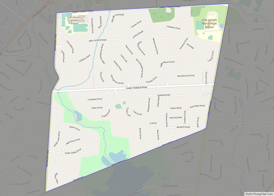
Online Interactive Map
Click on ![]() to view map in "full screen" mode.
to view map in "full screen" mode.
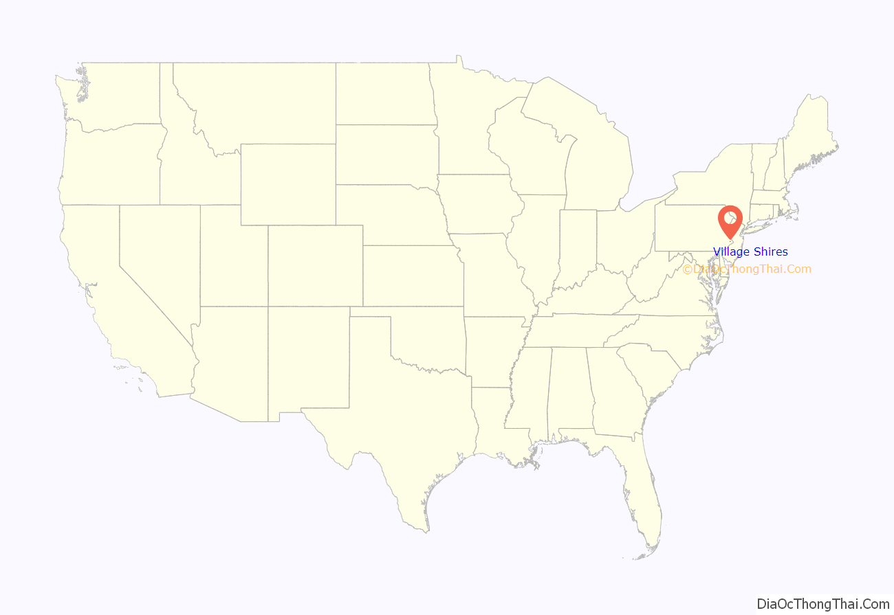
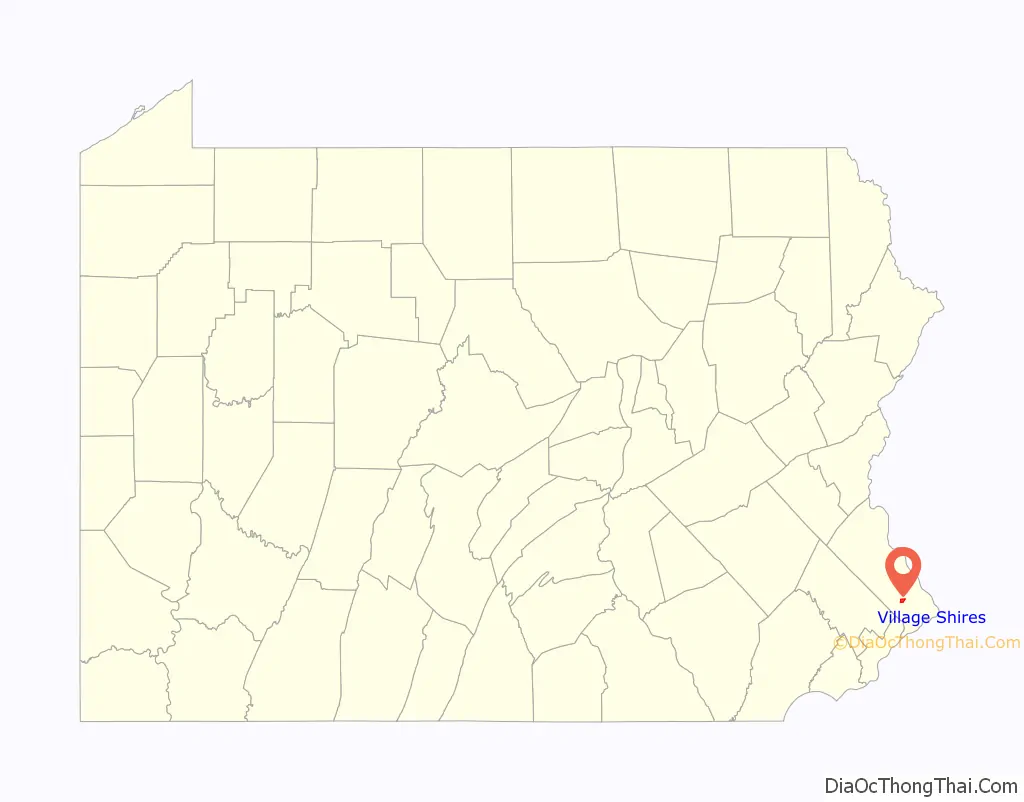
Village Shires location map. Where is Village Shires CDP?
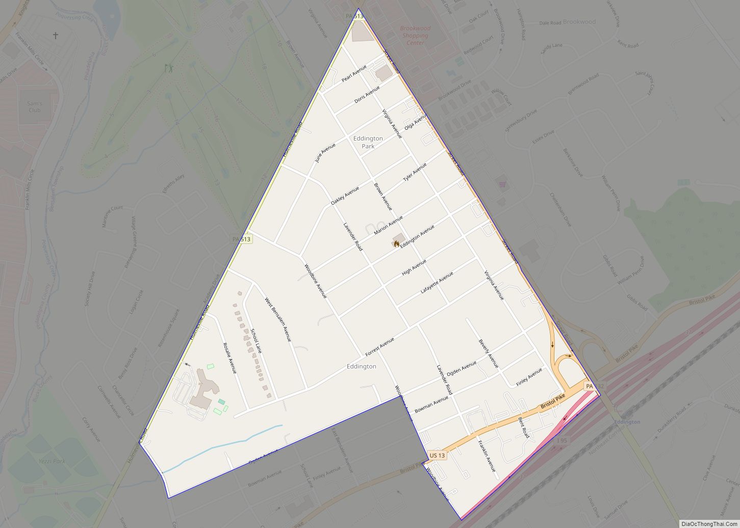
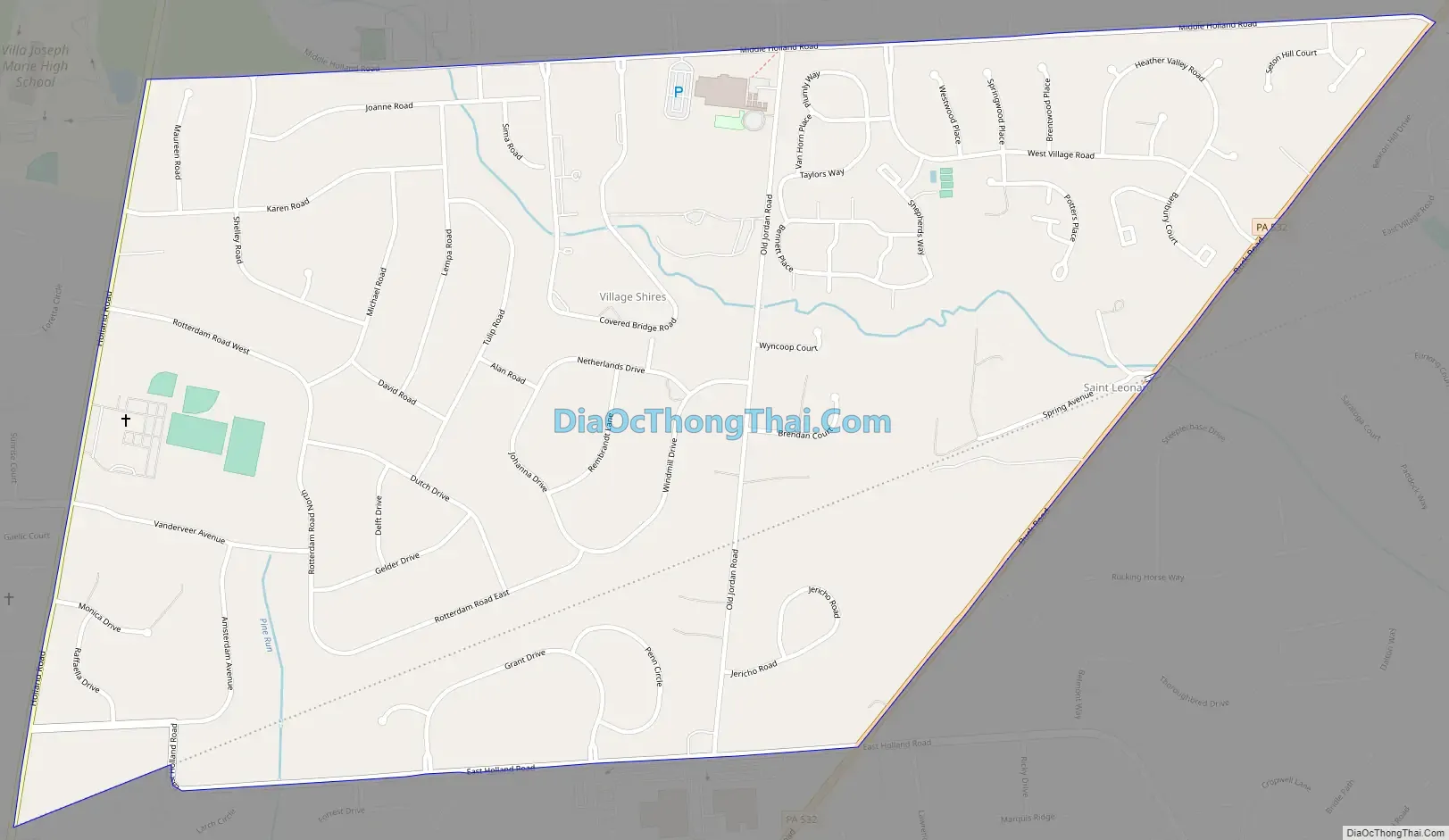
Village Shires Road Map
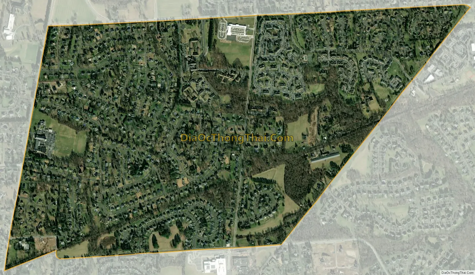
Village Shires city Satellite Map
Geography
Village Shires is located at 40°12′3″N 74°58′19″W / 40.20083°N 74.97194°W / 40.20083; -74.97194 (40.200808, -74.971928).
According to the United States Census Bureau, the CDP has a total area of 1.2 square miles (3.1 km), all land.
See also
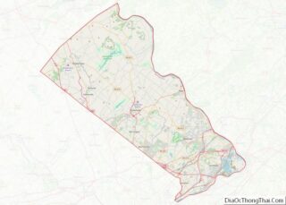
Map of Pennsylvania State and its subdivision:- Adams
- Allegheny
- Armstrong
- Beaver
- Bedford
- Berks
- Blair
- Bradford
- Bucks
- Butler
- Cambria
- Cameron
- Carbon
- Centre
- Chester
- Clarion
- Clearfield
- Clinton
- Columbia
- Crawford
- Cumberland
- Dauphin
- Delaware
- Elk
- Erie
- Fayette
- Forest
- Franklin
- Fulton
- Greene
- Huntingdon
- Indiana
- Jefferson
- Juniata
- Lackawanna
- Lancaster
- Lawrence
- Lebanon
- Lehigh
- Luzerne
- Lycoming
- Mc Kean
- Mercer
- Mifflin
- Monroe
- Montgomery
- Montour
- Northampton
- Northumberland
- Perry
- Philadelphia
- Pike
- Potter
- Schuylkill
- Snyder
- Somerset
- Sullivan
- Susquehanna
- Tioga
- Union
- Venango
- Warren
- Washington
- Wayne
- Westmoreland
- Wyoming
- York
- Alabama
- Alaska
- Arizona
- Arkansas
- California
- Colorado
- Connecticut
- Delaware
- District of Columbia
- Florida
- Georgia
- Hawaii
- Idaho
- Illinois
- Indiana
- Iowa
- Kansas
- Kentucky
- Louisiana
- Maine
- Maryland
- Massachusetts
- Michigan
- Minnesota
- Mississippi
- Missouri
- Montana
- Nebraska
- Nevada
- New Hampshire
- New Jersey
- New Mexico
- New York
- North Carolina
- North Dakota
- Ohio
- Oklahoma
- Oregon
- Pennsylvania
- Rhode Island
- South Carolina
- South Dakota
- Tennessee
- Texas
- Utah
- Vermont
- Virginia
- Washington
- West Virginia
- Wisconsin
- Wyoming