Westmont is a borough in Cambria County, Pennsylvania, United States. It is part of the Johnstown, Pennsylvania Metropolitan Statistical Area. The population was 5,181 at the 2010 census, down from 5,523 at the 2000 census.
| Name: | Westmont borough |
|---|---|
| LSAD Code: | 21 |
| LSAD Description: | borough (suffix) |
| State: | Pennsylvania |
| County: | Cambria County |
| Incorporated: | 1892 |
| Elevation: | 1,752 ft (534 m) |
| Total Area: | 2.37 sq mi (6.13 km²) |
| Land Area: | 2.37 sq mi (6.13 km²) |
| Water Area: | 0.00 sq mi (0.00 km²) |
| Total Population: | 4,982 |
| Population Density: | 2,106.55/sq mi (813.31/km²) |
| FIPS code: | 4283584 |
| GNISfeature ID: | 1215038 |
| Website: | westmontborough.com |
Online Interactive Map
Click on ![]() to view map in "full screen" mode.
to view map in "full screen" mode.
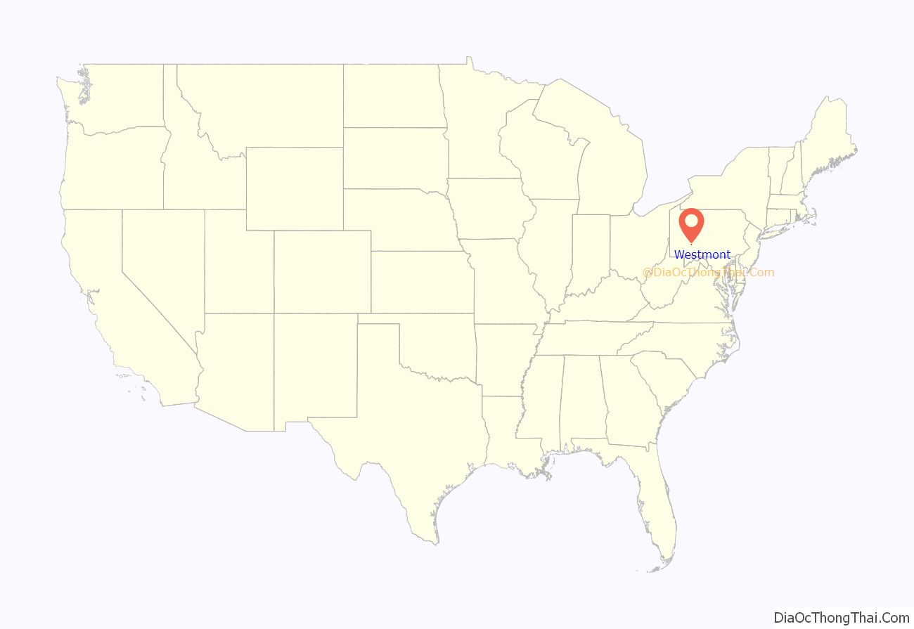
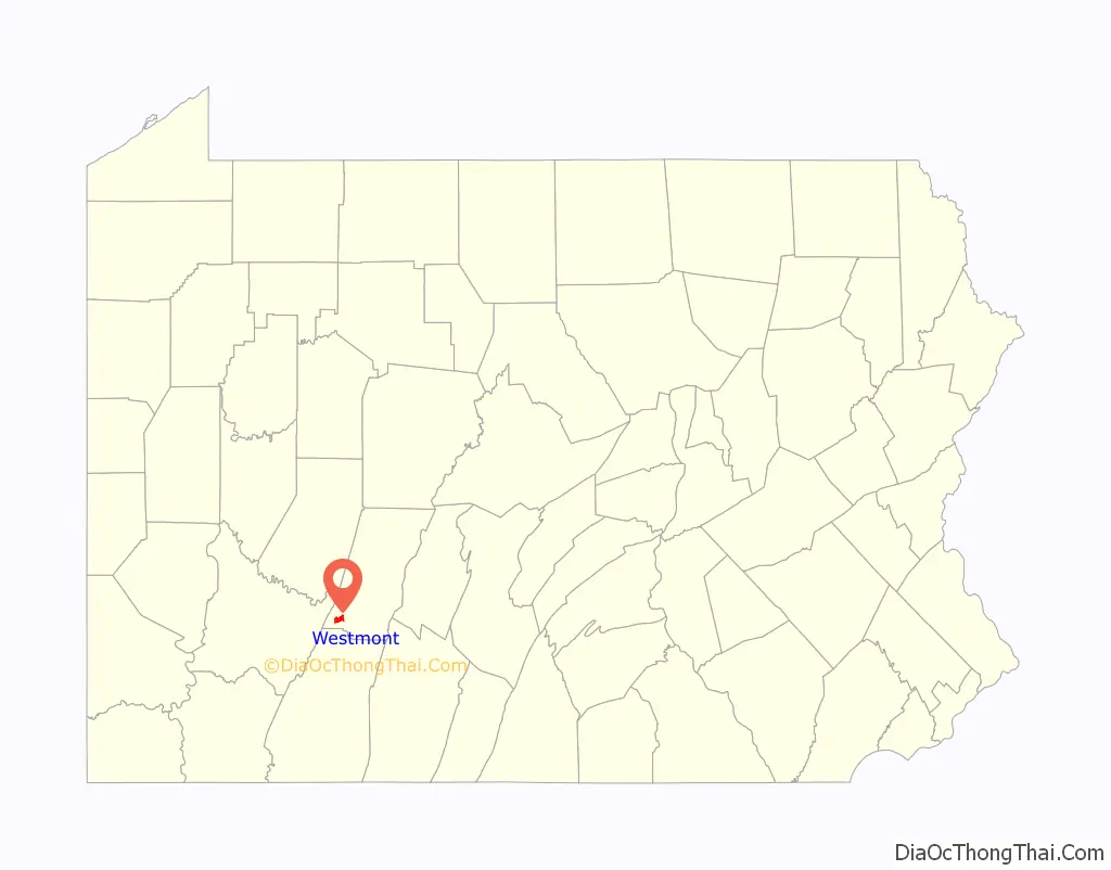
Westmont location map. Where is Westmont borough?
History
Before the Johnstown Flood of 1889, the Yoder Hill area consisted of nothing more than a few farms, accessible by only a few steep, muddy roads. However, since the flood was so devastating to the city and to its major employer, the Cambria Iron Company, the iron company decided to develop the top of the hill as a suburb for its top personnel to live in. The company commissioned the famous landscape architect, Charles Miller, to lay out the grid for the settlement of “Tiptop”, later renamed Westmont. Westmont was located on a ridge high above the valley in which Johnstown is located, and thus in a place of safety. As such, it was also above the smoke, noise, and stench of the city, and attracted the well-to-do of the town, eager to escape what (in many cases) their own factories had wrought. An inclined railway, the Johnstown Inclined Plane, was built for easy travel to the city. With the problem of transportation solved, the new settlement began to grow, and it was incorporated as the Borough of Westmont on June 13, 1892. In 1935, the borough bought the inclined railway from Bethlehem Steel.
In 1938 the Johnstown Traction Company began to operate bus service to Westmont via buses that rode up and down the Inclined Plane. At one time there were plans to extend the Southmont streetcar line from its terminus at Diamond Boulevard and Menoher Boulevard along Diamond Boulevard to Luzerne Street, and then along Luzerne Street in the center median to Colgate Avenue. This rail service extension was never constructed, and streetcar service on the Southmont line was discontinued in 1954 when a rock slide along Southmont Boulevard damaged the track and overhead. Following completion of the “Easy Grade” highway of Menoher Boulevard (PA Route 271) from downtown Johnstown through to Westmont, bus service was transferred to this route and service via the Inclined Plane was discontinued.
Because of its upland location, Westmont escaped destruction in the subsequent floods that damaged flood-prone Johnstown.
A Westmont native was the first American soldier to die in the Vietnam War. Captain Harry Griffith Cramer Jr. grew up at 321 Luzerne Street, a house which still stands today. He graduated from West Point in 1946, earned a Silver Star for valor in Korea, and commanded the first team of US Special Forces advisers to deploy to Vietnam. He was killed near Nha Trang on October 21, 1957.
The Westmont Historic District was listed on the National Register of Historic Places in 1995.
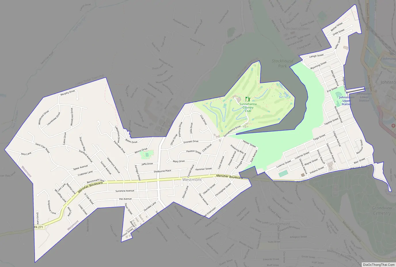
Westmont Road Map
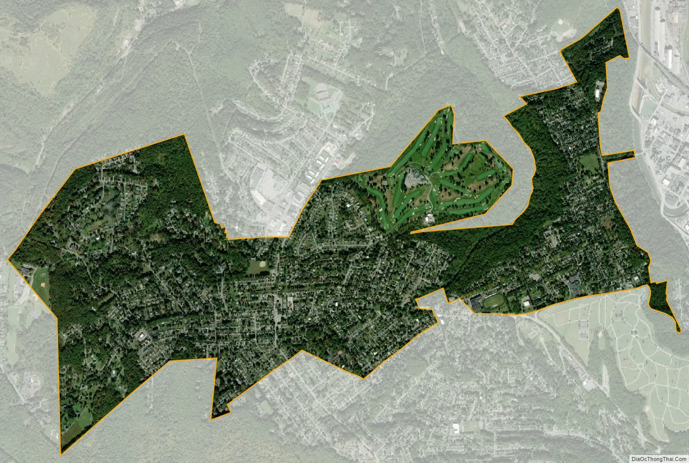
Westmont city Satellite Map
Geography
Westmont is located in southwestern Cambria County and is bordered to the east by the city of Johnstown, to the north by the borough of Brownstown, and to the south by the borough of Southmont and the unincorporated community of Elim. Westmont sits on heights rising up to 700 feet (210 m) above the Stonycreek and Conemaugh River valleys in the center of Johnstown.
According to the United States Census Bureau, the borough of Westmont has a total area of 2.4 square miles (6.1 km), all land.
See also
Map of Pennsylvania State and its subdivision:- Adams
- Allegheny
- Armstrong
- Beaver
- Bedford
- Berks
- Blair
- Bradford
- Bucks
- Butler
- Cambria
- Cameron
- Carbon
- Centre
- Chester
- Clarion
- Clearfield
- Clinton
- Columbia
- Crawford
- Cumberland
- Dauphin
- Delaware
- Elk
- Erie
- Fayette
- Forest
- Franklin
- Fulton
- Greene
- Huntingdon
- Indiana
- Jefferson
- Juniata
- Lackawanna
- Lancaster
- Lawrence
- Lebanon
- Lehigh
- Luzerne
- Lycoming
- Mc Kean
- Mercer
- Mifflin
- Monroe
- Montgomery
- Montour
- Northampton
- Northumberland
- Perry
- Philadelphia
- Pike
- Potter
- Schuylkill
- Snyder
- Somerset
- Sullivan
- Susquehanna
- Tioga
- Union
- Venango
- Warren
- Washington
- Wayne
- Westmoreland
- Wyoming
- York
- Alabama
- Alaska
- Arizona
- Arkansas
- California
- Colorado
- Connecticut
- Delaware
- District of Columbia
- Florida
- Georgia
- Hawaii
- Idaho
- Illinois
- Indiana
- Iowa
- Kansas
- Kentucky
- Louisiana
- Maine
- Maryland
- Massachusetts
- Michigan
- Minnesota
- Mississippi
- Missouri
- Montana
- Nebraska
- Nevada
- New Hampshire
- New Jersey
- New Mexico
- New York
- North Carolina
- North Dakota
- Ohio
- Oklahoma
- Oregon
- Pennsylvania
- Rhode Island
- South Carolina
- South Dakota
- Tennessee
- Texas
- Utah
- Vermont
- Virginia
- Washington
- West Virginia
- Wisconsin
- Wyoming


