Wormleysburg is a borough in Cumberland County, Pennsylvania, United States. The population was 3,070 at the 2010 census. It is part of the Harrisburg–Carlisle Metropolitan Statistical Area.
Wormleysburg is served by West Shore School District. The borough is home to Harsco Corporation.
| Name: | Wormleysburg borough |
|---|---|
| LSAD Code: | 21 |
| LSAD Description: | borough (suffix) |
| State: | Pennsylvania |
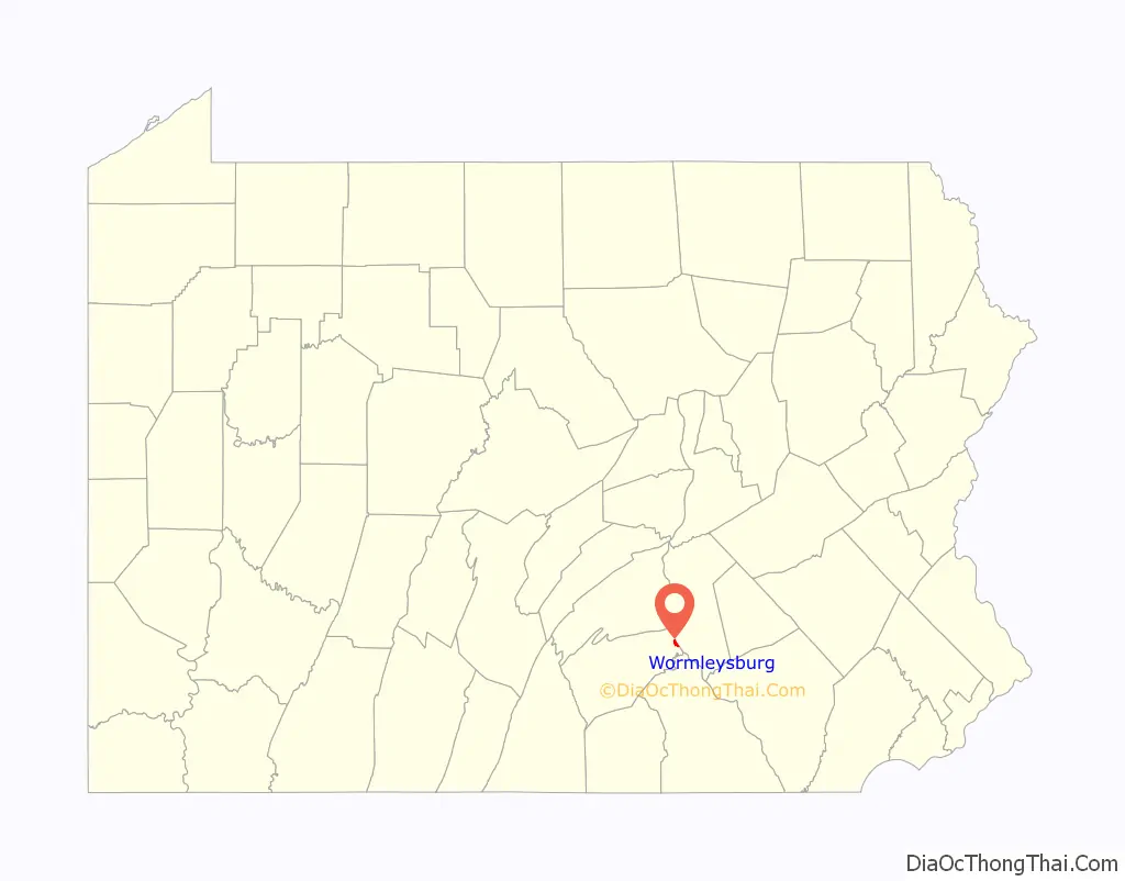
| County: | Cumberland County |
| Incorporated: | 1916 |
| Elevation: | 338 ft (103 m) |
| Total Area: | 0.79 sq mi (2.04 km²) |
| Land Area: | 0.78 sq mi (2.01 km²) |
| Water Area: | 0.01 sq mi (0.03 km²) |
| Total Population: | 3,070 |
| Population Density: | 3,930.50/sq mi (1,518.46/km²) |
| Area code: | 717 223 |
| FIPS code: | 4286528 |
| Website: | www.wormleysburgpa.org |
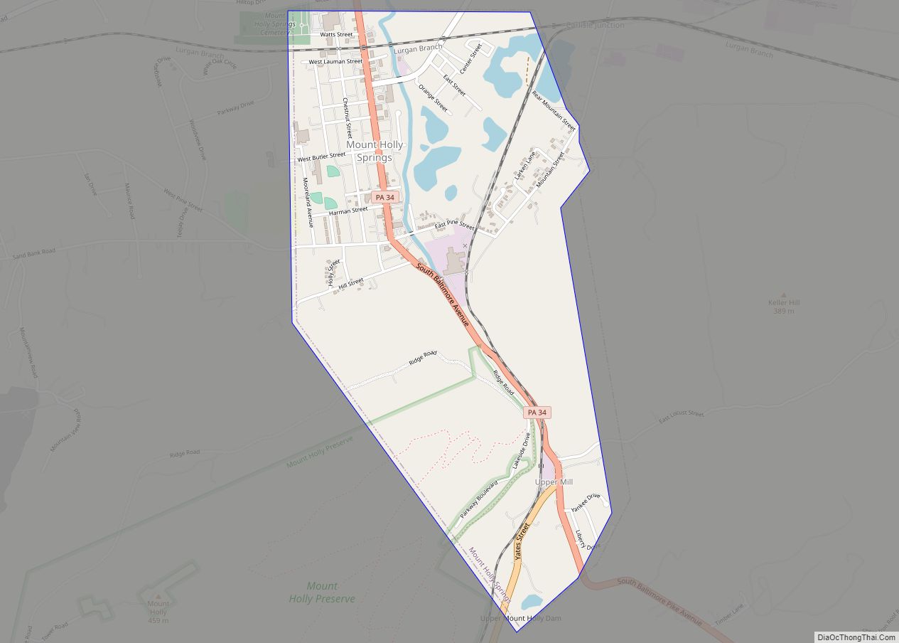
Online Interactive Map
Click on ![]() to view map in "full screen" mode.
to view map in "full screen" mode.
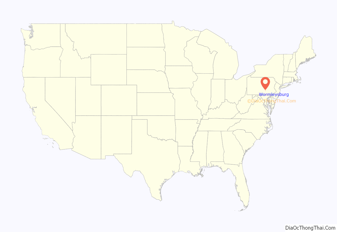
Wormleysburg location map. Where is Wormleysburg borough?
History
The community was named for founder John Wormley and was incorporated as a borough in May 1916 from East Pennsboro Township.
The John Wormley House was added to the National Register of Historic Places in 1976.
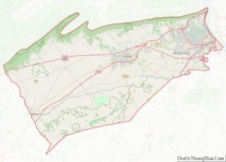
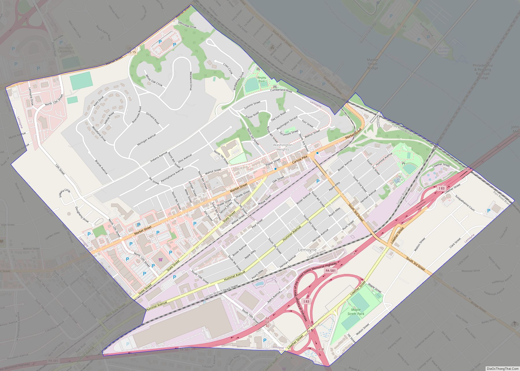
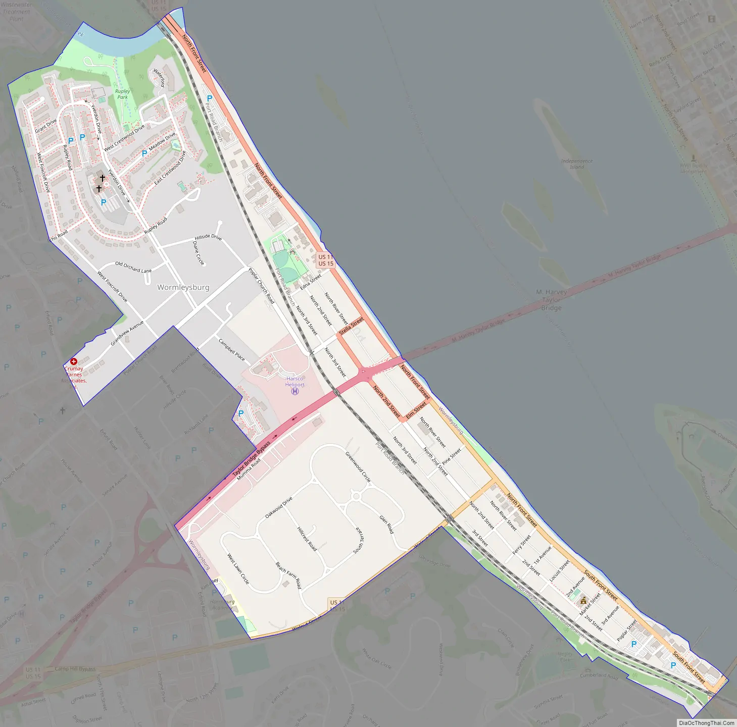
Wormleysburg Road Map
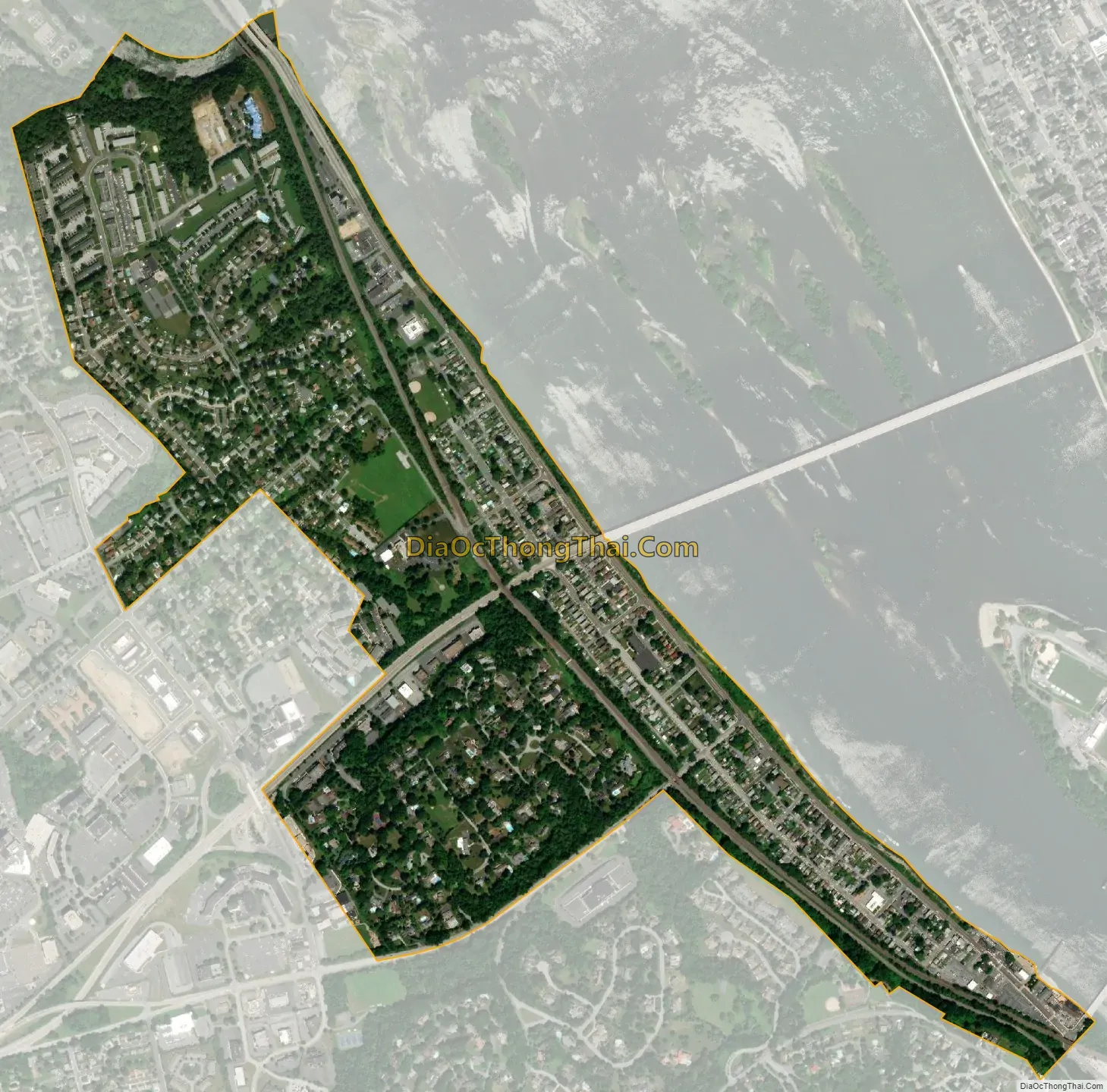
Wormleysburg city Satellite Map
Geography
Wormleysburg is located on the eastern border of Cumberland County at 40°15′31″N 76°54′21″W / 40.25861°N 76.90583°W / 40.25861; -76.90583 (40.258689, -76.905954). It is situated on the west bank of the Susquehanna River across from Harrisburg, the state capital. It is bordered to the north and west by East Pennsboro Township and to the south by the borough of Lemoyne. U.S. Routes 11 and 15 pass through the borough together, leading north 4.5 miles (7.2 km) to Exit 65 on Interstate 81 and southwest 3 miles (5 km) through Camp Hill to the Capital Beltway (Pennsylvania Route 581). The M. Harvey Taylor Memorial Bridge and Market Street Bridge cross the Susquehanna from Wormleysburg into Harrisburg.
According to the U.S. Census Bureau, Wormleysburg has a total area of 0.81 square miles (2.1 km), of which 0.01 square miles (0.03 km), or 1.33%, is water.
See also
Map of Pennsylvania State and its subdivision:- Adams
- Allegheny
- Armstrong
- Beaver
- Bedford
- Berks
- Blair
- Bradford
- Bucks
- Butler
- Cambria
- Cameron
- Carbon
- Centre
- Chester
- Clarion
- Clearfield
- Clinton
- Columbia
- Crawford
- Cumberland
- Dauphin
- Delaware
- Elk
- Erie
- Fayette
- Forest
- Franklin
- Fulton
- Greene
- Huntingdon
- Indiana
- Jefferson
- Juniata
- Lackawanna
- Lancaster
- Lawrence
- Lebanon
- Lehigh
- Luzerne
- Lycoming
- Mc Kean
- Mercer
- Mifflin
- Monroe
- Montgomery
- Montour
- Northampton
- Northumberland
- Perry
- Philadelphia
- Pike
- Potter
- Schuylkill
- Snyder
- Somerset
- Sullivan
- Susquehanna
- Tioga
- Union
- Venango
- Warren
- Washington
- Wayne
- Westmoreland
- Wyoming
- York
- Alabama
- Alaska
- Arizona
- Arkansas
- California
- Colorado
- Connecticut
- Delaware
- District of Columbia
- Florida
- Georgia
- Hawaii
- Idaho
- Illinois
- Indiana
- Iowa
- Kansas
- Kentucky
- Louisiana
- Maine
- Maryland
- Massachusetts
- Michigan
- Minnesota
- Mississippi
- Missouri
- Montana
- Nebraska
- Nevada
- New Hampshire
- New Jersey
- New Mexico
- New York
- North Carolina
- North Dakota
- Ohio
- Oklahoma
- Oregon
- Pennsylvania
- Rhode Island
- South Carolina
- South Dakota
- Tennessee
- Texas
- Utah
- Vermont
- Virginia
- Washington
- West Virginia
- Wisconsin
- Wyoming