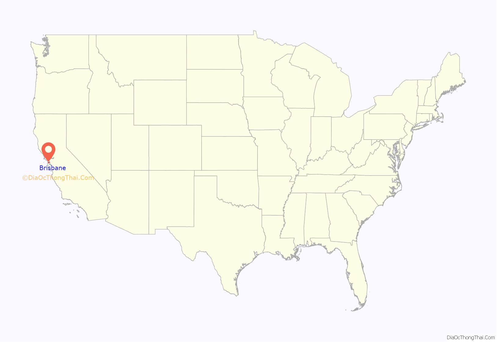
Brisbane (pron. /ˈbrɪzbeɪn/ BRIZ-bayn) is a small city in San Mateo County, California, located on the lower slopes of the San Bruno Mountain. The city is on the northeastern edge of San Mateo County, located immediately south of the San Francisco city limits on the San Francisco Bay. The population was 4,851 as of the 2020 census.
Brisbane is called “The City of Stars” because of a holiday tradition dating back to 1939. At the start of the Christmas/Hanukkah season, many residents and business owners place large, illuminated stars, some as big as 10 feet (3.0 m) or more in diameter, on the downhill sides of homes and offices throughout Brisbane. Many of the stars are kept up all year.
| Name: | Brisbane city |
|---|---|
| LSAD Code: | 25 |
| LSAD Description: | city (suffix) |
| State: | California |
| County: | San Mateo County |
| Incorporated: | November 27, 1961 |
| Elevation: | 108 ft (33 m) |
| Total Area: | 19.97 sq mi (51.71 km²) |
| Land Area: | 2.98 sq mi (7.73 km²) |
| Water Area: | 16.98 sq mi (43.98 km²) 84.58% |
| Total Population: | 4,851 |
| Population Density: | 1,625.13/sq mi (627.42/km²) |
| ZIP code: | 94005 |
| FIPS code: | 0608310 |
| GNISfeature ID: | 1658137 |
| Website: | www.brisbaneca.org |
Online Interactive Map
Click on ![]() to view map in "full screen" mode.
to view map in "full screen" mode.
Brisbane location map. Where is Brisbane city?
History
The first recorded inhabitants were the Costanoan Indians. They built dome-shaped dwellings of boughs and tules. By 1776, Spanish explorers had arrived and the Franciscan missionaries soon followed leaving numerous large land grants in their wake. With Mexican rule, the lands controlled by the Mission were released to private enterprise.
Brisbane was originally part of Rancho Cañada de Guadalupe la Visitación y Rodeo Viejo, a large tract of land that included the Cañada de Guadalupe (now Guadalupe Valley), and also the Bayshore district of Daly City, the Visitacion Valley district of San Francisco, and San Bruno Mountain. Visitacion City, as it was initially known, was platted in 1908 adjacent to a new rail line that had been completed in 1907 to the east of the town site. The Southern Pacific Railroad built the new line to create a faster and more direct route into San Francisco. The railroad also planned to build extensive terminal facilities just north of the town site. The Visitacion Valley rail yard and locomotive works were expected to employ over 1,000 workers, but construction was halted soon after it began due to the Panic of 1907. The town site remained largely undeveloped for many years. The railroad resumed construction of the yard and shops during World War I, and the facilities were completed by 1918.
The city is served by San Mateo County Libraries.
In the 1920s Arthur Annis proposed the name change from Visitacion City to Brisbane. Annis regarded the name Visitacion City as a handicap “being so close to a San Francisco city district with a similar name”, which he felt would confuse people and prevent “Brisbane” from establishing its own unique identity. Accounts of how the city acquired its name vary. According to his daughter, the city was named for Brisbane, Queensland, perhaps due to the area’s resemblance to that port city at the time. Another story holds that it was named for newspaper columnist Arthur Brisbane.
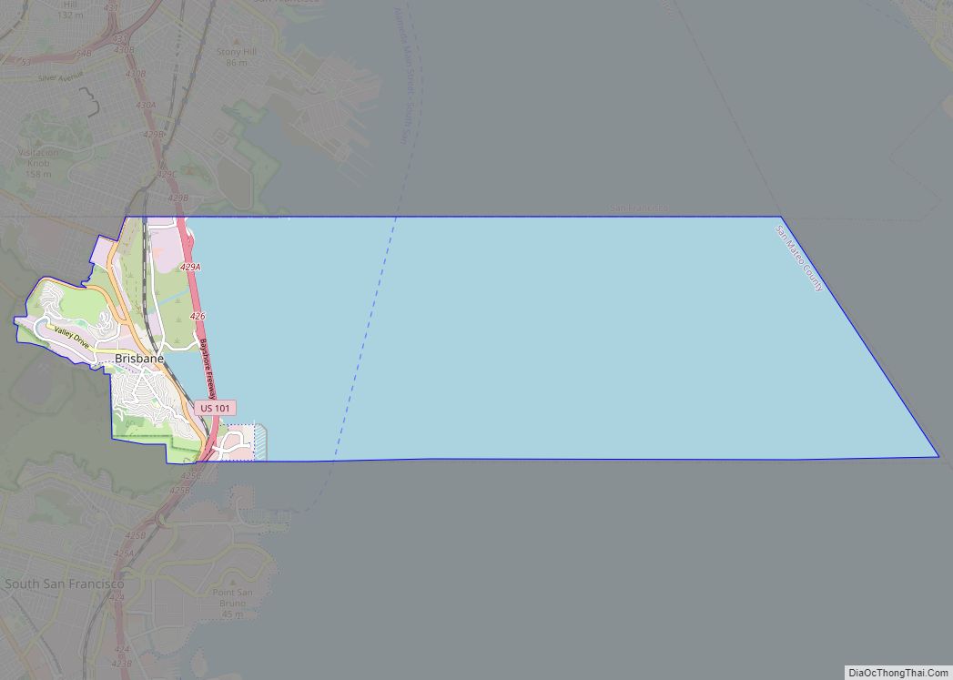
Brisbane Road Map
Brisbane city Satellite Map
Geography
According to the United States Census Bureau, the city has a total area of 20.1 square miles (52 km), of which 3.1 square miles (8.0 km) is land and 17.0 square miles (44 km) (84.58%) is water, the latter the Brisbane Lagoon. A remnant of San Francisco Bay, the Lagoon was formed by the construction of the U. S. Highway 101 causeway, and became diminished as most of its north and central portions were filled with landfill. Brisbane sits at the southeast corner of the Guadalupe Valley.
Guadalupe Valley Creek is a small creek which flows east through Brisbane along the north flank of San Bruno Mountain and enters the Brisbane Lagoon after passing under the Tunnel Avenue bridge.
See also
Map of California State and its subdivision:- Alameda
- Alpine
- Amador
- Butte
- Calaveras
- Colusa
- Contra Costa
- Del Norte
- El Dorado
- Fresno
- Glenn
- Humboldt
- Imperial
- Inyo
- Kern
- Kings
- Lake
- Lassen
- Los Angeles
- Madera
- Marin
- Mariposa
- Mendocino
- Merced
- Modoc
- Mono
- Monterey
- Napa
- Nevada
- Orange
- Placer
- Plumas
- Riverside
- Sacramento
- San Benito
- San Bernardino
- San Diego
- San Francisco
- San Joaquin
- San Luis Obispo
- San Mateo
- Santa Barbara
- Santa Clara
- Santa Cruz
- Shasta
- Sierra
- Siskiyou
- Solano
- Sonoma
- Stanislaus
- Sutter
- Tehama
- Trinity
- Tulare
- Tuolumne
- Ventura
- Yolo
- Yuba
- Alabama
- Alaska
- Arizona
- Arkansas
- California
- Colorado
- Connecticut
- Delaware
- District of Columbia
- Florida
- Georgia
- Hawaii
- Idaho
- Illinois
- Indiana
- Iowa
- Kansas
- Kentucky
- Louisiana
- Maine
- Maryland
- Massachusetts
- Michigan
- Minnesota
- Mississippi
- Missouri
- Montana
- Nebraska
- Nevada
- New Hampshire
- New Jersey
- New Mexico
- New York
- North Carolina
- North Dakota
- Ohio
- Oklahoma
- Oregon
- Pennsylvania
- Rhode Island
- South Carolina
- South Dakota
- Tennessee
- Texas
- Utah
- Vermont
- Virginia
- Washington
- West Virginia
- Wisconsin
- Wyoming
