Broadmoor is a census-designated place (CDP) in an unincorporated area of San Mateo County, California, United States. The enclave is entirely surrounded by Daly City. The population was 4,176 at the 2010 census.
| Name: | Broadmoor CDP |
|---|---|
| LSAD Code: | 57 |
| LSAD Description: | CDP (suffix) |
| State: | California |
| County: | San Mateo County |
| Elevation: | 348 ft (106 m) |
| Total Area: | 0.43 sq mi (1.12 km²) |
| Land Area: | 0.43 sq mi (1.12 km²) |
| Water Area: | 0.00 sq mi (0.00 km²) 0% |
| Total Population: | 4,411 |
| Population Density: | 10,210.65/sq mi (3,942.63/km²) |
| ZIP code: | 94014, 94015 |
| Area code: | 650 |
| FIPS code: | 0608338 |
| GNISfeature ID: | 0255917 |
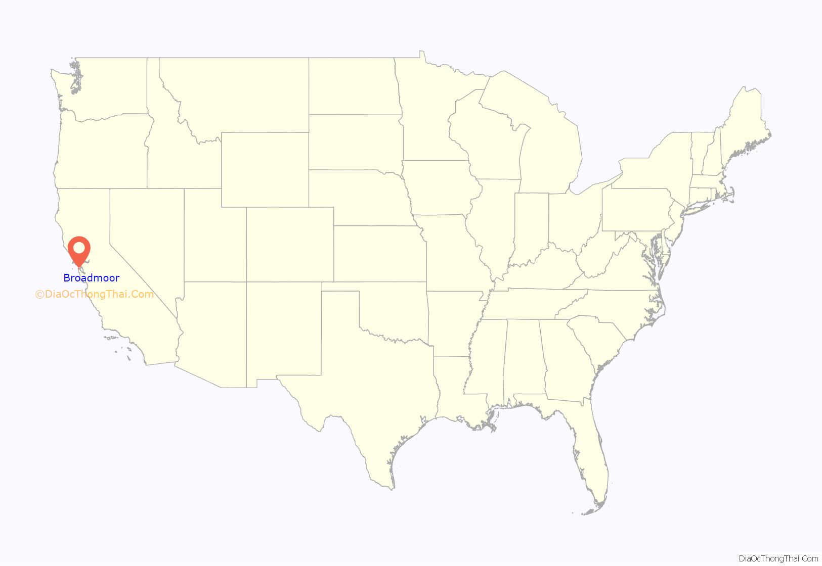
Online Interactive Map
Click on ![]() to view map in "full screen" mode.
to view map in "full screen" mode.
Broadmoor location map. Where is Broadmoor CDP?

History
The farms that had long graced the area started to give way to suburban housing developments from the 1940s onwards. The residents of Broadmoor, rallying around their police protection district and their sense of identity as a separate community, have been mostly successful in fighting off annexation by Daly City, despite losing slices of their community’s territory, including its police headquarters, in the many piecemeal annexations which over the years saw Daly City gradually encircle Broadmoor in its entirety. Daly City’s attempts to annex the enclave and Broadmoor residents’ resistance to those efforts have led to strained relations between the two entities at times.
Broadmoor Road Map
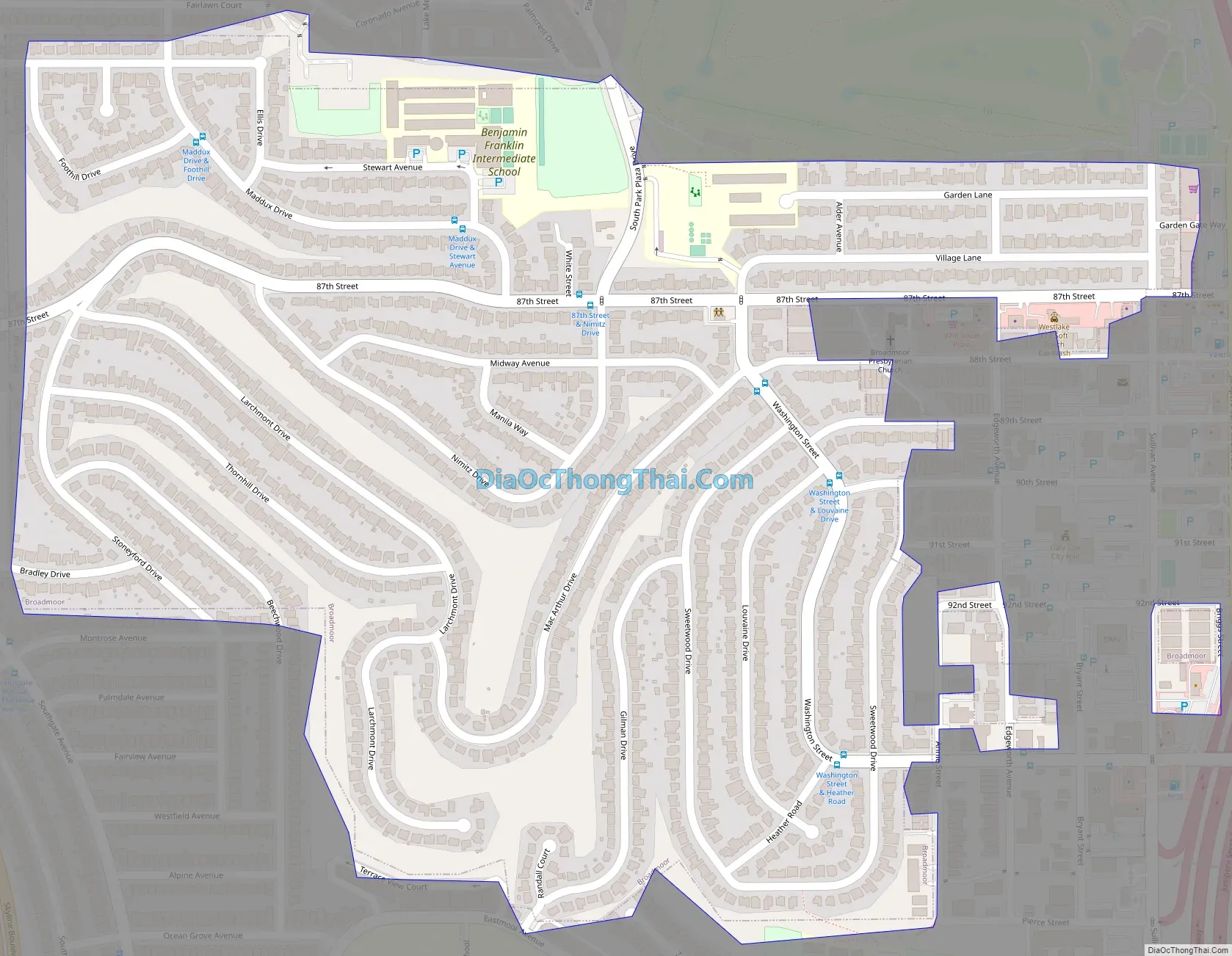
Broadmoor city Satellite Map

Geography
Broadmoor is located at 37°41′33″N 122°28′44″W / 37.69250°N 122.47889°W / 37.69250; -122.47889 (37.692433, -122.478901).
According to the United States Census Bureau, the CDP has a total area of 0.432 square miles, all of it land.
See also
Map of California State and its subdivision:- Alameda
- Alpine
- Amador
- Butte
- Calaveras
- Colusa
- Contra Costa
- Del Norte
- El Dorado
- Fresno
- Glenn
- Humboldt
- Imperial
- Inyo
- Kern
- Kings
- Lake
- Lassen
- Los Angeles
- Madera
- Marin
- Mariposa
- Mendocino
- Merced
- Modoc
- Mono
- Monterey
- Napa
- Nevada
- Orange
- Placer
- Plumas
- Riverside
- Sacramento
- San Benito
- San Bernardino
- San Diego
- San Francisco
- San Joaquin
- San Luis Obispo
- San Mateo
- Santa Barbara
- Santa Clara
- Santa Cruz
- Shasta
- Sierra
- Siskiyou
- Solano
- Sonoma
- Stanislaus
- Sutter
- Tehama
- Trinity
- Tulare
- Tuolumne
- Ventura
- Yolo
- Yuba
- Alabama
- Alaska
- Arizona
- Arkansas
- California
- Colorado
- Connecticut
- Delaware
- District of Columbia
- Florida
- Georgia
- Hawaii
- Idaho
- Illinois
- Indiana
- Iowa
- Kansas
- Kentucky
- Louisiana
- Maine
- Maryland
- Massachusetts
- Michigan
- Minnesota
- Mississippi
- Missouri
- Montana
- Nebraska
- Nevada
- New Hampshire
- New Jersey
- New Mexico
- New York
- North Carolina
- North Dakota
- Ohio
- Oklahoma
- Oregon
- Pennsylvania
- Rhode Island
- South Carolina
- South Dakota
- Tennessee
- Texas
- Utah
- Vermont
- Virginia
- Washington
- West Virginia
- Wisconsin
- Wyoming


