Daly City (/ˈdeɪli/) is the second most populous city in San Mateo County, California, United States, with population of 104,901 according to the 2020 census. Located in the San Francisco Bay Area, and immediately south of San Francisco (sharing its northern border with almost all of San Francisco’s southern border), it is named for businessman and landowner John Donald Daly.
| Name: | Daly City city |
|---|---|
| LSAD Code: | 25 |
| LSAD Description: | city (suffix) |
| State: | California |
| County: | San Mateo County |
| Incorporated: | March 22, 1911 |
| Elevation: | 344 ft (105 m) |
| Total Area: | 7.64 sq mi (19.78 km²) |
| Land Area: | 7.64 sq mi (19.78 km²) |
| Water Area: | 0.00 sq mi (0.00 km²) 0% |
| Total Population: | 104,901 |
| Population Density: | 13,734.09/sq mi (5,302.44/km²) |
| FIPS code: | 0617918 |
| Website: | www.dalycity.org |
Online Interactive Map
Click on ![]() to view map in "full screen" mode.
to view map in "full screen" mode.
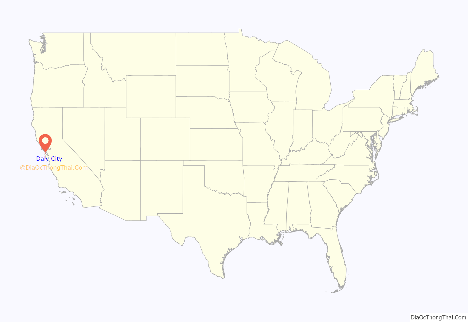
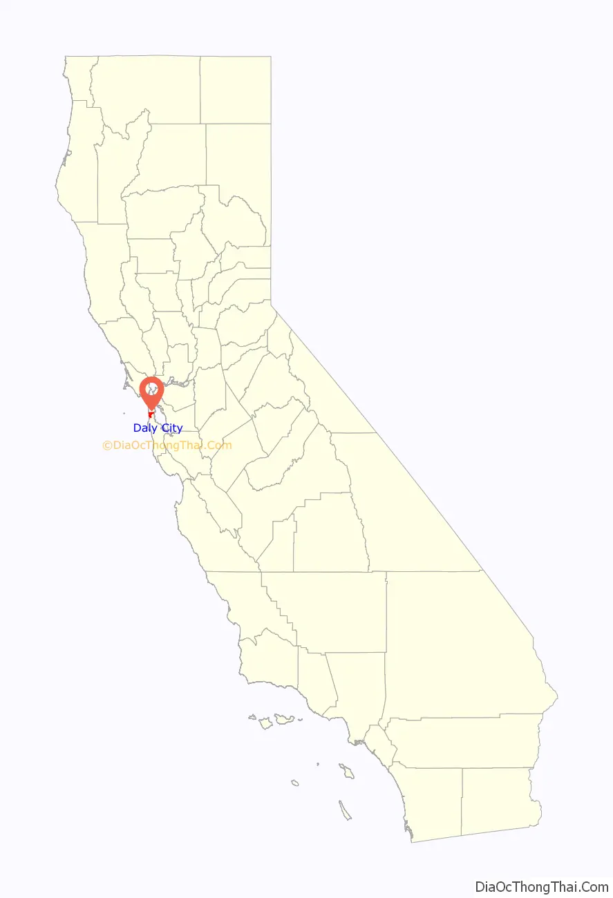
Daly City location map. Where is Daly City city?
History
Archaeological evidence suggests the San Francisco Bay Area has been inhabited as early as 2700 BC. People of the Ohlone language group probably occupied Northern California from at least the year A.D. 500. Though their territory had been claimed by Spain since the early 16th century, they would have relatively little contact with Europeans until 1769, when, as part of an effort to colonize Alta California, an exploration party led by Don Gaspar de Portolá learned of the existence of San Francisco Bay. Seven years later, in 1776, an expedition led by Juan Bautista de Anza selected the site for the Presidio of San Francisco, which José Joaquín Moraga would soon establish. Later the same year, the Franciscan missionary Francisco Palóu founded the Mission San Francisco de Asís (Mission Dolores). As part of the founding, the priests claimed the land south of the mission for sixteen miles for raising crops and for fodder for cattle and sheep. In 1778, the priests and soldiers marked out a trail to connect San Francisco to the rest of California. At the top of Mission Hill, the priests named the gap between San Bruno Mountain and the hills on the coast La Portezuela (“The Little Door”). La Portezuela was later referred to as Daly’s Hill, the Center of Daly City, and is now called Top of the Hill.
During Spanish rule, the area between San Bruno Mountain and the Pacific remained uninhabited. Upon independence from Spain, prominent Mexican citizens were granted land parcels to establish large ranches, three of which covered areas now in Daly City and Colma. Rancho Buri Buri was granted to Jose Sanchez in 1835 and covered 14,639 acres (59.24 km) including parts of modern-day Colma, Burlingame, San Bruno, South San Francisco, and Millbrae. Rancho Laguna de la Merced was 2,219 acres (8.98 km) acres and covered the area around a lake of the same name. The third ranch covering parts of the Daly City–Colma area was named Rancho Cañada de Guadalupe la Visitación y Rodeo Viejo and stretched from the Visitacion Valley area in San Francisco, to the city of South San Francisco covering 5,473 acres (22.15 km).
Following the Mexican Cession of California at the end of the Mexican–American War the owners of Rancho Laguna de La Merced tried to claim land between San Bruno Mountain and Lake Merced. An 1853 US government survey declared that the contested area was in fact government property and could be acquired by private citizens. There was a brief land rush as settlers, mainly Irish established ranches and farms in parts of what is now the neighborhoods of Westlake, Serramonte, and the cities of Colma and Pacifica. A decade later, several families left as increase in the fog density killed grain and potato crops. The few remaining families switched to dairy and cattle farming as a more profitable enterprise. In the late 19th century as San Francisco grew and San Mateo County was established, Daly City also gradually grew including homes and schools along the lines for the Southern Pacific railroad. Daly City served as a location where San Franciscans would cross over county lines to gamble and fight. As tensions built in approach to the American Civil War, California was divided between pro-slavery, and Free Soil advocates. Two of the main figures in the debate were US Senator David C. Broderick, a Free Soil advocate, and David S. Terry, who was in favor of extension of slavery into California. Quarreling and political fighting between the two eventually led to a duel in the Lake Merced area at which Terry mortally wounded Broderick, who would die three days later. The site of the duel is marked with two granite shafts where the men stood, and is designated as California Historical Landmark number 19.
20th century
On the morning of April 18, 1906, a major earthquake struck just off the coast of Daly City near Mussel Rock. After quake and subsequent fire destroyed many San Franciscans homes, they left to temporary housing on the ranches of the area to the south, including the large one owned by John Daly. Daly had come to the Bay Area in 1853 where he had worked on a dairy farm, and after several years married his bosses’ daughter and acquired 250 acres (1.0 km) at the Top of the Hill area. Over the years Daly’s business grew, as did his political clout. When a flood of refugees from the quake came, Daly and other local farmers donated milk and other food items. Daly later subdivided his property, from which several housing tracts emerged.
As some of the refugees established homes in the area, the need for city services grew. This, combined with the fear of annexation by San Francisco and being ignored by San Mateo County, whose seat far to the south left residents feeling ignored, created a demand for incorporation. The first such attempt was proposed in 1908 for incorporation as the city of Vista Grande. Vista Grande would have spanned from the Pacific to the Bay, with San Francisco as its northern border and South San Francisco and the old Rancho Buri Buri as its southern border. The proposal was rejected over the scope of the planned city, which was too broad for many residents. The initial proposal also revealed rifts in the community among the various regions, including the area around the cemeteries, who were excluded from further plans of incorporation. On January 16, 1911, an incorporation committee filed a petition with San Mateo County supervisors to incorporate the City of Daly City. The city would run from San Francisco along the San Bruno Hills until Price and School streets with San Francisco and west to the summit of the San Bruno Hills. The city would have an estimated population of 2,900. On March 18, 1911, a special election was held, with incorporation narrowly succeeding by a vote of 132 to 130.
It remained a relatively small community until the late 1940s, when developer Henry Doelger established Westlake, a major district of homes and businesses, including the Westlake Shopping Center. Beginning in the 1950’s Filipino Americans began to purchase homes east of Junipero Serra Boulevard, as they were barred from the Westlake development due to racial covenants. On March 22, 1957, Daly City was again the epicenter of an earthquake, this one a 5.3 magnitude quake on the San Andreas Fault, which caused some structural damage in Westlake and closed State Route 1 along the Westlake Palisades. In 1963, Daly City annexed the city of Bayshore. The Cow Palace, located in Bayshore and now within the city limits of Daly City, was the site of the following year’s Republican National Convention. The Daly City BART station opened on September 11, 1972, providing northern San Mateo County with rail service to downtown San Francisco and other parts of the Bay Area. The line was extended south to Colma in 1996 and then to Millbrae and the San Francisco International Airport in 2003.
In October 1984, Taiwanese American writer Henry Liu was assassinated in his garage in Daly City, allegedly by Kuomintang agents.
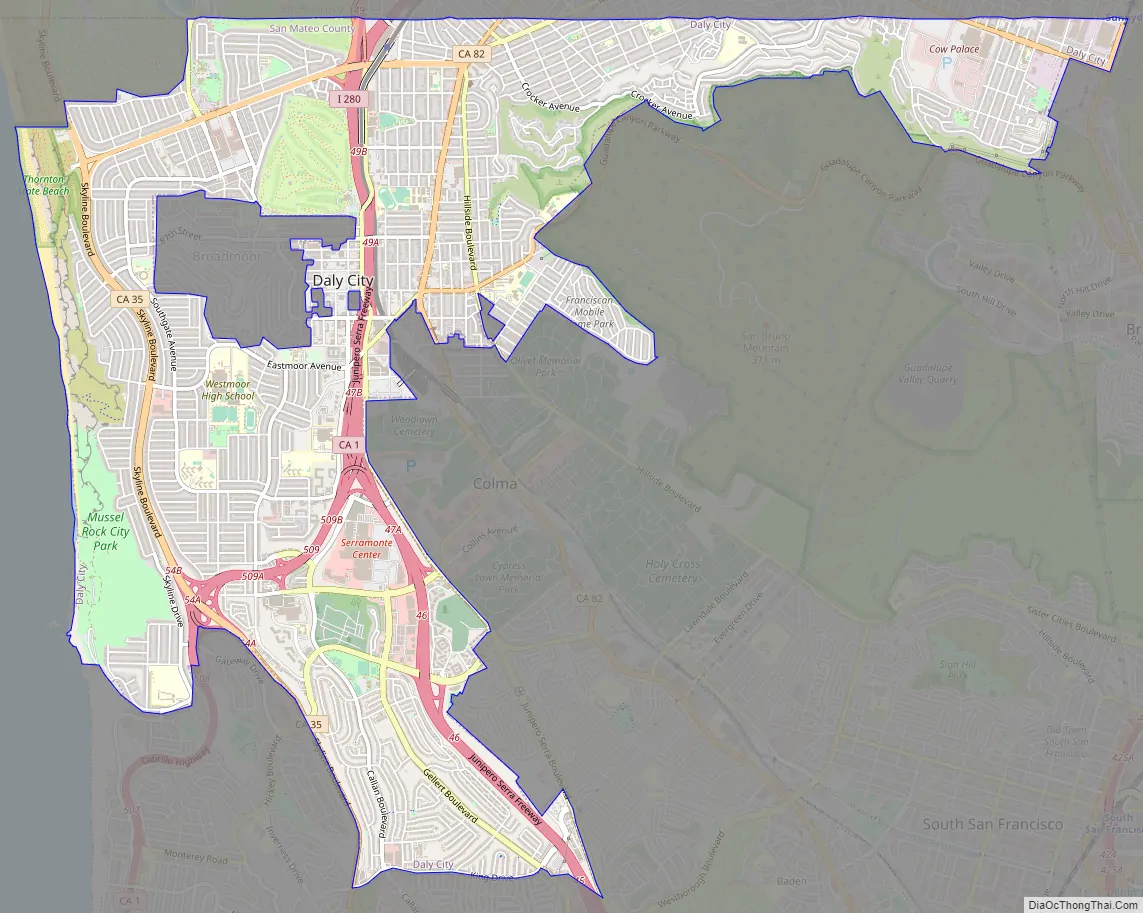
Daly City Road Map
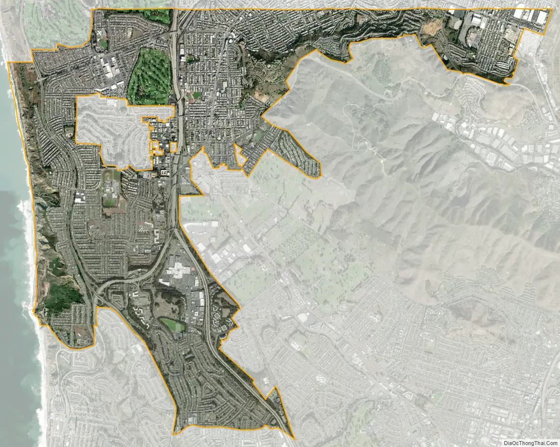
Daly City city Satellite Map
Geography
According to the United States Census Bureau, the city has a total area of 7.7 square miles (20 km), all land.
Daly City is bordered by the cities of San Francisco, Brisbane, Pacifica, South San Francisco, and the town of Colma. The city borders several unincorporated areas of San Mateo County. It surrounds Broadmoor, and borders San Bruno Mountain State Park, the Olympic Club, Lake Merced, and unincorporated areas near Colma. Seismic faults in and near Daly City include the San Andreas Fault, Hillside Fault and Serra Fault.
Neighborhoods
Neighborhoods of Daly City include Westlake, St. Francis Heights, Serramonte, Top of the Hill, Hillside, Crocker, Southern Hills, and Bayshore. Westlake is notable for its distinct architecture and for being among the earliest examples of a planned, large-tract suburb. It was the inspiration for Malvina Reynolds’ 1962 song “Little Boxes”, and later a coffee-table book and documentary Little Boxes: The Architecture of a Classic Midcentury Suburb. Bayshore, the easternmost neighborhood of Daly City, was once an incorporated city, Bayshore City, until being annexed to Daly City in 1963. Several Daly City neighborhoods, such as Crocker, Southern Hills, and Bayshore, share a street grid and similar characteristics with adjacent San Francisco neighborhoods, such as Crocker-Amazon and Visitacion Valley.
Several neighborhoods associated with Daly City lie outside of its city limits. Broadmoor is an unincorporated area completely surrounded by Daly City. Colma is an incorporated town sandwiched between Daly City, South San Francisco, and San Bruno Mountain. These enclaves are in charge of their own police and fire services, but also share some services with Daly City.
Climate
Daly City’s climate is similar to San Francisco’s climate, with fog occurring in the spring and early-late summer. Summers are cool and dry, whereas winters are mild and wet.
See also
Map of California State and its subdivision:- Alameda
- Alpine
- Amador
- Butte
- Calaveras
- Colusa
- Contra Costa
- Del Norte
- El Dorado
- Fresno
- Glenn
- Humboldt
- Imperial
- Inyo
- Kern
- Kings
- Lake
- Lassen
- Los Angeles
- Madera
- Marin
- Mariposa
- Mendocino
- Merced
- Modoc
- Mono
- Monterey
- Napa
- Nevada
- Orange
- Placer
- Plumas
- Riverside
- Sacramento
- San Benito
- San Bernardino
- San Diego
- San Francisco
- San Joaquin
- San Luis Obispo
- San Mateo
- Santa Barbara
- Santa Clara
- Santa Cruz
- Shasta
- Sierra
- Siskiyou
- Solano
- Sonoma
- Stanislaus
- Sutter
- Tehama
- Trinity
- Tulare
- Tuolumne
- Ventura
- Yolo
- Yuba
- Alabama
- Alaska
- Arizona
- Arkansas
- California
- Colorado
- Connecticut
- Delaware
- District of Columbia
- Florida
- Georgia
- Hawaii
- Idaho
- Illinois
- Indiana
- Iowa
- Kansas
- Kentucky
- Louisiana
- Maine
- Maryland
- Massachusetts
- Michigan
- Minnesota
- Mississippi
- Missouri
- Montana
- Nebraska
- Nevada
- New Hampshire
- New Jersey
- New Mexico
- New York
- North Carolina
- North Dakota
- Ohio
- Oklahoma
- Oregon
- Pennsylvania
- Rhode Island
- South Carolina
- South Dakota
- Tennessee
- Texas
- Utah
- Vermont
- Virginia
- Washington
- West Virginia
- Wisconsin
- Wyoming


