El Granada is a village and census-designated place (CDP) in the coastal area of northern San Mateo County, California, United States. The population was 5,481 at the 2020 census. The village is named for the city of Granada, Spain.
| Name: | El Granada CDP |
|---|---|
| LSAD Code: | 57 |
| LSAD Description: | CDP (suffix) |
| State: | California |
| County: | San Mateo County |
| Elevation: | 39 ft (12 m) |
| Total Area: | 4.822 sq mi (12.489 km²) |
| Land Area: | 4.822 sq mi (12.489 km²) |
| Water Area: | 0 sq mi (0 km²) 0% |
| Total Population: | 5,481 |
| Population Density: | 1,100/sq mi (440/km²) |
| ZIP code: | 94018 |
| Area code: | 650 |
| FIPS code: | 0621936 |
| GNISfeature ID: | 1659720 |
Online Interactive Map
Click on ![]() to view map in "full screen" mode.
to view map in "full screen" mode.
El Granada location map. Where is El Granada CDP?


History
El Granada’s unusual concentric-circular street layout was designed by the influential architect and city planner Daniel Burnham. Burnham’s other works included overseeing the design for the 1893 Columbian Exposition in Chicago and designing the 1902 Flatiron Building in New York City. Burnham’s plan was commissioned by the Ocean Shore Railroad, which developed El Granada as a seaside resort for visitors who would use the railroad to travel between San Francisco and El Granada. The city was originally named “Granada” after the city in Spain but the Post Office mistakenly recorded the name as “El Granada” in 1909. Financial difficulties and the advent of the automobile caused the railroad to abandon the plan, and El Granada subsequently became a residential community.
El Granada Road Map

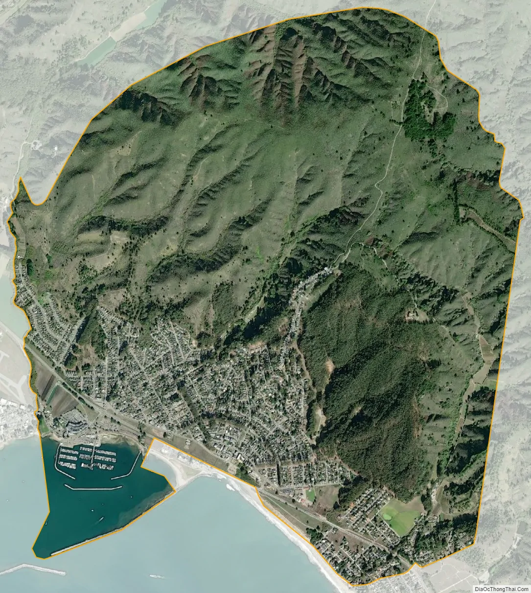
El Granada city Satellite Map
Geography
El Granada is located at 37°30′14″N 122°28′24″W / 37.50389°N 122.47333°W / 37.50389; -122.47333 (37.503766, -122.473230), on the less densely populated Pacific coast side of San Mateo County, approximately 25 miles (40 km) south of San Francisco and 45 miles (72 km) north of Santa Cruz, California. Neighboring towns include Montara and Moss Beach to the north and Half Moon Bay to the south.
According to the United States Census Bureau, the CDP has a total area of 4.8 square miles (12 km), all of it land.
See also
Map of California State and its subdivision:- Alameda
- Alpine
- Amador
- Butte
- Calaveras
- Colusa
- Contra Costa
- Del Norte
- El Dorado
- Fresno
- Glenn
- Humboldt
- Imperial
- Inyo
- Kern
- Kings
- Lake
- Lassen
- Los Angeles
- Madera
- Marin
- Mariposa
- Mendocino
- Merced
- Modoc
- Mono
- Monterey
- Napa
- Nevada
- Orange
- Placer
- Plumas
- Riverside
- Sacramento
- San Benito
- San Bernardino
- San Diego
- San Francisco
- San Joaquin
- San Luis Obispo
- San Mateo
- Santa Barbara
- Santa Clara
- Santa Cruz
- Shasta
- Sierra
- Siskiyou
- Solano
- Sonoma
- Stanislaus
- Sutter
- Tehama
- Trinity
- Tulare
- Tuolumne
- Ventura
- Yolo
- Yuba
- Alabama
- Alaska
- Arizona
- Arkansas
- California
- Colorado
- Connecticut
- Delaware
- District of Columbia
- Florida
- Georgia
- Hawaii
- Idaho
- Illinois
- Indiana
- Iowa
- Kansas
- Kentucky
- Louisiana
- Maine
- Maryland
- Massachusetts
- Michigan
- Minnesota
- Mississippi
- Missouri
- Montana
- Nebraska
- Nevada
- New Hampshire
- New Jersey
- New Mexico
- New York
- North Carolina
- North Dakota
- Ohio
- Oklahoma
- Oregon
- Pennsylvania
- Rhode Island
- South Carolina
- South Dakota
- Tennessee
- Texas
- Utah
- Vermont
- Virginia
- Washington
- West Virginia
- Wisconsin
- Wyoming


